เค†เคฐเฅ‹เคน เค…เคงเฅเคฏเคพเคฏ เคคเฅ€เคธเคฐเคพ เค•เคพเคตเฅเคฏ เคญเคพเค—


เค†เคœ เคนเคฎ เค†เคฐเฅ‹เคน เคชเฅเคธเฅเคคเคฟเค•เคพ เค•เคพ เคคเฅ€เคธเคฐเคพ เค…เคงเฅเคฏเคพเคฏ เค•เคฐเฅ‡เค‚เค—เฅ‡ – เคชเคฅเคฟเค• (เค•เคตเคฟ เคฐเคพเคฎเคจเคฐเฅ‡เคถ เคคเฅเคฐเคฟเคชเคพเค เฅ€)


เคชเฅเคฐเคถเฅเคจ- เคชเคฅเคฟเค• เค•เคพ เคฎเคจ เค•เคนเคพเค‚ เคตเคฟเคšเคฐเคจเคพ เคšเคพเคนเคคเคพ เคนเฅˆ ?
เค‰เคคเฅเคคเคฐ – ย 
เคชเคฅเคฟเค• เคชเฅเคฐเค•เฅƒเคคเคฟ เค•เฅ‡ เคธเฅŒเค‚เคฆเคฐเฅเคฏ เคธเฅ‡ เค…เคญเคฟเคญเฅ‚เคค เคนเฅˆ | เคชเฅเคฐเคคเคฟเค•เฅเคทเคฃ เคจเฅ‚เคคเคจ ย เคตเฅ‡เคถ เคงเคพเคฐเคฃ เค•เคฐเคจเฅ‡ เคตเคพเคฒเฅ€ เคฌเคพเคฆเคฒเฅ‹เค‚ เค•เฅ€
เคชเค‚เค•เฅเคคเคฟ เค•เฅ‹ เคคเคฅเคพ เคจเฅ€เคฒเฅ‡ เคธเคฎเค‚เคฆเคฐ เค•เฅ€ เคฒเคนเคฐเฅ‹เค‚ เค•เฅ‹ เคฆเฅ‡เค–เค•เคฐ เคตเคน ย เคฎเฅเค—เฅเคง เคนเฅ‹ เคฐเคนเคพ เคนเฅˆ | เคชเคฅเคฟเค• เค•เคพ เคฎเคจ
เคจเฅ€เคฒเฅ‡ เค…เค•เคพเคถ เค”เคฐ เคจเฅ€เคฒเฅ‡ เคธเคฎเฅเคฆเฅเคฐ เค•เฅ‡ เคฌเฅ€เคš เคตเคฟเคšเคพเคฐ เคจเคพ เคšเคพเคนเคคเคพ เคนเฅˆ | เค‰เคธเค•เคพ เคฎเคจ เคšเคพเคนเคคเคพ เคนเฅˆ เค•เคฟ เคตเคน
เคฌเคพเคฆเคฒเฅ‹เค‚ เคชเคฐ เคฌเฅˆเค เค•เคฐ เค†เค•เคพเคถ เค•เฅ‡ เคฌเฅ€เคš เคตเคฟเคšเคฐเคฃ เค•เคฐเฅ‡เค‚ เค”เคฐ เคชเฅเคฐเค•เฅƒเคคเคฟ เค•เฅ‡ เคธเคฎเคธเฅเคค เคธเฅŒเค‚เคฆเคฐเฅเคฏ เค•เคพ เค…เคจเฅเคญเคต
เค•เคฐเฅ‡เค‚ |

เคชเฅเคฐเคถเฅเคจ- เคธเฅ‚เคฐเฅเคฏเฅ‹เคฆเคฏ เคตเคฐเฅเคฃเคจ เค•เฅ‡ เคฒเคฟเค เค•เคฟเคธ เคคเคฐเคน เค•เฅ‡ ย เคฌเคฟเค‚เคฌเฅ‹ เค•เคพ เคชเฅเคฐเคฏเฅ‹เค— เคนเฅเค† เคนเฅˆ ?
เค‰เคคเฅเคคเคฐ – ย 
เคธเฅเคฌเคน เค•เฅ‡ เคธเฅ‚เคฐเคœ เค•เฅ€ เคฒเคพเคฒเคฟเคฎเคพ เคœเคฌ เคธเคฎเฅเคฆเฅเคฐ เคคเคฒ เคชเคฐ เคชเคกเคผเคคเฅ€ เคนเฅˆ | เคคเฅ‹ เคšเคพเคฐเฅ‹เค‚ เคคเคฐเคซ เคฒเคพเคฒเคฟเคฎเคพ เคฌเคฟเค–เคฐเคคเฅ€
เคนเฅˆเค‚ | เค•เคตเคฟ เคจเฅ‡ เค•เคฒเฅเคชเคจเคพ เค•เฅ€ เคนเฅˆ เค•เคฟ เคฎเคพเคจเฅ‹ เคฒเค•เฅเคทเฅเคฎเฅ€ เค•เคพ เคฎเค‚เคฆเคฟเคฐ เคนเฅˆ เค”เคฐ เคฒเค•เฅเคทเฅเคฎเฅ€ เค•เฅ‡ เคธเฅเคตเคพเค—เคค เค•เฅ‡ เคฒเคฟเค เคฌเคจเคพเคˆ
เค—เคˆ เคธเฅเคจเคนเคฐเฅ€ เคธเคกเคผเค• เคนเฅˆ | เค•เคตเคฟ เค•เฅ‹ เคเคธเคพ เคชเฅเคฐเคคเฅ€เคค เคนเฅ‹เคคเคพ เคนเฅˆ เค•เคฟ เคธเฅ‚เคฐเฅเคฏ เค‰เคธเคฎเค‚เคฆเคฟเคฐ เค•เคพ เค‰เคœเฅเคœเคตเคฒ เค•เค…เค‚เค—เฅ‚เคฐเคพ
เคนเฅˆ เค”เคฐ เคฒเค•เฅเคทเฅเคฎเฅ€ เค•เฅ€ เคธเคตเคพเคฐเฅ€ เค•เฅ‹ เค‡เคธ เคชเฅเคฃเฅเคฏ เคงเคฐเคคเฅ€ เคชเคฐ เค‰เคคเคพเคฐเคจเฅ‡ เค•เฅ‡ เคฒเคฟเค เคธเฅเคตเคฏเค‚ เคธเคฎเฅเคฆเฅเคฐ เคฆเฅ‡เคต เคจเฅ‡ เคฌเคนเฅเคค
เคธเฅเค‚เคฆเคฐ เคธเฅเคตเคฐเฅเคฃเคฟเคฎ เคฎเคพเคฐเฅเค— เคฌเคจเคพ เคฆเคฟเคฏเคพ เคนเฅ‹ | เค•เคตเคฟ เค•เฅ€ เค•เคฒเฅเคชเคจเคพ ย เคฌเคนเฅเคค เคนเฅ€ เคธเฅเค‚เคฆเคฐ เคคเคฐเฅ€เค•เฅ‡ เคธเฅ‡ เคฌเคฟเค‚เคฌเฅ‹ เค•เฅ‡ เคฐเฅ‚เคช
เคฎเฅ‡เค‚ เค‰เคญเคฐเค•เคฐ เค†เคˆ เคนเฅˆ |

เคชเฅเคฐเคถเฅเคจ- เคชเคฅเคฟเค• เค•เคตเคฟเคคเคพ เคฎเฅ‡เค‚ เค•เคˆ เคธเฅเคฅเคพเคจเฅ‹เค‚ เคชเคฐ เคชเฅเคฐเค•เฅƒเคคเคฟ เค•เฅ‹ เคฎเคจเฅเคทเฅเคฏ เค•เฅ‡ เคฐเฅ‚เคช เคฎเฅ‡เค‚ เคฆเฅ‡เค–เคพ เค—เคฏเคพ เคนเฅˆ เคเคธเฅ‡
เค‰เคฆเคพเคนเคฐเคฃเฅ‹เค‚ เค•เคพ เคญเคพเคต เคธเฅเคชเคทเฅเคŸ เค•เคฐเคคเฅ‡ เคนเฅเค เคฒเคฟเค–เฅ‡เค‚?
เค‰เคคเฅเคคเคฐ – ย 
เคถเฅเคฐเฅ€ เคฐเคพเคฎ เคจเคฐเฅ‡เคถ เคคเฅเคฐเคฟเคชเคพเค เฅ€ เค†เคงเฅเคจเคฟเค• เคฏเฅเค— เค•เฅ‡ เค•เคตเคฟเคฏเฅ‹เค‚ เคฎเฅ‡เค‚ เค…เคชเคจเคพ เคฎเคนเคคเฅเคตเคชเฅ‚เคฐเฅเคฃ เคธเฅเคฅเคพเคจ เคฐเค–เคคเฅ‡ เคนเฅˆเค‚ | เคคเฅเคฐเคฟเคชเคพเค เฅ€
เคœเฅ€ เคฌเคนเฅเคฎเฅเค–เฅ€ เคชเฅเคฐเคคเคฟเคญเคพ เค•เฅ‡ เค•เคฒเคพเค•เคพเคฐ เคฅเฅ‡ | เคชเฅเคฐเคพเค•เฅƒเคคเคฟเค• เคชเฅเคฐเฅ‡เคฎ เค”เคฐ เคจเคตเฅ€เคจเคคเคพ เค•เฅ‡ เคชเฅเคฐเคคเคฟ เค†เค—เฅเคฐเคน เคญเฅ€ เค‰เคจเค•เฅ‡
เค•เคพเคตเฅเคฏ เค•เฅ€ เคชเฅเคฐเคฎเฅเค– เคตเคฟเคถเฅ‡เคทเคคเคพ เคฐเคนเฅ€ เคนเฅˆ | เคชเคฅเคฟเค• เค•เคตเคฟเคคเคพ เคฎเฅ‡เค‚ เคญเฅ€ เคชเฅเคฐเค•เฅƒเคคเคฟ ย เค•เฅ‡ เค‰เคชเคพเคฆเคพเคจ เค“เค‚ เค•เฅ‹ เคฎเคพเคจเคต
เค•เฅ€ เคญเคพเค‚เคคเคฟ เค•เคฐเคคเฅ‡ เคนเฅเค เคฆเคฟเค–เคพเคฏเคพ เคนเฅˆ | เคœเคฟเคธเคธเฅ‡ เค•เคตเคฟเคคเคพ เค•เฅ‡ เคธเฅŒเค‚เคฆเคฐเฅเคฏ เค…เคญเคฟเคตเฅƒเคฆเฅเคงเคฟ เคนเฅเคˆ เคนเฅˆ | เคธเฅ‚เคฐเฅเคฏ เค•เฅ‡ เคธเคพเคฎเคจเฅ‡
เคฌเคพเคฆเคฒเฅ‹เค‚ เค•เคพ เคจเคพเคšเคจเคพ เค•เคญเฅ€ เคถเฅเคตเฅ‡เคค เคถเฅเคฏเคพเคฎ เคจเฅ€เคฒ เคตเคฐเฅเคฃ เค•เฅ‹ เคงเคพเคฐเคฃ เค•เคฐเคจเคพ เค—เคนเคฐเฅ‡ เค…เค‚เคงเฅ‡เคฐเฅ‡ เค•เคพ เคฎเคพเคจเคตเฅ€เค•เคฐเคฃ
เค•เคฟเคฏเคพ เคนเฅˆ เค†เคงเฅ€ เคฐเคพเคค เค•เฅ‹ เคธเคพเคฐเฅ‡ เคธเค‚เคธเคพเคฐ เค•เฅ‹ เคœเฅ‹ เคขเค• เคฒเฅ‡เคคเคพ เคนเฅˆ | เค…เค•เคพเคถ เคฐเฅ‚เคชเฅ€ เค›เคค เคชเคฐ เคคเคพเคฐเฅ‹เค‚ เค•เฅ‹
เคฌเคฟเค–เคฐเคพ เคฆเฅ‡เคคเคพ เคนเฅˆ เคคเคฌ เค‡เคธ เคœเค—เคค เค•เคพ เคธเฅเคตเคพเคฎเฅ€ เคฎเค‚เคฆ เค—เคคเคฟ เคธเฅ‡ เคšเคฒเค•เคฐ เค†เคคเคพ เคนเฅˆ | เคธเคพเค—เคฐ เค“เค‚ เค•เฅ‹ เค…เคชเคจเฅ‡
เคฎเฅ€เค เฅ‡ เค—เฅ€เคค เคธเฅเคจเคพเคคเคพ เคนเฅˆ | เค†เคงเฅ€ เคฐเคพเคค เค•เฅ‹ เคœเคฌ เคธเฅ‚เคฐเฅเคฏ เคจเคฟเค•เคฒเคจเฅ‡ เค•เฅ€ เคคเฅˆเคฏเคพเคฐเฅ€ เค•เคฐเคคเคพ เคนเฅˆ เค”เคฐ เคงเฅ€เคฎเฅ€ เคงเฅ€เคฎเฅ€
เค—เคคเคฟ เคธเฅ‡ เคšเคฒเคคเคพ เคนเฅเค† เคธเคพเค—เคฐ เค•เฅ‡ เค•เคฟเคจเคพเคฐเฅ‡ เค…เคชเคจเฅ€ เคฒเคพเคฒเคฟเคฎเคพ เคญเฅ€ เคฌเคฟเค–เฅ‡เคฐเคคเคพ เคนเฅˆ | เค”เคฐ เคšเคพเค‚เคฆ เค‰เคธเค•เฅ‡ เคฐเฅ‚เคช
เค•เฅ‹ เคฆเฅ‡เค–เค•เคฐ เคนเค‚เคธ เค•เคฐ เคตเคพเคชเคธเฅ€ เค•เฅ€ เคคเฅˆเคฏเคพเคฐเฅ€ เค•เคฐเคคเคพ เคนเฅˆ | เคชเฅ‡เคกเคผ เคชเคคเฅเคคเฅ‡ เคซเฅ‚เคฒ เคฎเฅเคธเฅเค•เฅเคฐเคพเคจเฅ‡ เคฒเค—เคคเฅ‡ เคนเฅˆเค‚ เคชเค•เฅเคทเฅ€
เคšเคนเคšเคพเคนเคจเฅ‡ เคฒเค—เคคเฅ‡ เคนเฅˆเค‚ | เคตเฅƒเค•เฅเคทเฅ‹เค‚ เค•เฅ‹ เคญเฅ€ เคธเคœเฅ‡ เคงเคœเฅ‡ เคชเฅเคฐเคธเคจเฅเคจ เคฎเคจเฅเคทเฅเคฏ เค•เฅ‡ เคฐเฅ‚เคช เคฎเฅ‡เค‚ เคฆเคฐเฅเคถเคพเคฏเคพ เคนเฅˆ | เคซเฅ‚เคฒเฅ‹เค‚ เค•เฅ‹
เคธเฅเค– เค•เฅ€ เคธเคพเคธ เคฒเฅ‡เคคเฅ‡ เคนเฅเค ย เคชเฅเคฐเคพเคฃเฅ€ เค•เฅ€ เคญเคพเค‚เคคเคฟ เคฆเคฟเค–เคพเคฏเคพ เค—เคฏเคพ เคนเฅˆ | เค‡เคธ เคคเคฐเคน เค‡เคธ เค•เคตเคฟเคคเคพ เคฎเฅ‡เค‚ เค•เคˆ
เคธเฅเคฅเคพเคจเฅ‹เค‚ เคชเคฐ เคชเฅเคฐเค•เฅƒเคคเคฟ เค•เฅ‹ เคฎเคจเฅเคทเฅเคฏ เค•เฅ‡ เคฐเฅ‚เคช เคฎเฅ‡เค‚ เคฆเคฐเฅเคถเคพเคฏเคพ เค—เคฏเคพ เคนเฅˆ |


เคตเฅเคฏเคพเค•เคฐเคฃ เคซเฅ€เคšเคฐ เคฒเฅ‡เค–เคจ

เคซเฅ€เคšเคฐ เคฒเฅ‡เค–เคจ เค•เฅ‡ เค—เฅเคฃ:
1 – เคตเคฟเคถเฅเคตเคธเคจเฅ€เคฏเคคเคพ
2 – เคธเคฐเคธเคคเคพ เคเคตเค‚ เคธเคนเคœเคคเคพ
3 – เคฐเฅ‹เคšเค•เคคเคพ เคเคตเค‚ เคธเค‚เค•เฅเคทเคฟเคชเฅเคค เคคเคพ
4 – เคชเฅเคฐเคธเค‚เค—เคฟเค•เคคเคพ


5 – เคชเฅเคฐเคšเคฒเคฟเคค เคถเคฌเฅเคฆเคพเคตเคฒเฅ€ เค•เคพ เคชเฅเคฐเคฏเฅ‹เค—

เคซเฅ€เคšเคฐ เคฒเฅ‡เค–เคจ เค•เคพ เค•เฅเคฐเคฎ:
1 เคถเฅ€เคฐเฅเคทเค•
2 เคญเฅ‚เคฎเคฟเค•เคพ ย 
3 เคตเคฟเคทเคฏ เค•เคพ เคตเคฟเคธเฅเคคเคพเคฐ ย 
4 เคจเคฟเคทเฅเค•เคฐเฅเคท เคฏเคพ เคธเคฎเคพเคชเคจ

เคซเฅ€เคšเคฐ ย เคฒเฅ‡เค–เคจ เค•เฅ‹เคจเฅ€ เคฎเคฒเคฟเค• เคถเฅเคฐเฅ‡เคฃเคฟเคฏเฅ‹เค‚ เคฎเฅ‡เค‚ เคฌเคพเค‚เคŸเคพ เคœเคพ เคธเค•เคคเคพ เคนเฅˆ –
– เคธเคพเคฎเคพเคœเคฟเค• เคธเคพเค‚เคธเฅเค•เฅƒเคคเคฟเค•
– เคธเคพเคนเคฟเคคเฅเคฏเคฟเค• ย เคซเฅ€เคšเคฐ
– เคชเฅเคฐเคพเค•เฅƒเคคเคฟเค• เคซเฅ€เคšเคฐ
– เค˜เคŸเคจเคพเคชเคฐเค• เคซเฅ€เคšเคฐ
– เคฐเคพเคœเคจเฅ€เคคเคฟเค• เคซเฅ€เคšเคฐ

เค•เฅเค› เคฎเคนเคคเฅเคตเคชเฅ‚เคฐเฅเคฃ เคซเฅ€เคšเคฐ เค•เฅ‡ เค‰เคฆเคพเคนเคฐเคฃ –

1. เคธเฅเคตเคšเฅเค›เคคเคพ เค…เคญเคฟเคฏเคพเคจ เคชเคฐ เคเค• เคซเฅ€เคšเคฐ เคฒเคฟเค–เคฟเค |ย 
ย ย ย ย ย ย ย ย ย ย ย ย ย ย ย ย ย ย ย ย ย 
เคธเฅเคตเคšเฅเค›เคคเคพ เค…เคญเคฟเคฏเคพเคจ
เคญเคพเคฐเคค เค•เฅ‡ เคชเฅเคฐเคงเคพเคจเคฎเค‚เคคเฅเคฐเฅ€ เคถเฅเคฐเฅ€ เคจเคฐเฅ‡เค‚เคฆเฅเคฐ เคฎเฅ‹เคฆเฅ€ เคฆเฅเคตเคพเคฐเคพ เคฎเคนเคพเคคเฅเคฎเคพ เค—เคพเค‚เคงเฅ€ เค•เฅ€ 150เคตเฅ€เค‚ เคœเคฏเค‚เคคเฅ€ เค•เฅ‡ เค…เคตเคธเคฐ เคชเคฐ
เค†เคฐเค‚เคญ เค•เคฟเคฏเคพ เค—เคฏเคพ เคธเฅเคตเคšเฅเค› เคญเคพเคฐเคค เค…เคญเคฟเคฏเคพเคจ เค…เคฌ เคคเค• เคธเคฌเคธเฅ‡ เคฌเคกเคผเคพ เคธเฅเคตเคšเฅเค›เคคเคพ เค…เคญเคฟเคฏเคพเคจ เคนเฅˆ |
เค—เคพเค‚เคงเฅ€ เคœเฅ€ เค•เฅ‡ เค†เคตเคพเคนเคจ เค•เฅ‹ เคชเฅ‚เคฐเคพ เค•เคฐเคจเฅ‡ เคตเคพเคฒเฅ‡ เคฆเฅ‡เคถ เค…เคฌ เค‰เคจเค•เฅ‡ เคฒเคฟเค เค•เฅเคฒเฅ€เคจ เค‡เค‚เคกเคฟเคฏเคพ เค•เฅ‡ เค†เคนเฅเคตเคพเคจ
เค•เฅ‹ เคชเฅ‚เคฐเคพ เค•เคฐเคจเฅ‡ เคจเคฟเค•เคฒ เคชเคกเคผเคพ | เคฆเฅ‡เคถ เค•เฅ‹ เคธเฅเคตเคšเฅเค› เคฌเคจเคพเคจเคพ เคธเคฟเคฐเฅเคซ เค•เคฟเคธเฅ€ เคธเคฐเค•เคพเคฐ เคฏเคพ เคธเค‚เค—เค เคจ เค•เฅ€
เคœเคฟเคฎเฅเคฎเฅ‡เคฆเคพเคฐเฅ€ เคจเคนเฅ€เค‚ เคนเฅ‹ เคธเค•เคคเฅ€ เคนเฅ‹ เคจเคนเฅ€เค‚ เคธเค‚เคญเคต เคญเฅ€ เคจเคนเฅ€เค‚ เคนเฅˆ | เคœเคฌ เคคเค• เคฆเฅ‡เคถ เค•เฅ‡ เคจเคพเค—เคฐเคฟเค• เค‡เคธเค•เฅ‡
เคชเฅเคฐเคคเคฟ เคœเคพเค—เคฐเฅ‚เค• เคจเคนเฅ€เค‚ เคนเฅ‹เค‚เค—เฅ‡ เคคเคฌ เคคเค• เค‡เคธ เคฎเคนเคพเคจ เคฒเค•เฅเคทเฅเคฏ เค•เฅ‹ เคชเฅเคฐเคพเคชเฅเคค เค•เคฐเคจเคพ เคธเค‚เคญเคต เคจเคนเฅ€เค‚ เคนเฅˆ |
เคธเฅเคตเคšเฅเค›เคคเคพ เค•เฅ€ เคญเคพเคตเคจเคพ เคนเคฎเคพเคฐเฅ‡ เค…เค‚เคฆเคฐ เคนเฅ‹เคจเฅ€ เคšเคพเคนเคฟเค เคฌเคฒเฅเค•เคฟ เคนเคฎเฅ‡เค‚ เคธเฅเคตเคฏเค‚ เคนเฅ€ เค‡เคธเค•เฅ‡ เคชเฅเคฐเคคเคฟ เค†เค‚เคคเคฐเคฟเค•
เคธเฅเคคเคฐ เคชเคฐ เคธเคšเฅ‡เคค เคนเฅ‹เคจเคพ เคนเฅ‹เค—เคพ | เคจเคพ เคคเฅ‹ เค—เค‚เคฆเค—เฅ€ เคซเฅˆเคฒเคพเคเค‚ เค”เคฐ เคจเคพ เคนเฅ€ เค•เคฟเคธเฅ€ เค•เฅ‹ เค—เค‚เคฆเค—เฅ€ เคซเฅˆเคฒเคพเคจเฅ‡
เคฆเฅ‡ เคฏเคนเฅ€ เคญเคพเคตเคจเคพ เคธเฅเคตเคธเฅเคฅ เค…เคญเคฟเคฏเคพเคจ เค•เฅ‹ เคธเคซเคฒ เคเคตเค‚ เคธเคพเคฐเฅเคฅเค• เคฌเคจเคพ เคธเค•เคคเฅ€ เคนเฅˆ | เคนเคฎเฅ‡เค‚ เคธเฅเคตเคšเฅเค›เคคเคพ
เค•เฅ‡ เคฎเคนเคคเฅเคต เค•เฅ‹ เคธเคฎเคเคจเคพ เคšเคพเคนเคฟเค เค‡เคธเค•เฅ‡ เค…เคญเคพเคต เคฎเฅ‡เค‚ เคฏเคพเคจเฅ€ เค—เค‚เคฆเค—เฅ€ เคธเฅ‡ เคนเฅ‹เคจเฅ‡ เคตเคพเคฒเฅ‡ เคฆเฅเคทเฅเคชเฅเคฐเคญเคพเคตเฅ‹เค‚ เค•เฅ‹
เคญเฅ€ เคœเคพเคจเคพ เคนเฅ‹เค—เคพ เคตเคฟเคถเฅเคต เคชเคŸเคฒ เคชเคฐ เค…เคชเคจเฅ€ เค—เค‚เคฆเค—เฅ€ เค•เฅ€ เค›เคตเคฟ เค•เฅ‹ เคฎเคฟเคŸเคพเค•เคฐ เค…เคชเคจเฅ€ เคธเฅเคตเคšเฅเค›เคคเคพ
เคชเฅเคฐเคฟเคฏเคพ เค›เคตเคฟ เค•เฅ‹ เคธเฅเคฅเคพเคชเคฟเคค เค•เคฐเคจเคพ เคนเฅ‹เค—เคพ เค”เคฐ เค‡เคธ เคธเฅเคตเคšเฅเค›เคคเคพ เค…เคญเคฟเคฏเคพเคจ เค•เฅ‹ เคธเคซเคฒ เคฌเคจเคพเคจเคพ เคนเฅ‹เค—เคพ |

2. เคตเคจ เคฐเคนเฅ‡เค‚เค—เฅ‡- เคนเคฎ เคฐเคนเฅ‡เค‚เค—เฅ‡ เคชเคฐ เคเค• เคซเฅ€เคšเคฐ เคฒเคฟเค–เคฟเค |

เคตเคจ เคฐเคนเฅ‡เค‚เค—เฅ‡ : เคนเคฎ เคฐเคนเฅ‡เค‚เค—เฅ‡
เคชเคฟเค›เคฒเฅ‡ เคธเฅˆเค•เคกเคผเฅ‹เค‚ เคตเคฐเฅเคทเฅ‹เค‚ เคธเฅ‡ เคตเฅƒเค•เฅเคท เค•เคŸ เคฐเคนเฅ‡ เคนเฅˆเค‚ เคœเค‚เค—เคฒเฅ‹เค‚ เค•เคพ เคธเคซเคพเคฏเคพ เคนเฅ‹ เคฐเคนเคพ เคนเฅˆ | เคฎเคจเฅเคทเฅเคฏ เคจเฅ‡ เค เคพเคจ
เคฒเคฟเคฏเคพ เค•เคฟ เคนเคฎ เคนเฅ€ เคฐเคนเฅ‡เค‚เค—เฅ‡ เคšเคพเคนเฅ‡ เคœเค‚เค—เคฒ เคฐเคนเฅ‡ เคฏเคพ เคจเคพ เคฐเคนเฅ‡ เคฏเคฆเคฟ เคœเค‚เค—เคฒ เคฐเคนเฅ‡ เคคเฅ‹ เคนเคฎ เค•เคนเคพเค‚ เคฐเคนเฅ‡เค‚เค—เฅ‡ |
เคœเค‚เค—เคฒ เคธเคฟเค•เฅเคกเคผ เค•เคฐ เค›เฅ‹เคŸเฅ‡ เคนเฅ‹เคคเฅ‡ เคœเคพ เคฐเคนเฅ‡ เคนเฅˆเค‚ | เคจเค—เคฐ เคซเคฒ-เคซเฅ‚เคฒ เค•เคฐ เคฌเคกเคผเฅ‡ เคนเฅ‹เคคเฅ‡ เคœเคพ เคฐเคนเฅ‡ เคนเฅˆเค‚ | เคฎเคจเฅเคทเฅเคฏ
เค”เคฐ เคชเฅเคฐเค•เฅƒเคคเคฟ เคฎเฅ‡เค‚ เค—เคนเคฐเคพ เคธเค‚เคฌเค‚เคง เคฐเคนเคพ เคนเฅˆ | เคฎเคพเคจเคต เค…เคชเคจเฅ€ เคธเคญเฅ€ เค…เคตเคธเฅเคฅเคพเค“เค‚ เค•เฅ€ เคชเฅ‚เคฐเฅเคคเคฟ เค•เฅ‡ เคฒเคฟเค
เคชเฅ‚เคฐเฅเคฃเคคเคพ เคชเฅเคฐเค•เฅƒเคคเคฟ เคชเคฐ เคนเฅ€ เคจเคฟเคฐเฅเคญเคฐ เคนเฅˆ | เคตเคจ เคธเค‚เคชเคฆเคพ เคญเฅ€ เคชเฅเคฐเค•เฅƒเคคเคฟ เค•เฅ€ เคเค• เค…เคฆเฅเคญเฅเคค เค”เคฐ เค…เคคเฅเคฏเค‚เคค เค‰เคชเคฏเฅ‹เค—เฅ€
เคนเฅˆ | เคตเคจ เคคเคฅเคพ เคชเฅ‡เคกเคผ เคชเฅŒเคงเฅ‡ เคชเคฐเฅเคฏเคพเคตเคฐเคฃ เคธเฅ‡ เค•เคพเคฐเฅเคฌเคจ เคกเคพเค‡เค‘เค•เฅเคธเคพเค‡เคก ย เคฒเฅ‡เค•เคฐ เค‰เคธเฅ‡ เคชเฅเคฐเคพเคฃ เคฆเคพเคฏเคฟเคจเฅ€
เค‘เค•เฅเคธเฅ€เคœเคจ เคฎเฅ‡เค‚ เคฌเคฆเคฒ เคฆเฅ‡เคคเฅ‡ เคนเฅˆเค‚ | เคตเฅƒเค•เฅเคทเฅ‹เค‚ เค•เคพ เคชเฅเคฐเคคเฅเคฏเฅ‡เค• เค…เค‚เค— – เคซเคฒ, เคซเฅ‚เคฒ, เคชเคคเฅเคคเคฟเคฏเคพเค‚, เค›เคพเคฒ เคฏเคนเคพเค‚ เคคเค•
เค•เฅ€ เคœเคกเคผ เคญเฅ€ เค‰เคชเคฏเฅ‹เค—เฅ€ เคนเฅˆ | เคนเคฎเฅ‡เค‚ เคธเฅเคตเคพเคฆเคฟเคทเฅเคŸ เคซเคฒเฅ‹เค‚ เค•เฅ‡ เคธเคพเคฅ เคธเคพเคฅ เคœเฅ€เคตเคจ เคฐเค•เฅเคทเค• เค”เคทเคงเคฟเคฏเคพเค‚ เคญเฅ€
เคฎเคฟเคฒเคคเฅ€ เคนเฅˆเค‚ | เคตเคจ เคฌเคพเคฆเคฒเฅ‹เค‚ เค•เฅ‹ เคฐเฅ‹เค•เค•เคฐ เคตเคฐเฅเคทเคพ เค•เคฐเคพเคจเฅ‡ เคฎเฅ‡เค‚ เคญเฅ€ เคธเคนเคพเคฏเคคเคพ เค•เคฐเคคเฅ‡ เคนเฅˆเค‚ | เคชเคฐเฅเคฏเคพเคตเคฐเคฃ เค•เฅ‹
เคญเฅ€ เคถเฅเคฆเฅเคง เค•เคฐเคคเฅ‡ เคนเฅˆเค‚ เคตเคจเฅ‹เค‚ เคธเฅ‡ เคชเฅเคฐเคพเคชเฅเคค เคฒเค•เคกเคผเคฟเคฏเคพเค‚ เคญเคตเคจ เคจเคฟเคฐเฅเคฎเคพเคฃ เค”เคฐ เคซเคฐเฅเคจเฅ€เคšเคฐ เคฌเคจเคพเคจเฅ‡ เค•เคพ เค•เคพเคฎ เค•เคฐเคคเฅ€
เคนเฅˆเค‚ | เคตเคจเฅ‹เค‚ เคธเฅ‡ เคนเคฎเฅ‡เค‚ เค…เคจเฅ‡เค• เคชเฅเคฐเค•เคพเคฐ เค•เฅ‡ เคฒเคพเคญ เคชเฅเคฐเคพเคชเฅเคค เคนเฅ‹เคคเฅ‡ เคนเฅˆเค‚ | เคซเคฟเคฐ เคญเฅ€ เคฎเคจเฅเคทเฅเคฏ เคจเฅ‡ เค…เค‚เคงเคพเคงเฅเค‚เคง เคตเฅƒเค•เฅเคทเฅ‹เค‚ เค•เฅ€
เค•เคŸเคพเคˆ เค•เฅ€ เคนเฅˆ | เคœเคฟเคธเค•เฅ‡ เค•เคพเคฐเคฃ เค…เคจเฅ‡เค• เคธเคฎเคธเฅเคฏเคพเคเค‚ เค‰เคคเฅเคชเคจเฅเคจ เคนเฅ‹ เค—เค เคนเฅˆเค‚ | เค…เคšเคพเคจเค• เคฎเฅŒเคธเคฎ เคชเคฐเคฟเคตเคฐเฅเคคเคจ
เคนเฅ‹ เคœเคพเคคเคพ เคนเฅˆ | เคœเฅ€เคต-เคœเค‚เคคเฅเค“เค‚ เค•เฅ€ เค•เคˆ เคชเฅเคฐเคœเคพเคคเคฟเคฏเคพเค‚ เคฒเฅเคชเฅเคค เคนเฅ‹ เค—เคˆ เคนเฅˆเค‚ | เคชเฅƒเคฅเฅเคตเฅ€ เค•เฅ‡ เคคเคพเคชเคฎเคพเคจ เคฎเฅ‡เค‚ เคตเฅƒเคฆเฅเคงเคฟ
เคนเฅ‹เคจเฅ‡ เคฒเค— เค—เคˆ เคนเฅˆ | เคนเคฟเคฎเคจเคฆเฅ‹ เค•เคพ เคชเคฟเค˜เคฒเคจเคพ เคธเคฎเฅเคฆเฅเคฐเฅ€ เคœเคฒ- เค…เคคเคฟ เคฎเฅ‡เค‚ เคตเฅƒเคฆเฅเคงเคฟ เค…เคจเฅ‡เค• เคธเคฎเคธเฅเคฏเคพเค“เค‚ เค•เฅ‹
เค‰เคคเฅเคชเคจเฅเคจ เคนเฅ‹ เค—เคˆ เคนเฅˆ เคฎเคจเฅเคทเฅเคฏ เค…เคชเคจเฅ€ เค†เคตเคถเฅเคฏเค•เคคเคพเค“เค‚ เค•เฅ€ เคชเฅ‚เคฐเฅเคคเคฟ เค•เฅ‡ เคฒเคฟเค เคตเคฟเค•เคพเคธ เค•เฅ‡ เคฒเคฟเค เคตเคจ เคธเค‚เคชเคฆเคพ
เค•เคพ เคชเฅเคฐเคฏเฅ‹เค— เค•เคฐเคคเคพ เคนเฅˆ | เค‡เคธเคฒเคฟเค เคนเคฎเฅ‡เค‚ เคฏเคน เคฌเคพเคค เคธเคฎเคเคจเฅ€ เคนเฅ‹เค—เฅ€ เค•เคฟ เคตเคฟเค•เคพเคธ เค”เคฐ เคชเคฐเฅเคฏเคพเคตเคฐเคฃ
เคเค• เคฆเฅ‚เคธเคฐเฅ‡ เค•เฅ‡ เคตเคฟเคฐเฅ‹เคงเฅ€ เคจเคนเฅ€เค‚ เคเค• เคฆเฅ‚เคธเคฐเฅ‡ เค•เฅ‡ เคชเฅ‚เคฐเค• เคนเฅˆเค‚ | เคฏเคฆเคฟ เคตเฅƒเค•เฅเคท เคจ เคฐเคนเฅ‡ เคคเฅ‹ เคธเค‚เคชเฅ‚เคฐเฅเคฃ เคฎเคพเคจเคต เคœเค—เคค
เค•เคพ เค…เคธเฅเคคเคฟเคคเฅเคต เคนเฅ€ เคฎเคฟเคŸ เคœเคพเคเค—เคพ | เคฏเคน เคญเฅ€ เคธเคนเฅ€ เคนเฅˆ เค•เคฟ เคตเคฟเค•เคพเคธ เค•เฅ‡ เคฒเคฟเค เคตเฅƒเค•เฅเคท เค•เคพเคŸเคจเคพ เค†เคตเคถเฅเคฏเค•
เคนเฅˆ | เค‡เคธเค•เฅ‡ เคฒเคฟเค เคนเคฎเฅ‡เค‚ เคตเฅƒเค•เฅเคทเคพเคฐเฅ‹เคชเคฃ เค•เฅ‹ เค…เคชเคจเคพ เค•เคฐเฅเคคเคตเฅเคฏ เคธเคฎเค เค‡เคธเค•เคพ เคชเคพเคฒเคจ เค•เคฐเคจเคพ เคšเคพเคนเคฟเค เค‡เคธเค•เฅ‡
เคธเคพเคฅ เคนเฅ€ เคนเคฎเฅ‡เค‚ เคธเคคเคค เคชเฅ‹เคทเคฃเฅ€เคฏ เคตเคฟเค•เคพเคธ เค•เฅ€ เคตเคฟเคšเคพเคฐเคงเคพเคฐเคพ เค•เฅ‹ เค…เคชเคจเคพเคจเคพ เคšเคพเคนเคฟเค |

เค†เคฐเฅ‹เคน เค…เคงเฅเคฏเคพเคฏ เคšเฅŒเคฅเคพ เค•เคพเคตเฅเคฏ เคญเคพเค—

เค†เคœ เคนเคฎ เค†เคฐเฅ‹เคน เคชเฅเคธเฅเคคเคฟเค•เคพ เค•เคพเคตเฅเคฏ เคญเคพเค— เค•เคพ เคšเฅŒเคฅเคพ เค…เคงเฅเคฏเคพเคฏ เค•เคฐเฅ‡เค‚เค—เฅ‡ – เคตเฅ‡ เค†เค‚เค–เฅ‡เค‚ (เคธเฅเคฎเคฟเคคเฅเคฐเคพเคจเค‚เคฆเคจ เคชเค‚เคค)

เคชเฅเคฐเคถเฅเคจ –เค•เคตเคฟเคคเคพ เคญเฅ€ เค†เค‚เค–เฅ‡เค‚ เคฎเฅ‡เค‚ เค•เคฟเคธเคพเคจ เค•เฅ€ เคชเฅ€เคกเคผเคพ เค•เฅ‡ เคฒเคฟเค เค•เคฟเคธเฅ‡ เคœเคฟเคฎเฅเคฎเฅ‡เคฆเคพเคฐ เคฌเคคเคพเคฏเคพ เค—เคฏเคพ เคนเฅˆ?
เค‰เคคเฅเคคเคฐ –
เค•เคฟเคธเคพเคจ เค•เฅ€ เคชเฅ€เคกเคผเคพ เค•เฅ‡ เคฒเคฟเค เคœเคฎเฅ€เคฆเคพเคฐ เค”เคฐ เคฎเคนเคพเคœเคจ เคคเคฅเคพ เค•เฅเคฐเฅ‚เคฐ เค•เฅ‹เคคเคตเคพเคฒ เค•เฅ‹ เคœเคฟเคฎเฅเคฎเฅ‡เคฆเคพเคฐ เค เคนเคฐเคพเคฏเคพ
เค—เคฏเคพ เคนเฅˆ | เคฎเคนเคพเคœเคจ เคจเฅ‡ เค…เคชเคจเคพ เคฌเฅเคฏเคพเคœ เค”เคฐ เค‹เคฃ เคตเคธเฅ‚เคฒเคจเฅ‡ เค•เฅ‡ เคฒเคฟเค เค‰เคธเค•เฅ‡ เค–เฅ‡เคค, เคฌเฅˆเคฒ เค”เคฐ เค˜เคฐเคฌเคพเคฐ
เคฌเคฟเค•เคตเคพ เคฆเคฟเคฏเคพ | เคœเคฎเฅ€เคฆเคพเคฐ เค•เฅ‡ ย เค•เคพเคฐเฅ เค•เฅ‚เคจเฅ‹ เคจเฅ‡ เค•เคฟเคธเคพเคจ เค•เฅ‡ เคœเคตเคพเคจ เคฌเฅ‡เคŸเฅ‡ เค•เฅ‹ เคชเฅ€เคŸ-เคชเฅ€เคŸเค•เคฐ เคฎเคพเคฐ เคฆเคฟเคฏเคพ |
เค•เคฟเคธเคพเคจ เค‡เคคเคจเคพ เคชเฅˆเคธเฅ‹เค‚ เค•เคพ เคฎเฅ‹เคนเคคเคพเคœ เคนเฅ‹ เค—เคฏเคพ เค•เฅ€เคฒเคพเคšเคพเคฐ เค•เคฟเคธเคพเคจ เค…เคชเคจเฅ€ เคชเคคเฅเคจเฅ€ เค•เฅ€ เคฆเคตเคพ เคฆเคพเคฐเฅ‚ เคจเคพ
เค•เคฐเคพ เคธเค•เคพ เค”เคฐ เคตเคน เคญเฅ€ เคšเคฒ เคฌเคธเฅ€ | เค”เคฐ เค‰เคธเค•เฅ€ เคฆเฅ‚เคง เคฎเฅ‚เคนเฅ€ เคฌเคšเฅเคšเฅ€ เค•เคพ เคญเฅ€ เคฆเฅ‡เคนเคพเค‚เคค เคนเฅ‹ เค—เคฏเคพ |
เค•เคฟเคธเคพเคจ เค•เฅ€ ย เคชเฅเคคเฅเคฐเคตเคงเฅ‚ เคชเคฐ เคญเฅ€ เค•เฅ‹เคคเคตเคพเคฒ เคจเฅ‡ เค•เฅ‚ เคฆเฅƒเคทเฅเคŸเคฟ เคกเคพเคฒเฅ€ | เคตเคน เคญเฅ€ เค•เฅเคเค‚ เคฎเฅ‡เค‚ เคกเฅ‚เคฌ เค•เคฐ เคฎเคฐ เค—เคˆ |
เคธเคฎเคพเคœ เค•เฅ‹ เค…เคจเฅ เคชเฅเคฐเคฆเคพเคจ เค•เคฐเคจเฅ‡ เคตเคพเคฒเฅ‡ เค•เฅƒเคทเค• เคธเฅ‡ เคธเคพเคฐเคพ เคธเค‚เคธเคพเคฐ เค•เคฟเคจเคพเคฐเคพ เค•เคฐ เคคเคฎเคพเคถเคพ เคฆเฅ‡เค–เคคเคพ เคฐเคนเคพ |
เค•เคฟเคธเคพเคจ เค…เค•เฅ‡เคฒเคพ เคนเฅ€ เคชเฅ€เคกเคผเคพ เค•เฅ‹ เคธเคนเคคเคพ เคฐเคนเคพ เค”เคฐ เคญเฅ€เคคเคฐ เคนเฅ€ เคญเฅ€เคคเคฐ เค˜เฅเคŸเคคเคพ เคฐเคนเคพ |

เคชเฅเคฐเคถเฅเคจ – เคชเคฟเค›เคฒเฅ‡ เคธเฅเค– เค•เฅ€ เคธเฅเคฎเฅƒเคคเคฟ เค†เค‚เค–เฅ‹เค‚ เคฎเฅ‡เค‚ เค•เฅเคทเคฃเคญเคฐ เคเค• เคšเคฎเค• เคนเฅˆ เคฒเคพเคคเฅ€ | เค‡เคธเคฎเฅ‡เค‚ เค•เคฟเคธเคพเคจ เค•เฅ‡
เค•เคฟเคจ เคชเคฟเค›เคฒเฅ‡ เคธเฅเค–เฅ‹เค‚ เค•เฅ€ เค“เคฐ เคธเค‚เค•เฅ‡เคค เค•เคฟเคฏเคพ เค—เคฏเคพ เคนเฅˆ?
เค‰เคคเฅเคคเคฐ –
เคตเฅ‡ เค†เค‚เค–เฅ‡เค‚ เค•เคตเคฟเคคเคพ เคฎเฅ‡เค‚ เคธเฅเคฎเคฟเคคเฅเคฐเคพเคจเค‚เคฆเคจ เคชเค‚เคค เคœเฅ€ เคจเฅ‡ เค•เคฟเคธเคพเคจ เค•เฅ‡ เคชเคฟเค›เคฒเฅ‡ เคธเฅเค–เฅ‹เค‚ เค•เฅ€ เค“เคฐ เคธเค‚เค•เฅ‡เคค เค•เคฟเคฏเคพ
เคนเฅˆ | เค•เคฟเคธเคพเคจ เค•เฅ‡ เค•เคตเคฟ เคฒเคนเคฐเคพเคคเฅ‡ เคนเคฐเฅ‡ เคญเคฐเฅ‡ เค–เฅ‡เคค ย เคฅเฅ‡ | เคœเคฟเคจ เค•เฅ€ เคนเคฐเคฟเคฏเคพเคฒเฅ€ เค•เฅ‹ เคฆเฅ‡เค–เค•เคฐ เค‰เคธเค•เคพ เคคเคจ เคฎเคจ
เคชเฅเคฐเคธเคจเฅเคจ เคนเฅ‹ เคœเคพเคคเคพ เคฅเคพ | เคคเคฌ เคตเคน เคธเฅเคตเคพเคงเฅ€เคจเคคเคพ เค‰เคธเฅ€ เคธเฅ‡ เค‰เคธเค•เคพ เคฎเคธเฅเคคเค• เคŠเค‚เคšเคพ เค‰เค เคคเคพ เคฅเคพ | เค˜เคฐ เคฎเฅ‡เค‚ เคฌเฅˆเคฒเฅ‹เค‚
เค•เฅ€ เคœเฅ‹เคกเคผเฅ€ เคฅเฅ€ | เคฆเฅ‚เคง เคฆเฅ‡เคจเฅ‡ เคตเคพเคฒเฅ€ เค—เคพเคฏ เคฅเฅ€ |เคœเฅ‹ เค•เคฟเคธเคพเคจ เคธเฅ‡ เค‡เคคเคจเคพ เคชเฅเคฐเฅ‡เคฎ เค•เคฐเคคเฅ€ เคฅเฅ€ เค•เคฟ เคตเคน เค•เคฟเคธเคพเคจ
เค•เฅ‹ เคนเฅ€ เค…เคชเคจเคพ ย เคฆเฅ‚เคง เคฆเฅ‹เคนเคจเฅ‡ เคฆเฅ‡เคคเฅ€ เคฅเฅ€ | เค•เคฟเคธเคพเคจ เค•เคพ เคญเคฐเคพ เคชเฅ‚เคฐเคพ เคชเคฐเคฟเคตเคพเคฐ เคฅเคพ | เคเค• เคœเคตเคพเคจ เคฌเฅ‡เคŸเคพ เค”เคฐ
เคฌเคนเฅ‚ เคฅเฅ€ | เค•เคฟเคธเคพเคจ เค•เฅ€ เคฆเฅ‡เค–เคญเคพเคฒ เค•เคฐเคจเฅ‡ เคตเคพเคฒเฅ€ เค‰เคธเค•เฅ€ เค…เคชเคจเฅ€ เคชเคคเฅเคจเฅ€ เคฅเฅ€ | เคตเคน เคธเฅเค– เค”เคฐ เคธเคฎเฅƒเคฆเฅเคงเคฟ เคธเฅ‡
เคธเฅเค– เคชเฅ‚เคฐเฅเคตเค• เค…เคชเคจเฅ‡ เคชเคฐเคฟเคตเคพเคฐ เค•เฅ‡ เคธเคพเคฅ เคœเฅ€เคตเคจ เคตเฅเคฏเคคเฅ€เคค เค•เคฐ เคฐเคนเคพ เคฅเคพ | เคชเคฐเค‚เคคเฅ เคธเคฌ เค•เฅเค› เคถเฅ‹เคทเค• เคตเคฐเฅเค—
เค•เฅ€ เคญเฅ‡เค‚เคŸ เคšเคขเคผย เค—เคฏเคพ เคฅเคพ | เคฏเคน เค‰เคชเคฐเฅ‹เค•เฅเคค เค–เฅเคถเคฟเคฏเคพเค‚, เคธเฅเค– เค•เฅ€ เคธเฅเคฎเฅƒเคคเคฟเคฏเคพเค‚ เค•เคฟเคธเคพเคจ เค•เฅ€ เค†เค‚เค–เฅ‹เค‚ เคฎเฅ‡เค‚ เค•เฅเคทเคฃ
เคญเคฐ เค•เฅ‡ เคฒเคฟเค เคšเคฎเค• เคฒเคพ เคฆเฅ‡เคคเฅ€ เคฅ |

เคชเฅเคฐเคถเฅเคจ – เค•เคฟเคธเคพเคจ เค•เฅ€ ย เคตเคฟเคฐเคพเคจ เค†เค‚เค–เฅ‡เค‚ เคจเฅ‰เค• เคธเคฆเฅƒเคถ เคฌเคจ เคœเคพเคคเฅ€ เคนเฅˆเค‚ เค•เฅเคฏเฅ‹เค‚ ?
เค‰เคคเฅเคคเคฐ –
เค•เคฟเคธเคพเคจ เคฌเคนเฅเคค เค–เฅเคถ เค”เคฐ เคงเคจ-เคงเคพเคจเฅเคฏ เคธเฅ‡ เคญเคฐเคชเฅ‚เคฐ เค…เคชเคจเฅ‡ เคชเคฐเคฟเคตเคพเคฐ เคฎเฅ‡เค‚ เคฌเคนเฅเคค เค–เฅเคถ เคฅเคพ | เคฒเฅ‡เค•เคฟเคจ เค†เคœ
เค‰เคธเค•เฅ€ เคฆเฅเคฐเฅเคฆเคถเคพ เคœเฅ‹ เคนเฅˆ เค‰เคธเฅ‡ เค…เคชเคจเฅ€ เคตเคฟเคตเคถเคคเคพ เค”เคฐ เค…เคธเคนเคพเคฏเคคเคพ เคชเคฐ เคฐเฅ‹เคจเคพ เค†เคคเคพ เคนเฅˆ | เคตเคน เคฎเคนเคพเคœเคจ
เค•เคพ เค•เฅเค› เคญเฅ€ เคฌเคฟเค—เคพเคกเคผ เคจเคนเฅ€เค‚ เคธเค•เคคเคพ | เคฏเคน เคธเฅ‹เคš เค•เคฐ เค‰เคธเค•เฅ€ เค†เค‚เค–เฅ‡เค‚ เคจเคฎ เคนเฅ‹ เคœเคพเคคเฅ€ เคนเฅˆ | เค•เฅ‹เคคเคตเคพเคฒ
เคชเคฐ เค‰เคธเค•เคพ เคœเฅ‹เคฐ เคจเคนเฅ€เค‚ เคšเคฒเคคเคพ |เคœเคฎเฅ€เคฆเคพเคฐ เค•เฅ‡ เคฆเฅเค– เคตเคน เคธเคนเคคเคพ เค—เคฏเคพ | เคฏเคน เคธเคญเฅ€ เคฌเคพเคคเฅ‡เค‚ เค‰เคธเค•เฅ€ เค†เค‚เค–เฅ‡เค‚
เคคเฅ€เคฐ เค•เฅ‡ เคธเคฎเคพเคจ เคจเฅเค•เฅ€เคฒเฅ€ เคนเฅ‹ เคœเคพเคคเฅ€ เคนเฅˆ เค”เคฐเคเคธเคพ เคฒเค—เคคเคพ เคนเฅˆ เคฎเคพเคจเฅ‹ เคตเคน เค…เคคเฅเคฏเคพเคšเคพเคฐเฅ‹เค‚ เค•เฅ€ เค›เคพเคคเฅ€ เค•เฅ‹ เคญเฅ‡เคฆ
เคกเคพเคฒเฅ‡เค—เฅ€ |

เคชเฅเคฐเคถเฅเคจ –ย เคธเค‚เคฆเคฐเฅเคญ เคธเคนเคฟเคค เค†เคถเฅเคฏ เคธเฅเคชเคทเฅเคŸ เค•เคฐเฅ‡เค‚ :
เค• – เคŠเคœเคฐเฅ€ เค‰เคธเค•เฅ‡ เคธเคฟเคตเคพ เค•เคฟเคธเฅ‡ เค•เคฌ
ย ย ย ย ย ย ย เคชเคพเคธ เคฆเฅเคนเคพเคจเฅ‡ เค†เคจเฅ‡ เคฆเฅ‡เคคเฅ€?
เค– – เค˜เคฐ เคฎเฅ‡เค‚ เคตเคฟเคงเคตเคพ เคฐเคนเฅ€ เคชเคคเฅ‹เคนเฅ‚
ย ย ย ย ย ย ย เคฒเค•เฅเคทเฅเคฎเฅ€ เคฅเฅ€, เคฏเคฆเฅเคฏเคชเคฟ เคชเคคเคฟ เค˜เคพเคคเคฟเคจ
เค‰เคคเฅเคคเคฐ –
เค• – เค†เค‚เค–เฅ‡เค‚ เค•เคตเคฟเคคเคพ เคฎเฅ‡เค‚ เค•เคฟเคธเคพเคจ เค•เฅ‡ เคชเคพเคธ เคเค• เคถเฅเคตเฅ‡เคค เค—เคพเคฏ เคฅเฅ€ | เคœเคฟเคธเค•เคพ เคจเคพเคฎ เคŠเคœเคฐเฅ€ เคฅเคพ |
เคœเคฟเคธเฅ‡ เคตเคน เคฌเคนเฅเคค เคชเฅเคฐเฅ‡เคฎ เค•เคฐเคคเคพ เคฅเคพ | เคฎเคนเคพเคœเคจ เคจเฅ‡ เคฌเฅเคฏเคพเคœ เค•เฅ€ เค•เฅ‹เคกเคผเฅ€ เค•เฅ‹เคกเคผเฅ€ เคตเคธเฅ‚เคฒเคจเฅ‡ เค•เฅ‡ เคฒเคฟเค เค•เคฟเคธเคพเคจ
เค•เฅ€ เคฌเฅˆเคฒเฅ‹เค‚ เค•เฅ€ เคœเฅ‹เคกเคผเฅ€ เคคเคฅเคพ เค—เคพเคฏ เค•เฅ‹ เคจเฅ€เคฒเคพเคฎ เค•เคฐ เคฆเคฟเคฏเคพ | เค•เคฟเคธเคพเคจ เค•เฅ‹ เค…เคชเคจเฅ€ เค—เคพเคฏ เค•เฅ€ เคฌเคนเฅเคค เคฏเคพเคฆ
เค† เคฐเคนเฅ€ เคฅเฅ€ เค•เคฟ เคฆเฅ‚เคง ย เคฆเฅเคนเคพเคจเฅ‡ เค•เฅ‡ เคฒเคฟเค เค•เคฟเคธเคพเคจ ย เค•เฅ‡ เค…เคคเคฟเคฐเคฟเค•เฅเคค เค•เคฟเคธเฅ€ เค•เฅ‹ เคชเคพเคธ เคจเคนเฅ€เค‚ เค†เคจเฅ‡ เคฆเฅ‡เคคเฅ€ เคฅเฅ€ |
เค†เคœ เคธเคฌเค•เฅเค› เค‰เคธเคธเฅ‡ เค›เฅ€เคจ เค—เคฏเคพ |

เค–- เค‰เคชเคฐเฅ‹เค•เฅเคค ย เคชเค‚เค•เฅเคคเคฟเคฏเคพเค‚ ย เคฎเคนเคพเคœเคจ เค•เฅ‡ เค•เคพเคฐเค•เฅ‚เคจเฅ‹ ย เค•เคฟเคธเคพเคจ เค•เฅ‡ เคœเคตเคพเคจ เคชเฅเคคเฅเคฐ เค•เฅ‹ เคฎเคพเคฐ เคกเคพเคฒเคพ |
เค‡เคธเฅ€ เค•เคพเคฐเคฃ เค‰เคธเค•เฅ€ เคชเฅเคคเฅเคฐเคตเคงเฅ‚ เคตเคฟเคงเคตเคพ เคนเฅ‹ เค—เคˆ | เค‰เคธเค•เฅ€ เค‡เคธเฅ€ ย เคธเฅเคฅเคฟเคคเคฟ เค•เคพ เคšเคฟเคคเฅเคฐเคฃ เค•เคฐเคคเฅ‡ เคนเฅเค เค•เคตเคฟ
เค•เคนเคคเคพ เคนเฅˆ เค•เฅ€ เค•เคฟเคธเคพเคจ เค•เคพ เคชเฅเคคเฅเคฐ เคจเคนเฅ€เค‚ เคฐเคนเคพ | เค‰เคธเค•เฅ‡ เค‰เคธเค•เฅ‡ เคชเฅ€เค›เฅ‡ เค‰เคธเค•เฅ€ เคตเคฟเคงเคตเคพ เคชเฅเคคเฅเคฐเคตเคงเฅ‚ เคฐเคน เค—เคˆ เคœเฅ‹
เค•เคนเคจเฅ‡ เค•เคพ เคคเฅ‹ เคจเคพเคฎ เคธเฅ‡ เคฒเค•เฅเคทเฅเคฎเฅ€ เคฅเฅ€ | เคชเคฐเค‚เคคเฅ เคตเคน เคชเคคเคฟ เค•เฅ‹ เค–เคพเคจเฅ‡ เคตเคพเคฒเฅ€ เคฅเฅ€ | เค•เคตเคฟ เคจเฅ‡ เค‡เคจ เคชเค‚เค•เฅเคคเคฟเคฏเฅ‹เค‚ เคฎเฅ‡เค‚
เคธเคฎเคพเคœ เคฎเฅ‡เค‚ เคตเคฟเคงเคตเคพเค“เค‚ เค•เฅ‡ เคชเฅเคฐเคคเคฟ เค…เคชเคจเคพเค เคœเคพเคจเฅ‡ เคตเคพเคฒเฅ‡ เคฆเฅƒเคทเฅเคŸเคฟเค•เฅ‹เคฃ เค•เฅ‹ เคตเฅเคฏเค•เฅเคค เค•เคฟเคฏเคพ เคนเฅˆ | เค•เฅ‹เคˆ เค•เคธเฅ‚เคฐ
เคจเคพ เคนเฅ‹เคคเฅ‡ เคนเฅเค เคญเฅ€ เค•เคฟเคธเคพเคจ เค•เฅ€ เคชเฅเคคเฅเคฐเคตเคงเฅ‚ เค•เฅ‹ เคชเคคเคฟ เค˜เคพเคคเคฟเคจ เคนเฅ‹เคจเฅ‡ เค•เคพ เค•เคฒเค‚เค• เคธเคนเคจเคพ เคชเคกเคผ เคฐเคนเคพ เคนเฅˆ |

เค†เคฐเฅ‹เคน เค…เคงเฅเคฏเคพเคฏ เคชเคพเค‚เคšเคตเคพ เค•เคพเคตเฅเคฏ เคญเคพเค—


เค†เคœ เคนเคฎ เค†เคฐเฅ‹เคน เคชเฅเคธเฅเคคเคฟเค•เคพ เค•เคพเคตเฅเคฏ เคญเคพเค— เค•เคพ เคšเฅŒเคฅเคพ เค…เคงเฅเคฏเคพเคฏ เค•เคฐเฅ‡เค‚เค—เฅ‡ – เค˜เคฐ เค•เฅ€ เคฏเคพเคฆ (เคญเคตเคพเคจเฅ€ เคชเฅเคฐเคธเคพเคฆ เคฎเคฟเคถเฅเคฐ)


เคชเฅเคฐเคถเฅเคจ – เคชเคพเคจเฅ€ เค•เฅ‡ เคฐเคพเคค เคญเคฐ เค—เคฟเคฐเคจเฅ‡ เค”เคฐ เคชเฅเคฐเคพเคฃ เคฎเคจ เค•เฅ‡ เค—เคฟเคฐเคจเฅ‡ เคธเฅ‡ เคชเคฐเคธเฅเคชเคฐ เค•เฅเคฏเคพ เคธเค‚เคฌเค‚เคง เคนเฅˆ ?
เค‰เคคเฅเคคเคฐ –
เคฐเคพเคทเฅเคŸเฅเคฐเฅ€เคฏ เค†เค‚เคฆเฅ‹เคฒเคจ เคธเฅ‡ เคœเฅเคกเคผเฅ‡ เคนเฅเค เค•เคตเคฟ เคญเคตเคพเคจเฅ€ เคชเฅเคฐเคธเคพเคฆ เคฎเคฟเคถเฅเคฐ เค•เฅ‹ เคญเคพเคฐเคค เค›เฅ‹เคกเคผเฅ‹ เค†เค‚เคฆเฅ‹เคฒเคจ เค•เฅ‡ เค…เค‚เคคเคฐเฅเค—เคค
เคœเฅ‡เคฒ เคฏเคพเคคเฅเคฐเคพ เค•เฅ€ เคฏเคพเคคเฅเคฐเคพ เคฏเคพเคคเคจเคพ เคธเคนเคจเฅ€ เคชเคกเคผเฅ€ | เคฏเคน เค•เคตเคฟเคคเคพ เคœเคฌ เคตเคน เคœเฅ‡เคฒ เคฎเฅ‡เค‚ เคฅเฅ‡ | เคคเคฌ เค‰เคจเฅเคนเฅ‹เค‚เคจเฅ‡ เคฒเคฟเค–เฅ€
เคฌเคนเฅเคค เคตเคฐเฅเคทเคพ เคนเฅ‹ เคฐเคนเฅ€ เคนเฅˆ | เคฐเคพเคค เคญเคฐ เคตเคฐเฅเคทเคพ เคนเฅ‹เคจเฅ‡ เคธเฅ‡ เค•เคตเคฟ เค•เฅ‹ เค…เคชเคจเฅ‡ เค˜เคฐ เค•เฅ€ เคฏเคพเคฆ เค† เค—เคˆ เค˜เคฐ เค•เฅ‡ เคธเคฆเคธเฅเคฏ
เค•เฅ‡ เคธเคพเคฅ เคนเค‚เคธเฅ€ เค–เฅ‡เคฒ เค•เคฐเคคเฅ‡ เคนเฅเค เคฎเคจเฅ‹เคฐเคฎ เคฆเคฟเคจ เคœเฅเคฏเคพเคฆเคพ เค—เค เคœเคฟเคธ เคชเฅเคฐเค•เคพเคฐ เคฎเฅ‡เค˜เคพ เค…เค•เคพเคถ เคธเฅ‡ เค—เคฟเคฐเค•เคฐ
เคตเคฐเฅเคทเคพ เคฒเคพ เคฐเคนเฅ‡ เคนเฅˆเค‚ | เค‰เคธเฅ€ เคคเคฐเคน เค•เคตเคฟ เค•เคพ เคฎเคจ เคฏเคนเคพเค‚ เคชเคฐเคฟเคตเคพเคฐ เค•เฅ€ เคธเฅเคฎเฅƒเคคเคฟเคฏเฅ‹เค‚ เคธเฅ‡ เค—เคฟเคฐเคพ เคนเฅเค† เคนเฅˆ | เคœเฅˆเคธเฅ‡ เคœเฅˆเคธเฅ‡
เคชเคพเคจเฅ€ เคฐเคพเคค เคญเคฐ เคฒเค—เคพเคคเคพเคฐ เค—เคฟเคฐเคคเคพ เคœเคพ เคฐเคนเคพ เคนเฅˆ เคตเฅˆเคธเฅ‡-เคตเฅˆเคธเฅ‡ เค•เคตเคฟ เค•เฅ‡ เคฒเคฟเค เคฎเฅ‡เค‚ เคญเฅ€ เค…เคชเคจเฅ‡ เคชเคฐเคฟเคœเคจเฅ‹เค‚ เค•เฅ€
เคธเฅเคฎเฅƒเคคเคฟเคฏเคพเค‚ เคšเคฒเคšเคฟเคคเฅเคฐ เคฌเคจเค•เคฐ เคจเคฟเคฐเค‚เคคเคฐ เคฌเคขเคผเคคเฅ€ เคœเคพ เคฐเคนเฅ€ เคนเฅˆ |

เคชเฅเคฐเคถเฅเคจ – เคฎเคพเคฏเค•เฅ‡ เค†เคˆ เคฌเคนเคจ เค•เฅ‡ เคฒเคฟเค เค•เคตเคฟ เคจเฅ‡ เค˜เคฐ เค•เฅ‹ เคชเคฐเคฟเคคเคพเคช เค•เคพ เค˜เคฐ เค•เฅเคฏเฅ‹เค‚ เค•เคนเคพ เคนเฅˆ ?
เค‰เคคเฅเคคเคฐ – ย 
เค•เคตเคฟ เคธเฅ‹เคš เคฐเคนเคพ เคนเฅˆ เค•เคฟ เค‰เคธเค•เฅ€ เคฌเคนเคจ เคฎเคพเคฏเค•เฅ‡ เคฎเฅ‡เค‚ เค…เคจเค‚เคค เค–เฅเคถเคฟเคฏเคพเค‚ เคฌเคพเค‚เคŸเคจเฅ‡ เค†เคˆ เคนเฅ‹เค—เฅ€ | เคธเฅ‹เคšเคพ เคนเฅ‹เค—เคพ
เค•เคฟ เคชเคฟเคคเคพ เค•เฅ‡ เค˜เคฐ เคœเคพเค•เคฐ เค…เคชเคจเฅ‡ เคญเคพเค‡เคฏเฅ‹เค‚ เคฌเคนเคจเฅ‹เค‚ เคธเฅ‡ เคฎเคฟเคฒเฅ‚เค‚เค—เฅ€ เคชเคฐเค‚เคคเฅ เคตเคนเคพเค‚ เคœเคพเค•เคฐ เค‰เคธเฅ‡ เคชเคคเคพ เคšเคฒเคพ
เคนเฅ‹เค—เคพ เค•เคฟ เค‰เคธเค•เคพ เคเค• เคญเคพเคˆ เคœเฅ‡เคฒ เคฎเฅ‡เค‚ เคนเฅˆ | เค‰เคธเค•เฅ€ เคตเคนเฅ€ เค–เฅเคถเคฟเคฏเคพเค‚ เคฆเฅเค– เคฎเฅ‡เค‚ เคฌเคฆเคฒ เคœเคพเคเค‚เค—เฅ€ | เคตเคนเฅ€
เค˜เคฐ เค‰เคธเค•เฅ‡ เคฒเคฟเค เคฆเฅเค–เฅ‹เค‚ เค•เคพ เค˜เคฐ เคฌเคจ เค—เคฏเคพ เคนเฅ‹เค—เคพ | เค‡เคธเฅ€ เค•เคพเคฐเคฃ เคฌเคพเคช เค•เฅ‡ เค˜เคฐ เค•เฅ‹ (เคชเคฐเคฟเคคเคพเคช เค•เคพ
เค˜เคฐ) เค•เคนเคพ เคนเฅˆ |

เคชเฅเคฐเคถเฅเคจ – เคชเคฟเคคเคพ เค•เฅ‡ เคตเฅเคฏเค•เฅเคคเคฟเคคเฅเคต เค•เฅ€ เค•เคฟเคจ เคตเคฟเคถเฅ‡เคทเคคเคพเค“เค‚ เค•เฅ‹ เค‰เค•เฅ‡เคฐเคพ เค—เคฏเคพ เคนเฅˆ?
เค‰เคคเฅเคคเคฐ –
เคญเคตเคพเคจเฅ€ เคชเฅเคฐเคธเคพเคฆ เคฎเคฟเคถเฅเคฐ เค•เฅ‡ เคชเคฟเคคเคพ เค•เฅ€ เคจเคฟเคฎเฅเคจเคฒเคฟเค–เคฟเคค เคตเคฟเคถเฅ‡เคทเคคเคพเค“เค‚ เค•เฅ‹ เค•เคพเคฐ เค† เค—เคฏเคพ เคนเฅˆ –
i) เคฌเคฒเคฟเคทเฅเค  เคถเคฐเฅ€เคฐ เค”เคฐ เคธเคพเคนเคธเฅ€ ย ย เค•เคตเคฟ เคจเฅ‡ เค…เคชเคจเฅ‡ เคชเคฟเคคเคพ เค•เคพ เคตเคฟเคถเคพเคฒเค•เคพเคฏ เค”เคฐ เคฎเคœเคฌเฅ‚เคค
เคถเคฐเฅ€เคฐ เค”เคฐ เคธเคพเคนเคธเฅ€ เคตเฅเคฏเค•เฅเคคเคฟ เคฆเคฐเฅเคถเคพเคฏเคพ เคนเฅˆ | เค•เคญเฅ€ เค•เคนเคคเฅ‡ เคนเฅˆเค‚ เค•เคฟ เค‰เคจเค•เฅ‡ เคชเคฟเคคเคพ เคชเคฐ เคฌเฅเคขเคผเคพเคชเฅ‡ เค•เคพ เค•เฅ‹เคˆ
เคฒเค•เฅเคทเคฃ เคฆเคฟเค–เคพเคˆ เคจเคนเฅ€เค‚ เคฆเฅ‡เคคเคพ | เคตเคน เค…เคญเฅ€ เคญเฅ€ เคชเฅ‚เคฐเฅ€ เค•เฅเคทเคฎเคคเคพ เค•เฅ‡ เคธเคพเคฅ เคฆเฅŒเคกเคผ เคธเค•เคคเฅ‡ เคนเฅˆเค‚ | เค–เคฟเคฒ เค–เคฟเคฒเคพ
เคธเค•เคคเฅ‡ เคนเฅˆเค‚ | เคธเคพเคนเคธ ย เคคเฅ‹ เค‰เคจเคฎเฅ‡ เค‡เคคเคจเคพ เคนเฅˆ เค•เคฟ เคตเคน เค…เคชเคจเฅ‡ เคธเคพเคฎเคจเฅ‡ เคถเฅ‡เคฐ เคคเฅ‹ เค•เฅเคฏเคพ เคฎเฅŒเคค เค•เฅ‹ เคฆเฅ‡เค–เค•เคฐ
เคญเฅ€ เคจเคพ เคกเคฐเฅ‡ | เค‰เคจเค•เฅ€ เค†เคตเคพเคœ เคฎเฅ‡เค‚ เคฌเคพเคฆเคฒเฅ‹เค‚ เคœเฅˆเคธเฅ€ เค—เคฐเฅเคœเคจ เคนเฅˆ | เค•เคพเคฎ เคญเฅ€ เคคเฅ‚เคซเคพเคจ เค•เฅ€ เคคเคฐเคน เคคเฅ‡เคœเฅ€ เคธเฅ‡
เค•เคฐเคคเฅ‡ เคนเฅˆเค‚ |
ii) เคงเคพเคฐเฅเคฎเคฟเค• เคชเฅเคฐเคตเฅƒเคคเฅเคคเคฟ – เคตเคน เคธเฅเคฌเคน เค‰เค เค•เคฐ เค˜เคฐ เค•เฅ€ เค›เคค เคชเคฐ เคœเคพเค•เคฐ เคตเฅเคฏเคพเคฏเคพเคฎ เค•เคฐเคคเฅ‡ เคนเฅˆเค‚ |
เคฎเฅเค—เคฒเคฆ เคญเฅ€ เคœเคพเคจเคคเฅ‡ เคนเฅˆเค‚ |ย เคฆเค‚เคก เคฌเฅˆเค เค• เคจเคฟเค•เคพเคฒเคคเฅ‡ เคนเฅˆเค‚ | เค”เคฐ เคธเคพเคฅ เคฎเฅ‡เค‚ เค—เฅ€เคคเคพ เค•เคพ เคชเคพเค  เคญเฅ€ เค•เคฐเคคเฅ‡ เคนเฅˆเค‚ |
เคฏเคน เค‰เคจเค•เฅ€ เคเค• เคงเคพเคฐเฅเคฎเคฟเค• เคชเฅเคฐเคตเฅƒเคคเฅเคคเคฟ เค•เคพ เค‰เคฆเคพเคนเคฐเคฃ เคนเฅˆ |
iii) เค•เฅ‹เคฎเคฒ เคนเฅƒเคฆเคฏ – เคญเคตเคพเคจเฅ€ เคชเฅเคฐเคธเคพเคฆ เคฎเคฟเคถเฅเคฐ เค•เฅ‡ เคชเคฟเคคเคพ เคฎเคจ เคธเฅ‡ เคญเฅ€ เคตเคฟเคถเคพเคฒ เค”เคฐ เค‰เคฆเคพเคฐ เคนเฅˆเค‚ | เคตเคน
เค…เคคเฅเคฏเค‚เคค เคธเคฐเคฒ, เคญเฅ‹เคฒเฅ‡, เคธเคนเฅƒเคฆเคฏ เค”เคฐ ย เคญเคพเคตเฅเค• เคนเฅˆ | เค…เคชเคจเฅ‡ เคชเคฐเคฟเคตเคพเคฐ เคœเคจเฅ‹เค‚ เคธเฅ‡ เคตเคน เค—เคนเคฐเคพ เคฒเค—เคพเคต
เคฐเค–เคคเฅ‡ เคนเฅˆเค‚ | เค‰เคจ เค•เฅ‡ 5 เคชเฅเคคเฅเคฐ เคนเฅˆ เคตเคน เคธเคฌเคธเฅ‡ เค—เคนเคฐเฅ‡ เคœเฅเคกเคผเฅ‡ เคนเฅเค เคนเฅˆเค‚ เค”เคฐ เค•เคตเคฟ เคธเฅ‡ เค‰เคจเค•เคพ เคตเคฟเคถเฅ‡เคท เคฒเค—เคพเคต เคนเฅˆ |

เคชเฅเคฐเคถเฅเคจ – เคจเคฟเคฎเฅเคจเคฒเคฟเค–เคฟเคค เคชเค‚เค•เฅเคคเคฟเคฏเฅ‹เค‚ เคฎเฅ‡เค‚ เคฌเคธ เคถเคฌเฅเคฆ เค•เฅ‡ เคชเฅเคฐเคฏเฅ‹เค— เค•เฅ€ เคตเคฟเคถเฅ‡เคทเคคเคพเคเค‚ เคฌเคคเคพเค‡เค?
เคฎเฅˆเค‚ เคฎเคœเฅ‡ เคฎเฅ‡เค‚ เคนเฅ‚เค‚ เคธเคนเฅ€ เคนเฅˆ,
เค˜เคฐ เคจเคนเฅ€เค‚ เคนเฅ‚เค‚ เคฌเคธ เคฏเคนเฅ€ เคนเฅˆ,
เค•เคฟเค‚เคคเฅ เคฏเคน เคฌเคธ เคฌเคกเคผเคพ เคฌเคธ เคนเฅˆ,
เค‡เคธเฅ€ เคฌเคธ เคธเฅ‡ เคธเคฌ เคตเฅ€เคฐเคธ เคนเฅˆ | ย 
เค‰เคคเฅเคคเคฐ –
เคฏเคนเคพเค‚ เคฌเคธ เคถเคฌเฅเคฆ เค•เคพ เคชเฅเคฐเคฏเฅ‹เค— เคตเคฟเคถเคฟเคทเฅเคŸ เคนเฅˆ เคฌเคธ เคถเคฌเฅเคฆ เคคเฅ€เคจ เคฌเคพเคฐ เคชเฅเคฐเคฏเฅ‹เค— เค•เคฟเคฏเคพ เค—เคฏเคพ เคนเฅˆ |
เคชเคฐเค‚เคคเฅ เคคเฅ€เคจเฅ‹เค‚ เคฌเคธ เค•เคพ เค…เคฐเฅเคฅ เค…เคฒเค— เค…เคฒเค— เคนเฅˆ | เคเค• เคฌเคธ เค•เคพ เคตเคฟเคตเคฟเคง เคชเฅเคฐเค•เคพเคฐ เคธเฅ‡ เค…เคฐเฅเคฅ เคนเฅˆ | เคชเคนเคฒเฅ‡
เคฌเคธ เคฎเฅ‡เค‚ เค•เคตเคฟ เค…เคชเคจเฅ‡ เคชเคฟเคคเคพ เค”เคฐ เคชเคฐเคฟเคตเคพเคฐ เคœเคจเฅ‹เค‚ เค•เฅ‹ เคธเคพเค‚เคคเฅเคตเคจเคพ เคฆเฅ‡ เคฐเคนเคพ เคนเฅˆ | เค•เฅ‡เคตเคฒ เคฎเคพเคฎเฅ‚เคฒเฅ€ เคธเฅ€ เคฌเคพเคค
เคนเฅˆ เค•เคฟ เคฎเฅˆเค‚ เค˜เคฐ เคชเคฐ เคจเคนเฅ€เค‚ เคนเฅ‚เค‚ เคฌเคธ เคฏเคนเคพเค‚ เคœเฅ‡เคฒ เคฎเฅ‡เค‚ เคนเฅ‚เค‚ | เคฆเฅ‚เคธเคฐเฅ€ เคฌเคพเคฐ เคฌเคธ เคถเคฌเฅเคฆ เคฎเฅ‡เค‚ เค•เฅ‡เคตเคฒ เค•เคตเคฟ เค•เฅ‡ เคฎเคจ
เค•เฅ€ เคตเฅเคฏเคพเค•เฅเคฒเคคเคพ เค”เคฐ เคชเฅ€เคกเคผเคพ เค•เคพ เค…เคจเฅเคญเคต เคนเฅ‹เคคเคพ เคนเฅˆ | เคตเคพเคธเฅเคคเคตเคฟเค•เคคเคพ เคฏเคนเฅ€ เคนเฅˆ เค•เคฟ เคตเคน เค˜เคฐ เคธเฅ‡ เคฆเฅ‚เคฐ เคนเฅˆ
เค•เคฟ เค‰เคธเค•เฅ€ เคธเคนเคจเคถเค•เฅเคคเคฟ เค•เคฟ เคฎเคพเคจเฅ‹ เคšเคฐเคฎ เคธเฅ€เคฎเคพ เคนเฅ‹ เค—เคˆ เคนเฅˆ | เค…เค‚เคคเคฟเคฎ เคฌเคธ เคฆเฅเคตเคพเคฐเคพ เค•เคตเคฟ เคฅเฅ‹เคกเคผเคพ
เค†เคถเคพเคตเคพเคฆเฅ€ เคญเฅ€ เคนเฅˆ เค•เคตเคฟ เค•เฅ€ เคตเคฟเคญเคฟเคจเฅเคจ เคธเฅเคฅเคฟเคคเคฟเคฏเฅ‹เค‚ เค”เคฐ เคญเคพเคตเคจเคพเค“เค‚ เค•เฅ‹ เคชเฅเคฐเคธเฅเคคเฅเคค เค•เคฟเคฏเคพ เคนเฅˆ | เคตเฅˆเคธเฅ‡ เคคเฅ‹
เคœเฅ‡เคฒ เคฎเฅ‡เค‚ เคฎเฅˆเค‚ เคฎเคœเฅ‡ เคธเฅ‡ เคนเฅ‚เค‚ เคฒเฅ‡เค•เคฟเคจ เค˜เคฐ เค•เฅ‡ เคฒเฅ‹เค— เคฒเฅ‹เค—เฅ‹เค‚ เค•เฅ€ เค–เฅเคถเคฟเคฏเฅ‹เค‚ เคธเฅ‡ เคฎเฅˆเค‚ เคตเค‚เคšเคฟเคค เคนเฅ‚เค‚ เคฏเคนเคพเค‚ เคฌเคธ
เคจเคฟเคฐเคพเคถเคพเคตเคพเคฆเฅ€ เคšเคฟเคคเฅเคฐเคฃ เคฆเฅ‡ เคฐเคนเคพ เคนเฅˆ |

เคชเฅเคฐเคถเฅเคจ – เค•เคตเคฟเคคเคพ เค•เฅ€ เค…เค‚เคคเคฟเคฎ 12 เคชเค‚เค•เฅเคคเคฟเคฏเฅ‹เค‚ เค•เฅ‹ เคชเคขเคผเค•เคฐ เค•เคฒเฅเคชเคจเคพ เค•เฅ€เคœเคฟเค เค•เคฟ เค•เคญเฅ€ เค…เคชเคจเฅ€
เค•เคฟเคธ เคธเฅเคฅเคฟเคคเคฟ เคฎเคจ: เคธเฅเคฅเคฟเคคเคฟ เค•เฅ‹ เค…เคชเคจเฅ‡ เคชเคฐเคฟเคœเคจเฅ‹เค‚ เคธเฅ‡ เค›เฅเคชเคพเคจเคพ เคšเคพเคนเคคเคพ เคนเฅˆ?
เค‰เคคเฅเคคเคฐ –
เค•เคตเคฟ เคœเฅ‡เคฒ เคฎเฅ‡เค‚ เคนเฅˆ | เค‰เคธเฅ‡ เค˜เคฐ เค•เฅ€ เคฏเคพเคฆ เคธเคคเคพเคคเฅ€ เคนเฅˆ | เคฌเคนเฅเคค เคคเฅ‡เคœ เคฌเคพเคฐเคฟเคถ เคนเฅ‹ เคฐเคนเฅ€ เคนเฅˆ เคคเฅ‹ เคตเคน เคธเคพเคตเคจ
เค•เฅ‹ เคธเค‚เคฌเฅ‹เคงเคฟเคค เค•เคฐเคคเฅ‡ เคนเฅเค เค…เคชเคจเฅ‡ เค†เคช เคธเฅ‡ เคนเฅ€ เคฌเคพเคคเฅ‡เค‚ เค•เคฐ เคฐเคนเคพ เคนเฅˆ | เค˜เคฐ เค•เฅ‹ เคฏเคพเคฆ เค•เคฐ เคฐเคนเคพ เคนเฅˆ | เค˜เคฐ เค•เฅ‡
เคฒเฅ‹เค—เฅ‹เค‚ เค•เฅ‡ เคตเคฟเคฏเฅ‹เค— เคธเฅ‡ เคชเฅ€เคกเคผเคฟเคค เคนเฅˆ | ย เคฆเฅ‚เคธเคฐเฅ‡ เคธเคญเฅ€ เคฒเฅ‹เค—เฅ‹เค‚ เคธเฅ‡ เค‰เคธเฅ‡ เคกเคฐ เคฒเค— เคฐเคนเคพ เคนเฅˆ | เค•เคนเคคเคพ เคนเฅˆ เค•เคฟ เคฎเฅˆเค‚
เค†เคฆเคฎเฅ€ เคธเฅ‡ เคญเฅ€ เคกเคฐเคจเฅ‡ เคฒเค— เค—เคฏเคพ เคนเฅ‚เค‚ เคœเฅ‡เคฒ เค•เฅ€ เคฏเคพเคคเคจเคพเคเค‚ เคธเคน เคฐเคนเคพ เคนเฅ‚เค‚ | เคถเคฐเฅ€เคฐ เค”เคฐ เคฎเคจ เคขเคฒเคจเฅ‡ เคฒเค—เคพ เคนเฅˆ |
เคฐเคพเคค เคฐเคพเคค เคญเคฐ เคœเคพเค—เคคเคพ เคฐเคนเคคเคพ เคนเฅ‚เค‚ เค”เคฐ เคšเฅเคช เคฐเคนเคจเฅ‡ เคฒเค—เคพ เคนเฅ‚เค‚ | เคœเฅ‡เคฒ เคฎเฅ‡เค‚ เคฐเคนเค•เคฐ เค…เคชเคจเคพ เค…เคธเฅเคคเคฟเคคเฅเคต เคนเฅ€ เคญเฅ‚เคฒ
เค—เคฏเคพ เคนเฅ‚เค‚ | เค…เคชเคจเฅ€ เคตเคพเคธเฅเคคเคตเคฟเค•เคคเคพ เค›เคฟเคชเคพเค•เคฐ เคธเคพเคตเคจ เค•เฅ‡ เคฎเคพเคงเฅเคฏเคฎ เคธเฅ‡ เค…เคชเคจเฅ‡ เค˜เคฐ เคฎเฅ‡เค‚ เค–เฅเคถเคฟเคฏเฅ‹เค‚ เค•เฅ‡ เคธเค‚เคฆเฅ‡เคถ
เคญเคฟเคœเคตเคพเคคเคพ เคนเฅ‚เค‚ | เคฏเคนเคพเค‚ เค•เคตเคฟ เค•เฅ€ เคฎเคจ เค•เฅ€ เคธเฅเคฅเคฟเคคเคฟ เคฆเฅ€เคตเคพเคจเฅ‹เค‚ เคœเฅˆเคธเฅ€ เคนเฅ‹ เค—เคˆ เคนเฅˆเค…เคฐเฅเคฅเคพเคค เค‰เคธเฅ‡ เค˜เคฐ เค•เฅ€ เคฏเคพเคฆ
เค† เคฐเคนเฅ€ เคนเฅˆ | ย 

เค†เคœ เคนเคฎ เค†เคฐเฅ‹เคน เคชเฅเคธเฅเคคเคฟเค•เคพ เค•เคพเคตเฅเคฏ เคญเคพเค— เค•เคพ เค›เคŸเคพ เค…เคงเฅเคฏเคพเคฏ เค•เคฐเฅ‡เค‚เค—เฅ‡ – เคšเค‚เคชเคพ เค•เคพเคฒเฅ‡ เค•เคพเคฒเฅ‡ เค…เค•เฅเคทเคฐ เคจเคนเฅ€เค‚ เคšเฅ€เคจเคคเฅ€

เคชเฅเคฐเคถเฅเคจ – เค•เคตเคฟ เคจเฅ‡ เคšเค‚เคชเคพ เค•เฅ€ เค•เคฟเคจ เคตเคฟเคถเฅ‡เคทเคคเคพเค“เค‚ เค•เคพ เค‰เคฒเฅเคฒเฅ‡เค– เค•เคฟเคฏเคพ เคนเฅˆ?
เค‰เคคเฅเคคเคฐ –
เค•เคตเคฟ เคจเฅ‡ เคšเค‚เคชเคพ เค•เฅ€ เคจเคฟเคฎเฅเคจเคฒเคฟเค–เคฟเคค เคตเคฟเคถเฅ‡เคทเคคเคพเค“เค‚ เค•เคพ เค‰เคฒเฅเคฒเฅ‡เค– เค•เคฟเคฏเคพ เคนเฅˆ –
– เคญเฅ‹เคฒเคพเคชเคจ |
– เค…เคจเคชเคขเคผ |
– เคถเคฐเคพเคฐเคคเฅ€ เคธเฅเคตเคญเคพเคต |
– เคฎเฅเค–เคฐ เคธเฅเคตเคญเคพเคต – ย เคฎเคจ เค•เฅ€ เคฌเคพเคค เค•เฅ‹ เคฌเคฟเคจเคพ เค›เคฟเคชเคพเค เคธเฅ€เคงเฅ‡ เคฎเฅเค‚เคน เคชเคฐ เค•เคนเคจเคพ |
– เค†เคคเฅเคฎเฅ€เคฏเคคเคพ ย – เคชเคฐเคฟเคตเคพเคฐ เค•เฅ‡ เคธเคพเคฅ เคฎเคฟเคฒเค•เคฐ เคฐเคนเคจเฅ‡ เค•เฅ€ เคญเคพเคตเคจเคพ |
– เคตเคฟเคฆเฅเคฐเฅ‹เคนเฅ€ เค•เคทเฅเคŸ เคฆเฅ‡เคจเฅ‡ เคตเคพเคฒเฅ‡ เค•เฅ‡ เคชเฅเคฐเคคเคฟ เค–เฅเคฒเคพ เคตเคฟเคฆเฅเคฐเฅ‹เคน |

เคชเฅเคฐเคถเฅเคจ – เคšเค‚เคชเคพ เค•เฅŒเคจ เคนเฅˆ เค‰เคธเฅ‡ เค•เคฟเคธ เคฌเคพเคค เคชเคฐ เค†เคถเฅเคšเคฐเฅเคฏ เคนเฅ‹เคคเคพ เคนเฅˆ ?
เค‰เคคเฅเคคเคฐ –
เคšเค‚เคชเคพ เคธเฅเค‚เคฆเคฐ เคจเคพเคฎเค• เค—เฅเคตเคพเคฒเฅ‡ เค•เฅ€ เคฌเฅ‡เคŸเฅ€ เคนเฅˆ | เคฌเคฟเคฒเฅเค•เฅเคฒ เค…เคจเคชเคขเคผ เคนเฅˆ | เคฎเฅˆเค‚ เคชเคขเคผเฅ‡-เคฒเคฟเค–เฅ‡ เคฒเฅ‹เค—เฅ‹เค‚ เค•เฅ‹ เค…เคšเฅเค›เคพ เคจเคนเฅ€เค‚
เคฎเคพเคจเคคเฅ€ เค”เคฐ เคชเคขเคผเคพเคˆ เค•เฅ‹ เคญเฅ€ เค…เคšเฅเค›เคพ เคจเคนเฅ€เค‚ เคฎเคพเคจเคคเฅ€ | เคœเคฌ เคฒเฅ‡เค–เค• เค•เฅ‹ เค•เคพเคฒเฅ‡ เค•เคพเคฒเฅ‡ เค…เค•เฅเคทเคฐ เคชเคขเคผเคคเฅ‡ เคฆเฅ‡เค–เคคเฅ€ เคนเฅˆ |
เคคเฅ‹ เค‡เคธ เคฌเคพเคค เคชเคฐ เค†เคถเฅเคšเคฐเฅเคฏ เคนเฅ‹เคคเคพ เคนเฅˆ เค‡เคจ เค…เค•เฅเคทเคฐเฅ‹เค‚ เคฎเฅ‡เค‚ เค•เฅˆเคธเฅ‡-เค•เฅˆเคธเฅ‡ เคธเฅเคตเคฐ เคญเคฐเฅ‡ เคนเฅเค เคนเฅˆเค‚ | เคœเคฟเคธเคธเฅ‡ เค•เฅเค› เคจเคพ เค•เฅเค›
เคชเคขเคผ เค•เคฐ เคฌเฅ‹เคฒเคพ เคœเคพเคคเคพ เคนเฅˆ | เคตเคน เค‡เคธ เคฌเคพเคค เคชเคฐ เค†เคถเฅเคšเคฐเฅเคฏ เค•เคฐเคคเฅ€ เคนเฅˆ |

เคชเฅเคฐเคถเฅเคจ – เคšเค‚เคชเคพ เคจเฅ‡ เคเคธเคพ เค•เฅเคฏเฅ‹เค‚ เค•เคนเคพ เค•เคฟ เค•เฅ‹เคฒเค•เคพเคคเคพ เคชเคฐ เคฌเคœเคฐ เค—เคฟเคฐเฅ‡ ?
เค‰เคคเฅเคคเคฐ –
เค•เคตเคฟ เคšเค‚เคชเคพ เค•เฅ‹ เคชเคขเคผเคจเฅ‡ เค•เฅ‡ เคฒเคฟเค เค•เคนเคคเคพ เคนเฅˆ เค•เคฟ เคœเคฌ เคคเฅ‡เคฐเฅ€ เคถเคพเคฆเฅ€ เคนเฅ‹ เคœเคพเคเค—เฅ€ | เคคเฅเคฎ เคธเคธเฅเคฐเคพเคฒ เคœเคพเค“เค—เฅ€ |
เคคเคฌ เค•เฅเค› เคฆเคฟเคจเฅ‹เค‚ เคคเค• เคคเฅ‹ เคคเฅเคฎเฅเคนเคพเคฐเฅ‡ เคชเคคเคฟ เคคเฅเคฎเฅเคนเคพเคฐเฅ‡ เคธเคพเคฅ เคฐเคนเฅ‡เค—เคพ | เคซเคฟเคฐ เค•เคฎเคพเคจเฅ‡ เค•เฅ‡ เคฒเคฟเค เค•เฅ‹เคฒเค•เคพเคคเคพ เคšเคฒเคพ
เคœเคพเคเค—เคพ | เคคเฅเคฎ เคœเคพเคจเคคเฅ‡ เคนเฅ‹ เค•เฅ‹เคฒเค•เคพเคคเคพ เคฌเคนเฅเคค เคฆเฅ‚เคฐ เคนเฅˆ เคคเฅ‹ เคคเฅเคฎ เคชเคคเคฟ เค•เฅ‹ เคธเค‚เคฆเฅ‡เคถ เค•เฅˆเคธเฅ‡ เคญเฅ‡เคœเฅ‹เค—เฅ€ | เค‰เคธเฅ‡ เคชเคคเฅเคฅเคฐ
เค•เฅˆเคธเฅ‡ เคฒเคฟเค–เฅ‹เค—เฅ‡ เค‡เคธเคฒเคฟเค เค•เคญเฅ€ เค‰เคธเฅ‡ เคชเคขเคผเคจเฅ‡ เคฒเคฟเค–เคจเฅ‡ เค•เฅ‡ เคฒเคฟเค เค•เคนเคคเคพ เคนเฅˆ | เคคเฅ‹ เคคเฅ‚ เค•เคญเฅ€ เค•เฅ‹ เคตเฅ‹ เคฌเคนเฅเคค เค…เคšเฅเค›เฅ‡
เคธเฅ‡ เคธเฅ€เคงเคพ เคœเคตเคพเคฌ เคฆเฅ‡เคคเฅ€ เคนเฅˆ | เคชเคนเคฒเฅ€ เคฌเคพเคค เคคเฅ‹ เคฎเฅˆเค‚ เคถเคพเคฆเฅ€ เคจเคนเฅ€เค‚ เค•เคฐเฅ‚เค‚เค—เฅ€ เค…เค—เคฐ เค•เคฐเฅ‚เค‚เค—เฅ€ เคคเฅ‹ เคฎเฅ‡เคฐเฅ‡ เคชเคคเคฟ เค•เฅ‹ เคฎเฅˆเค‚
เค•เฅ‹เคฒเค•เคพเคคเคพ เคจเคนเฅ€เค‚ เคœเคพเคจเฅ‡ เคฆเฅ‚เค‚เค—เฅ€ | เค•เฅ‹เคฒเค•เคพเคคเคพ เคชเคฐ เคฌเคœเคฐ เค—เคฟเคฐเฅ‡ เค…เคฐเฅเคฅเคพเคค เค•เฅ‹เคฒเค•เคพเคคเคพ เค•เคพ ย เคธเคคเฅเคฏเคพเคจเคพเคถ เคนเฅ‹ |

เคชเฅเคฐเคถเฅเคจ – เคšเค‚เคชเคพ เค•เฅ‹เคˆ เคชเคฐ เค•เฅเคฏเฅ‹เค‚ เคตเคฟเคถเฅเคตเคพเคธ เคจเคนเฅ€เค‚ เคนเฅ‹เคคเคพ เค•เคฟ เค—เคพเค‚เคงเฅ€ เคฌเคพเคฌเคพ เคจเฅ‡ เคชเคขเคผเคจเฅ‡ เคฒเคฟเค–เคจเฅ‡ เค•เฅ€ เคฌเคพเคค เค•เคนเฅ€
เคนเฅ‹เค—เฅ€ ?
เค‰เคคเฅเคคเคฐ –
เคšเค‚เคชเคพ เคจเฅ‡ เคฆเฅ‹ เคฌเคพเคคเฅ‡เค‚ เคธเฅเคจ เคฐเค–เฅ€ เคฅเฅ€ –
i) เคชเคขเคผเคจเคพ เคฒเคฟเค–เคจเคพ เคฌเฅเคฐเฅ€ เคฌเคพเคค เคนเฅˆ |
ii) เค—เคพเค‚เคงเฅ€ เคฌเคพเคฌเคพ เค…เคšเฅเค›เฅ‡ เคฎเคจเฅเคทเฅเคฏ เคนเฅˆ |
เคœเคฌ ย เค•เคตเคฟ เค•เคนเคคเคพ เคนเฅˆ เค•เคฟ เค—เคพเค‚เคงเฅ€ เคฌเคพเคฌเคพ เค•เคนเคคเฅ‡ เคนเฅˆเค‚ ย เคธเคฌ เคชเคขเคผ เคฒเคฟเค– เคœเคพเค | เคคเฅ‚ เคญเฅ€ เคชเคขเคผเคจเคพ เคถเฅเคฐเฅ‚ เค•เคฐ เคฆเฅ‡ |
เคคเฅ‹ เค‰เคธเค•เฅ‹ เคตเคฟเคถเฅเคตเคพเคธ เคจเคนเฅ€เค‚ เคนเฅ‹ เคชเคพเคคเคพ เค•เคฟ เค—เคพเค‚เคงเฅ€ เคฌเคพเคฌเคพ เคคเฅ‹ เค…เคšเฅเค›เฅ‡ เคฎเคจเฅเคทเฅเคฏ เคฅเฅ‡ | เค‰เคจเฅเคนเฅ‹เค‚เคจเฅ‡ เค•เฅˆเคธเฅ‡ เคชเคขเคผเคจเฅ‡ เคฒเคฟเค–เคจเฅ‡
เคœเฅˆเคธเฅ€ เคฌเฅเคฐเฅ€ เคฌเคพเคค เค•เคนเฅ€ เคนเฅ‹เค—เฅ€ |

เคถเฅเคญเค•เคพเคฎเคจเคพเคเค‚ เคธเคนเคฟเคค !

เค†เคœ เคนเคฎ เคตเคฟเคคเคพเคจ เคชเฅเคธเฅเคคเคฟเค•เคพ เค•เคพ เคคเฅ€เคธเคฐเคพ เค…เคงเฅเคฏเคพเคฏ เค•เคฐเฅ‡เค‚เค—เฅ‡ – เค†เคฒเฅ‹ เค†เคงเคพเคฐเคฟ |

เคชเฅเคฐเคถเฅเคจ เคชเคพเค เฅ เค•เฅ‡ เค•เคฟเคจ เค…เค‚เคถเค“ เคธเฅ‡ เคธเคฎเคพเคœ เค•เฅ€ เคฏเคน เคธเคšเฅเคšเคพเคˆ เค‰เคœเคพเค—เคฐ เคนเฅ‹เคคเฅ€ เคนเฅˆ เค•เคฟ เคชเฅเคฐเฅเคท เค•เฅ‡ เคฌเคฟเคจเคพ
เคธเฅเคคเฅเคฐเฅ€ เค•เคพ เค•เฅ‹เคˆ เค…เคธเฅเคคเคฟเคคเฅเคต เคจเคนเฅ€เค‚ เคนเฅˆ เค•เฅเคฏเคพ เคตเคฐเฅเคคเคฎเคพเคจ เคธเคฎเคฏ เคฎเฅ‡เค‚ เคธเฅเคคเฅเคฐเคฟเคฏเฅ‹เค‚ เค•เฅ€ เค‡เคธ เคธเคพเคฎเคพเคœเคฟเค• เคธเฅเคฅเคฟเคคเคฟ เคฎเฅ‡เค‚
เค•เฅ‹เคˆ เคชเคฐเคฟเคตเคฐเฅเคคเคจ เค†เคฏเคพ เคนเฅˆ ? เคคเคฐเฅเค• เคธเคนเคฟเคค เค‰เคคเฅเคคเคฐ เคฆเฅ€เคœเคฟเค |
เค‰เคคเฅเคคเคฐ –
เค†เคฒเฅ‹ เค†เคงเคพเคฐ เคชเคพเค  เคฎเฅ‡เค‚ เค•เคˆ เคธเฅเคฅเคฒเฅ‹เค‚ เคชเคฐ เค‡เคธ เค“เคฐ เคธเค‚เค•เฅ‡เคค เค•เคฟเคฏเคพ เค—เคฏเคพ เคนเฅˆ เค•เคฟ เคญเคพเคฐเคคเฅ€เคฏ เคธเคฎเคพเคœ เคฎเฅ‡เค‚ เคชเฅเคฐเฅเคท
เค•เฅ‡ เคฌเคฟเคจเคพ เคธเฅเคคเฅเคฐเฅ€ เค•เคพ เค•เฅ‹เคˆ เค…เคธเฅเคคเคฟเคคเฅเคต เคจเคนเฅ€เค‚ เคนเฅˆ | เคฒเฅ‡เค–เคฟเค•เคพ เคฌเฅ‡เคฌเฅ€ เคนเคพเคฒเคฆเคพเคฐ เค•เฅ‹ เคชเฅเคฐเฅเคท เค•เฅ‡ เคธเคนเคพเคฐเฅ‡ เค•เฅ‡ เคฌเคฟเคจเคพ
เค…เคชเคจเคพ เคœเฅ€เคตเคจ เคฏเคพเคชเคจ เค•เฅ‡ เคฒเคฟเค เค•เคพเคซเฅ€ เคธเค‚เค˜เคฐเฅเคท เค•เคฐเคจเคพ เคชเคกเคผเคพ เค•เคพเคฎ เคขเฅ‚เค‚เคขเคจเคพ เคฎเค•เคพเคจ เค•เฅ€ เคคเคฒเคพเคถ เค•เคฐเคจเคพ
เค”เคฐ เคฒเฅ‹เค—เฅ‹เค‚ เค•เฅ€ เค—เค‚เคฆเฅ€ เคจเคœเคฐเฅ‹เค‚ เค•เคพ เคธเคพเคฎเคจเคพ เค•เคฐเคจเคพ เคเคธเฅ‡ เคนเฅ€ เคธเค‚เค˜เคฐเฅเคท เคนเฅˆ | เคชเฅเคฐเฅเคท เค•เฅ‡ เคฌเคฟเคจเคพ เคธเฅเคคเฅเคฐเฅ€ เค•เฅ‡ เคœเฅ€เคตเคจ
เคฎเฅ‡เค‚ เค…เคจเฅ‡เค• เคธเคฎเคธเฅเคฏเคพเคเค‚ เค†เคคเฅ€ เคนเฅˆเค‚ | เค†เคธเคชเคพเคธ เค•เฅ‡ เคฒเฅ‹เค— เค‰เคจเคธเฅ‡ เคชเฅ‚เค›เคคเฅ‡ เคนเฅˆเค‚ เคคเฅเคฎเฅเคนเคพเคฐเคพ เคธเฅเคตเคพเคฎเฅ€ เค•เคนเคพเค‚ เคนเฅˆ | เคคเฅเคฎ
เค•เคฟเคคเคจเฅ‡ เคฆเคฟเคจ เคธเฅ‡ เคฏเคนเคพเค‚ เคฐเคนเคพ เคนเฅ‹ |เคคเฅเคฎ เค…เคชเคจเฅ‡ เคธเฅเคตเคพเคฎเฅ€ เค•เฅ‡ เคชเคพเคธ เค•เฅเคฏเฅ‹เค‚ เคจเคนเฅ€เค‚ เคœเคพเคคเฅ€ เคนเฅ‹ |

เค•เคฟเคธเฅ€ เคฆเคฟเคจ เค˜เคฐ เคชเคนเฅเค‚เคšเคคเฅ‡ เคตเค•เฅเคค เคฆเฅ‡เคฐเฅ€ เคนเฅ‹ เคœเคพเค เคคเฅ‹ เคฎเค•เคพเคจ เคฎเคพเคฒเคฟเค• เคธเฅเคคเฅเคฐเฅ€ เคชเฅ‚เค›เคคเฅ€ เคนเฅˆ | เค‡เคคเคจเฅ€ เคฆเฅ‡เคฐ เค•เคนเคพเค‚
เคฐเคน เค—เคˆ | เค•เคนเคพเค‚ เคœเคพเคคเฅ€ เคนเฅˆ เคฐเฅ‹เคœ-เคฐเฅ‹เคœ | เคคเฅ‚ เค…เค•เฅ‡เคฒเฅ€ เคนเฅˆ | เคคเฅเคเฅ‡ เค‡เคจ เคฌเคพเคคเฅ‹เค‚ เค•เคพ เคงเฅเคฏเคพเคจ เคฐเค–เคจเคพ เคšเคพเคนเคฟเค
เคตเค—เฅˆเคฐเคพ-เคตเค—เฅˆเคฐเคพ เคตเคฐเฅเคคเคฎเคพเคจ เคธเคฎเคฏ เคฎเฅ‡เค‚ เคธเฅเคคเฅเคฐเคฟเคฏเฅ‹เค‚ เค•เฅ€ เคธเคพเคฎเคพเคœเคฟเค• เคธเฅเคฅเคฟเคคเคฟ เคฎเฅ‡เค‚ เค•เคพเคซเฅ€ เคฌเคฆเคฒเคพเคต เค†เคฏเคพ เคนเฅˆ | เคธเฅเคคเฅเคฐเฅ€
เคฏเคพ เคชเฅเคฐเฅเคท เค•เฅ‡ เคฌเคฟเคจเคพ เคธเฅเคตเคคเค‚เคคเฅเคฐ เคฐเฅ‚เคช เคธเฅ‡ เคฐเคน เคฐเคนเฅ€ เคนเฅˆ | เค…เคจเฅ‡เค• เคชเฅเคฐเค•เคพเคฐ เค•เฅ‡ เค•เคพเคฐเฅเคฏ เค•เคฐเค•เฅ‡ เค…เคชเคจเคพ เคœเฅ€เคตเคจ เคฏเคพเคชเคจ
เค•เคฐ เคฐเคนเฅ‡ เคนเฅˆเค‚ | เคนเคฐ เค•เฅเคทเฅ‡เคคเฅเคฐ เคฎเฅ‡เค‚ เคชเฅเคฐเฅเคท เค•เฅ€ เคฌเคฐเคพเคฌเคฐเฅ€ เค•เคฐ เคฐเคนเฅ‡ เคนเฅˆเค‚ | เค‰เคจเฅเคนเฅ‡เค‚ เคธเคฎเคพเคœ เคฎเฅ‡เค‚ เคญเฅ€ เคธเคฎเฅเคฎเคพเคจ เค•เฅ€ เคฆเฅƒเคทเฅเคŸเคฟ เคธเฅ‡
เคนเฅ€ เคฆเฅ‡เค–เคพ เคœเคพเคคเคพ เคนเฅˆ | เค•เฅเค› เค…เคธเคพเคฎเคพเคœเคฟเค• เคคเคคเฅเคต เคธเฅเคคเฅเคฐเฅ€ เค•เฅ‡ เค…เค•เฅ‡เคฒเฅ‡เคชเคจ เค•เคพ เค…เคจเฅเคšเคฟเคค เคฒเคพเคญ เค‰เค เคพเคจเคพ เคšเคพเคนเคคเฅ‡
เคนเฅˆเค‚ | เค‡เคธเคฒเคฟเค เคธเคฐเค•เคพเคฐ เค•เฅ‹ เค…เค•เฅ‡เคฒเฅ€ เคฐเคนเคจเฅ‡ เคตเคพเคฒเฅ€ เคฎเคนเคฟเคฒเคพเค“เค‚ เค•เฅ€ เคธเฅเคฐเค•เฅเคทเคพ เค•เฅ‡ เคฒเคฟเค เคฎเคนเคฟเคฒเคพ เค†เคถเฅเคฐเคฎ
เค”เคฐ เคฎเคนเคฟเคฒเคพ เค†เคตเคพเคธ ย เค˜เคฐเฅ‹เค‚ เค•เคพ เคจเคฟเคฐเฅเคฎเคพเคฃ เค•เคฐเคจเคพ เคšเคพเคนเคฟเค | เคตเคน เคฐเคพเคœเคจเฅ€เคคเคฟ เค•เคพ เค•เฅเคทเฅ‡เคคเฅเคฐ เคนเฅ‹ เคฏเคพ เค–เฅ‡เคฒ
เค•เคพ เคฎเฅˆเคฆเคพเคจ เคนเฅ‹ เคธเฅเคคเฅเคฐเคฟเคฏเฅ‹เค‚ เคจเฅ‡ เคนเคฐ เคœเค—เคน เค…เคชเคจเฅ€ เคธเฅเคฅเคฟเคคเคฟ เคฎเคœเคฌเฅ‚เคค เค•เคฐ เคฒเฅ€ เคนเฅˆ |

เคชเฅเคฐเคถเฅเคจ – ย เค…เคชเคจเฅ‡ เคชเคฐเคฟเคตเคพเคฐ เคธเฅ‡ เคคเคพเคคเฅเคถ เค•เฅ‡ เค˜เคฐ เคคเค• เค•เฅ‡ ย เคธเคซเคผเคฐ เคฎเฅˆเค‚ เคฌเฅ‡เคฌเฅ€ เค•เฅ‡ เคธเคพเคฎเคจเฅ‡ เคฐเคฟเคถเฅเคคเฅ‹เค‚ เค•เฅ€ เค•เฅŒเคจ
เคธเฅ€ เคธเคšเฅเคšเคพเคˆ เค‰เคœเคพเค—เคฐ เคนเฅ‹เคคเฅ€ เคนเฅˆ?
เค‰เคคเฅเคคเคฐ –
เค‡เคธ เคธเคซเคฐ เคฎเฅ‡เค‚ เคฌเฅ‡เคฌเฅ€ เคจเฅ‡ เคœเคพเคจ เคฒเคฟเคฏเคพ เค•เคฟ เคฐเคฟเคถเฅเคคเฅ‡ เคฆเคฟเคฒเฅ‹เค‚ เคธเฅ‡ เคฌเคจเคคเฅ‡ เคนเฅˆเค‚ | เคคเคพเคคเฅเคถ เค‰เคธเฅ‡ เคฆเคฟเคฒ เคธเฅ‡ เคšเคพเคนเคคเฅ‡ เคฅเฅ‡ |
เค‰เคจเฅเคนเฅ‹เค‚เคจเฅ‡ เค‰เคธเฅ‡ เคฌเฅ‡เคŸเฅ€ เคฌเคจเคพเค•เคฐ เคฐเค–เคพ เคฅเคพ |เค•เคฟเคธเฅ€ เคšเฅ€เคœ เค•เฅ€ เค•เคฎเฅ€ เคจเคนเฅ€เค‚ เคนเฅ‹เคจเฅ‡ เคฆเฅ€ | เค‡เคธ เค˜เคฐ เคฎเฅ‡เค‚ เค†เคจเฅ‡ เคธเฅ‡
เคชเคนเคฒเฅ‡ เค‰เคธเฅ‡ เคฌเคนเฅเคค เคธเคพเคฐเฅ€ เค•เค เคฟเคจเคพเค‡เคฏเฅ‹เค‚ เค•เคพ เคธเคพเคฎเคจเคพ เค•เคฐเคจเคพ เคชเคกเคผเคพ | เค‰เคธเค•เฅ‡ เคฎเคพเคคเคพ เคชเคฟเคคเคพ เคญเคพเคˆ เคฌเค‚เคงเฅ เค†เคฆเคฟ
เคธเคฌเค•เฅ‹ เคชเคคเคพ เคฅเคพ เค•เคฟ เคตเคน เคชเคคเคฟ เคธเฅ‡ เค…เคฒเค— เคนเฅ‹เค•เคฐ เค…เคชเคจเฅ‡ เคฌเคšเฅเคšเฅ‹เค‚ เค•เฅ‡ เคธเคพเคฅ เค…เค•เฅ‡เคฒเฅ€ เคฐเคน เคฐเคนเฅ€ เคนเฅˆ | เค•เฅ‹เคˆ
เคญเฅ€ เค‰เคธเค•เฅ€ เคธเคนเคพเคฏเคคเคพ เค”เคฐ เคนเคพเคฒเคšเคพเคฒ เคชเฅ‚เค›เคจเฅ‡ เคจเคนเฅ€เค‚ เค†เคฏเคพ | เค‰เคธเฅ‡ เค…เคชเคจเฅ€ เคฎเคพเค‚ เค•เฅ€ เคฎเฅƒเคคเฅเคฏเฅ เค•เคพ เคธเคฎเคพเคšเคพเคฐ
เคญเฅ€ 7 เคฎเคนเฅ€เคจเฅ‡ เค•เฅ‡ เคฌเคพเคฆ เคชเคคเคพ เคšเคฒเคพ เค‰เคธเค•เคพ เค˜เคฐ เคคเฅ‹เคกเคผ เคฆเคฟเคฏเคพ เค—เคฏเคพ | เคตเคน เคฐเคพเคค เคญเคฐ เคฌเคšเฅเคšเฅ‹เค‚ เค•เฅ‡ เคธเคพเคฅ
เค–เฅเคฒเฅ‡ เค†เคธเคฎเคพเคจ เคฎเฅ‡เค‚ เคเค• เคชเคฐเคฟเคšเคฟเคค เคญเฅ‹เคฒเคพ เคฆเคพ เค•เฅ‡ เคธเคพเคฅ เคฌเฅˆเค เฅ€ เคฐเคนเฅ€ | เคชเคพเคธ เคนเฅ€ เค‰เคธเค•เฅ‡ เคฆเฅ‹ เคญเคพเคˆ เคฐเคนเคคเฅ‡
เคฅเฅ‡ | เคชเคฐเค‚เคคเฅ เค‰เคจเฅเคนเฅ‹เค‚เคจเฅ‡ เค‰เคธเค•เฅ€ เค–เคฌเคฐ เค–เฅ‹เคœ เคจเคนเฅ€เค‚ เคฒเฅ€ | เค‰เคธเค•เฅ‡ เคธเคพเคฎเคจเฅ‡ เคธเคญเฅ€ เคฐเคฟเคถเฅเคคเฅ‹เค‚ เค•เฅ€ เคชเฅ‹เคฒ เค–เฅเคฒเคคเฅ€
เค—เคˆ เคธเคญเฅ€ เคธเค‚เคฌเค‚เคง เคตเฅเคฏเคฐเฅเคฅ เคนเฅ€ เคฒเค—เคคเฅ‡ เค—เค เค‰เคธเค•เฅ€ เคธเคนเคพเคฏเคคเคพ เค…เคจเคœเคพเคจ เคฒเฅ‹เค—เฅ‹เค‚ เคฎเฅ‡เค‚ เคธเฅ‡ เคธเฅเคจเฅ€เคฒ เคกเฅเคฐเคพเค‡เคตเคฐ,
เคคเคพเคคเฅเคถ เค”เคฐ เคญเฅ‹เคฒเคพ ย เคฆเคพ เคจเฅ‡ เค•เฅ€ เค”เคฐเคคเฅ‹เค‚ เคจเฅ‡ เคญเฅ€ เค‰เคธเค•เคพ เคฆเคฐเฅเคฆ เค•เคฎ เคนเฅ€ เคธเคฎเคเคพ | เคนเคฐ เค†เคฆเคฎเฅ€ เค‰เคธเค•เฅ€
เคฎเคœเคฌเฅ‚เคฐเฅ€ เค•เคพ เคซเคพเคฏเคฆเคพ เค‰เค เคพเคจเคพ เคšเคพเคนเคคเคพ เคฅเคพ |

เคชเฅเคฐเคถเฅเคจ – เค‡เคธ เคชเคพเค  เคธเฅ‡ เค˜เคฐเฅ‹เค‚ เคฎเฅ‡เค‚ เค•เคพเคฎ เค•เคฐเคจเฅ‡ เคตเคพเคฒเฅ‹เค‚ เค•เฅ‡ เคœเฅ€เคตเคจ เค•เฅ€ เคœเคŸเคฟเคฒเคคเคพเค“เค‚ เค•เคพ เคชเคคเคพ เคšเคฒเคคเคพ
เคนเฅˆ เค˜เคฐเฅ‡เคฒเฅ‚ เคจเฅŒเค•เคฐเฅ‹เค‚ เค•เฅ‹ เค”เคฐ เค•เคฟเคจ เคธเคฎเคธเฅเคฏเคพเค“เค‚ เค•เคพ เคธเคพเคฎเคจเคพ เค•เคฐเคจเคพ เคชเคกเคผเคคเคพ เคนเฅˆ เค‡เคธ เคชเคฐ เคตเคฟเคšเคพเคฐ
เค•เคฐเคฟเค?
เค‰เคคเฅเคคเคฐ –
เค†เคฒเฅ‹ เค†เคงเคพเคฐเคฟ ย เคชเคพเค  เคธเฅ‡ เคนเคฎเฅ‡เค‚ เคชเคคเคพ เคšเคฒเคคเคพ เคนเฅˆ เค•เคฟ เคฒเฅ‹เค—เฅ‹เค‚ เค•เฅ‡ เค˜เคฐเฅ‹เค‚ เคฎเฅ‡เค‚ เค•เคพเคฎ เค•เคฐเคจเฅ‡ เคตเคพเคฒเฅ‡ เค˜เคฐเฅ‡เคฒเฅ‚ เคจเฅŒเค•เคฐเฅ‹เค‚
เค•เฅ‹ เค•เคฟเคธ เคชเฅเคฐเค•เคพเคฐ ย เคธเฅ‡ เค…เคจเฅ‡เค• เค•เค เคฟเคจเคพเค‡เคฏเฅ‹เค‚ เค•เคพ เคธเคพเคฎเคจเคพ เค•เคฐเคจเคพ เคชเคกเคผเคคเคพ เคนเฅˆ | เคฐเคนเคจเฅ‡ เค•เฅ‡ เคฒเคฟเค เค…เคšเฅเค›เฅ€
เคœเค—เคน เคจเคนเฅ€เค‚ เคนเฅ‹เคคเฅ€ | เคฌเคšเฅเคšเฅ‹เค‚ เค•เฅ€ เคถเคฟเค•เฅเคทเคพ เค•เคพ เค•เฅ‹เคˆ เคชเฅเคฐเคฌเค‚เคง เคจเคนเฅ€เค‚ เคนเฅ‹เคคเคพ | เคœเคนเคพเค‚ เคตเฅ‹ เคฐเคนเคคเฅ‡ เคนเฅˆเค‚ เค†เคธเคชเคพเคธ
เค—เค‚เคฆเค—เฅ€ เคนเฅ‹เคคเฅ€ เคนเฅˆ เค‰เคจเฅเคนเฅ‡เค‚ เค…เคชเคจเฅ€ เคคเคฐเคน เค•เคพ เคœเฅ€เคตเคจ เคœเฅ€เคจเฅ‡ เค•เคพ เค•เฅ‹เคˆ เคนเค• เคจเคนเฅ€เค‚ เคนเฅ‹เคคเคพ | เคฎเคพเคฒเคฟเค• เคจเฅ‡ เคœเฅ‹
เค•เคนเคพ เค‰เคจเฅเคนเฅ‡เค‚ เคตเคนเฅ€ เค•เคฐเคจเคพ เคชเคกเคผเคคเคพ เคนเฅˆ | เคธเคพเคฐเคพ เคฆเคฟเคจ เค•เคพเคฎ เค•เคฐเค•เฅ‡ เคญเฅ€ เค‰เคจเฅเคนเฅ‡เค‚ เคกเคพเค‚เคŸ เคนเฅ€ เคฎเคฟเคฒเคคเฅ€ เคนเฅˆ | เค•เคˆ เคฌเคพเคฐ
เคคเฅ‹ เคตเคน เคญเฅ‚เค–เฅ‡ เคชเฅเคฏเคพเคธเฅ‡ เคนเฅ€ เค…เคชเคจเคพ เค•เคพเคฎ เค•เคฐเคคเฅ‡ เคฐเคนเคคเฅ‡ เคนเฅˆเค‚ | เค•เคฟเคธเฅ€ เค•เคฟเคธเฅ€ เค˜เคฐ เคฎเฅ‡เค‚ เคคเฅ‹ เค˜เคฐเฅ‡เคฒเฅ‚ เคจเฅŒเค•เคฐเฅ‹เค‚ เค•เฅ‡
เคธเคพเคฅ เค…เคฎเคพเคจเคตเฅ€เคฏ เคตเฅเคฏเคตเคนเคพเคฐ เคญเฅ€ เคนเฅ‹เคคเคพ เคนเฅˆ | เค›เฅ‹เคŸเฅ€ เคธเฅ€ เค—เคฒเคคเฅ€ เคชเคฐ เค‰เคจเฅเคนเฅ‡เค‚ เคชเคถเฅเค“เค‚ เค•เฅ€ เคคเคฐเคน เคฎเคพเคฐเคพ เคœเคพเคคเคพ
เคนเฅˆ | เคฌเฅ€เคฎเคพเคฐ เคนเฅ‹เคจเฅ‡ เคชเคฐ เคฆเคตเคพ เคญเฅ€ เคจเคนเฅ€เค‚ เค•เคฐเคตเคพเคˆ เคœเคพเคคเฅ€ | เค•เคˆ เคฌเคพเคฐ เคคเฅ‹ เค‰เคจเฅเคนเฅ‡เค‚ เคฎเคœเคฆเฅ‚เคฐเฅ€ เค•เฅ‡ เคฒเคฟเค เคญเฅ€
เค—เคฟเคกเคผเค—เคฟเคกเคผเคพเคจเคพ เคชเคกเคผเคคเคพ เคนเฅˆ | เค˜เคฐเฅ‡เคฒเฅ‚ เคจเฅŒเค•เคฐเฅ‹เค‚ เค•เฅ‹ เคฌเคนเฅเคค เคธเคพเคฐเฅ€ เคธเคฎเคธเฅเคฏเคพเค“เค‚ เค•เคพ เคธเคพเคฎเคจเคพ เค•เคฐเคจเคพ เคชเคกเคผเคคเคพ เคนเฅˆ |

เคชเฅเคฐเคถเฅเคจ – เค†เคฒเฅ‹ เค†เคงเคพเคฐเคฟ ย เคฐเคšเคจเคพ เคฌเฅ‡เคฌเฅ€ เค•เฅ€ เคตเฅเคฏเค•เฅเคคเคฟเค—เคค เคธเคฎเคธเฅเคฏเคพเค“เค‚ เค•เฅ‡ เคธเคพเคฅ-เคธเคพเคฅ เค•เคˆ เคธเคพเคฎเคพเคœเคฟเค•
เคฎเฅเคฆเฅเคฆเฅ‹เค‚ เค•เฅ‹ เคธเคฎเฅ‡เคŸเฅ‡ เคนเฅเค เคนเฅˆเค‚ เค•เคฟเคจเฅเคนเฅ€เค‚ เคฆเฅ‹ เคฎเฅเค–เฅเคฏ เคธเคฎเคธเฅเคฏเคพเค“เค‚ เคชเคฐ เค…เคชเคจเฅ‡ เคตเคฟเคšเคพเคฐ เคชเฅเคฐเค•เคŸ เค•เคฐเฅ‡เค‚ ?
เค‰เคคเฅเคคเคฐ –
เค‡เคธ เคชเคพเค  เค•เฅ‡ เค…เคจเฅเคธเคพเคฐ เคฌเคนเฅเคค เคธเฅ€ เคธเคฎเคธเฅเคฏเคพเคเค‚ เคนเฅˆเค‚ | เคœเฅˆเคธเฅ‡ เค•เคฟ เคชเคฐเคฟเคคเฅเคฏเค•เฅเคคเคพ เคธเฅเคคเฅเคฐเฅ€ เค•เฅ€ เคฆเคถเคพ, เค†เคตเคพเคœ เค•เฅ€
เคธเคฎเคธเฅเคฏเคพ, เคฌเคšเฅเคšเฅ‹เค‚ เค•เฅ€ เคถเคฟเค•เฅเคทเคพ เค•เฅ€ เคธเคฎเคธเฅเคฏเคพ, เคธเคพเคฐเฅเคตเคœเคจเคฟเค• เคถเฅŒเคšเคพเคฒเคฏ เค•เฅ€ เคธเคฎเคธเฅเคฏเคพ, เค˜เคฐเฅ‡เคฒเฅ‚ เคจเฅŒเค•เคฐเฅ‹เค‚
เค•เฅ€ เคธเคฎเคธเฅเคฏเคพ, เค—เค‚เคฆเค—เฅ€ เค•เฅ€ เคธเคฎเคธเฅเคฏเคพ เค”เคฐ เคธเฅเคคเฅเคฐเคฟเคฏเฅ‹เค‚ เค•เฅ€ เคฆเคถเคพ เค†เคฆเคฟ |

เคชเคนเคฒเฅ€ เคธเคฎเคธเฅเคฏเคพ –
เคธเคฎเคพเคœ เคฎเฅ‡เค‚ เคธเฅเคคเฅเคฐเฅ€ เค•เฅ€ เคฆเคถเคพ เค•เฅ‹ เคฒเฅ‡เคคเฅ‡ เคนเฅˆเค‚ | เคเค• เค…เค•เฅ‡เคฒเฅ€ เคฐเคน เคฐเคนเฅ€ เคธเฅเคคเฅเคฐเฅ€ เค•เฅ‹ เคธเคฎเคพเคœ เคฎเฅ‡เค‚ เคคเคพเคจเฅ‡ เค•เฅเคฏเฅ‹เค‚ เคธเฅเคจเคจเฅ‡
เคชเคกเคผเคคเฅ‡ เคนเฅˆเค‚ ? เค•เฅเคฏเคพ เค‰เคธเฅ‡ เค…เคชเคจเฅ€ เค‡เคšเฅเค›เคพ เคธเฅ‡ เคœเฅ€เคจเฅ‡ เค•เคพ เคนเค• เคจเคนเฅ€เค‚ เคนเฅˆ ? เคฒเฅ‹เค— เค‰เคธเฅ‡ เค—เค‚เคฆเฅ€ เคจเคœเคฐเฅ‹เค‚ เคธเฅ‡ เคฆเฅ‡เค–เคคเฅ‡
เคนเฅˆเค‚ เค…เค•เฅ‡เคฒเฅ€ เคฎเคœเคฌเฅ‚เคฐ เคธเฅเคคเฅเคฐเฅ€ เค•เฅ€ เคฎเคฆเคฆ เค•เคฐเคจเฅ‡ เค•เฅ€ เคฌเคœเคพเคฏ เค‰เคธเฅ‡ เคชเคฐเฅ‡เคถเคพเคจ เค•เคฟเคฏเคพ เคœเคพเคคเคพ เคนเฅˆ | เค‰เคธเค•เฅ‡
เค…เค•เฅ‡เคฒเฅ‡เคชเคจ เค•เคพ เค•เฅเค› เคฒเฅ‹เค— เคจเคพเคœเคพเคฏเคœ เคฒเคพเคญ เค‰เค เคพเคจเคพ เคšเคพเคนเคคเฅ‡ เคนเฅˆเค‚ | เค•เฅเค› เคคเคพเคจเฅ‡ เค•เคธเคคเฅ‡ เคนเฅˆเค‚ | เคตเคน เค…เคชเคจเฅ‡
เค•เคพเคฎ เคธเฅ‡ เค•เคพเคฎ เคฐเค–เคคเฅ‡ เคนเฅเค เคญเฅ€ เคฒเฅ‹เค—เฅ‹เค‚ เค•เฅ€ เค•เฅ เคฆเฅƒเคทเฅเคŸเคฟ เค•เคพ เคถเคฟเค•เคพเคฐ เคฌเคจเคคเฅ€ เคฐเคนเคคเฅ€ เคนเฅˆ |
เคฆเฅ‚เคธเคฐเฅ€ ย เคธเคฎเคธเฅเคฏเคพ –
เคธเคพเคฐเฅเคตเคœเคจเคฟเค• เคถเฅŒเคšเคพเคฒเคฏเฅ‹เค‚ เค•เคพ เคญเคพเคต เค•เคˆ เค•เฅเคทเฅ‡เคคเฅเคฐเฅ‹เค‚ เคฎเฅ‡เค‚ เค˜เคฐเฅ‹เค‚ เคฎเฅ‡เค‚ เคญเฅ€ เคถเฅŒเคšเคพเคฒเคฏ เคฌเคพเคฅเคฐเฅ‚เคฎ เคจเคนเฅ€เค‚ เคนเฅ‹เคคเฅ‡ | เคเคธเฅ‡
เคฎเฅ‡เค‚ เคชเฅเคฐเฅเคทเฅ‹เค‚ เค•เคพ เค•เคพเคฎ เคคเฅ‹ เคšเคฒ เคœเคพเคคเคพ เคนเฅˆ | เคฎเค—เคฐ เคธเฅเคคเฅเคฐเคฟเคฏเฅ‹เค‚ เค•เฅ‹ เคญเคพเคฐเฅ€ เคชเคฐเฅ‡เคถเคพเคจเฅ€ เค•เคพ เคธเคพเคฎเคจเคพ เค•เคฐเคจเคพ เคชเคกเคผเคคเคพ
เคนเฅˆ | เค‡เคจ เคธเคฎเคธเฅเคฏเคพเค“เค‚ เค•เฅ‹ เคธเคฎเคพเคœ เคนเฅ€ เคฆเฅ‚เคฐ เค•เคฐ เคธเค•เคคเคพ เคนเฅˆ | เค†เคชเคธเฅ€ เคญเฅ‡เคฆเคญเคพเคต เคญเฅเคฒเคพเค•เคฐ เคนเคฎ เคœเคพเคคเคฟ เค•เคพ
เคธเคฎเฅเคฎเคพเคจ เค•เคฐเฅ‡เค‚ เคต เค…เคธเคนเคพเคฏ เคฒเฅ‹เค—เฅ‹เค‚ เค•เฅ€ เคธเคนเคพเคฏเคคเคพ เค•เคฐเฅ‡เค‚ เคคเคญเฅ€ เค‡เคจ เคธเคฎเคธเฅเคฏเคพเค“เค‚ เค•เคพ เคธเคฎเคพเคงเคพเคจ เคนเฅ‹ เคธเค•เฅ‡เค—เคพ |

เคชเฅเคฐเคถเฅเคจ – โ€˜ เคคเฅเคฎ เคฆเฅ‚เคธเคฐเฅ€ เค†เคถเคพเคชเฅ‚เคฐเฅเคฃเคพ เคฆเฅ‡เคตเฅ€ เคฌเคจ เคธเค•เคคเฅ€ เคนเฅ‹ โ€™ – เคœเฅ‡เค เฅ‚ เค•เคพ เคฏเคน เค•เคฅเคจ เคฐเคšเคจเคพ- เคธเค‚เคธเคพเคฐ
เค•เฅ‡ เค•เคฟเคธ เคธเคคเฅเคฏ เค•เฅ‹ เค‰เคฆเฅเค˜เคพเคŸเคฟเคค เค•เคฐเคคเคพ เคนเฅˆ?
เค‰เคคเฅเคคเคฐ –
โ€˜เคคเฅเคฎ เคฆเฅ‚เคธเคฐเฅ€ เค…เคจเฅเคจเคชเฅ‚เคฐเฅเคฃเคพ เคฆเฅ‡เคตเฅ€ เคฌเคจ เคธเค•เคคเฅ€ เคนเฅ‹โ€™ย เคœเฅ‡เค เฅ‚ เค•เคพ เคฏเคน เค•เคฅเคจ เคฒเฅ‡เค–เคฟเค•เคพ เคฌเฅ‡เคฌเฅ€ เคฎเฅ‡เค‚ เคจเคฏเคพ เค‰เคคเฅเคธเคพเคน
เค•เคพ เคธเค‚เคšเคพเคฐ เค•เคฐเคคเคพ เคนเฅˆ | เค‡เคธ เค•เคฅเคจ เค•เคพ เค†เคถเคฏ เคฅเคพ เค•เคฟ เคฒเฅ‡เค–เคฟเค•เคพ เค•เฅ‡ เคœเฅ€เคตเคจ เค•เฅ€ เคœเคŸเคฟเคฒเคคเคพเคเค‚ เค‰เคธเค•เฅ‡
เค†เค—เฅ‡ เคจเคนเฅ€เค‚ เค† เคธเค•เคคเฅ€ | เค†เคถเคพเคชเฅ‚เคฐเฅเคฃเคพ เคฆเฅ‡เคตเฅ€ เคจเฅ‡ เคญเฅ€ เค…เคญเคพเคตเฅ‹เค‚ – เคญเคฐเฅ‡ ย เคœเฅ€เคตเคจ เคฎเฅ‡เค‚ เค…เคชเคจเคพ เคฒเฅ‡เค–เคจ เคœเคพเคฐเฅ€
เคฐเค–เคพ เค”เคฐ เคจเคˆ เคŠเค‚เคšเคพเค‡เคฏเฅ‹เค‚ เค•เฅ‹ เค›เฅ‚ เคฒเคฟเคฏเคพ | เคœเคฟเคธ เค•เคฟเคธเฅ€ เคฎเฅ‡เค‚ เคฒเฅ‡เค–เคจ เคชเฅเคฐเคคเคฟเคญเคพ เคนเฅˆ | เค‰เคธเฅ‡ เคœเคฐเคพ เคธเคพ เค‰เคคเฅเคธเคพเคนเคฟเคค
เค•เคฐ เคฆเฅ‡ เคคเฅ‹ เคฎเฅˆเค‚ เค…เคšเฅเค›เคพ เคฒเฅ‡เค–เคจ เคฒเคฟเค–เคจเฅ‡ เคฒเค— เคœเคพเคคเคพ เคนเฅˆ | เคœเฅ‡เค เฅ‚ เคจเฅ‡ เคฒเฅ‡เค–เคฟเค•เคพ เค•เฅ€ เคฒเฅ‡เค–เคจ เคชเฅเคฐเคคเคฟเคญเคพ เค•เฅ‹ เคชเคนเคšเคพเคจเคพ
เคฅเคพ | เคšเคพเคนเคคเฅ‡ เคฅเฅ‡ เค•เคฟ เคฒเฅ‡เค–เคฟเค•เคพ เคฌเฅ‡เคฌเฅ€ เคฒเคฟเค–เคจเคพ เคœเคพเคฐเฅ€ เคฐเค–เฅ‡เค‚ | เคต เคชเคคเฅเคฐเฅ‹เค‚ เค•เฅ‡ เคฎเคพเคงเฅเคฏเคฎ เคธเฅ‡ เค‰เคจเค•เคพ เค‰เคคเฅเคธเคพเคน เคฌเคขเคผเคพเคคเฅ‡
เคฅเฅ‡ | เคชเฅเคฐเฅ‹เคคเฅเคธเคพเคนเคจ เคฎเคฟเคฒเคจเฅ‡ เคชเคฐ เคฎเคจเฅเคทเฅเคฏ เคฎเฅ‡เค‚ เค•เคพเคฎ เคญเฅ€ เค•เคฐ เคœเคพเคคเคพ เคนเฅˆ | เคœเคฟเคธเฅ‡ เคธเฅ‹เคšเคจเฅ‡ เคธเฅ‡ เคญเฅ€ เคกเคฐเคคเคพ เคนเฅˆ |

เคชเฅเคฐเคถเฅเคจ – เคฌเฅ‡เคฌเฅ€ เค•เฅ€ เคœเคฟเค‚เคฆเค—เฅ€ เคฎเฅ‡เค‚ เคธเคพเคฅ เค‰เคธเค•เคพ เคชเคฐเคฟเคตเคพเคฐ เคจเคพ เค†เคฏเคพ เคนเฅ‹เคคเคพ เคคเฅ‹ เค‰เคธเค•เคพ เคœเฅ€เคตเคจ เค•เฅˆเคธเคพ
เคนเฅ‹เคคเคพ เค•เคฒเฅเคชเคจเคพ เค•เคฐเฅ‡เค‚ เค”เคฐ เคฒเคฟเค–เฅ‡เค‚ |
เค‰เคคเฅเคคเคฐ –
เคฌเฅ‡เคฌเฅ€ เค•เฅ€ เคœเคฟเค‚เคฆเค—เฅ€ เคฎเฅ‡เค‚ เคคเคพเคคเฅเคถ เค•เคพ เคชเคฐเคฟเคตเคพเคฐ ย เคจเคพ เค†เคฏเคพ เคนเฅ‹เคคเคพ เคคเฅ‹ เคจเคฟเคถเฅเคšเคฏ เคนเฅ€ เค‰เคธเค•เคพ เคœเฅ€เคตเคจ เคเค• เคจเคฐเค•
เค•เฅ€ เคคเคฐเคน เคนเฅ‹เคคเคพ | เค‰เคธเฅ‡ เคชเฅ‡เคŸ เคญเคฐ เค–เคพเคจเคพ เคญเฅ€ เคจเคพ เคฎเคฟเคฒเคคเคพ | เคฌเคšเฅเคšเฅ‹เค‚ เค•เคพ เคชเคพเคฒเคจ เคชเฅ‹เคทเคฃ เคญเฅ€ เค เฅ€เค• เคจเคพ เคนเฅ‹เคคเคพ |
เค‰เคธเค•เฅ‡ เคชเคฐเคฟเคตเคพเคฐ เค•เฅ‹ เคญเฅ€เค– เคฎเคพเค‚เค—เคจเฅ‡ เค•เฅ€ เคชเคกเคผเคคเฅ€ | เค‰เคธเค•เฅ‡ เคฌเคšเฅเคšเฅ‡ เคฆเฅ‚เคธเคฐเฅ‹เค‚ เค•เคพ เคœเฅ‚เค เคจ เค–เคพ เคฐเคนเฅ‡ เคนเฅ‹เคคเฅ‡ เคฌเฅเคฐเฅ€ เคธเค‚เค—เคค
เคฎเฅ‡เค‚ เคชเคกเคผ เค—เค เคนเฅ‹เคคเฅ‡ เคฌเฅ‡เคฌเฅ€ เค•เฅ‹ เคญเฅ€ เคฌเคธเฅเคคเฅ€ เค•เฅ‡ เค—เฅเค‚เคกเฅ‹เค‚ เคธเฅ‡ เค…เคชเคจเฅ€ เค‡เคœเฅเคœเคค เคฌเคšเคพเคจเฅ‡ เคฎเฅเคถเฅเค•เคฟเคฒ เคนเฅ‹ เคœเคพเคคเฅ€ | เค‰เคธเฅ‡
เคชเคขเคผเคจเฅ‡ เคฒเคฟเค–เคจเฅ‡ เค•เคพ เคคเฅ‹ เค…เคซเคธเคฐ เคนเฅ€ เคจเคพ เคฎเคฟเคฒเคคเคพ | เคเฅ‹เคชเคกเคผเคชเคŸเฅเคŸเฅ€ เคฎเฅ‡เค‚ เค…เคธเฅเคตเคฟเคงเคพเค“เค‚ เค•เฅ‡ เคธเคพเคฅย เค…เคชเคจเคพ เคœเฅ€เคตเคจ
เคตเฅเคฏเคคเฅ€เคค เค•เคฐ เคฐเคนเฅ€ เคนเฅ‹เคคเฅ€ |

เคชเฅเคฐเคถเฅเคจ – เคฌเฅ‡เคฌเฅ€ เค•เฅ‡ เคšเคฐเคฟเคคเฅเคฐ เค•เฅ€ เคตเคฟเคถเฅ‡เคทเคคเคพเคเค เคฒเคฟเค–เคฟเค?
เค‰เคคเฅเคคเคฐ –ย 
เคฏเคน เคชเคพเค  เคฌเฅ‡เคฌเฅ€ เค•เฅ€ เค†เคคเฅเคฎเค•เคฅเคพ เคนเฅˆ เคฌเฅ‡เคฌเฅ€ เค•เฅ‡ เคšเคฐเคฟเคคเฅเคฐ เค•เฅ€ เคชเฅเคฐเคฎเฅเค– เคตเคฟเคถเฅ‡เคทเคคเคพเคเค เคจเคฟเคฎเฅเคจเคฒเคฟเค–เคฟเคค เคนเฅˆ –

i) เคธเคพเคนเคธเฅ€ – เคฌเฅ‡เคฌเฅ€ เค•เคพ เคšเคฐเคฟเคคเฅเคฐ เคเค• เคธเคพเคนเคธเฅ€ เคฎเคนเคฟเคฒเคพ เค•เฅ‡ เคฐเฅ‚เคช เคฎเฅ‡เค‚ เค‰เคญเคฐ เค•เคฐ เคธเคพเคฎเคจเฅ‡ เค†เคคเคพ เคนเฅˆ |
เคตเคน เคชเคคเคฟ เค•เฅ‡ เคธเคพเคฅ เค…เคฒเค— เคนเฅ‹เค•เคฐ เค…เคชเคจเฅ‡ เคฌเคšเฅเคšเฅ‹เค‚ เค•เฅ‡ เคธเคพเคฅ เค•เคฟเคฐเคพเค เค•เฅ‡ เคฎเค•เคพเคจ เคฎเฅ‡เค‚ เคฐเคนเคคเฅ€ เคนเฅˆเค‚ | เคฒเฅ‹เค—เฅ‹เค‚ เค•เฅ‡
เค˜เคฐเฅ‹เค‚ เคฎเฅ‡เค‚ เค•เคพเคฎ เค•เคฐเค•เฅ‡ เค…เคชเคจเฅ‡ เคฌเคšเฅเคšเฅ‹เค‚ เค•เคพ เคชเคพเคฒเคจ เคชเฅ‹เคทเคฃ เค•เคฐเคคเฅ€ เคนเฅˆเค‚ | เค•เคพเคฎ เค›เฅ‚เคŸ เคœเคพเคจเฅ‡ เคชเคฐ เคญเฅ€ เค˜เคฌเคฐเคพเคคเฅ‡
เคจเคนเฅ€เค‚ เคฐเคพเคค เคญเคฐ เค–เฅเคฒเฅ‡ เคฎเฅ‡เค‚ เค…เคชเคจเฅ‡ เคฌเคšเฅเคšเฅ‹เค‚ เค•เฅ‡ เคธเคพเคฎเคพเคจ เค•เฅ‡ เคธเคพเคฅ เคฐเคนเคคเฅ€ เคนเฅˆเค‚ | เคฏเคน เคœเฅ€เคตเคจ ย เคฎเฅˆเค‚ เค†เคจเฅ‡ เคตเคพเคฒเฅ€ เคชเฅเคฐเคคเฅเคฏเฅ‡เค•
เคชเคฐเคฟเคธเฅเคฅเคฟเคคเคฟ เค•เคพ เคฎเฅเค•เคพเคฌเคฒเคพ เคธเคพเคนเคธ เคชเฅ‚เคฐเฅเคตเค• เค•เคฐเคคเฅ€ เคนเฅˆ |
ii) เคชเคฐเคฟเคถเฅเคฐเคฎเฅ€ – เคฌเฅ‡เคฌเฅ€ เคฌเคนเฅเคค เคชเคฐเคฟเคถเฅเคฐเคฎเฅ€ เคฎเคนเคฟเคฒเคพ เคนเฅˆ | เคฐเคพเคค เค‰เคธเค•เฅ‡ เค˜เคฐ เค•เคพ เคธเคพเคฐเคพ เค•เคพเคฎเค•เคพเคœ เคจเคฟเคชเคŸเคพ
เค•เคฐ เคธเคฎเคฏ เคจเคฟเค•เคพเคฒเค•เคฐ เคชเคขเคผ เคญเฅ€ เคฒเฅ‡เคคเฅ€ เคนเฅˆ |

iii) เค…เคงเฅเคฏเคฏเคจ เคถเฅ€เคฒ เคฌเฅ‡เคฌเฅ€ เค•เฅ‹ เค‡เคธ เคฌเคพเคค เค•เคพ เคฆเฅเค– เคนเฅˆ เค•เคฟ เคฎเฅˆเค‚ เคฌเคšเคชเคจ เคฎเฅ‡เค‚ เคชเคขเคผ เคฒเคฟเค– เคจเคนเฅ€เค‚ เคธเค•เคคเฅ€ เคฅเฅ€ |
เคธเคพเคฅ เค‰เคธเค•เฅ‡ เค˜เคฐ เค…เคฒเคฎเคพเคฐเคฟเคฏเคพเค‚ เคธเคพเคซ เค•เคฐเคคเฅ‡ เคนเฅเค เค‰เคธเค•เฅ€ เคจเคœเคฐ เค‰เคธเค•เฅ‹ เคชเคฐ เคชเคกเคผเคคเฅ€ เคนเฅˆ | เคธเฅ‹เคšเคคเฅ€ เคฅเฅ€ เค•เคฟ
เค‰เคจเฅเคนเฅ‡เค‚ เค•เฅŒเคจ เคชเคขเคผเคคเคพ เคนเฅ‹เค—เคพ เคตเฅˆเคธเฅ‡ เคฎเฅ‡เค‚ เค›เค เฅ€ เค•เค•เฅเคทเคพ เคฎเฅ‡เค‚ เคฅเฅ€ เคœเคฌ เค‰เคธเคจเฅ‡ เคชเคขเคผเคพเคˆ เค›เฅ‹เคกเคผ เคฆเฅ€ เคฅเฅ€ | เคœเคฌ เคคเค• เค‰เคธเคจเฅ‡
เค‰เคธเฅ‡ เคชเฅ‚เค›เคพ เคคเฅ‹ เค‰เคธเคจเฅ‡ เคฐเคตเคฟเค‚เคฆเฅเคฐ เคจเคพเคฅ เค เคพเค•เฅเคฐ เคจเคœเคผเคฐเฅเคฒ เค‡เคธเฅเคฒเคพเคฎ เคถเคฐเคฆ เคšเค‚เคฆเฅเคฐ เค†เคฆเคฟ เค•เฅ‡ เคจเคพเคฎ ย เค—เคฟเคจเคตเคพ เคฆเคฟเค |

iv) เคฎเคฎเคคเคพ เคธเฅ‡ เคญเคฐเฅ€ เคนเฅเคˆ – เคฌเฅ‡เคฌเฅ€ เค•เฅ‹ เค…เคชเคจเฅ‡ เคฌเคšเฅเคšเฅ‹เค‚ เค•เฅ‡ เคญเคตเคฟเคทเฅเคฏ เค•เฅ€ เคฌเคนเฅเคค เคšเคฟเค‚เคคเคพ เคฐเคนเคคเฅ€ เคนเฅˆ |
เค‰เคจเฅเคนเฅ‹เค‚เคจเฅ‡ เคชเคขเคผเคพ เคฒเคฟเค–เคพ เค•เคฐ เคธเคญเฅเคฏ เคจเคพเค—เคฐเคฟเค• เคฌเคจเคพเคจเคพ เคšเคพเคนเคคเฅ€ เคนเฅˆ | เคฐเคพเคค เค‰เคธเค•เฅ€ เคธเคนเคพเคฏเคคเคพ เคธเฅ‡ เคตเคน เคฆเฅ‹ เคฌเคšเฅเคšเฅ‹เค‚
เค•เฅ‹ เคธเฅเค•เฅ‚เคฒ เคฎเฅ‡เค‚ เคชเฅเคฐเคตเฅ‡เคถ เคฆเคฟเคฒเคพ เคฆเฅ‡เคคเฅ€ เคนเฅˆ | เค‰เคธเค•เคพ เคฌเคกเคผเคพ เคฒเคกเคผเค•เคพ เค•เคนเฅ€เค‚ เคจเฅŒเค•เคฐเฅ€ เค•เคฐเคคเคพ เคฅเคพ | เค‰เคธเค•เคพ เค‰เคธเฅ‡ เคชเคคเคพ
เคจเคนเฅ€เค‚ เคšเคฒเคคเคพ เคฅเคพ | เคคเฅ‹ เคตเคน เคตเฅเคฏเคพเค•เฅเคฒ เคฒเฅŒเคŸเคคเฅ€ เคฅเฅ€ | เคฐเคพเคค เค‰เคธเคจเฅ‡ เค‰เคธเฅ‡ เค‰เคธเค•เฅ‡ เคฌเฅ‡เคŸเฅ‡ เคธเฅ‡ เคฎเคฟเคฒเคตเคพ เคฆเคฟเคฏเคพ | เคตเคน
เคชเฅ‚เคœเคพ เค•เฅ‡ เค…เคตเคธเคฐ เคชเคฐ เค…เคชเคจเฅ‡ เคฌเคกเคผเฅ‡ เคฒเคกเคผเค•เฅ‡ เค•เฅ‹ เคญเฅ€ เค˜เคฐ เคฒเฅ‡ เค†เคคเฅ€ เคนเฅˆ | เค‡เคธ เคชเฅเคฐเค•เคพเคฐ เคธเฅเคชเคทเฅเคŸ เคนเฅˆ เค•เคฟ เคฌเฅ‡เคฌเฅ€ เคเค•
เคชเคฐเคฟเคถเฅเคฐเคฎเฅ€, เคธเคพเคนเคธเฅ€, เคธเฅเคตเคพเคญเคฟเคฎเคพเคจเฅ€ เคเคต เค…เคงเฅเคฏเคฏเคจ เคถเฅ€เคฒเคคเคพ เคตเคพเคฒเฅ€ เคฎเคนเคฟเคฒเคพ เคฅเฅ€ |

เค†เคœ เคนเคฎ เคตเคฟเคคเคพเคจ เคชเฅเคธเฅเคคเคฟเค•เคพ เค•เคพ เคคเฅ€เคธเคฐเคพ เค…เคงเฅเคฏเคพเคฏ เค•เคฐเฅ‡เค‚เค—เฅ‡ – เค†เคฒเฅ‹ เค†เคงเคพเคฐเคฟ |

เคชเฅเคฐเคถเฅเคจ เคชเคพเค เฅ เค•เฅ‡ เค•เคฟเคจ เค…เค‚เคถเค“ เคธเฅ‡ เคธเคฎเคพเคœ เค•เฅ€ เคฏเคน เคธเคšเฅเคšเคพเคˆ เค‰เคœเคพเค—เคฐ เคนเฅ‹เคคเฅ€ เคนเฅˆ เค•เคฟ เคชเฅเคฐเฅเคท เค•เฅ‡ เคฌเคฟเคจเคพ
เคธเฅเคคเฅเคฐเฅ€ เค•เคพ เค•เฅ‹เคˆ เค…เคธเฅเคคเคฟเคคเฅเคต เคจเคนเฅ€เค‚ เคนเฅˆ เค•เฅเคฏเคพ เคตเคฐเฅเคคเคฎเคพเคจ เคธเคฎเคฏ เคฎเฅ‡เค‚ เคธเฅเคคเฅเคฐเคฟเคฏเฅ‹เค‚ เค•เฅ€ เค‡เคธ เคธเคพเคฎเคพเคœเคฟเค• เคธเฅเคฅเคฟเคคเคฟ เคฎเฅ‡เค‚
เค•เฅ‹เคˆ เคชเคฐเคฟเคตเคฐเฅเคคเคจ เค†เคฏเคพ เคนเฅˆ ? เคคเคฐเฅเค• เคธเคนเคฟเคค เค‰เคคเฅเคคเคฐ เคฆเฅ€เคœเคฟเค |
เค‰เคคเฅเคคเคฐ –
เค†เคฒเฅ‹ เค†เคงเคพเคฐ เคชเคพเค  เคฎเฅ‡เค‚ เค•เคˆ เคธเฅเคฅเคฒเฅ‹เค‚ เคชเคฐ เค‡เคธ เค“เคฐ เคธเค‚เค•เฅ‡เคค เค•เคฟเคฏเคพ เค—เคฏเคพ เคนเฅˆ เค•เคฟ เคญเคพเคฐเคคเฅ€เคฏ เคธเคฎเคพเคœ เคฎเฅ‡เค‚ เคชเฅเคฐเฅเคท
เค•เฅ‡ เคฌเคฟเคจเคพ เคธเฅเคคเฅเคฐเฅ€ เค•เคพ เค•เฅ‹เคˆ เค…เคธเฅเคคเคฟเคคเฅเคต เคจเคนเฅ€เค‚ เคนเฅˆ | เคฒเฅ‡เค–เคฟเค•เคพ เคฌเฅ‡เคฌเฅ€ เคนเคพเคฒเคฆเคพเคฐ เค•เฅ‹ เคชเฅเคฐเฅเคท เค•เฅ‡ เคธเคนเคพเคฐเฅ‡ เค•เฅ‡ เคฌเคฟเคจเคพ
เค…เคชเคจเคพ เคœเฅ€เคตเคจ เคฏเคพเคชเคจ เค•เฅ‡ เคฒเคฟเค เค•เคพเคซเฅ€ เคธเค‚เค˜เคฐเฅเคท เค•เคฐเคจเคพ เคชเคกเคผเคพ เค•เคพเคฎ เคขเฅ‚เค‚เคขเคจเคพ เคฎเค•เคพเคจ เค•เฅ€ เคคเคฒเคพเคถ เค•เคฐเคจเคพ
เค”เคฐ เคฒเฅ‹เค—เฅ‹เค‚ เค•เฅ€ เค—เค‚เคฆเฅ€ เคจเคœเคฐเฅ‹เค‚ เค•เคพ เคธเคพเคฎเคจเคพ เค•เคฐเคจเคพ เคเคธเฅ‡ เคนเฅ€ เคธเค‚เค˜เคฐเฅเคท เคนเฅˆ | เคชเฅเคฐเฅเคท เค•เฅ‡ เคฌเคฟเคจเคพ เคธเฅเคคเฅเคฐเฅ€ เค•เฅ‡ เคœเฅ€เคตเคจ
เคฎเฅ‡เค‚ เค…เคจเฅ‡เค• เคธเคฎเคธเฅเคฏเคพเคเค‚ เค†เคคเฅ€ เคนเฅˆเค‚ | เค†เคธเคชเคพเคธ เค•เฅ‡ เคฒเฅ‹เค— เค‰เคจเคธเฅ‡ เคชเฅ‚เค›เคคเฅ‡ เคนเฅˆเค‚ เคคเฅเคฎเฅเคนเคพเคฐเคพ เคธเฅเคตเคพเคฎเฅ€ เค•เคนเคพเค‚ เคนเฅˆ | เคคเฅเคฎ
เค•เคฟเคคเคจเฅ‡ เคฆเคฟเคจ เคธเฅ‡ เคฏเคนเคพเค‚ เคฐเคนเคพ เคนเฅ‹ |เคคเฅเคฎ เค…เคชเคจเฅ‡ เคธเฅเคตเคพเคฎเฅ€ เค•เฅ‡ เคชเคพเคธ เค•เฅเคฏเฅ‹เค‚ เคจเคนเฅ€เค‚ เคœเคพเคคเฅ€ เคนเฅ‹ |

เค•เคฟเคธเฅ€ เคฆเคฟเคจ เค˜เคฐ เคชเคนเฅเค‚เคšเคคเฅ‡ เคตเค•เฅเคค เคฆเฅ‡เคฐเฅ€ เคนเฅ‹ เคœเคพเค เคคเฅ‹ เคฎเค•เคพเคจ เคฎเคพเคฒเคฟเค• เคธเฅเคคเฅเคฐเฅ€ เคชเฅ‚เค›เคคเฅ€ เคนเฅˆ | เค‡เคคเคจเฅ€ เคฆเฅ‡เคฐ เค•เคนเคพเค‚
เคฐเคน เค—เคˆ | เค•เคนเคพเค‚ เคœเคพเคคเฅ€ เคนเฅˆ เคฐเฅ‹เคœ-เคฐเฅ‹เคœ | เคคเฅ‚ เค…เค•เฅ‡เคฒเฅ€ เคนเฅˆ | เคคเฅเคเฅ‡ เค‡เคจ เคฌเคพเคคเฅ‹เค‚ เค•เคพ เคงเฅเคฏเคพเคจ เคฐเค–เคจเคพ เคšเคพเคนเคฟเค
เคตเค—เฅˆเคฐเคพ-เคตเค—เฅˆเคฐเคพ เคตเคฐเฅเคคเคฎเคพเคจ เคธเคฎเคฏ เคฎเฅ‡เค‚ เคธเฅเคคเฅเคฐเคฟเคฏเฅ‹เค‚ เค•เฅ€ เคธเคพเคฎเคพเคœเคฟเค• เคธเฅเคฅเคฟเคคเคฟ เคฎเฅ‡เค‚ เค•เคพเคซเฅ€ เคฌเคฆเคฒเคพเคต เค†เคฏเคพ เคนเฅˆ | เคธเฅเคคเฅเคฐเฅ€
เคฏเคพ เคชเฅเคฐเฅเคท เค•เฅ‡ เคฌเคฟเคจเคพ เคธเฅเคตเคคเค‚เคคเฅเคฐ เคฐเฅ‚เคช เคธเฅ‡ เคฐเคน เคฐเคนเฅ€ เคนเฅˆ | เค…เคจเฅ‡เค• เคชเฅเคฐเค•เคพเคฐ เค•เฅ‡ เค•เคพเคฐเฅเคฏ เค•เคฐเค•เฅ‡ เค…เคชเคจเคพ เคœเฅ€เคตเคจ เคฏเคพเคชเคจ
เค•เคฐ เคฐเคนเฅ‡ เคนเฅˆเค‚ | เคนเคฐ เค•เฅเคทเฅ‡เคคเฅเคฐ เคฎเฅ‡เค‚ เคชเฅเคฐเฅเคท เค•เฅ€ เคฌเคฐเคพเคฌเคฐเฅ€ เค•เคฐ เคฐเคนเฅ‡ เคนเฅˆเค‚ | เค‰เคจเฅเคนเฅ‡เค‚ เคธเคฎเคพเคœ เคฎเฅ‡เค‚ เคญเฅ€ เคธเคฎเฅเคฎเคพเคจ เค•เฅ€ เคฆเฅƒเคทเฅเคŸเคฟ เคธเฅ‡
เคนเฅ€ เคฆเฅ‡เค–เคพ เคœเคพเคคเคพ เคนเฅˆ | เค•เฅเค› เค…เคธเคพเคฎเคพเคœเคฟเค• เคคเคคเฅเคต เคธเฅเคคเฅเคฐเฅ€ เค•เฅ‡ เค…เค•เฅ‡เคฒเฅ‡เคชเคจ เค•เคพ เค…เคจเฅเคšเคฟเคค เคฒเคพเคญ เค‰เค เคพเคจเคพ เคšเคพเคนเคคเฅ‡
เคนเฅˆเค‚ | เค‡เคธเคฒเคฟเค เคธเคฐเค•เคพเคฐ เค•เฅ‹ เค…เค•เฅ‡เคฒเฅ€ เคฐเคนเคจเฅ‡ เคตเคพเคฒเฅ€ เคฎเคนเคฟเคฒเคพเค“เค‚ เค•เฅ€ เคธเฅเคฐเค•เฅเคทเคพ เค•เฅ‡ เคฒเคฟเค เคฎเคนเคฟเคฒเคพ เค†เคถเฅเคฐเคฎ
เค”เคฐ เคฎเคนเคฟเคฒเคพ เค†เคตเคพเคธ  เค˜เคฐเฅ‹เค‚ เค•เคพ เคจเคฟเคฐเฅเคฎเคพเคฃ เค•เคฐเคจเคพ เคšเคพเคนเคฟเค | เคตเคน เคฐเคพเคœเคจเฅ€เคคเคฟ เค•เคพ เค•เฅเคทเฅ‡เคคเฅเคฐ เคนเฅ‹ เคฏเคพ เค–เฅ‡เคฒ
เค•เคพ เคฎเฅˆเคฆเคพเคจ เคนเฅ‹ เคธเฅเคคเฅเคฐเคฟเคฏเฅ‹เค‚ เคจเฅ‡ เคนเคฐ เคœเค—เคน เค…เคชเคจเฅ€ เคธเฅเคฅเคฟเคคเคฟ เคฎเคœเคฌเฅ‚เคค เค•เคฐ เคฒเฅ€ เคนเฅˆ |

เคชเฅเคฐเคถเฅเคจ –  เค…เคชเคจเฅ‡ เคชเคฐเคฟเคตเคพเคฐ เคธเฅ‡ เคคเคพเคคเฅเคถ เค•เฅ‡ เค˜เคฐ เคคเค• เค•เฅ‡  เคธเคซเคผเคฐ เคฎเฅˆเค‚ เคฌเฅ‡เคฌเฅ€ เค•เฅ‡ เคธเคพเคฎเคจเฅ‡ เคฐเคฟเคถเฅเคคเฅ‹เค‚ เค•เฅ€ เค•เฅŒเคจ
เคธเฅ€ เคธเคšเฅเคšเคพเคˆ เค‰เคœเคพเค—เคฐ เคนเฅ‹เคคเฅ€ เคนเฅˆ?
เค‰เคคเฅเคคเคฐ –
เค‡เคธ เคธเคซเคฐ เคฎเฅ‡เค‚ เคฌเฅ‡เคฌเฅ€ เคจเฅ‡ เคœเคพเคจ เคฒเคฟเคฏเคพ เค•เคฟ เคฐเคฟเคถเฅเคคเฅ‡ เคฆเคฟเคฒเฅ‹เค‚ เคธเฅ‡ เคฌเคจเคคเฅ‡ เคนเฅˆเค‚ | เคคเคพเคคเฅเคถ เค‰เคธเฅ‡ เคฆเคฟเคฒ เคธเฅ‡ เคšเคพเคนเคคเฅ‡ เคฅเฅ‡ |
เค‰เคจเฅเคนเฅ‹เค‚เคจเฅ‡ เค‰เคธเฅ‡ เคฌเฅ‡เคŸเฅ€ เคฌเคจเคพเค•เคฐ เคฐเค–เคพ เคฅเคพ |เค•เคฟเคธเฅ€ เคšเฅ€เคœ เค•เฅ€ เค•เคฎเฅ€ เคจเคนเฅ€เค‚ เคนเฅ‹เคจเฅ‡ เคฆเฅ€ | เค‡เคธ เค˜เคฐ เคฎเฅ‡เค‚ เค†เคจเฅ‡ เคธเฅ‡
เคชเคนเคฒเฅ‡ เค‰เคธเฅ‡ เคฌเคนเฅเคค เคธเคพเคฐเฅ€ เค•เค เคฟเคจเคพเค‡เคฏเฅ‹เค‚ เค•เคพ เคธเคพเคฎเคจเคพ เค•เคฐเคจเคพ เคชเคกเคผเคพ | เค‰เคธเค•เฅ‡ เคฎเคพเคคเคพ เคชเคฟเคคเคพ เคญเคพเคˆ เคฌเค‚เคงเฅ เค†เคฆเคฟ
เคธเคฌเค•เฅ‹ เคชเคคเคพ เคฅเคพ เค•เคฟ เคตเคน เคชเคคเคฟ เคธเฅ‡ เค…เคฒเค— เคนเฅ‹เค•เคฐ เค…เคชเคจเฅ‡ เคฌเคšเฅเคšเฅ‹เค‚ เค•เฅ‡ เคธเคพเคฅ เค…เค•เฅ‡เคฒเฅ€ เคฐเคน เคฐเคนเฅ€ เคนเฅˆ | เค•เฅ‹เคˆ
เคญเฅ€ เค‰เคธเค•เฅ€ เคธเคนเคพเคฏเคคเคพ เค”เคฐ เคนเคพเคฒเคšเคพเคฒ เคชเฅ‚เค›เคจเฅ‡ เคจเคนเฅ€เค‚ เค†เคฏเคพ | เค‰เคธเฅ‡ เค…เคชเคจเฅ€ เคฎเคพเค‚ เค•เฅ€ เคฎเฅƒเคคเฅเคฏเฅ เค•เคพ เคธเคฎเคพเคšเคพเคฐ
เคญเฅ€ 7 เคฎเคนเฅ€เคจเฅ‡ เค•เฅ‡ เคฌเคพเคฆ เคชเคคเคพ เคšเคฒเคพ เค‰เคธเค•เคพ เค˜เคฐ เคคเฅ‹เคกเคผ เคฆเคฟเคฏเคพ เค—เคฏเคพ | เคตเคน เคฐเคพเคค เคญเคฐ เคฌเคšเฅเคšเฅ‹เค‚ เค•เฅ‡ เคธเคพเคฅ
เค–เฅเคฒเฅ‡ เค†เคธเคฎเคพเคจ เคฎเฅ‡เค‚ เคเค• เคชเคฐเคฟเคšเคฟเคค เคญเฅ‹เคฒเคพ เคฆเคพ เค•เฅ‡ เคธเคพเคฅ เคฌเฅˆเค เฅ€ เคฐเคนเฅ€ | เคชเคพเคธ เคนเฅ€ เค‰เคธเค•เฅ‡ เคฆเฅ‹ เคญเคพเคˆ เคฐเคนเคคเฅ‡
เคฅเฅ‡ | เคชเคฐเค‚เคคเฅ เค‰เคจเฅเคนเฅ‹เค‚เคจเฅ‡ เค‰เคธเค•เฅ€ เค–เคฌเคฐ เค–เฅ‹เคœ เคจเคนเฅ€เค‚ เคฒเฅ€ | เค‰เคธเค•เฅ‡ เคธเคพเคฎเคจเฅ‡ เคธเคญเฅ€ เคฐเคฟเคถเฅเคคเฅ‹เค‚ เค•เฅ€ เคชเฅ‹เคฒ เค–เฅเคฒเคคเฅ€
เค—เคˆ เคธเคญเฅ€ เคธเค‚เคฌเค‚เคง เคตเฅเคฏเคฐเฅเคฅ เคนเฅ€ เคฒเค—เคคเฅ‡ เค—เค เค‰เคธเค•เฅ€ เคธเคนเคพเคฏเคคเคพ เค…เคจเคœเคพเคจ เคฒเฅ‹เค—เฅ‹เค‚ เคฎเฅ‡เค‚ เคธเฅ‡ เคธเฅเคจเฅ€เคฒ เคกเฅเคฐเคพเค‡เคตเคฐ,
เคคเคพเคคเฅเคถ เค”เคฐ เคญเฅ‹เคฒเคพ  เคฆเคพ เคจเฅ‡ เค•เฅ€ เค”เคฐเคคเฅ‹เค‚ เคจเฅ‡ เคญเฅ€ เค‰เคธเค•เคพ เคฆเคฐเฅเคฆ เค•เคฎ เคนเฅ€ เคธเคฎเคเคพ | เคนเคฐ เค†เคฆเคฎเฅ€ เค‰เคธเค•เฅ€
เคฎเคœเคฌเฅ‚เคฐเฅ€ เค•เคพ เคซเคพเคฏเคฆเคพ เค‰เค เคพเคจเคพ เคšเคพเคนเคคเคพ เคฅเคพ |

เคชเฅเคฐเคถเฅเคจ – เค‡เคธ เคชเคพเค  เคธเฅ‡ เค˜เคฐเฅ‹เค‚ เคฎเฅ‡เค‚ เค•เคพเคฎ เค•เคฐเคจเฅ‡ เคตเคพเคฒเฅ‹เค‚ เค•เฅ‡ เคœเฅ€เคตเคจ เค•เฅ€ เคœเคŸเคฟเคฒเคคเคพเค“เค‚ เค•เคพ เคชเคคเคพ เคšเคฒเคคเคพ
เคนเฅˆ เค˜เคฐเฅ‡เคฒเฅ‚ เคจเฅŒเค•เคฐเฅ‹เค‚ เค•เฅ‹ เค”เคฐ เค•เคฟเคจ เคธเคฎเคธเฅเคฏเคพเค“เค‚ เค•เคพ เคธเคพเคฎเคจเคพ เค•เคฐเคจเคพ เคชเคกเคผเคคเคพ เคนเฅˆ เค‡เคธ เคชเคฐ เคตเคฟเคšเคพเคฐ
เค•เคฐเคฟเค?
เค‰เคคเฅเคคเคฐ –
เค†เคฒเฅ‹ เค†เคงเคพเคฐเคฟ  เคชเคพเค  เคธเฅ‡ เคนเคฎเฅ‡เค‚ เคชเคคเคพ เคšเคฒเคคเคพ เคนเฅˆ เค•เคฟ เคฒเฅ‹เค—เฅ‹เค‚ เค•เฅ‡ เค˜เคฐเฅ‹เค‚ เคฎเฅ‡เค‚ เค•เคพเคฎ เค•เคฐเคจเฅ‡ เคตเคพเคฒเฅ‡ เค˜เคฐเฅ‡เคฒเฅ‚ เคจเฅŒเค•เคฐเฅ‹เค‚
เค•เฅ‹ เค•เคฟเคธ เคชเฅเคฐเค•เคพเคฐ  เคธเฅ‡ เค…เคจเฅ‡เค• เค•เค เคฟเคจเคพเค‡เคฏเฅ‹เค‚ เค•เคพ เคธเคพเคฎเคจเคพ เค•เคฐเคจเคพ เคชเคกเคผเคคเคพ เคนเฅˆ | เคฐเคนเคจเฅ‡ เค•เฅ‡ เคฒเคฟเค เค…เคšเฅเค›เฅ€
เคœเค—เคน เคจเคนเฅ€เค‚ เคนเฅ‹เคคเฅ€ | เคฌเคšเฅเคšเฅ‹เค‚ เค•เฅ€ เคถเคฟเค•เฅเคทเคพ เค•เคพ เค•เฅ‹เคˆ เคชเฅเคฐเคฌเค‚เคง เคจเคนเฅ€เค‚ เคนเฅ‹เคคเคพ | เคœเคนเคพเค‚ เคตเฅ‹ เคฐเคนเคคเฅ‡ เคนเฅˆเค‚ เค†เคธเคชเคพเคธ
เค—เค‚เคฆเค—เฅ€ เคนเฅ‹เคคเฅ€ เคนเฅˆ เค‰เคจเฅเคนเฅ‡เค‚ เค…เคชเคจเฅ€ เคคเคฐเคน เค•เคพ เคœเฅ€เคตเคจ เคœเฅ€เคจเฅ‡ เค•เคพ เค•เฅ‹เคˆ เคนเค• เคจเคนเฅ€เค‚ เคนเฅ‹เคคเคพ | เคฎเคพเคฒเคฟเค• เคจเฅ‡ เคœเฅ‹
เค•เคนเคพ เค‰เคจเฅเคนเฅ‡เค‚ เคตเคนเฅ€ เค•เคฐเคจเคพ เคชเคกเคผเคคเคพ เคนเฅˆ | เคธเคพเคฐเคพ เคฆเคฟเคจ เค•เคพเคฎ เค•เคฐเค•เฅ‡ เคญเฅ€ เค‰เคจเฅเคนเฅ‡เค‚ เคกเคพเค‚เคŸ เคนเฅ€ เคฎเคฟเคฒเคคเฅ€ เคนเฅˆ | เค•เคˆ เคฌเคพเคฐ
เคคเฅ‹ เคตเคน เคญเฅ‚เค–เฅ‡ เคชเฅเคฏเคพเคธเฅ‡ เคนเฅ€ เค…เคชเคจเคพ เค•เคพเคฎ เค•เคฐเคคเฅ‡ เคฐเคนเคคเฅ‡ เคนเฅˆเค‚ | เค•เคฟเคธเฅ€ เค•เคฟเคธเฅ€ เค˜เคฐ เคฎเฅ‡เค‚ เคคเฅ‹ เค˜เคฐเฅ‡เคฒเฅ‚ เคจเฅŒเค•เคฐเฅ‹เค‚ เค•เฅ‡
เคธเคพเคฅ เค…เคฎเคพเคจเคตเฅ€เคฏ เคตเฅเคฏเคตเคนเคพเคฐ เคญเฅ€ เคนเฅ‹เคคเคพ เคนเฅˆ | เค›เฅ‹เคŸเฅ€ เคธเฅ€ เค—เคฒเคคเฅ€ เคชเคฐ เค‰เคจเฅเคนเฅ‡เค‚ เคชเคถเฅเค“เค‚ เค•เฅ€ เคคเคฐเคน เคฎเคพเคฐเคพ เคœเคพเคคเคพ
เคนเฅˆ | เคฌเฅ€เคฎเคพเคฐ เคนเฅ‹เคจเฅ‡ เคชเคฐ เคฆเคตเคพ เคญเฅ€ เคจเคนเฅ€เค‚ เค•เคฐเคตเคพเคˆ เคœเคพเคคเฅ€ | เค•เคˆ เคฌเคพเคฐ เคคเฅ‹ เค‰เคจเฅเคนเฅ‡เค‚ เคฎเคœเคฆเฅ‚เคฐเฅ€ เค•เฅ‡ เคฒเคฟเค เคญเฅ€
เค—เคฟเคกเคผเค—เคฟเคกเคผเคพเคจเคพ เคชเคกเคผเคคเคพ เคนเฅˆ | เค˜เคฐเฅ‡เคฒเฅ‚ เคจเฅŒเค•เคฐเฅ‹เค‚ เค•เฅ‹ เคฌเคนเฅเคค เคธเคพเคฐเฅ€ เคธเคฎเคธเฅเคฏเคพเค“เค‚ เค•เคพ เคธเคพเคฎเคจเคพ เค•เคฐเคจเคพ เคชเคกเคผเคคเคพ เคนเฅˆ |

เคชเฅเคฐเคถเฅเคจ – เค†เคฒเฅ‹ เค†เคงเคพเคฐเคฟ  เคฐเคšเคจเคพ เคฌเฅ‡เคฌเฅ€ เค•เฅ€ เคตเฅเคฏเค•เฅเคคเคฟเค—เคค เคธเคฎเคธเฅเคฏเคพเค“เค‚ เค•เฅ‡ เคธเคพเคฅ-เคธเคพเคฅ เค•เคˆ เคธเคพเคฎเคพเคœเคฟเค•
เคฎเฅเคฆเฅเคฆเฅ‹เค‚ เค•เฅ‹ เคธเคฎเฅ‡เคŸเฅ‡ เคนเฅเค เคนเฅˆเค‚ เค•เคฟเคจเฅเคนเฅ€เค‚ เคฆเฅ‹ เคฎเฅเค–เฅเคฏ เคธเคฎเคธเฅเคฏเคพเค“เค‚ เคชเคฐ เค…เคชเคจเฅ‡ เคตเคฟเคšเคพเคฐ เคชเฅเคฐเค•เคŸ เค•เคฐเฅ‡เค‚ ?
เค‰เคคเฅเคคเคฐ –
เค‡เคธ เคชเคพเค  เค•เฅ‡ เค…เคจเฅเคธเคพเคฐ เคฌเคนเฅเคค เคธเฅ€ เคธเคฎเคธเฅเคฏเคพเคเค‚ เคนเฅˆเค‚ | เคœเฅˆเคธเฅ‡ เค•เคฟ เคชเคฐเคฟเคคเฅเคฏเค•เฅเคคเคพ เคธเฅเคคเฅเคฐเฅ€ เค•เฅ€ เคฆเคถเคพ, เค†เคตเคพเคœ เค•เฅ€
เคธเคฎเคธเฅเคฏเคพ, เคฌเคšเฅเคšเฅ‹เค‚ เค•เฅ€ เคถเคฟเค•เฅเคทเคพ เค•เฅ€ เคธเคฎเคธเฅเคฏเคพ, เคธเคพเคฐเฅเคตเคœเคจเคฟเค• เคถเฅŒเคšเคพเคฒเคฏ เค•เฅ€ เคธเคฎเคธเฅเคฏเคพ, เค˜เคฐเฅ‡เคฒเฅ‚ เคจเฅŒเค•เคฐเฅ‹เค‚
เค•เฅ€ เคธเคฎเคธเฅเคฏเคพ, เค—เค‚เคฆเค—เฅ€ เค•เฅ€ เคธเคฎเคธเฅเคฏเคพ เค”เคฐ เคธเฅเคคเฅเคฐเคฟเคฏเฅ‹เค‚ เค•เฅ€ เคฆเคถเคพ เค†เคฆเคฟ |

เคชเคนเคฒเฅ€ เคธเคฎเคธเฅเคฏเคพ –
เคธเคฎเคพเคœ เคฎเฅ‡เค‚ เคธเฅเคคเฅเคฐเฅ€ เค•เฅ€ เคฆเคถเคพ เค•เฅ‹ เคฒเฅ‡เคคเฅ‡ เคนเฅˆเค‚ | เคเค• เค…เค•เฅ‡เคฒเฅ€ เคฐเคน เคฐเคนเฅ€ เคธเฅเคคเฅเคฐเฅ€ เค•เฅ‹ เคธเคฎเคพเคœ เคฎเฅ‡เค‚ เคคเคพเคจเฅ‡ เค•เฅเคฏเฅ‹เค‚ เคธเฅเคจเคจเฅ‡
เคชเคกเคผเคคเฅ‡ เคนเฅˆเค‚ ? เค•เฅเคฏเคพ เค‰เคธเฅ‡ เค…เคชเคจเฅ€ เค‡เคšเฅเค›เคพ เคธเฅ‡ เคœเฅ€เคจเฅ‡ เค•เคพ เคนเค• เคจเคนเฅ€เค‚ เคนเฅˆ ? เคฒเฅ‹เค— เค‰เคธเฅ‡ เค—เค‚เคฆเฅ€ เคจเคœเคฐเฅ‹เค‚ เคธเฅ‡ เคฆเฅ‡เค–เคคเฅ‡
เคนเฅˆเค‚ เค…เค•เฅ‡เคฒเฅ€ เคฎเคœเคฌเฅ‚เคฐ เคธเฅเคคเฅเคฐเฅ€ เค•เฅ€ เคฎเคฆเคฆ เค•เคฐเคจเฅ‡ เค•เฅ€ เคฌเคœเคพเคฏ เค‰เคธเฅ‡ เคชเคฐเฅ‡เคถเคพเคจ เค•เคฟเคฏเคพ เคœเคพเคคเคพ เคนเฅˆ | เค‰เคธเค•เฅ‡
เค…เค•เฅ‡เคฒเฅ‡เคชเคจ เค•เคพ เค•เฅเค› เคฒเฅ‹เค— เคจเคพเคœเคพเคฏเคœ เคฒเคพเคญ เค‰เค เคพเคจเคพ เคšเคพเคนเคคเฅ‡ เคนเฅˆเค‚ | เค•เฅเค› เคคเคพเคจเฅ‡ เค•เคธเคคเฅ‡ เคนเฅˆเค‚ | เคตเคน เค…เคชเคจเฅ‡
เค•เคพเคฎ เคธเฅ‡ เค•เคพเคฎ เคฐเค–เคคเฅ‡ เคนเฅเค เคญเฅ€ เคฒเฅ‹เค—เฅ‹เค‚ เค•เฅ€ เค•เฅ เคฆเฅƒเคทเฅเคŸเคฟ เค•เคพ เคถเคฟเค•เคพเคฐ เคฌเคจเคคเฅ€ เคฐเคนเคคเฅ€ เคนเฅˆ |
เคฆเฅ‚เคธเคฐเฅ€  เคธเคฎเคธเฅเคฏเคพ –
เคธเคพเคฐเฅเคตเคœเคจเคฟเค• เคถเฅŒเคšเคพเคฒเคฏเฅ‹เค‚ เค•เคพ เคญเคพเคต เค•เคˆ เค•เฅเคทเฅ‡เคคเฅเคฐเฅ‹เค‚ เคฎเฅ‡เค‚ เค˜เคฐเฅ‹เค‚ เคฎเฅ‡เค‚ เคญเฅ€ เคถเฅŒเคšเคพเคฒเคฏ เคฌเคพเคฅเคฐเฅ‚เคฎ เคจเคนเฅ€เค‚ เคนเฅ‹เคคเฅ‡ | เคเคธเฅ‡
เคฎเฅ‡เค‚ เคชเฅเคฐเฅเคทเฅ‹เค‚ เค•เคพ เค•เคพเคฎ เคคเฅ‹ เคšเคฒ เคœเคพเคคเคพ เคนเฅˆ | เคฎเค—เคฐ เคธเฅเคคเฅเคฐเคฟเคฏเฅ‹เค‚ เค•เฅ‹ เคญเคพเคฐเฅ€ เคชเคฐเฅ‡เคถเคพเคจเฅ€ เค•เคพ เคธเคพเคฎเคจเคพ เค•เคฐเคจเคพ เคชเคกเคผเคคเคพ
เคนเฅˆ | เค‡เคจ เคธเคฎเคธเฅเคฏเคพเค“เค‚ เค•เฅ‹ เคธเคฎเคพเคœ เคนเฅ€ เคฆเฅ‚เคฐ เค•เคฐ เคธเค•เคคเคพ เคนเฅˆ | เค†เคชเคธเฅ€ เคญเฅ‡เคฆเคญเคพเคต เคญเฅเคฒเคพเค•เคฐ เคนเคฎ เคœเคพเคคเคฟ เค•เคพ
เคธเคฎเฅเคฎเคพเคจ เค•เคฐเฅ‡เค‚ เคต เค…เคธเคนเคพเคฏ เคฒเฅ‹เค—เฅ‹เค‚ เค•เฅ€ เคธเคนเคพเคฏเคคเคพ เค•เคฐเฅ‡เค‚ เคคเคญเฅ€ เค‡เคจ เคธเคฎเคธเฅเคฏเคพเค“เค‚ เค•เคพ เคธเคฎเคพเคงเคพเคจ เคนเฅ‹ เคธเค•เฅ‡เค—เคพ |

เคชเฅเคฐเคถเฅเคจ – โ€˜ เคคเฅเคฎ เคฆเฅ‚เคธเคฐเฅ€ เค†เคถเคพเคชเฅ‚เคฐเฅเคฃเคพ เคฆเฅ‡เคตเฅ€ เคฌเคจ เคธเค•เคคเฅ€ เคนเฅ‹ โ€™ – เคœเฅ‡เค เฅ‚ เค•เคพ เคฏเคน เค•เคฅเคจ เคฐเคšเคจเคพ- เคธเค‚เคธเคพเคฐ
เค•เฅ‡ เค•เคฟเคธ เคธเคคเฅเคฏ เค•เฅ‹ เค‰เคฆเฅเค˜เคพเคŸเคฟเคค เค•เคฐเคคเคพ เคนเฅˆ?
เค‰เคคเฅเคคเคฐ –
โ€˜เคคเฅเคฎ เคฆเฅ‚เคธเคฐเฅ€ เค…เคจเฅเคจเคชเฅ‚เคฐเฅเคฃเคพ เคฆเฅ‡เคตเฅ€ เคฌเคจ เคธเค•เคคเฅ€ เคนเฅ‹โ€™ เคœเฅ‡เค เฅ‚ เค•เคพ เคฏเคน เค•เคฅเคจ เคฒเฅ‡เค–เคฟเค•เคพ เคฌเฅ‡เคฌเฅ€ เคฎเฅ‡เค‚ เคจเคฏเคพ เค‰เคคเฅเคธเคพเคน
เค•เคพ เคธเค‚เคšเคพเคฐ เค•เคฐเคคเคพ เคนเฅˆ | เค‡เคธ เค•เคฅเคจ เค•เคพ เค†เคถเคฏ เคฅเคพ เค•เคฟ เคฒเฅ‡เค–เคฟเค•เคพ เค•เฅ‡ เคœเฅ€เคตเคจ เค•เฅ€ เคœเคŸเคฟเคฒเคคเคพเคเค‚ เค‰เคธเค•เฅ‡
เค†เค—เฅ‡ เคจเคนเฅ€เค‚ เค† เคธเค•เคคเฅ€ | เค†เคถเคพเคชเฅ‚เคฐเฅเคฃเคพ เคฆเฅ‡เคตเฅ€ เคจเฅ‡ เคญเฅ€ เค…เคญเคพเคตเฅ‹เค‚ – เคญเคฐเฅ‡  เคœเฅ€เคตเคจ เคฎเฅ‡เค‚ เค…เคชเคจเคพ เคฒเฅ‡เค–เคจ เคœเคพเคฐเฅ€
เคฐเค–เคพ เค”เคฐ เคจเคˆ เคŠเค‚เคšเคพเค‡เคฏเฅ‹เค‚ เค•เฅ‹ เค›เฅ‚ เคฒเคฟเคฏเคพ | เคœเคฟเคธ เค•เคฟเคธเฅ€ เคฎเฅ‡เค‚ เคฒเฅ‡เค–เคจ เคชเฅเคฐเคคเคฟเคญเคพ เคนเฅˆ | เค‰เคธเฅ‡ เคœเคฐเคพ เคธเคพ เค‰เคคเฅเคธเคพเคนเคฟเคค
เค•เคฐ เคฆเฅ‡ เคคเฅ‹ เคฎเฅˆเค‚ เค…เคšเฅเค›เคพ เคฒเฅ‡เค–เคจ เคฒเคฟเค–เคจเฅ‡ เคฒเค— เคœเคพเคคเคพ เคนเฅˆ | เคœเฅ‡เค เฅ‚ เคจเฅ‡ เคฒเฅ‡เค–เคฟเค•เคพ เค•เฅ€ เคฒเฅ‡เค–เคจ เคชเฅเคฐเคคเคฟเคญเคพ เค•เฅ‹ เคชเคนเคšเคพเคจเคพ
เคฅเคพ | เคšเคพเคนเคคเฅ‡ เคฅเฅ‡ เค•เคฟ เคฒเฅ‡เค–เคฟเค•เคพ เคฌเฅ‡เคฌเฅ€ เคฒเคฟเค–เคจเคพ เคœเคพเคฐเฅ€ เคฐเค–เฅ‡เค‚ | เคต เคชเคคเฅเคฐเฅ‹เค‚ เค•เฅ‡ เคฎเคพเคงเฅเคฏเคฎ เคธเฅ‡ เค‰เคจเค•เคพ เค‰เคคเฅเคธเคพเคน เคฌเคขเคผเคพเคคเฅ‡
เคฅเฅ‡ | เคชเฅเคฐเฅ‹เคคเฅเคธเคพเคนเคจ เคฎเคฟเคฒเคจเฅ‡ เคชเคฐ เคฎเคจเฅเคทเฅเคฏ เคฎเฅ‡เค‚ เค•เคพเคฎ เคญเฅ€ เค•เคฐ เคœเคพเคคเคพ เคนเฅˆ | เคœเคฟเคธเฅ‡ เคธเฅ‹เคšเคจเฅ‡ เคธเฅ‡ เคญเฅ€ เคกเคฐเคคเคพ เคนเฅˆ |

เคชเฅเคฐเคถเฅเคจ – เคฌเฅ‡เคฌเฅ€ เค•เฅ€ เคœเคฟเค‚เคฆเค—เฅ€ เคฎเฅ‡เค‚ เคธเคพเคฅ เค‰เคธเค•เคพ เคชเคฐเคฟเคตเคพเคฐ เคจเคพ เค†เคฏเคพ เคนเฅ‹เคคเคพ เคคเฅ‹ เค‰เคธเค•เคพ เคœเฅ€เคตเคจ เค•เฅˆเคธเคพ
เคนเฅ‹เคคเคพ เค•เคฒเฅเคชเคจเคพ เค•เคฐเฅ‡เค‚ เค”เคฐ เคฒเคฟเค–เฅ‡เค‚ |
เค‰เคคเฅเคคเคฐ –
เคฌเฅ‡เคฌเฅ€ เค•เฅ€ เคœเคฟเค‚เคฆเค—เฅ€ เคฎเฅ‡เค‚ เคคเคพเคคเฅเคถ เค•เคพ เคชเคฐเคฟเคตเคพเคฐ  เคจเคพ เค†เคฏเคพ เคนเฅ‹เคคเคพ เคคเฅ‹ เคจเคฟเคถเฅเคšเคฏ เคนเฅ€ เค‰เคธเค•เคพ เคœเฅ€เคตเคจ เคเค• เคจเคฐเค•
เค•เฅ€ เคคเคฐเคน เคนเฅ‹เคคเคพ | เค‰เคธเฅ‡ เคชเฅ‡เคŸ เคญเคฐ เค–เคพเคจเคพ เคญเฅ€ เคจเคพ เคฎเคฟเคฒเคคเคพ | เคฌเคšเฅเคšเฅ‹เค‚ เค•เคพ เคชเคพเคฒเคจ เคชเฅ‹เคทเคฃ เคญเฅ€ เค เฅ€เค• เคจเคพ เคนเฅ‹เคคเคพ |
เค‰เคธเค•เฅ‡ เคชเคฐเคฟเคตเคพเคฐ เค•เฅ‹ เคญเฅ€เค– เคฎเคพเค‚เค—เคจเฅ‡ เค•เฅ€ เคชเคกเคผเคคเฅ€ | เค‰เคธเค•เฅ‡ เคฌเคšเฅเคšเฅ‡ เคฆเฅ‚เคธเคฐเฅ‹เค‚ เค•เคพ เคœเฅ‚เค เคจ เค–เคพ เคฐเคนเฅ‡ เคนเฅ‹เคคเฅ‡ เคฌเฅเคฐเฅ€ เคธเค‚เค—เคค
เคฎเฅ‡เค‚ เคชเคกเคผ เค—เค เคนเฅ‹เคคเฅ‡ เคฌเฅ‡เคฌเฅ€ เค•เฅ‹ เคญเฅ€ เคฌเคธเฅเคคเฅ€ เค•เฅ‡ เค—เฅเค‚เคกเฅ‹เค‚ เคธเฅ‡ เค…เคชเคจเฅ€ เค‡เคœเฅเคœเคค เคฌเคšเคพเคจเฅ‡ เคฎเฅเคถเฅเค•เคฟเคฒ เคนเฅ‹ เคœเคพเคคเฅ€ | เค‰เคธเฅ‡
เคชเคขเคผเคจเฅ‡ เคฒเคฟเค–เคจเฅ‡ เค•เคพ เคคเฅ‹ เค…เคซเคธเคฐ เคนเฅ€ เคจเคพ เคฎเคฟเคฒเคคเคพ | เคเฅ‹เคชเคกเคผเคชเคŸเฅเคŸเฅ€ เคฎเฅ‡เค‚ เค…เคธเฅเคตเคฟเคงเคพเค“เค‚ เค•เฅ‡ เคธเคพเคฅ เค…เคชเคจเคพ เคœเฅ€เคตเคจ
เคตเฅเคฏเคคเฅ€เคค เค•เคฐ เคฐเคนเฅ€ เคนเฅ‹เคคเฅ€ |

เคชเฅเคฐเคถเฅเคจ – เคฌเฅ‡เคฌเฅ€ เค•เฅ‡ เคšเคฐเคฟเคคเฅเคฐ เค•เฅ€ เคตเคฟเคถเฅ‡เคทเคคเคพเคเค เคฒเคฟเค–เคฟเค?
เค‰เคคเฅเคคเคฐ – 
เคฏเคน เคชเคพเค  เคฌเฅ‡เคฌเฅ€ เค•เฅ€ เค†เคคเฅเคฎเค•เคฅเคพ เคนเฅˆ เคฌเฅ‡เคฌเฅ€ เค•เฅ‡ เคšเคฐเคฟเคคเฅเคฐ เค•เฅ€ เคชเฅเคฐเคฎเฅเค– เคตเคฟเคถเฅ‡เคทเคคเคพเคเค เคจเคฟเคฎเฅเคจเคฒเคฟเค–เคฟเคค เคนเฅˆ –

i) เคธเคพเคนเคธเฅ€ – เคฌเฅ‡เคฌเฅ€ เค•เคพ เคšเคฐเคฟเคคเฅเคฐ เคเค• เคธเคพเคนเคธเฅ€ เคฎเคนเคฟเคฒเคพ เค•เฅ‡ เคฐเฅ‚เคช เคฎเฅ‡เค‚ เค‰เคญเคฐ เค•เคฐ เคธเคพเคฎเคจเฅ‡ เค†เคคเคพ เคนเฅˆ |
เคตเคน เคชเคคเคฟ เค•เฅ‡ เคธเคพเคฅ เค…เคฒเค— เคนเฅ‹เค•เคฐ เค…เคชเคจเฅ‡ เคฌเคšเฅเคšเฅ‹เค‚ เค•เฅ‡ เคธเคพเคฅ เค•เคฟเคฐเคพเค เค•เฅ‡ เคฎเค•เคพเคจ เคฎเฅ‡เค‚ เคฐเคนเคคเฅ€ เคนเฅˆเค‚ | เคฒเฅ‹เค—เฅ‹เค‚ เค•เฅ‡
เค˜เคฐเฅ‹เค‚ เคฎเฅ‡เค‚ เค•เคพเคฎ เค•เคฐเค•เฅ‡ เค…เคชเคจเฅ‡ เคฌเคšเฅเคšเฅ‹เค‚ เค•เคพ เคชเคพเคฒเคจ เคชเฅ‹เคทเคฃ เค•เคฐเคคเฅ€ เคนเฅˆเค‚ | เค•เคพเคฎ เค›เฅ‚เคŸ เคœเคพเคจเฅ‡ เคชเคฐ เคญเฅ€ เค˜เคฌเคฐเคพเคคเฅ‡
เคจเคนเฅ€เค‚ เคฐเคพเคค เคญเคฐ เค–เฅเคฒเฅ‡ เคฎเฅ‡เค‚ เค…เคชเคจเฅ‡ เคฌเคšเฅเคšเฅ‹เค‚ เค•เฅ‡ เคธเคพเคฎเคพเคจ เค•เฅ‡ เคธเคพเคฅ เคฐเคนเคคเฅ€ เคนเฅˆเค‚ | เคฏเคน เคœเฅ€เคตเคจ  เคฎเฅˆเค‚ เค†เคจเฅ‡ เคตเคพเคฒเฅ€ เคชเฅเคฐเคคเฅเคฏเฅ‡เค•
เคชเคฐเคฟเคธเฅเคฅเคฟเคคเคฟ เค•เคพ เคฎเฅเค•เคพเคฌเคฒเคพ เคธเคพเคนเคธ เคชเฅ‚เคฐเฅเคตเค• เค•เคฐเคคเฅ€ เคนเฅˆ |
ii) เคชเคฐเคฟเคถเฅเคฐเคฎเฅ€ – เคฌเฅ‡เคฌเฅ€ เคฌเคนเฅเคค เคชเคฐเคฟเคถเฅเคฐเคฎเฅ€ เคฎเคนเคฟเคฒเคพ เคนเฅˆ | เคฐเคพเคค เค‰เคธเค•เฅ‡ เค˜เคฐ เค•เคพ เคธเคพเคฐเคพ เค•เคพเคฎเค•เคพเคœ เคจเคฟเคชเคŸเคพ
เค•เคฐ เคธเคฎเคฏ เคจเคฟเค•เคพเคฒเค•เคฐ เคชเคขเคผ เคญเฅ€ เคฒเฅ‡เคคเฅ€ เคนเฅˆ |

iii) เค…เคงเฅเคฏเคฏเคจ เคถเฅ€เคฒ เคฌเฅ‡เคฌเฅ€ เค•เฅ‹ เค‡เคธ เคฌเคพเคค เค•เคพ เคฆเฅเค– เคนเฅˆ เค•เคฟ เคฎเฅˆเค‚ เคฌเคšเคชเคจ เคฎเฅ‡เค‚ เคชเคขเคผ เคฒเคฟเค– เคจเคนเฅ€เค‚ เคธเค•เคคเฅ€ เคฅเฅ€ |
เคธเคพเคฅ เค‰เคธเค•เฅ‡ เค˜เคฐ เค…เคฒเคฎเคพเคฐเคฟเคฏเคพเค‚ เคธเคพเคซ เค•เคฐเคคเฅ‡ เคนเฅเค เค‰เคธเค•เฅ€ เคจเคœเคฐ เค‰เคธเค•เฅ‹ เคชเคฐ เคชเคกเคผเคคเฅ€ เคนเฅˆ | เคธเฅ‹เคšเคคเฅ€ เคฅเฅ€ เค•เคฟ
เค‰เคจเฅเคนเฅ‡เค‚ เค•เฅŒเคจ เคชเคขเคผเคคเคพ เคนเฅ‹เค—เคพ เคตเฅˆเคธเฅ‡ เคฎเฅ‡เค‚ เค›เค เฅ€ เค•เค•เฅเคทเคพ เคฎเฅ‡เค‚ เคฅเฅ€ เคœเคฌ เค‰เคธเคจเฅ‡ เคชเคขเคผเคพเคˆ เค›เฅ‹เคกเคผ เคฆเฅ€ เคฅเฅ€ | เคœเคฌ เคคเค• เค‰เคธเคจเฅ‡
เค‰เคธเฅ‡ เคชเฅ‚เค›เคพ เคคเฅ‹ เค‰เคธเคจเฅ‡ เคฐเคตเคฟเค‚เคฆเฅเคฐ เคจเคพเคฅ เค เคพเค•เฅเคฐ เคจเคœเคผเคฐเฅเคฒ เค‡เคธเฅเคฒเคพเคฎ เคถเคฐเคฆ เคšเค‚เคฆเฅเคฐ เค†เคฆเคฟ เค•เฅ‡ เคจเคพเคฎ  เค—เคฟเคจเคตเคพ เคฆเคฟเค |

iv) เคฎเคฎเคคเคพ เคธเฅ‡ เคญเคฐเฅ€ เคนเฅเคˆ – เคฌเฅ‡เคฌเฅ€ เค•เฅ‹ เค…เคชเคจเฅ‡ เคฌเคšเฅเคšเฅ‹เค‚ เค•เฅ‡ เคญเคตเคฟเคทเฅเคฏ เค•เฅ€ เคฌเคนเฅเคค เคšเคฟเค‚เคคเคพ เคฐเคนเคคเฅ€ เคนเฅˆ |
เค‰เคจเฅเคนเฅ‹เค‚เคจเฅ‡ เคชเคขเคผเคพ เคฒเคฟเค–เคพ เค•เคฐ เคธเคญเฅเคฏ เคจเคพเค—เคฐเคฟเค• เคฌเคจเคพเคจเคพ เคšเคพเคนเคคเฅ€ เคนเฅˆ | เคฐเคพเคค เค‰เคธเค•เฅ€ เคธเคนเคพเคฏเคคเคพ เคธเฅ‡ เคตเคน เคฆเฅ‹ เคฌเคšเฅเคšเฅ‹เค‚
เค•เฅ‹ เคธเฅเค•เฅ‚เคฒ เคฎเฅ‡เค‚ เคชเฅเคฐเคตเฅ‡เคถ เคฆเคฟเคฒเคพ เคฆเฅ‡เคคเฅ€ เคนเฅˆ | เค‰เคธเค•เคพ เคฌเคกเคผเคพ เคฒเคกเคผเค•เคพ เค•เคนเฅ€เค‚ เคจเฅŒเค•เคฐเฅ€ เค•เคฐเคคเคพ เคฅเคพ | เค‰เคธเค•เคพ เค‰เคธเฅ‡ เคชเคคเคพ
เคจเคนเฅ€เค‚ เคšเคฒเคคเคพ เคฅเคพ | เคคเฅ‹ เคตเคน เคตเฅเคฏเคพเค•เฅเคฒ เคฒเฅŒเคŸเคคเฅ€ เคฅเฅ€ | เคฐเคพเคค เค‰เคธเคจเฅ‡ เค‰เคธเฅ‡ เค‰เคธเค•เฅ‡ เคฌเฅ‡เคŸเฅ‡ เคธเฅ‡ เคฎเคฟเคฒเคตเคพ เคฆเคฟเคฏเคพ | เคตเคน
เคชเฅ‚เคœเคพ เค•เฅ‡ เค…เคตเคธเคฐ เคชเคฐ เค…เคชเคจเฅ‡ เคฌเคกเคผเฅ‡ เคฒเคกเคผเค•เฅ‡ เค•เฅ‹ เคญเฅ€ เค˜เคฐ เคฒเฅ‡ เค†เคคเฅ€ เคนเฅˆ | เค‡เคธ เคชเฅเคฐเค•เคพเคฐ เคธเฅเคชเคทเฅเคŸ เคนเฅˆ เค•เคฟ เคฌเฅ‡เคฌเฅ€ เคเค•
เคชเคฐเคฟเคถเฅเคฐเคฎเฅ€, เคธเคพเคนเคธเฅ€, เคธเฅเคตเคพเคญเคฟเคฎเคพเคจเฅ€ เคเคต เค…เคงเฅเคฏเคฏเคจ เคถเฅ€เคฒเคคเคพ เคตเคพเคฒเฅ€ เคฎเคนเคฟเคฒเคพ เคฅเฅ€ |

Mesopotamian Civilization: Development, Settlements, and Planning Principles

The Mesopotamian Civilization is often regarded as the โ€œcradle of civilizationโ€, emerging around 3500 BCE in the fertile region between the Tigris River and Euphrates River. The term โ€œMesopotamiaโ€ itself means โ€œland between two rivers.โ€ This region (modern-day Iraq and parts of Syria) witnessed the rise of some of the worldโ€™s earliest cities, governance systems, and urban planning practices.

From a planning perspective, Mesopotamian cities represent an early stage of urban evolution, characterized by organic growth, irrigation-based development, religious centrality, and defensive planning.


1. Geographical Context and Significance

https://images.openai.com/static-rsc-4/YG8trCI5KDZcXHYaUvjAuxNhmgzNIB3lxJW92bKp4G06Ik41UU42Juh6xozGQZ8Q_j7bFYDS_EpBbyWjBHprMq4OeU12b_wuSr0Fn0laHmuP1EVy0A9yi6ezmDEM3N20Bz75p0MOb-aaZq4HEwOTYwLaS1XzDqGXjNqi87c0E0pM7sFd5rL7TmH1LsZky7XT?purpose=fullsize
https://images.openai.com/static-rsc-4/-lIXqJu5EXJZtA9yUiDWc9CP6ximVXB5spnAXZRDp7T-FKBDrpr3nObVIdRgzWpRB7aVAaE_tESDboQarpQ4pKl9hMlsBluMBVRziS5QWlQJYHA82iGHHP2_pYHxvGTjszkMpg2nefnwDvXAKT5Gm40emF78NTFzM4z9nkMWCtnDQk_ZhYw57UTx5mvddm3O?purpose=fullsize
https://images.openai.com/static-rsc-4/4qsiJRUydAo6UigIlUerh4mqcMeMO01Tv8gi-chAIW4I4qkVfrC0t7IIlhbk7E7jNW36KbzGem79-OOcw7Hl4Z_9_2ZKJdt_wcCuK_UfXvACR6b0u9sW7dxkTkudF39ZqmijVX-ATuVRqcvuWAtNeu1MoKKKgCxh9qhVr2fvEVj-A8yIc5gF7_7WHTTvcQto?purpose=fullsize

7

Key Features of the Region:

  • Fertile alluvial plains between the two rivers
  • Unpredictable flooding (unlike the Nile)
  • Arid surroundings with limited rainfall
  • Need for artificial irrigation systems

Planning Implications:

  • Development of irrigation canals and water control systems
  • Settlements located near rivers and canals
  • Early examples of water resource management

2. Development of Mesopotamian Civilization

2.1 Early Settlements

  • Began as agricultural villages
  • Dependent on irrigation farming

2.2 Rise of City-States

  • Independent city-states such as:
    • Ur
    • Uruk
    • Babylon

Each city functioned as a political, economic, and religious center.

2.3 Urban Expansion

  • Growth due to trade, agriculture, and governance
  • Development of writing (cuneiform)
  • Emergence of legal systems (Code of Hammurabi)

3. Settlement Pattern

https://images.openai.com/static-rsc-4/3lnI_zn8uqGwGe2zuc-9fLOF4Wfq61TDJI2W65dCKAd-5ccun8UOObLwCQLBbQazPQW8rNu36zAWhWffHwNJ48fAONyq5iWd9Y32ynzvA2Rnp-uS-P0fqs1zSrwXyQ2-LBNeKt2wByd66cerMCzjxBRvBg2ITqmsURR8eEzZjqzBiSCCbIZ8b1H56gHKRgua?purpose=fullsize
https://images.openai.com/static-rsc-4/u8s1PX73MP5c4vOR3LnixDSOeOqOWsUe68xiPyIIOJh9ikr6Hp9AgpuK9Qh4e2S8uvdNFgFYlS1nBjV9El6fy4Suuk5VQtgJNLrruR7vnctsIQV_M0I-_FWvBf8CUC7huRy8qOEJ_oOStDcSBgzIHgSe5HFOAzLan8rUWFDJebMgQhr9Pcvzb2_0APg-mwwr?purpose=fullsize
https://images.openai.com/static-rsc-4/h45MFBOLmiDXxgirExvUex2XtpaW5_nyucoIKcWGK4Kk2HlktAObLrjJUByhD7Y-kCBpX4eBh54-RcMrMA3RQrkaBcY0-EGzPWI-8iNp6vxAK-8TbolVoDlYUKdRU4b1SVCMa4aTRbi48DuNkqKUMWT4c5kVqIw8g0-G84jjeMZAkyE0FZRWMpfF7dp7K8gC?purpose=fullsize

6

3.1 Organic Pattern

  • Irregular street layout
  • Unplanned growth over time
  • Narrow, winding streets

3.2 Compact Settlements

  • Dense housing clusters
  • Efficient use of limited space

3.3 River-Based Location

  • Settlements located near rivers and canals

Planning Principle:

  • Adaptation to environmental and social needs rather than geometric planning

4. Urban Structure and Land Use

4.1 Central Religious Core

  • Ziggurat (temple complex) at the center
  • Religious and administrative functions combined

4.2 Residential Areas

  • Dense clusters of mud-brick houses
  • Organized around courtyards

4.3 Market Areas

  • Trade and commercial activities near city center

4.4 Defensive Walls

  • Cities surrounded by thick walls and gates

Planning Principle:

  • Religious centrality and defensive planning
  • Compact and inward-looking urban form

5. Architecture and Housing

https://images.openai.com/static-rsc-4/ZGP0yysfE_33lFBJqCbxUHTPfW0IpWJv711fKqQqTVk2aetfsKJbC549-RYsHSLf0F5XjMbxF5Kbuls_qnB1kA3NKyPRITBFv9VE2arbNxyrXttiTVFa-KD3qpMx-YAOwG9oZbBf4QtA3l0v_mVQD8Kkh9aez-crSDEraR-5aV0BymQzhe2ffazFzS3CE8FU?purpose=fullsize
https://images.openai.com/static-rsc-4/ZoBAenLeERbR3SR2YXXP-Z9XpF8qL7fxr3uUwN3VP6yaSkoyYsQy_xnmU0vD7n4aqIZIkoOeGjHLrSlgTX4gyde6DQFMtY7fY8Fw4kL4pOXdfQEPZ2-TgLXJt_XYr4s9F9PTddvpukiqBcmrlC2xOt8kcX-orXefjRd9J_L3Pu6d1-76HiQLeHFJBgwphVLG?purpose=fullsize
https://images.openai.com/static-rsc-4/ASgX1Gm-i3gPl71d8xfNTB8m-4XPLacvJR7iYFkNX1AOVQndCFAdWXbrR9wZ0oS6A8rwdrFo7WIAVCnFgFHy02uXnR_1AZqbX82cdcDjz92cGCb9Qy_mq0MX7eAUr0TLsqIj4qvd3hrTv_FgKqM2cKffLH7_OijFtuGCq3wlnPWzhhazXDfLx8ctuNJuW5Ff?purpose=fullsize

6

Housing Characteristics:

  • Built using mud bricks (due to lack of stone)
  • Flat roofs and small openings
  • Courtyard houses for ventilation

Monumental Structures:

  • Ziggurats (step pyramids)
  • Palaces and administrative buildings

Planning Principle:

  • Use of locally available materials
  • Climate-responsive architecture

6. Infrastructure and Water Management

6.1 Irrigation Systems

  • Canals, levees, and reservoirs
  • Controlled distribution of water

6.2 Drainage

  • Basic drainage systems (less advanced than Indus Valley)

6.3 Transport

  • Rivers used as primary transport routes

Planning Principle:

  • Water management as the backbone of settlement development

7. Defense and Security

Key Features:

  • Fortified city walls
  • Controlled entry gates
  • Watchtowers

Example:

  • Babylon was famous for its massive walls

Planning Principle:

  • Security and protection against invasions

8. Governance and Administration

Mesopotamian cities had structured governance systems.

Features:

  • City-states ruled by kings or priests
  • Legal systems (Code of Hammurabi)
  • Organized taxation and labor

Planning Implication:

  • Regulation of trade and land use
  • Centralized control of resources

Planning Principle:

  • Administrative efficiency and regulation

9. Economic and Trade Factors

  • Agriculture as the base economy
  • Trade with neighboring regions (Indus Valley, Egypt)
  • Development of marketplaces

Planning Principle:

  • Economic activity shaping urban growth

10. Environmental Challenges and Adaptation

Challenges:

  • Unpredictable floods
  • Soil salinity due to irrigation
  • Limited natural resources

Adaptation Strategies:

  • Construction of canals and embankments
  • Crop diversification

Planning Principle:

  • Resilience through environmental management

11. Key Planning Principles of Mesopotamian Civilization

The major planning principles derived from Mesopotamian cities include:

  1. Water Resource Management (Irrigation-based planning)
  2. Organic Urban Growth
  3. Religious and Administrative Centrality
  4. Compact and Dense Settlements
  5. Defensive Planning (Walled cities)
  6. Use of Local Materials
  7. Economic and Trade Integration
  8. Environmental Adaptation and Resilience

12. Comparison with Other River Valley Civilizations

  • Less geometric than Indus Valley cities
  • More organic and unplanned
  • Stronger emphasis on defense and religion
  • Advanced irrigation but weaker sanitation systems

13. Relevance to Modern Planning

Mesopotamian planning provides valuable lessons:

  • Water-sensitive planning โ†’ Irrigation and flood management
  • Compact urban form โ†’ Efficient land use
  • Mixed-use development โ†’ Integrated economic activities
  • Defensive planning โ†’ Disaster risk reduction

In modern contexts, especially in arid regions, these principles are crucial for sustainable development.


Conclusion

The Mesopotamian civilization represents one of the earliest experiments in urban living, characterized by organic settlement patterns, irrigation-based agriculture, and strong religious and administrative centers. Despite lacking the geometric precision of later civilizations, Mesopotamian cities were highly adaptive to their environment and demonstrated sophisticated approaches to water management and governance.

The planning principles derived from Mesopotamian citiesโ€”such as resource management, compactness, and resilienceโ€”continue to hold relevance in contemporary urban planning. These ancient cities remind us that successful settlements are those that effectively balance environmental constraints, economic needs, and social organization.

Town and Country Planning: Definitions, Goals, and Objectives of Planning

1. Introduction

Town and country planning is an important discipline that focuses on the organized development and management of both urban and rural areas. It aims to ensure the efficient use of land, proper infrastructure development, environmental protection, and improved quality of life for communities. Planning helps guide the growth of cities, towns, and rural settlements in a systematic manner so that development occurs in a balanced, sustainable, and equitable way.

With increasing population growth, urbanization, and industrialization, planning has become essential to address problems such as housing shortages, traffic congestion, environmental degradation, and uneven regional development. Town and country planning provides a framework for coordinating social, economic, and physical development within a region.

Photo by Tom Fisk on Pexels.com

2. Meaning of Town and Country Planning

Town and country planning refers to the process of organizing and controlling the development of land and resources in both urban and rural areas. It includes the planning of settlements, infrastructure, transportation systems, public services, and environmental management.

The term โ€œtown planningโ€ generally refers to the planning of urban areas such as cities and towns, while โ€œcountry planningโ€ focuses on rural areas including villages, agricultural land, forests, and natural resources.

Together, town and country planning aims to create well-organized and sustainable environments for human activities.


3. Definitions of Town and Country Planning

Various scholars and planning organizations have defined town and country planning in different ways.

Lewis Keeble

Lewis Keeble defined town planning as:

โ€œThe art and science of ordering the use of land and the siting of buildings and communication routes so as to secure the maximum practicable degree of economy, convenience and beauty.โ€

This definition highlights the importance of efficient land use, functional design, and aesthetic quality in urban development.


Patrick Geddes

Patrick Geddes emphasized the importance of understanding the relationship between people, environment, and economic activities. He introduced the idea that planning should be based on comprehensive surveys of social and environmental conditions.

His approach is often summarized through the concept of โ€œPlace, Work, and Folk.โ€


Town and Country Planning Association

According to the Town and Country Planning Association, planning is:

โ€œThe process of guiding the development and use of land in order to improve the quality of life and promote sustainable development.โ€


General Definition

In general terms, town and country planning can be defined as:

โ€œA systematic process of organizing land use, infrastructure, and development activities in urban and rural areas to achieve orderly growth, economic efficiency, social welfare, and environmental sustainability.โ€


4. Goals of Planning

The goals of planning represent the broad outcomes that planning aims to achieve. These goals guide the development strategies and policies prepared by planners.

Sustainable Development

One of the major goals of planning is to promote sustainable development by balancing economic growth, social welfare, and environmental protection.

Balanced Regional Development

Planning aims to reduce disparities between urban and rural areas and promote balanced development across regions.

Efficient Use of Land and Resources

Planning ensures that land and natural resources are used efficiently and responsibly.

Improved Quality of Life

Providing better housing, infrastructure, public services, and environmental conditions helps improve the overall quality of life for residents.

Environmental Protection

Planning aims to conserve natural resources, protect ecosystems, and reduce pollution.


5. Objectives of Planning

While goals represent broad aspirations, objectives are specific targets that help achieve these goals.

Orderly Urban Development

Planning ensures that cities and towns grow in a planned and organized manner rather than through uncontrolled expansion.

Efficient Land Use

Land-use planning helps allocate land for different purposes such as residential, commercial, industrial, and recreational activities.

Infrastructure Development

Planning focuses on providing adequate infrastructure including roads, water supply, sewage systems, electricity, and public transportation.

Housing Provision

Ensuring access to safe and affordable housing is a key objective of planning.

Social Welfare

Planning aims to improve social services such as education, healthcare, recreation, and community facilities.

Economic Development

Planning supports economic growth by promoting industries, businesses, and employment opportunities.

Environmental Sustainability

Protecting natural resources and maintaining ecological balance are essential objectives of planning.


6. Importance of Town and Country Planning

Town and country planning plays an essential role in managing development and improving living conditions.

Managing Urban Growth

Planning helps control urban expansion and prevents problems such as overcrowding and slum development.

Infrastructure Coordination

Planning ensures that infrastructure systems are developed in coordination with population growth and land use.

Environmental Management

Planning helps protect natural resources and reduce environmental degradation.

Social Equity

Planning promotes equitable access to housing, services, and economic opportunities.


7. Conclusion

Town and country planning is a comprehensive discipline that guides the development and management of urban and rural areas. It involves organizing land use, infrastructure, transportation, and public services in a systematic manner to achieve sustainable and balanced development.

Various scholars such as Lewis Keeble and Patrick Geddes have defined planning as both an art and a science that integrates social, economic, and environmental considerations. The goals of planning include sustainable development, balanced regional growth, and improved quality of life, while the objectives focus on efficient land use, infrastructure provision, housing development, and environmental protection.

Effective planning is essential for creating organized, livable, and sustainable settlements that meet the needs of present and future generations.

Daily writing prompt
What activities do you lose yourself in?

Urban and Rural India: Planning Concerns of Cities, Towns, and Villages

1. Introduction

India is characterized by a diverse settlement system consisting of large metropolitan cities, medium and small towns, and a vast network of villages. According to demographic patterns, India has historically been a predominantly rural country, although urbanization has been steadily increasing. Both urban and rural areas play significant roles in national development, and planning must address the specific needs and challenges of each type of settlement.

Urban areas are centers of industry, commerce, education, and services, while rural areas are primarily associated with agriculture, natural resource management, and traditional livelihoods. Effective planning in India requires an integrated approach that considers the development of cities, towns, and villages together rather than in isolation. Balanced development helps reduce regional disparities, improve living standards, and promote sustainable growth.

Photo by Markus Winkler on Pexels.com

2. Urban and Rural Structure in India

Indiaโ€™s settlement pattern includes three main categories:

  • Cities and metropolitan areas
  • Towns and small urban centers
  • Villages and rural settlements

Each category has different economic activities, population characteristics, infrastructure requirements, and development challenges.

Urban areas generally have higher population density, diverse economic activities, and developed infrastructure, whereas rural areas have lower population density and depend largely on agriculture and natural resources.


3. Planning Concerns of Cities

Cities are large and complex settlements that serve as economic and administrative centers. Rapid urbanization in India has created several planning challenges.

3.1 Housing and Urban Poverty

One of the major concerns in cities is the shortage of affordable housing. Rapid population growth and migration from rural areas have resulted in the expansion of slums and informal settlements.

Urban planning must focus on providing affordable housing, improving living conditions, and reducing homelessness.

3.2 Infrastructure and Basic Services

Cities require extensive infrastructure such as:

  • Water supply systems
  • Sewerage and sanitation networks
  • Electricity supply
  • Solid waste management
  • Transportation systems

In many Indian cities, infrastructure development has not kept pace with population growth.

3.3 Transportation and Mobility

Traffic congestion is a major issue in many urban areas. Efficient public transportation systems, pedestrian infrastructure, and traffic management strategies are essential for improving urban mobility.

3.4 Environmental Management

Urban areas face environmental challenges such as air pollution, water pollution, and loss of green spaces. Sustainable urban planning must include environmental protection and climate resilience.

3.5 Land Use Management

Efficient land-use planning is necessary to prevent unplanned development and ensure balanced distribution of residential, commercial, industrial, and recreational areas.


4. Planning Concerns of Towns

Towns serve as important intermediate settlements between cities and villages. They often function as regional service centers and support surrounding rural areas.

4.1 Infrastructure Development

Many towns in India lack adequate infrastructure such as proper roads, water supply, sanitation systems, and public transportation.

Planning must focus on improving basic infrastructure to support population growth and economic activities.

4.2 Economic Development

Towns play an important role in regional economic development by supporting small industries, markets, and service sectors.

Planning strategies should promote local economic activities and employment opportunities.

4.3 Urban Governance

Many towns face challenges related to weak administrative capacity and limited financial resources.

Strengthening local governance institutions is essential for effective planning and development.

4.4 Balanced Regional Development

Towns can help reduce migration to large cities by providing employment opportunities and essential services within smaller urban centers.


5. Planning Concerns of Villages

Villages are the backbone of rural India and are primarily dependent on agriculture and natural resources.

5.1 Agricultural Development

Planning in rural areas must focus on improving agricultural productivity through better irrigation systems, modern farming techniques, and access to markets.

5.2 Rural Infrastructure

Rural development requires improved infrastructure such as:

  • Rural roads
  • Electricity supply
  • Drinking water facilities
  • Sanitation systems
  • Healthcare and education facilities

These improvements help enhance the quality of life in rural communities.

5.3 Employment and Livelihoods

Many rural areas face challenges related to unemployment and underemployment. Planning must promote rural industries, agro-based enterprises, and skill development programs.

5.4 Rural Housing

Providing adequate housing in villages is another important planning concern. Rural housing programs aim to improve living conditions and ensure access to basic amenities.

5.5 Environmental Sustainability

Rural planning must also focus on sustainable management of natural resources such as land, forests, and water bodies.


6. Ruralโ€“Urban Linkages

Urban and rural areas are interconnected through economic, social, and transportation networks.

Cities depend on rural areas for:

  • Agricultural products
  • Natural resources
  • Labor supply

Rural areas depend on cities for:

  • Markets for agricultural goods
  • Employment opportunities
  • Education and healthcare services

Strengthening ruralโ€“urban linkages is essential for balanced regional development.


7. Integrated Planning for Urban and Rural Development

Integrated planning approaches aim to coordinate development between urban and rural areas.

Key strategies include:

  • Development of small and medium towns to reduce pressure on large cities
  • Promotion of regional planning to address spatial inequalities
  • Improvement of transportation networks connecting rural and urban areas
  • Encouraging rural industrialization and economic diversification

Such approaches help create a balanced settlement system.


8. Government Initiatives for Urban and Rural Development

The Government of India has introduced several programs to address planning concerns in both urban and rural areas.

Examples include:

Urban Development Programs

  • Smart Cities Mission
  • AMRUT (Atal Mission for Rejuvenation and Urban Transformation)
  • Pradhan Mantri Awas Yojana (Urban)

Rural Development Programs

  • Mahatma Gandhi National Rural Employment Guarantee Act (MGNREGA)
  • Pradhan Mantri Awas Yojana (Gramin)
  • National Rural Livelihood Mission

These programs aim to improve infrastructure, housing, employment, and service delivery.


9. Conclusion

Urban and rural India together form a complex settlement system that requires comprehensive and integrated planning. Cities face challenges related to housing, infrastructure, transportation, and environmental management. Towns require improved infrastructure and economic development to serve as regional growth centers. Villages need better agricultural productivity, rural infrastructure, employment opportunities, and resource management.

Effective planning must address the specific needs of cities, towns, and villages while strengthening ruralโ€“urban linkages. By promoting balanced regional development and improving infrastructure and services across all types of settlements, planners can contribute to sustainable and inclusive development in India.

Daily writing prompt
Which animal would you compare yourself to and why?

Egyptian Civilization (Nile Valley): Development, Settlement, and Planning Principles

The Egyptian Civilization is one of the oldest and most enduring civilizations in human history, flourishing along the fertile banks of the Nile River around 3000 BCE. Often referred to as the โ€œGift of the Nile,โ€ this civilization developed in a unique environmental setting that profoundly influenced its settlement patterns, urban planning, economy, and governance.

Understanding Egyptian civilization is important from a planning perspective because it demonstrates early examples of environmental adaptation, linear settlement development, centralized planning, and integration of religion with urban form.


1. Geographical Context and Significance of the Nile

https://images.openai.com/static-rsc-4/33X_ndIkaIPSl8tU8fqhSVF4f6J8cY1FIfppxs_7ljIyuRlWUreuaPTQjbr2T1Ip9BRwowqls8x2nCefrgNH7RwRz-MYPVNZL-znGDWth41erKgoG6Wozwso0TgjJvo-_Btw0zjUaCQLrfQ4xsZIyKSdRCjHkL_A4BTXIgWOC_VZIQWFWlkku7Gy6V-v5vgx?purpose=fullsize
https://images.openai.com/static-rsc-4/bSUKg_xR_g1omARhUfNzeeod49tNnPIlMb6AHzMh4CjgKGTRyaIOHmsS5hVLuiCvDoQIwp9kYmbicGU4_RumYmwGUc9uNkYdaYKd181ObY3t8ksgRAwEq9q8kdfQs6Oe2X4d1hTm0zObjKJGjvpKOBrkn9CENRxHppLllLTNKxNdLrdDP-XRxNsBY5-9-4zo?purpose=fullsize
https://images.openai.com/static-rsc-4/HFsiRU8N6TWNULfwcQSnLOE7uLPPi3IbeP6Njhss_qOcHMGPyk4Knzo4pEOXU7UDMVLSVEpKqLPt5_mnkYwZ0h2DICwuDesGf4S0Ofn1NHVgqBY7w71itxenrWjV-pNw6fgvfWL6zHH0-n65YJIWKRnOMQ4hsvGmOaT02P3uFj5OuJQwhsKbEBSr7IkzRoCZ?purpose=fullsize

6

The entire Egyptian civilization was centered around the Nile River.

Key Features of the Nile:

  • Annual flooding deposited fertile alluvial soil
  • Provided a reliable water source
  • Served as a natural transport corridor
  • Created a narrow habitable strip surrounded by desert

Planning Implication:

  • Settlements developed in a linear pattern along the river
  • Strong dependence on natural cycles shaped planning decisions

๐Ÿ‘‰ This reflects one of the earliest examples of water-based regional planning.


2. Development of Egyptian Civilization

2.1 Early Settlements

  • Small agricultural villages along the Nile
  • Subsistence farming based on flood cycles

2.2 Formation of Kingdoms

  • Unification of Upper and Lower Egypt
  • Emergence of centralized governance under Pharaohs

2.3 Urban Development

  • Growth of cities such as:
    • Memphis
    • Thebes
    • Amarna

These cities functioned as administrative, religious, and economic centers.


3. Settlement Pattern in Egyptian Civilization

https://images.openai.com/static-rsc-4/pkyqFpikIx56NpPDSP6-mfWJVIZqMiTkDe5218jLgBZEr2B7cqcj4q_Lq2dGMmLo-cnixWJJz3v0uPzcoXGG_XXM-fIwr3FBuN3syf0k6QqJa7noxTidxS1x3Bmy1PkMluGqPrymzz2q6aO5nl73ekT-NrWe26pHz9Zpi_cqH5eiMnkoYyoone8M9u3WOtPz?purpose=fullsize
https://images.openai.com/static-rsc-4/IMysTW1032s76jrGexX9gUccKrsk7xT509HVcwhbnFvYWlnHSJ9awKB743FragxJRmrdUMSs7vRttGB0c4fvlm0JruArajXCU0nf6g4KHvfvoYxjI8D5hjNKobRSdd3QmKn2ukhZBGZy5ZyfBlMtOEXqjzahlzD7-SiWJQy-MTN0AWD2iay7a6oZMT_4BTV0?purpose=fullsize
https://images.openai.com/static-rsc-4/zRJ5-TkjIsmqbI8TwG_WneOxgKKGDQRhgu-ZEObC4cvF7Oj_5lS6C5-D2N2pqh_YL0rMj3OjZak16bH4B8YD2BYuoZIAcOAmxRMQU9OQ9Za9UTsdLMEb2j_9lvNErK2ha1SBDH9ssztmZSLsu2RN7elTLd5Eb9JDcV6DtLgWBUtlcTb8Mccc8l0HxQkQR5LT?purpose=fullsize

6

3.1 Linear Pattern

  • Settlements aligned along the Nile River
  • Agricultural fields located adjacent to the river

3.2 Clustered Settlements

  • Villages grouped near fertile land and water sources

3.3 Planned Workersโ€™ Settlements

  • Example: Deir el-Medina (workersโ€™ village)
  • Organized layout with uniform housing

Planning Principle:

  • Proximity to water and agriculture
  • Efficient use of fertile land

4. Urban Structure and Land Use

Egyptian cities had a distinct internal structure influenced by religion and governance.

4.1 Functional Zoning

  • Religious Areas: Temples and pyramids
  • Administrative Areas: Palaces and government buildings
  • Residential Areas: Houses of workers and elites
  • Agricultural Zones: Surrounding fields

4.2 Social Hierarchy in Space

  • Elite classes lived in larger, well-planned houses
  • Workers and laborers lived in compact settlements

Planning Principle:

  • Spatial organization based on function and social hierarchy

5. Architecture and Housing

https://images.openai.com/static-rsc-4/__o5jdL_ylabPXIQ-SWYBz9Ks5TyR6pAJdwlwwzwDNodyhk20kSj6Uy8il_q1O-w5KFF3Ap2O8yD5065DX2fRNRGqauYZKaXH0VpEwFn-R22Uik3UTotCOZNBwlXKJFPMejFxJQFL6XCFN_0fEhiwzqPGzRiCgmHbocel9d6BEKxORwhbpoFjG8ROHDmfWYi?purpose=fullsize
https://images.openai.com/static-rsc-4/YVjpSqQUZueWbulUloGvXkU5YV3WykKOG0DDhbaZ6g9OZWb8E6wLJV4TiyD-3nemr_CDXBTw2U3kj-UPCRolWbOipcCpaenEa_EWTvd8JOz-lrde_qeDQZhoQA1TVUUeEQlfMDPcCiQvyWBS2Z1vqddvKoouRzW1x_J61N_-K0fN10LH7INxhsYubpJLf6kW?purpose=fullsize
https://images.openai.com/static-rsc-4/zuKLPRwHRDQmqLlrOx4C1-TJa2l-_gxfo9-gObdeVGEkv-0t6ZX4Zt04XakKim-xj5qw-KCstmf3g4m5N7d9YfbbZwjNIpQqKtF9dTurKTELAiMg7n4DLciPrTWY_rMQzjwoUx1EEulx5Zntp4NxnOvqGOA2GD_RK6vPzLmn8e1MdMcLtZmI_MZFWcagAoIc?purpose=fullsize

6

Housing Characteristics:

  • Built with mud bricks (locally available material)
  • Flat roofs and small windows (climate adaptation)
  • Courtyard houses for ventilation

Monumental Architecture:

  • Pyramids (e.g., Giza)
  • Temples (Luxor, Karnak)

Planning Principle:

  • Climate-responsive design
  • Use of local materials
  • Monumentality reflecting power and religion

6. Infrastructure and Water Management

6.1 Irrigation Systems

  • Basin irrigation using floodwaters
  • Canals and embankments

6.2 Transport

  • Nile as the main transport route
  • Boats used for trade and communication

6.3 Storage and Granaries

  • Storage of surplus food for drought periods

Planning Principle:

  • Efficient resource management
  • Integration of natural and built systems

7. Religious Influence on Planning

Religion played a central role in Egyptian urban planning.

Key Aspects:

  • Temples as focal points of cities
  • Alignment of structures with celestial bodies
  • Sacred landscapes (west bank for burial, east for living)

Planning Principle:

  • Integration of cosmology and spatial planning
  • Symbolic orientation and sacred geography

8. Governance and Administration

The Egyptian state was highly centralized under the Pharaoh.

Planning Implications:

  • Large-scale construction projects (pyramids, temples)
  • Organized labor and resource allocation
  • Standardization in construction

Planning Principle:

  • Centralized control and administrative efficiency

9. Environmental Adaptation

Egyptian planning shows a strong understanding of environmental conditions:

  • Settlements located above flood levels
  • Use of natural topography
  • Adaptation to desert climate

Planning Principle:

  • Resilience and sustainability through environmental adaptation

10. Key Planning Principles of Egyptian Civilization

From the above discussion, the major principles can be summarized:

  1. Water-Based Planning (dependence on the Nile)
  2. Linear Settlement Pattern
  3. Functional Zoning
  4. Centralized Governance and Control
  5. Religious and Symbolic Planning
  6. Climate-Responsive Architecture
  7. Efficient Irrigation and Resource Management
  8. Social Hierarchy Reflected in Space

11. Relevance to Modern Planning

Egyptian planning principles remain relevant today:

  • River-based planning โ†’ Waterfront and riverfront development
  • Climate-responsive design โ†’ Sustainable architecture
  • Compact settlements โ†’ Efficient land use
  • Integrated water management โ†’ Urban resilience

In contemporary contexts, especially in developing countries, these principles can guide:

  • Floodplain management
  • Water-sensitive urban design
  • Sustainable settlement planning

Conclusion

The Egyptian civilization, centered along the Nile River, represents one of the earliest examples of environmentally adaptive and functionally organized urban development. Its settlements were shaped by the rhythms of the river, the authority of centralized governance, and the deep influence of religion and culture.

The planning principles derived from Egyptian citiesโ€”such as water-centric development, linear settlement patterns, functional zoning, and climate-responsive designโ€”demonstrate a sophisticated understanding of the relationship between humans and their environment.

These principles continue to hold relevance in modern planning, particularly in the context of sustainability and resilience, making Egyptian civilization not only historically significant but also practically instructive for contemporary urban development.

Five-Year Plans in India (Development Approaches)

1. Introduction

After gaining independence in 1947, India adopted a planned development strategy to address the challenges of poverty, economic backwardness, unemployment, and regional disparities. To guide national development, the Government of India introduced Five-Year Plans, which were comprehensive economic development programs prepared for a period of five years.

The Five-Year Plans were formulated by the Planning Commission, established in 1950. These plans focused on the systematic allocation of resources and implementation of policies to achieve economic growth, social welfare, and balanced regional development. Each plan emphasized specific development priorities depending on the economic and social conditions of the country at the time.

Photo by Tima Miroshnichenko on Pexels.com

The Five-Year Planning model was inspired by the planning system used in the Soviet Union, but India adopted a mixed economic approach, combining public sector planning with private sector participation.


2. Objectives of Five-Year Plans

The Five-Year Plans were designed to achieve several key development objectives, including:

  • Economic growth and industrial development
  • Reduction of poverty and unemployment
  • Improvement of agriculture and food production
  • Development of infrastructure such as transportation, energy, and irrigation
  • Balanced regional development
  • Improvement of education, healthcare, and social welfare

These objectives aimed to improve the overall quality of life for the population and promote national development.


3. Development Approaches in Five-Year Plans

Over time, the development approach of the Five-Year Plans evolved depending on the economic priorities and challenges faced by the country.

Major approaches included:

  • Agricultural development
  • Industrialization
  • Poverty alleviation
  • Infrastructure development
  • Human development and inclusive growth

4. First Five-Year Plan (1951โ€“1956)

Development Approach: Agricultural Development

The First Five-Year Plan focused primarily on agriculture and irrigation because India faced severe food shortages after independence.

Key priorities included:

  • Agricultural development
  • Irrigation and flood control projects
  • Community development programs
  • Improvement of rural infrastructure

Major projects such as Bhakra-Nangal Dam and Hirakud Dam were initiated during this period.

The plan was largely successful and helped stabilize the Indian economy.


5. Second Five-Year Plan (1956โ€“1961)

Development Approach: Industrialization

The Second Plan emphasized rapid industrialization, particularly the development of heavy industries.

It was based on the Mahalanobis Model, which focused on expanding the public sector and building industrial capacity.

Key initiatives included:

  • Development of steel plants
  • Expansion of heavy industries
  • Growth of machine-building industries

Major steel plants were established in Bhilai, Rourkela, and Durgapur.


6. Third Five-Year Plan (1961โ€“1966)

Development Approach: Self-Sufficiency

The Third Plan aimed to achieve self-sufficiency in food production and economic growth.

Major priorities included:

  • Agricultural development
  • Expansion of industries
  • Strengthening of infrastructure

However, the plan was affected by wars with China (1962) and Pakistan (1965) and severe droughts.

Due to economic difficulties, the plan did not achieve its targets.


7. Plan Holiday (1966โ€“1969)

After the Third Plan, India experienced economic instability. Instead of launching a new Five-Year Plan, the government introduced three annual plans between 1966 and 1969.

The focus during this period was on stabilizing the economy and improving agricultural production.


8. Fourth Five-Year Plan (1969โ€“1974)

Development Approach: Growth with Stability

The Fourth Plan aimed to achieve economic growth while maintaining stability and controlling inflation.

Key priorities included:

  • Agricultural development
  • Industrial growth
  • Poverty reduction

During this period, the Green Revolution significantly increased agricultural productivity.


9. Fifth Five-Year Plan (1974โ€“1979)

Development Approach: Poverty Removal

The Fifth Plan emphasized poverty alleviation and self-reliance.

The major slogan of the plan was โ€œGaribi Hataoโ€ (Remove Poverty).

Key initiatives included:

  • Employment generation programs
  • Expansion of agricultural production
  • Public distribution systems

The plan was terminated early due to political changes.


10. Sixth Five-Year Plan (1980โ€“1985)

Development Approach: Poverty Reduction and Technological Development

The Sixth Plan focused on reducing poverty and improving technological capabilities.

Major priorities included:

  • Rural development
  • Employment generation
  • Infrastructure expansion
  • Technological modernization

Economic growth improved during this period.


11. Seventh Five-Year Plan (1985โ€“1990)

Development Approach: Productivity and Employment

The Seventh Plan focused on improving productivity, employment, and modernization of industries.

Key sectors included:

  • Agriculture
  • Energy
  • Transportation
  • Social services

The plan aimed to strengthen the economy and improve living standards.


12. Eighth Five-Year Plan (1992โ€“1997)

Development Approach: Economic Liberalization

The Eighth Plan was implemented after economic reforms introduced in 1991.

It emphasized:

  • Economic liberalization
  • Private sector participation
  • Human development
  • Expansion of infrastructure

The plan encouraged market-oriented economic policies.


13. Ninth Five-Year Plan (1997โ€“2002)

Development Approach: Growth with Social Justice

The Ninth Plan aimed to promote economic growth while ensuring social equity.

Key priorities included:

  • Poverty reduction
  • Rural development
  • Agricultural growth
  • Employment generation

The plan focused on improving living standards in rural areas.


14. Tenth Five-Year Plan (2002โ€“2007)

Development Approach: High Economic Growth

The Tenth Plan aimed to achieve 8% annual economic growth and reduce poverty.

Key objectives included:

  • Improving infrastructure
  • Expanding education and healthcare
  • Increasing employment opportunities

15. Eleventh Five-Year Plan (2007โ€“2012)

Development Approach: Inclusive Growth

The Eleventh Plan emphasized inclusive growth, ensuring that economic benefits reach all sections of society.

Key areas included:

  • Education and health services
  • Rural development
  • Infrastructure expansion
  • Environmental sustainability

16. Twelfth Five-Year Plan (2012โ€“2017)

Development Approach: Faster, Sustainable and More Inclusive Growth

The Twelfth Plan focused on sustainable and inclusive development.

Major priorities included:

  • Infrastructure development
  • Energy security
  • Skill development
  • Environmental protection

After 2017, the Five-Year Plan system was discontinued, and the Planning Commission was replaced by NITI Aayog.


17. Importance of Five-Year Plans

The Five-Year Plans played an important role in shaping India’s development strategy.

They helped:

  • Promote industrial and agricultural growth
  • Develop infrastructure such as roads, dams, and power plants
  • Reduce poverty and unemployment
  • Improve social services like education and healthcare

These plans laid the foundation for India’s economic development.


18. Conclusion

The Five-Year Plans were central to India’s development strategy after independence. Through systematic planning and resource allocation, these plans guided economic growth, agricultural development, industrial expansion, and social welfare programs.

Over time, the development approach evolved from agricultural development to industrialization, poverty reduction, economic liberalization, and inclusive growth. Although the Five-Year Plan system has now been replaced by new policy frameworks under NITI Aayog, its contributions remain significant in shaping India’s economic and developmental trajectory.

Daily writing prompt
Which animal would you compare yourself to and why?

Urbanisation in India

Urbanisation in India

1. Introduction

Urbanisation refers to the process by which an increasing proportion of a country’s population lives in urban areas such as cities and towns. It involves the growth and expansion of urban settlements due to factors such as industrialization, economic development, improved infrastructure, and migration from rural areas. Urbanisation is considered an important indicator of economic and social development because cities serve as centers of trade, industry, education, and innovation.

In India, urbanisation has been steadily increasing since independence. Although India still has a large rural population, cities are expanding rapidly due to economic opportunities and improved connectivity. Urbanisation has contributed significantly to economic growth, but it has also created challenges related to housing, infrastructure, environment, and social inequality.


2. Meaning of Urbanisation

Urbanisation can be defined as the increase in the proportion of population living in urban areas and the expansion of urban settlements due to economic and social changes.

Urbanisation involves several processes such as:

  • Growth of cities and towns
  • Rural-to-urban migration
  • Expansion of urban boundaries
  • Transformation of rural settlements into urban areas
  • Increase in urban economic activities

It reflects the shift from an agricultural economy to an industrial and service-based economy.


3. Trends of Urbanisation in India

Urbanisation in India has increased gradually over the last century. At the time of independence in 1947, India was largely rural with a small percentage of the population living in urban areas. However, economic development, industrialization, and modernization have accelerated urban growth.

Growth of Urban Population

The urban population of India has grown steadily due to natural population increase and migration from rural areas. Large metropolitan cities have experienced rapid expansion, while many small towns have also developed into urban centers.

Growth of Metropolitan Cities

Major cities such as:

  • Delhi
  • Mumbai
  • Kolkata
  • Chennai
  • Bengaluru
  • Hyderabad

have become major economic and administrative centers with large populations and extensive infrastructure.

Emergence of Megacities

Several Indian cities have developed into megacities with populations exceeding ten million. These cities play a significant role in national economic development.

Expansion of Urban Areas

Urban areas are expanding beyond their traditional boundaries into surrounding rural regions. This process, known as urban sprawl, leads to the development of suburban areas and peri-urban zones.


4. Causes of Urbanisation in India

Urbanisation in India is influenced by several economic, social, and technological factors.

Industrialization

Industrial development attracts workers from rural areas seeking employment in factories and industries. Industrial zones and manufacturing hubs contribute to the growth of cities.

Economic Opportunities

Cities offer better job opportunities in sectors such as services, information technology, trade, and finance. This attracts people from rural areas and smaller towns.

Ruralโ€“Urban Migration

Many people migrate to cities in search of improved living standards, education, healthcare, and employment opportunities.

Educational and Healthcare Facilities

Urban areas provide better access to educational institutions, hospitals, and specialized services.

Infrastructure Development

Improved transportation networks, communication systems, and public services encourage the growth of cities.

Government Policies

Government initiatives such as industrial corridors, special economic zones, and urban development programs also contribute to urban growth.


5. Characteristics of Urbanisation in India

Urbanisation in India has several distinctive features.

Rapid Growth of Large Cities

A significant proportion of the urban population is concentrated in large metropolitan cities.

Growth of Informal Settlements

Due to housing shortages and rapid migration, many urban residents live in informal settlements or slums.

Expansion of Urban Peripheries

Cities are expanding outward into rural areas, leading to the growth of suburban settlements.

Increasing Role of Service Sector

The service sector has become a major contributor to urban employment and economic growth.


6. Urban Problems Associated with Urbanisation

Rapid and unplanned urbanisation has created several challenges for Indian cities.

Housing Shortage and Slums

The rapid influx of migrants increases the demand for housing. Many people are unable to afford formal housing and live in slums or informal settlements.

Traffic Congestion

Increasing numbers of vehicles and inadequate public transportation systems lead to severe traffic congestion in major cities.

Inadequate Infrastructure

Urban infrastructure such as water supply, sewage systems, and waste management often fails to keep pace with population growth.

Environmental Pollution

Urbanisation contributes to air pollution, water pollution, and solid waste problems.

Urban Poverty

Despite economic growth, many urban residents live in poverty and work in the informal sector with low wages and limited job security.

Urban Sprawl

Uncontrolled expansion of cities leads to inefficient land use, loss of agricultural land, and increased transportation costs.


7. Role of Urban Planning in Managing Urbanisation

Urban planning plays a crucial role in managing the challenges of urbanisation.

Planning strategies include:

  • Preparation of master plans and development plans
  • Promotion of affordable housing programs
  • Development of public transportation systems
  • Protection of green spaces and natural resources
  • Improvement of urban infrastructure and services

Planning initiatives such as smart cities, sustainable mobility plans, and transit-oriented development (TOD) are being implemented to improve urban living conditions.


8. Government Initiatives for Urban Development

The Government of India has launched several programs to improve urban infrastructure and governance.

Examples include:

  • Smart Cities Mission
  • AMRUT (Atal Mission for Rejuvenation and Urban Transformation)
  • Pradhan Mantri Awas Yojana (Housing for All)
  • Swachh Bharat Mission

These programs aim to enhance urban infrastructure, housing, sanitation, and service delivery.


9. Conclusion

Urbanisation in India is a significant process that reflects the country’s economic transformation and social development. The growth of cities has contributed to economic opportunities, technological advancement, and improved access to services. However, rapid and unplanned urbanisation has also created serious challenges such as housing shortages, infrastructure pressure, environmental degradation, and social inequality.

Effective urban planning, sustainable development strategies, and strong governance are essential to manage urban growth and improve the quality of life in cities. By adopting integrated planning approaches and investing in infrastructure and social services, India can ensure that urbanisation becomes a driver of inclusive and sustainable development.

Daily writing prompt
Which animal would you compare yourself to and why?

Development of civilization: Global perspective ,River valley civilisation

The development of human civilization marks one of the most significant transformations in human historyโ€”from nomadic, hunter-gatherer societies to settled, organized, and complex urban systems. This evolution was not uniform across the globe but occurred in distinct regions under varying environmental, economic, and cultural conditions. Among the earliest and most influential forms of civilization were the river valley civilizations, which laid the foundation for urban planning, governance, agriculture, and social organization.

This essay examines the global perspective of civilization development and provides a detailed discussion of river valley civilizations, their characteristics, and planning principles.


1. Meaning and Concept of Civilization

A civilization refers to an advanced stage of human social development characterized by:

  • Permanent settlements
  • Organized government
  • Division of labor
  • Economic systems (agriculture, trade)
  • Cultural and technological advancements

Civilizations represent the transition from simple societies to complex urban systems, often marked by the emergence of cities.


2. Global Perspective of Civilization Development

2.1 Prehistoric Phase: Hunter-Gatherer Societies

https://images.openai.com/static-rsc-4/YgGTuAY7HAROWq6hOdC43QMptIZWHjJ-6WD1XC8795t3HY-DwDuBO_IgHkw0N7KjkcMDVJZMdr4YT4wScl-rz3ufWwp7xAVIk1PZ05aO9El4l-4dQshMniRDguIMa5VRo19eGkovd9KiOEZlzVrxye-ntEmASQ6dFR0mY0rip-XNCy2ijoH2Pr5yoX5JLLwm?purpose=fullsize
https://images.openai.com/static-rsc-4/j-9QW_c2d4-TStfRAR8ywq1SyhbUFipr6q7IXT1iOHgW4uG9urWf58Qm8bUQAWmNuwEQGRZv5o1-eMNte-57JX_47cwmtbeI28s4MzYKT_uq7j35Q_WBemRfWWmRhadXvL-D9Jv2a5E9b7y3Tjs2TZKVXtYRspn32JtQr_eOJw2qLRB9VRpZy6vhma3lx6UF?purpose=fullsize
https://images.openai.com/static-rsc-4/_rlr5Iz0bKl0LgXXk05w0mK9ESFg8okd8JDojaEhvjz7xZPsL0p5J_6-IMjRsznFMzc6S0q4Myun5KWAZ36xrVE3rc6AV6jiADWo15JBqX3x64n6ufnIoQjcjMLQ8HhyIwR18F7sEM7JC2RTDhyJ7siV8pvl05WCsQATTuQEaVbAT3ha51VyEHk0Pa65j50F?purpose=fullsize

6

  • Humans lived in small, mobile groups
  • Dependent on hunting and gathering
  • Temporary shelters
  • No permanent settlements

๐Ÿ‘‰ This phase lacked urban planning but laid the foundation for human adaptation to the environment.


2.2 Neolithic Revolution (Agricultural Phase)

https://images.openai.com/static-rsc-4/blslpbB6kIEGTtID0gNSWYErnB8rw_Y-LHKLIJyfVzKrERRS2GkKRQiCiLXSxfuc0JXsNkTCE5S_AXmWFWYYjF5a9ZjpMoUTFXwHImZ8ei-pmO51L9M_KPbHKWSnup-XPTzftCGMGH0oRoCSRIqSnEUFKFeDKsQCKDnj6HfZB08LOy7sL88A4k53od33lX7T?purpose=fullsize
https://images.openai.com/static-rsc-4/VR3x0Bb21ZqxzaFvRgS5SxqnsqxCWzFuvHepwWs05kGLr2LCxs_nZIsnUUWjIDb0AHyppk5gILSA7forFY9nl0zQfHl7akP8-zVgoGybC0VjQXc7c9uT3msYu-sOlelb-MOwSuGii54PzAmn5lv32530ud5lhf8O913p05p8VzRVJjxg2SbrytJAQOABadRq?purpose=fullsize
https://images.openai.com/static-rsc-4/buC6AX6qUgHpceuJiAlGuV7Use_VK6bIe9T1pOhy8IO3UWociD6wlWziAoUP1hC5AlBh7FMyrqirAjC2uTM0KMRdHPISErjSbnF03w6mdSoTG3M3xvjN2MX3PcCLBLkwTnA9W6bchxenwxlfCVLr8zN8wVMpTBK8TkY7JIBe9UU6iaKbM9EKXjgVUcCm_82z?purpose=fullsize

7

  • Transition to agriculture and domestication of animals
  • Emergence of permanent settlements
  • Development of tools and pottery
  • Surplus production

๐Ÿ‘‰ This stage marked the beginning of organized settlements and proto-urban planning.


2.3 Emergence of Early Civilizations

https://images.openai.com/static-rsc-4/jC6CfMTzT045zv5GdD5MrnxnN7P4panQ7Tj_OetL5sBhe3JJQmzbbZmWCfrx0MrRtV4y_ts4w2OJaPy9HMcqohSRXp6s2OToqCu88rvPWIAdBiboMYHHuxFc7mSD-3UuX4pPK-vJ7PjqiiFLz4t0V_8EJJwL2w7idDERfXumVWKFjEBdcjzLQH7JJspXzEOQ?purpose=fullsize
https://images.openai.com/static-rsc-4/3lnI_zn8uqGwGe2zuc-9fLOF4Wfq61TDJI2W65dCKAd-5ccun8UOObLwCQLBbQazPQW8rNu36zAWhWffHwNJ48fAONyq5iWd9Y32ynzvA2Rnp-uS-P0fqs1zSrwXyQ2-LBNeKt2wByd66cerMCzjxBRvBg2ITqmsURR8eEzZjqzBiSCCbIZ8b1H56gHKRgua?purpose=fullsize
https://images.openai.com/static-rsc-4/ZVu52R3mTgEW5Qs8mAWItYQTbesPP12ehH0AUDHnX-2N4dTm6LlOjzYy9eByEWNSOhiUA6jOgSJAHqghL5Br0qQAZPw4MyjNJOf1_8h_d7s1m712vyh3dyZv1IUNyVKQkk2kE5A__ug_SBKf_UuUDhhno4bmInGSJRzyi367_N-y22xBYOIuV1VcV4e0DD_H?purpose=fullsize

5

  • Growth of cities and towns
  • Development of writing systems
  • Organized governance and administration
  • Trade and specialization

๐Ÿ‘‰ Civilizations emerged independently in different parts of the world, especially along fertile river valleys.


3. River Valley Civilizations: The Cradle of Civilization

River valley civilizations are often called the โ€œcradle of civilizationโ€ because they provided ideal conditions for human settlement and growth.

Why River Valleys?

  • Availability of water
  • Fertile soil due to alluvial deposits
  • Flat land suitable for agriculture and settlement
  • Transport and communication routes

4. Major River Valley Civilizations

4.1 Mesopotamian Civilization (Tigrisโ€“Euphrates)

https://images.openai.com/static-rsc-4/fnxNJXj7_g16zRa3snoh-M9p9I-uj8BkhgIDmYWq1BZbutQ9at8gu7WOhghlTMHKb4aDBjYvX_Db0JM2Qqy6PFscWXNoZd4eRGbaF0dQRCek-bPjsxoRUWwUhrN892goWCQbHV7TtnkXeQ8VOlM4Nb3XlMIIZKqhye69x8xenAGfN53i4iqWn_EtKvGwiohw?purpose=fullsize
https://images.openai.com/static-rsc-4/SvhLd9porZTsDQXpTSsmDl8hN8MeGrQBAe4-20P0XdaTlK705-xaPA6YS5HyDSpqD6LUKCPWZwA4JW-BZDk5wzMv5F31Htl9CEAjjXfo4ua-OQyd2jFWIznuOqYRv9RaSztUodWYtvIUxzrREBAhN8F72tQMGG0EHa7SjHkazKAr3G-sobgfbxlst7weBLvd?purpose=fullsize
https://images.openai.com/static-rsc-4/aFIx3ysT7ReFEbhDpCkzlVAYsmMMyhs6K9yVnNFogZxubeWrWoQEtf6C4ZFi3vD9oRSnSI5pRSnrD04eUN3SIn2mvBxgXrHYYzL0P9d5jwTEr_yHKPlMc4HT4c3GcOBq1fLD4V0Tfa3Dv3sapT2n-VLr3NcAMr23B5mNqiRmXfXacTieIT_l2ytB2UqpmG-_?purpose=fullsize

5

Location

  • Between Tigris River and Euphrates River (modern Iraq)

Features

  • First known cities (Ur, Babylon)
  • Development of writing (cuneiform)
  • Irrigation-based agriculture
  • Ziggurats (temple structures)

Planning Characteristics

  • Organic city layout
  • Defensive walls
  • Irrigation canals

Principles

  • Water management
  • Religious centrality
  • Trade-based economy

4.2 Egyptian Civilization (Nile Valley)

https://images.openai.com/static-rsc-4/r1RDBdVc-Ql_3eqJ6aZhOt1duGNORF4gbwKG4snLOCmq9-cAg_ptGQhQSdIZBSnqC-KDNDoBN-3JYIdbBj9ny8pvnPnIOSJW7Nj87aVWPWsUGizUPseiS21yO_epryP1MlZqT8fdZOvu0TmEdo4KcDjjfkgP8iGavavUlp47fQar0jQf125SgPeCeiILsKm4?purpose=fullsize
https://images.openai.com/static-rsc-4/hd1fL7BmQFaWUoDXyv0vv3sMNQTeYE1ar-nlibFCsbQxUun73Cg0TE0DIreR_uIGKnYlXemtfJDGf9rZNhxecrXsA3ccw2ymwnqkhmqjcY5wAoSr1mIDMPeHaCVbAaI6wR2T3-ftKtfQrkGzE35cyZce0ONVdLbpzP45s_QEWl5bl6stL5zrZKQEBQri5o_q?purpose=fullsize
https://images.openai.com/static-rsc-4/7uwIx70ziRt-amvqLzdLYXJAtBox_D9N9eoPIJArA5vbu1MK4HDyhI8iisTg3zxm9CD8poKPXCJNdkSsgqfmCy16RCPWXP1SNjZDXCVv-Lj0EMIM_kDutgCCCnImmn79Ncmj_eLOWcstIyx-Ib1wwOy0P-e5LlMbNcvBLPxaMNhtleFX4wIe3_59ZD1K6dLj?purpose=fullsize

7

Location

  • Along the Nile River

Features

  • Predictable flooding ensured fertile soil
  • Strong centralized governance (Pharaohs)
  • Monumental architecture (pyramids, temples)

Planning Characteristics

  • Linear settlements along the river
  • Functional zoning
  • Integration with agriculture

Principles

  • Dependence on natural cycles
  • Religious and political centralization
  • Environmental adaptation

4.3 Indus Valley Civilization (Indusโ€“Saraswati)

https://images.openai.com/static-rsc-4/ToEgnuAkiTTecnIw8qQqW86e62oU3nttRt92fk_eDSNCz7rO7TZo0HHC0iHVODHejtsYv6xJS8mxVP6tR5FA9xbTmnXCl8TnemIKNKsSn4NMRoAe3OuNFbIKHwR8OqxYAb3kQDhIPZK-VH5WUBE9mdcR8WBU0AcL2EMRVIkJaEqrpNFRcq6b0qvOEkOkOwEI?purpose=fullsize
https://images.openai.com/static-rsc-4/9_hu2GrV1gxldOeax-kCsn5Xy0dEiOYfQ4wrxizVdJ1boA5MR8pj-iMsG0mRgROiVEU-ZklaZolvVHqATZ8UKPAFwQHofVPz83YKuvE4HRp3pdaEqAfG71ZNo2Smw6S9MPIuuua8KlGrsKFnUzPy7no820bZND_qperaznfHX4x6bl2WDCIGQJOf0jq5n0rq?purpose=fullsize
https://images.openai.com/static-rsc-4/lG7_Xx9gwjGl8VC8a6_FTx0vLpF2eMtKDZPrcZVXD-_UF6cVFOV6mReTfMfg5WJLJ7_AUctoP2riCXK0KBy95jtAyfzOtlY-EEQ_unajpv-MsdUN1CFsp13y0RJe2UzQLGvdMlro0b_CBlL1sN5ECyWpDxUljen9BWJvXHGt7I8PWbAshcy-ld8iVLqQOngv?purpose=fullsize

6

Location

  • Along the Indus River and its tributaries

Features

  • Highly advanced urban planning
  • Standardized construction
  • Trade with Mesopotamia

Planning Characteristics

  • Grid-iron street pattern
  • Zoning (citadel and residential areas)
  • Advanced drainage and sanitation
  • Water management systems

Principles

  • Scientific planning
  • Public health and hygiene
  • Infrastructure integration

๐Ÿ‘‰ Considered the most advanced urban planning system among early civilizations.


4.4 Chinese Civilization (Huang He / Yellow River)

https://images.openai.com/static-rsc-4/WBdk7cRfF28Qro3Or29WdwZHUG2IqEI1R9pWlecBfIK603gd45h6ptSV40wIqFTYMS3N9c32DIqM1IB-8E1I10OiUoWi42NsADeSr17Ak9e7vtMMGMPSOquc_mFRkhsZe0guhBRI6sGvN-mg1_tQtbnQBD8ZldD9VgpmzQ6GdR3JF23FB73V3dU5sabIvatJ?purpose=fullsize
https://images.openai.com/static-rsc-4/81nUYorLv3mtdi-_1G_pehP3ZdG_5Ke0QSEG8pbujS91DzKa7BFT43tBCm0JfU2UehOuHhPNrTJ-nh2uVWQu6Up8FcCWahdglFMGYgtjmkDbIWA8VPztIjnWMauO7jMB674Fl2NA3_DNlD8dOQA-brBwM7dBY5Okck-CshZ3p2VL6DOSQCQIM8cC0RAmBhkg?purpose=fullsize
https://images.openai.com/static-rsc-4/MwMdJcCaBOJeTPaFU9BfyLNejSJQ8uRhfNRpvIXC3O_-rwe1fCRYQ5q5ZvsWFZSHaGL2vZcM6Cl7C8KaJQQgPHY22UzoYPLv1RaOjr6n8BuvvMa-CQvj3xlxgtIQLQH-58ZSCQ5lrHl2yqnkMKnSZSKJAcuL5xIijo8EeKAZxzTR1gdEj6B9yNppod6iwNlz?purpose=fullsize

7

Location

  • Along the Yellow River (Huang He)

Features

  • Development of agriculture (millet farming)
  • Early dynastic rule
  • Walled cities

Planning Characteristics

  • Grid-based layouts
  • Fortified cities
  • Hierarchical organization

Principles

  • Political control and defense
  • Order and hierarchy
  • Integration of agriculture and settlement

5. Common Characteristics of River Valley Civilizations

Across all major river valley civilizations, several common features can be observed:

5.1 Agricultural Base

  • Fertile land supported food production
  • Surplus led to population growth

5.2 Urbanization

  • Emergence of towns and cities
  • Development of specialized occupations

5.3 Infrastructure Development

  • Irrigation systems
  • Roads and transport routes
  • Water supply and drainage

5.4 Social Organization

  • Division of labor
  • Class hierarchy
  • Organized governance

5.5 Trade and Economy

  • Local and long-distance trade
  • Development of markets

6. Planning Principles Derived from River Valley Civilizations

These civilizations established foundational planning principles:

6.1 Water-Centric Planning

  • Settlements located near rivers
  • Irrigation and water management systems

6.2 Functional Zoning

  • Separation of residential, religious, and administrative areas

6.3 Infrastructure Integration

  • Roads, drainage, and water systems planned together

6.4 Compact and Dense Settlements

  • Efficient land use

6.5 Environmental Adaptation

  • Use of local materials
  • Response to climate and geography

7. Significance in Urban Planning

River valley civilizations are significant because they:

  • Represent the origin of urban planning
  • Demonstrate early engineering and infrastructure systems
  • Show the importance of resource-based settlement planning
  • Provide lessons in sustainability and resilience

8. Relevance to Contemporary Planning

Modern planning continues to draw lessons from these civilizations:

  • Water-sensitive urban design (WSUD)
  • Sustainable resource management
  • Integrated infrastructure planning
  • Compact city development (aligned with TOD)

In the context of cities like Delhi, river-based planning (e.g., Yamuna floodplain management) is highly relevant.


Conclusion

The development of civilization from primitive societies to complex urban systems reflects humanityโ€™s ability to adapt, innovate, and organize. River valley civilizations played a crucial role in this transformation by providing the environmental and economic conditions necessary for growth.

From Mesopotamia to the Indus Valley and the Nile to the Yellow River, these civilizations demonstrate early examples of planning principles such as water management, zoning, infrastructure integration, and environmental adaptation. Their legacy continues to influence modern urban planning and sustainable development practices.

Understanding these early civilizations is essential not only for historical knowledge but also for shaping future cities that are resilient, efficient, and in harmony with nature.

Principles of planning as discussed in ancient Indian text

Urban planning in ancient India was not accidental; it was deeply rooted in philosophy, science, religion, and environmental understanding. Classical texts such as the Manasara, Mayamata, Arthashastra, and the broader corpus of Vastu Shastra provide detailed guidelines for settlement planning, architecture, infrastructure, and governance. These texts combined spiritual beliefs with practical planning, resulting in settlements that were efficient, sustainable, and culturally meaningful.

This essay discusses the major planning principles derived from these ancient Indian texts.


1. Concept of Vastu Shastra: Foundation of Planning

https://images.openai.com/static-rsc-4/M1mJT94fcf8luY132-LTfTjFOmjt4xELUa-MPFYbkor-Ia1I88tZV-3OhRPYMk_I9Icu7cuaJvMD1-t7YfLBpbJ_P-eocGWnM_QHLlaKu6mZTv8ehhr7br5Db9z0NSG9KAiiUy94OT5MFSdLdme6n1gsW9iy9xhIerKFplmsCRVs7328blJSHorAC2z_8F87?purpose=fullsize
https://images.openai.com/static-rsc-4/8dwY58rLT2RrCwBB0m5NNAvVTSOz_oXyVO9bGt5m0VdYwQPci0EXPk1_1UUFBqHsAz2jA8WXVTsfQuWoOYac_tp8NlJJIlELVU2gWUnbjnFeOd_hW4FdFtSY65jmf8Z9YOoGUGFe8FnH_tFSuZEAhBXK7XtT_DgcMasC0PIwSx7QinLMLFtA1QlcGLv5Hv5L?purpose=fullsize
https://images.openai.com/static-rsc-4/o_h--bHTIaEoCslDpx5_2DluMr6aJsqV8vvkxf7tvY9zFoptMFTPer_Ll5Ajow3XJRTvU5gi770TPlle0487bY5NcmZW4lKCmELe9zGb15EODXoR608vtFMq4Im5mn_UNBo9xaxFD83yK2kwASZ9l7P2tcVvW1A78rlBWv49-ljtNXRCFWRYNUjx2y2RuFFc?purpose=fullsize

7

The core philosophy of planning in ancient India is based on Vastu Shastra, which literally means the โ€œscience of dwelling.โ€ It integrates architecture, town planning, and environmental design.

Key Idea: Vastu Purusha Mandala

  • A geometric grid (usually square) used as the basis of planning
  • Represents cosmic order and balance
  • Divides space into smaller modules for functional allocation

Principle

  • Harmony between human life, nature, and cosmic forces
  • Planning based on orientation, proportion, and symmetry

2. Site Selection Principles (Bhoomi Pariksha)

Ancient texts emphasized careful selection of land before planning a settlement.

Criteria for Site Selection:

  • Fertile soil and suitable topography
  • Availability of water sources
  • Good climate and air quality
  • Absence of hazards (floods, marshes, disease-prone areas)

Principle:

  • Settlements must be located in ecologically suitable and healthy environments

๐Ÿ‘‰ This reflects early understanding of environmental sustainability and resilience.


3. Orientation and Directional Planning

https://images.openai.com/static-rsc-4/_RLoTy3KQnOPKj1YKtA-mgAf8WuJJ8JPZH3Z2uNancxQsXLSaG1MkNl1bF3c6V-G7QhLAe_sEFGrQSEnujNxR6D0CRU_U06iiT9JJRcMytv1-a8ER0-x33ZzYQeyPq0eQDvnoF8Vxr9ERnIMt2GlLRpjjEX612eodkrPBkc7OVo3jSLp8sB0M2hBZomhNBIx?purpose=fullsize
https://images.openai.com/static-rsc-4/2tjwoF3XZGdN0tfCZQI_e0yjIHo6hX1Z7WSUhKCGvuY2t6i5h7WCh0Lets9rKJnANHNMKoo1panqhPSRmY-czA6EQI0lRBbxDJh3JkYmS5vBVSqcQhPR_VhC-khnC8YfgHxcJmQxe0v8zwnaT5BIVGBL6Y1A0bjW4nM_0QYcLOtuRgdFQBht4Z93kNqgEww6?purpose=fullsize
https://images.openai.com/static-rsc-4/RQWuDdT_zdPZ3g7pXQTuFxBI3O5fwOz1X13vgKTXfi3b1DTCpuzOO5ZwxyYXsrXkeU51fW1kDZuPWHt_mOLWKBrO-VZI7Og-DBqrn9pblimLvMS226wUbeWdw4xW-5BnS0bFsD2FP0lv55rQ1xkBM1nDPxBJCkuITT4YEh2BSfQbsxszCdIDH80zK5UDb2MR?purpose=fullsize

6

Orientation was a critical aspect of planning.

Guidelines:

  • Alignment with cardinal directions (North, South, East, West)
  • Streets and buildings oriented to maximize sunlight and ventilation
  • East considered auspicious (associated with sunrise)

Principle:

  • Utilization of natural energy (sunlight, wind)
  • Climatic responsiveness

4. Town Planning and Layout (Nagara Vinyasa)

Ancient texts describe various types of town layouts such as:

  • Square (Chaturbhuj)
  • Rectangular
  • Circular
  • Radial

Key Planning Features:

  • Grid-based street network
  • Division into wards or sectors
  • Central administrative or religious area
  • Hierarchical road system

Principle:

  • Order, hierarchy, and functional organization
  • Efficient movement and accessibility

5. Zoning and Land Use Planning

https://images.openai.com/static-rsc-4/_N2stIjQdwwujE2h5WrxIU6hu4Hkxj4OMU5_3gsmOFlCN2Z7dqNt7n61hBeiRWlf5gnM9pCdUGUiMXld-iM65eyX5PIOeo3nPtBZw2Wsq62RGAcT85ejBeFvpkRoN--weaO0GGWsEXKbxqju9n8c71f_I3jIhTPDbxbRNMEgE8m9Q8lciW_X76V2gxeaX9qQ?purpose=fullsize
https://images.openai.com/static-rsc-4/5UGb8TxE1eHeXTAWz_vdovH8UyH9b5-vIf1oGEC8vD0OiZQMADFFw8hozKxysgdY12mXQ48dpOJlLvw2IRsqix7-ZSomn6kmK7YpEbUfhXloE9CpG7QZFsnI67yfHaMkWUd9cshVY5lgkErwOR8Fgca1bELPQ2FOMEkJmhzx6njmyul7eIcGyiC-eqRebnrU?purpose=fullsize
https://images.openai.com/static-rsc-4/VJMOy__GeKFJx4SI_EB2wb6LL6x5rKsNjJ9X4IfO0NBdo-kvBmORoekxL7KxQSCvEG9UntBYh5Q92WCB1NvLrLrTwe8M0khWd3OP0TaynL2WVQ8cx5myCAJ2QGDQ1DREgu5lJK1WoF2UXOFfKGesnGE2fM-S1y4V_kCyiTBotAXYNyP6AsTwwIgNFw9NpVu1?purpose=fullsize

6

Ancient Indian planning included clear zoning principles.

Zoning Based On:

  • Occupation (traders, artisans, priests, soldiers)
  • Social hierarchy
  • Functional needs (markets, temples, residences)

Principle:

  • Functional segregation with social and economic organization
  • Yet often mixed-use development within neighborhoods

6. Street Planning and Circulation

Street Hierarchy:

  • Main roads (Rajmarga)
  • Secondary streets
  • Lanes and by-lanes

Design Features:

  • Streets of varying widths depending on function
  • Provision for movement of people, animals, and chariots
  • Connectivity to important nodes like markets and temples

Principle:

  • Efficient circulation and accessibility
  • Hierarchical transport system

๐Ÿ‘‰ Comparable to modern road hierarchy in urban planning.


7. Water Management and Infrastructure

https://images.openai.com/static-rsc-4/nAuEqa-Yj1ssAywVDqnFUrasEXSVrRIEskqDTNEh8pEFQhpgZ9JCjHrk0N-NrkzUlevXeapmzhaYYSI9HxMNIO4jLKrC7Gh8OyvutEAj9pkNsoYIh9EWZuy1hCk9rWD-jzt-u1r6ANmfqja2Y-13RHi519_rHEVyYoUNGaZkAx2M_gGVhWSGE4D1CW8ACOtS?purpose=fullsize
https://images.openai.com/static-rsc-4/HvP8qdrze8f9vdSZP6k-Qy6XmiZrHZFWF35-YxdW9FoAJZPhXiCpEq2ilbB2K0H7UkdCArocst1rh7-oLTqj-cUHZSKH3wMtjHJA6_0PobyHCScOb_eco_bofWpcSqvu9phZq1WjTdsobZuYiTXykNxoFqZalebneRqmhht4edalP8iW81QJwiDUZsQYHN1O?purpose=fullsize
https://images.openai.com/static-rsc-4/VD4QbaGrJC6Sf1X3KCV3GN1T-yD53XMmTGReJA_Tmjeb3vEvz6LEK7-ENhc6_qxHYchkmkno9xyJM-4x0rs44oCSYrNZbDBAccQVwWQWX30GjPxf6LCwCroC38jtno8N2gcFt-6DKCKYdeWXHp3bU0PcIGJdCnCYd2hPzTdHYBjlG0Y2zA02tmLs9FPPGQ3Q?purpose=fullsize

6

Water management was a central concern in ancient planning.

Key Features:

  • Wells, tanks, stepwells (baolis)
  • Rainwater harvesting systems
  • Drainage systems for wastewater

Principle:

  • Conservation and efficient use of water
  • Integration of infrastructure with natural systems

8. Public Spaces and Community Planning

Key Elements:

  • Temples and religious centers
  • Marketplaces (bazaars)
  • Open spaces and gathering areas

Principle:

  • Promotion of social interaction and community life
  • Integration of economic and cultural activities

9. Defense and Security Planning

Features:

  • Fortified walls and gates
  • Watchtowers and controlled entry points
  • Strategic location (hilltops, riverbanks)

Principle:

  • Safety and protection of inhabitants
  • Controlled access and surveillance

10. Housing and Architecture

https://images.openai.com/static-rsc-4/cbpJmln7JNYo-w2RlO0EWUlyYhBQEm2X1jZBVH2E_z7SG79VLVEBNQ9XKfwElkM0FvXN6MT31-4LpFOjK_mb5pUMhh_V8d0gh4jSCmgKgaWddTbiJhvx3XxuFqbITxrkGPymoZdmN-0XBYeVrGog3UX13TV6bSKbLu2aA650D3Aw3d9CzWT11LpyU7GxWEe9?purpose=fullsize
https://images.openai.com/static-rsc-4/4VY6lGm_NMN13KbIJ63rdf63BR_RFWHh-A0XX_h8Ufwivd2Pw6hV2w7zvk9BBos_hGPrxuitRWwkSziv1NJ46YTYlHNiimHw2wmOYiUcHwOiHbeKKInfQ4avBH9_XryOpQ7fP8WmWNV3KGPsZfBZkQ5knCiZ1kZlHwN4FqaowoKLXsNO0uFB_iZXb9BdcjIP?purpose=fullsize
https://images.openai.com/static-rsc-4/y6BmEUbGdPih9a9IGqrATvpG6pwbxF--AmE4LMoDn81-KJjgL7apiE3g_1dzQyCQjkhwpxe_N8NsB6A_2owwsgSzQTnm7clATJjtcMZ38u0KrNVCAa7jiqyQrxCGPBUT25TlTR-bnqNKldRIyud77ogT-BXIqipMBkbYv4Z5C6Mj6RYVN5E-sinmtoJjgAoM?purpose=fullsize

7

Design Principles:

  • Courtyard-based houses for ventilation
  • Use of local materials
  • Climate-responsive design

Principle:

  • Sustainability and energy efficiency
  • Adaptation to local climate and culture

11. Governance and Administration (Arthashastra)

The Arthashastra provides administrative guidelines for cities:

Key Aspects:

  • Location of administrative buildings
  • Regulation of markets and trade
  • Maintenance of infrastructure
  • Taxation and land management

Principle:

  • Strong governance and regulation
  • Integration of planning with administration

12. Environmental and Sustainable Planning

Ancient texts emphasized harmony with nature:

  • Preservation of forests and water bodies
  • Respect for natural topography
  • Sustainable use of resources

Principle:

  • Ecological balance
  • Long-term sustainability

13. Key Planning Principles Summarized

From ancient Indian texts, the following core principles emerge:

  1. Harmony with Nature
  2. Scientific Site Selection
  3. Orientation and Climatic Design
  4. Geometric Planning (Mandala concept)
  5. Functional Zoning and Social Organization
  6. Hierarchical Circulation System
  7. Efficient Water and Infrastructure Management
  8. Community-Centric Public Spaces
  9. Security and Defense
  10. Strong Governance Framework

14. Relevance to Modern Planning

These ancient principles are highly relevant today:

  • Climate-responsive design โ†’ Sustainable architecture
  • Compact planning โ†’ Supports TOD and walkability
  • Water management โ†’ Urban resilience strategies
  • Mixed land use โ†’ Reduces travel demand
  • Community spaces โ†’ Enhances livability and safety

Modern planning increasingly recognizes the value of traditional knowledge systems.


Conclusion

Ancient Indian texts such as the Manasara, Mayamata, Arthashastra, and Vastu Shastra provide a comprehensive and sophisticated framework for planning settlements. These principles go beyond physical layout to include environmental sustainability, social organization, governance, and cultural integration.

Far from being outdated, these ideas offer valuable lessons for contemporary urban challenges. By integrating traditional wisdom with modern technology, planners can create cities that are not only efficient and functional but also sustainable, resilient, and culturally rooted.

Thus, ancient Indian planning principles represent a timeless foundation for building better human settlements.

Natural Resources and Planning

1. Introduction

Natural resources play a fundamental role in the development and planning of cities, regions, and nations. They include elements of the natural environment such as land, water, forests, minerals, energy sources, and biodiversity that are essential for human survival and economic activities. The availability and management of natural resources significantly influence patterns of settlement, economic development, infrastructure planning, and environmental sustainability.

Planning must ensure that natural resources are used efficiently while maintaining ecological balance and sustainability for future generations. In modern planning practice, the integration of natural resource management into development planning is considered essential to achieve sustainable development and environmental protection.

Photo by ThisIsEngineering on Pexels.com

2. Meaning of Natural Resources

Natural resources are materials and environmental components that occur naturally and are utilized by humans for various purposes. These resources provide the foundation for economic development, industrial growth, agricultural production, and human settlements.

Natural resources are broadly categorized into the following types:

Renewable Resources

These resources can be replenished naturally over time. Examples include:

  • Forests
  • Water resources
  • Solar energy
  • Wind energy
  • Agricultural land

Proper management is required to ensure their sustainability.

Non-Renewable Resources

These resources are finite and cannot be replenished within a short period of time. Examples include:

  • Coal
  • Petroleum
  • Natural gas
  • Minerals and metals

Excessive exploitation of non-renewable resources can lead to depletion and environmental degradation.


3. Importance of Natural Resources in Planning

Natural resources play a crucial role in planning because they influence the location and development of settlements, industries, and infrastructure.

Resource-Based Development

Many cities and regions develop around natural resources. For example:

  • Mining towns develop near mineral deposits.
  • Agricultural settlements develop in fertile regions.
  • Port cities develop near coastal areas.

The availability of natural resources often determines economic specialization and regional development patterns.

Environmental Sustainability

Planning must ensure that natural resources are used responsibly to prevent environmental degradation. Sustainable planning practices aim to balance economic growth with environmental conservation.

Infrastructure Development

Infrastructure systems such as water supply, energy production, and transportation networks depend heavily on natural resources.


4. Role of Natural Resources in Urban and Regional Planning

Land Resources

Land is one of the most important natural resources in planning. Land-use planning determines how land is allocated for various activities such as residential areas, industrial zones, commercial centers, agriculture, and open spaces.

Efficient land-use planning helps prevent problems such as urban sprawl, land degradation, and environmental damage.

Water Resources

Water is essential for domestic use, agriculture, industries, and ecosystem health. Urban planners must ensure the availability and management of water resources through:

  • Water supply systems
  • Watershed management
  • Protection of rivers, lakes, and wetlands
  • Stormwater drainage systems

Water resource planning is particularly important in rapidly growing cities.

Forest Resources

Forests contribute to ecological balance, climate regulation, and biodiversity conservation. Urban planning must incorporate green spaces, urban forests, and protected natural areas to maintain environmental quality.

Mineral and Energy Resources

Mineral resources support industrial development and economic growth. Planning decisions must consider the location of mineral deposits and ensure responsible extraction practices.

Energy resources such as coal, oil, natural gas, and renewable energy sources influence industrial location and infrastructure development.


5. Natural Resource Conservation in Planning

Effective planning must include strategies for conserving natural resources and minimizing environmental impacts.

Sustainable Land Use

Planning policies should promote sustainable land use by protecting agricultural land, forests, and ecologically sensitive areas.

Environmental Impact Assessment (EIA)

Before implementing major development projects, environmental impact assessments are conducted to evaluate potential environmental consequences.

Protection of Ecosystems

Planning should protect ecosystems such as wetlands, forests, and coastal areas that provide essential ecological services.

Promotion of Renewable Energy

Encouraging renewable energy sources such as solar and wind power can reduce dependence on non-renewable resources and minimize environmental pollution.


6. Natural Resource Planning at Different Levels

Natural resource management must be integrated into planning at various levels.

National Level

At the national level, policies and strategies are developed to manage natural resources and ensure sustainable development.

Regional Level

Regional planning focuses on managing resources across large geographic areas such as river basins, forest regions, and agricultural zones.

Local Level

Local planning ensures the efficient use of land, water, and other resources within cities and towns.


7. Challenges in Natural Resource Planning

Despite the importance of natural resources, several challenges affect their management.

Overexploitation

Rapid population growth and economic development often lead to excessive exploitation of natural resources.

Environmental Degradation

Deforestation, pollution, and land degradation threaten the sustainability of natural ecosystems.

Climate Change

Climate change affects water availability, agricultural productivity, and ecosystem stability.

Urban Expansion

Unplanned urban expansion often encroaches on agricultural land, forests, and wetlands.

These challenges highlight the need for sustainable planning strategies.


8. Sustainable Resource Management in Planning

Modern planning emphasizes sustainable resource management to ensure long-term environmental and economic stability.

Important strategies include:

  • Integrated land-use planning
  • Conservation of biodiversity
  • Sustainable water management
  • Promotion of renewable energy
  • Protection of environmentally sensitive areas

Such strategies help balance development needs with environmental protection.


9. Conclusion

Natural resources are essential for the development and sustainability of cities and regions. They influence settlement patterns, economic activities, infrastructure development, and environmental quality. Effective planning must ensure that natural resources are used efficiently while protecting ecosystems and maintaining ecological balance.

Integrating natural resource management into planning processes is crucial for achieving sustainable development. Through responsible resource management, environmental conservation, and sustainable planning strategies, societies can ensure that natural resources remain available for future generations while supporting economic and social development.

Daily writing prompt
Are you superstitious?

Historical Planning of Indian Cities: Key Examples and Principles

India offers a rich spectrum of historical cities that illustrate diverse planning traditionsโ€”from ancient grid-based settlements to medieval organic towns and colonial capital cities. These examples are especially valuable because they demonstrate context-sensitive planning, integrating climate, culture, economy, governance, and mobilityโ€”principles still relevant for contemporary urbanism and Transit-Oriented Development (TOD).


1. Indus Valley Cities: Scientific and Engineering-Based Planning

Examples

  • Mohenjo-daro
  • Harappa
  • Dholavira

Planning Characteristics

  • Grid-iron street pattern
  • Hierarchical zoning (citadel and lower town)
  • Advanced drainage and sanitation systems
  • Standardized building materials
  • Sophisticated water management (especially Dholavira)

Planning Principles

  • Public health and sanitation
  • Functional efficiency
  • Standardization and regulation
  • Infrastructure-led planning

๐Ÿ‘‰ These cities represent one of the earliest examples of evidence-based and engineering-oriented planning.


2. Ancient and Temple Cities: Cultural and Cosmological Planning

https://images.openai.com/static-rsc-4/nFOuXWAeXEBHw9PJ7LhLlHUeWlNHlBaXLHG5gGn8exr0GPmKw0i60Ve12jsvftcR28v8fZ7EouwwJltekTqxJHmyhhwlqhn-hUG0OXiZkmWZDHU1tnTGegYNA_IOUbjGHLuNI0LU3dVgM-Okg_Hi8ZznjmKljvFdKV8AInJvyBxi2BsPfWtrci7PO1braG3c?purpose=fullsize
https://images.openai.com/static-rsc-4/2YmivvM4WMFly9QzW9JWoqvxqvjG44OBAmfPtqM801v20_7cfJgHNtWem6eOqahzYjjhuUsnTqhom56jx1aTikWe3ekYOrCcUbJiNL_gHLr5vm0PXhOa-P9fRzQ2xowcUD9kMiNiI4LVXKMhmhAPcpxZaZdcLIyjiVgwOQr-X6RtGUEKWAGQLLXjqNo1XB_P?purpose=fullsize
https://images.openai.com/static-rsc-4/jtzhVTDI6fpXVlp5n1Zcr4PVRBnwgmvVQu5hmlzpG3dNXdtl2LBSg62FT-OQy_JSDyz_0Dr4hCdHeyD6OQ-lAeZhEvIKPZ473vaaM3XNgry90T3bPAk75NlHuxUtZ9rqCzPzIQsB4jqE_6-afddsyUfBQ7eYl--LkV6cqm66cr9uzO6qmoebdv-4jO5pj22f?purpose=fullsize

7

Examples

  • Varanasi
  • Madurai
  • Ujjain

Planning Characteristics

  • Development around temples or religious cores
  • Concentric or radial street patterns (Madurai)
  • Organic street networks (Varanasi)
  • Mixed land use (residential + commercial + religious)

Planning Principles

  • Religious and cultural centrality
  • Walkability and compactness
  • Integration of social life with spatial form
  • Symbolic and cosmological alignment (Vastu Shastra)

๐Ÿ‘‰ These cities highlight people-centric and culturally embedded planning.


3. Medieval Fort Cities: Defense-Oriented Planning

https://images.openai.com/static-rsc-4/uZ-PZMSpAW0iRVCM1UfER7ys88VQnCIDJ7r1EFqj8XV48HTmnrP0N4304YMyVIw9kq4Gf4yumRl5DwAHyhE5DG2dvQzs4JYESdJBVmQ5pZIrwODIf10pTOL3l8_mjMG_E3xJQ91qO6V3Hn7jyLoci_fC-ouC9_wZx8v5u26op84RMjy0uHZN-cwnLUcqpro5?purpose=fullsize
https://images.openai.com/static-rsc-4/6hrTEWQ4EObqJ0fR_H826cqoCeDAIZQ9-rarHfSHiG7IjFiwv-RAXH8CbYP5Z1J8JdNc1L_hC9P1gfaswbFM-y-v2r_HGlyKbjToD7thkWleKOzkFCTvXusA_n5nXsCHEBphJHD3IadWJRKrAgzY8-M6SxmfwV3QfoS0vtd5gM5krPED8iPg-GMutERH4smT?purpose=fullsize
https://images.openai.com/static-rsc-4/5QlXD339FxCAmuJNJOozkvCaFbM_czqtesu_BC_gmytKMfL8O28ToJj07opGKSkt7XKoiss3f12UoC9MGy0-IRok4JE1r7qBBZGHgtZDoD-jMyaneRGxk5P8cba-fGhsWFfiPLFnSYCTwg_7yAzarLyRchgbYvRydZ29i-QFdVn9BPpvXwKO5qU7QDUQX7Zw?purpose=fullsize

7

Examples

  • Jodhpur
  • Golconda
  • Chittorgarh

Planning Characteristics

  • Fortified walls, gates, and controlled entry
  • Compact settlements within defensive boundaries
  • Narrow, winding streets
  • Central palace or fort as focal point

Planning Principles

  • Security and defense
  • Compact urban form
  • Hierarchical spatial organization
  • Climate adaptation (narrow shaded streets)

๐Ÿ‘‰ These cities reflect strategic and security-driven planning.


4. Planned Medieval City: Jaipur

https://images.openai.com/static-rsc-4/QmrpahYVAx9jSno-HsuzN-5VqSAxf2TEIMfo3bdEI_7zbLTrKB6PwaC0b138rsinQVJ4-sarKJI0Rl06Bbn1QxutGIn-rQmFl3D3njIXMi_1y8uUg3wN23XRWaZIHE8kiXVhNkzSyFd3Ka-ZymbIQMtVzXaNIyVT8Js2NBnq5EzvaqVty58bi5ZIPlgTBEs8?purpose=fullsize
https://images.openai.com/static-rsc-4/diR-Wt3pWbjmsqFpuOYDByilTOJo9gFq9fK59FK_phLYGzEpNngfpl9GfZWEeisSzDHxHoCYR1dNvSjMzllzbWuZennUZzYsS_4FSH4MkSb_nTkfdd0Bp7yUNfI815wU1w-Ho7BxQ0VX0h-tJhvKO9eMVEK7EHsmaGxzJTcH27yx-t8dUKzzlCXkCuh0MziJ?purpose=fullsize
https://images.openai.com/static-rsc-4/r5ykKFGfMdAZnbtOp3m762LWvlga1IpWP9W3TMGkU8lxAr4OBwR5RW6xI8g8gQuymQ1yjPVK8XMtIDkteFD1iyrvn5vUgJIH4FqzKswu7GtUnUojgp1deN2gi4_HhFxDDqx5bVWVa7sXBDxuLn8iAsnJn3tM8O--NIIXh-H8wYYc6oUKhQBwlxzi03rKUXnb?purpose=fullsize

7

Example

  • Jaipur

Planning Characteristics

  • Grid-iron layout based on nine-square mandala (Navagraha plan)
  • Wide straight roads intersecting at right angles
  • Functional zoning (markets, residential areas, administrative zones)
  • Walled city with gates
  • Integrated bazaars (Johari Bazaar, Bapu Bazaar)

Planning Principles

  • Scientific and geometric planning
  • Integration of commerce and residence
  • Climate-responsive design (wide streets, shaded arcades)
  • Social organization and hierarchy

๐Ÿ‘‰ Jaipur is one of the best examples of pre-modern planned cities in India.


5. Mughal Cities: Garden and Axial Planning

https://images.openai.com/static-rsc-4/pPtHEYEisIfLB-znXvfIzEB45hD9hOQ_l4NO3EtpywyGEY-Yxf60FiMcWn0RnqDEGvJA-D1OGS0ZBaaMip79E1W43uTHaYfcKUroqBLsGot1SQSSgWeCFS2o0cNmZivEvRXmXXTdvZiKZExiByWvJKqbqfew8IvjLvh6utNMe4dh2u_nqC65w5-zvYK0Uzqk?purpose=fullsize
https://images.openai.com/static-rsc-4/CC2V5hEWXGBv2-onbQnza9u-1IVneiWKfqhXnIgMsreoq9DyIuI53yqEgT12SOoRhWPVtjf95Yd8fZiAE7BOInRFya4IJEbb1Z-A1OYDmvf47AUMGGykCAbU7NxRRVDW3iOh1GEu6sLJnPH4bJ0FxscrUaH6MD8vUR-2Qtk5u_IW-ZGT5V0r74DKzzeU1JUh?purpose=fullsize
https://images.openai.com/static-rsc-4/GR6TQ8mVdPhlCWWrOn9Dm_o7QZ8VH3Ggy9yysUYE0CPADA_BcMDzojTTY3pUTo_ggU8N4VuEGVxh0tU1-66SOHM-AK-gDtaz0GMd4AEiPPr8zV_WX8iS8gRn4u5OAM630-OnDZ1s0bIxapnJG5ebEVVMtFhbLQTQgn7u9ky0-7LNNSHPnDOzfahhuHBOUGkA?purpose=fullsize

6

Examples

  • Shahjahanabad
  • Fatehpur Sikri
  • Agra

Planning Characteristics

  • Axial planning with grand boulevards (e.g., Chandni Chowk)
  • Forts and palaces as dominant elements
  • Charbagh (four-part garden layout)
  • Integration with riverfronts

Planning Principles

  • Monumentality and grandeur
  • Symmetry and geometry
  • Integration of nature and built form
  • Royal and administrative dominance

๐Ÿ‘‰ Mughal cities emphasize aesthetic, symbolic, and imperial planning.


6. Colonial Cities: Segregated and Administrative Planning

https://images.openai.com/static-rsc-4/Udm4ujUZeIruuNnoonYz1sqfrsDM44eXdSpS_t6vTXd2sPjJFhRRHfgCytm2Pw_qY8jDV8rfblC3gcI8wAuSXO7-KBUsODsOi2PCr7PS6thlEnZvXH2GGcrOQL1RQvJ8LqaeLuHYArr-k0k5hWDKDQCbtwxTBwRR0_Ff1bybQUpye69_QF_Ex5eAqRvKxxkM?purpose=fullsize
https://images.openai.com/static-rsc-4/jM4SIFw3yjCDgPzXnuJbbaxnAeFyWwtwA4hIpGjY6-dGKz_UabZ17bF4OMwWaz3hENBL3qgBARXvA2rRg9kstJMIpK6Wx3M5tB02KOpre8g2gbUmclp0kzaYfLsUlH18ww8zyeZKrebmf3BWUI_QzMnyswqFvOc13voxjfhpi0A6dXKXLuPFyUIdopZZoaPo?purpose=fullsize
https://images.openai.com/static-rsc-4/OJX-gN2ich4sseJUC839i2IhTRPWs3ksamx3wYJcy0EPeZb5R3JkUSZAi_b47gq_pSV9TortjRM-41L0cS36quQlp6ZJDT1bxOmrVdAIGORHkce_dgtYWqWBxKcgVNKxY0en_W06BoMpBT7HTX15nbu9B2ab4-Xk0yNJVKbbzR2jbM6Fxnnm-6C0IlBD2rBJ?purpose=fullsize

6

Examples

  • New Delhi
  • Mumbai
  • Kolkata

Planning Characteristics

  • Segregation into:
    • Civil lines (European areas)
    • Native towns
    • Cantonments
  • Wide roads and open spaces
  • Grid and radial layouts
  • Administrative and institutional zones

Planning Principles

  • Control and governance
  • Sanitation and hygiene
  • Spatial segregation
  • Monumental planning (Lutyensโ€™ Delhi)

๐Ÿ‘‰ Colonial planning introduced modern infrastructure and administrative order, but also social segregation.


7. Modern Planned Cities: Post-Independence India

https://images.openai.com/static-rsc-4/E-Elxl_aPhmaWmuU0ICCGdXnyjbJkbTSyZIZ1rhfsnvIMz8VdW8YnLMUDjkmtLhrxN2KrbmMbJwWWbWytCCL3YXPgV9gEwT73nEZyeSecSEQtZn_e4PltCpdubDNcHFY0Fr3mDXexJsI31UoPd_7jh0aRdgk2P2utRfmTNocXW2xI3dlmaIAuVVGo0SNNbPm?purpose=fullsize
https://images.openai.com/static-rsc-4/xy5eUiyYOp-doUzMfeRG0dHEJbz2ThSBrIsanqeshmkY9mqqA02-VsjlBF4A8t2Wo37m3One5KnspK6CWtchso7YU8v8qLSRfKQvLiEdGAFmNPaNDqmVmmGYrrgwXLTsIORblVMABMHgk-JTFcS6H46d8GTgZzc5mh2iCM6Rr8bH23V-496F1ee0yovhu091?purpose=fullsize
https://images.openai.com/static-rsc-4/OntJ2rUPH9I4FlaHWH6cyMS7DFr0I_4dnon6qYM6ADWaw5lI0MOQgW_IP2FgWW7ki3LVP-8cfMq41qguSAcdy5BfhRPK6hC5MsPWRvcI_Mh2P_1M1TTH_dq1uQGFRYUGfu-X0Gfc5_-MojGUNutV3JsaaHvrpy3RG7Pz-wsgbXox1z5dHkz_EDHjg3MWm1DL?purpose=fullsize

7

Examples

  • Chandigarh
  • Bhubaneswar
  • Gandhinagar
  • Navi Mumbai

Planning Characteristics

  • Sector-based planning (Chandigarh)
  • Hierarchical road networks
  • Separation of land uses (zoning)
  • Green spaces and open areas
  • Emphasis on modern architecture

Planning Principles

  • Functional zoning
  • Human-scale planning
  • Integration of transport and land use
  • Environmental considerations

๐Ÿ‘‰ These cities reflect modernist planning ideals and institutional planning approaches.


8. Key Planning Principles from Indian Cities

Across different historical phases, Indian cities demonstrate several enduring principles:

8.1 Climate-Responsive Design

  • Narrow streets, courtyards, shaded bazaars

8.2 Mixed Land Use

  • Integration of residential, commercial, and social activities

8.3 Walkability

  • Compact urban forms (especially traditional cities)

8.4 Social and Cultural Integration

  • Religious and community spaces as focal points

8.5 Hierarchical Planning

  • Streets and land uses organized in hierarchy

8.6 Infrastructure and Water Management

  • Stepwells, tanks, drainage systems

9. Relevance for Contemporary Planning (Especially TOD)

Historical Indian cities offer valuable lessons for modern planning:

  • Compact form โ†’ Supports public transport and TOD
  • Mixed land use โ†’ Reduces travel demand
  • Walkable streets โ†’ Encourages active mobility
  • Climate-sensitive design โ†’ Enhances sustainability
  • Public spaces โ†’ Improves social interaction and safety

These principles align strongly with modern TOD concepts such as:

  • Accessibility
  • Reduced car dependency
  • Enhanced ridership
  • Improved urban livability

Conclusion

Indian historical cities present a diverse and rich legacy of planning practices, ranging from the scientific precision of the Indus Valley to the geometric planning of Jaipur, the grandeur of Mughal cities, and the structured layouts of colonial and modern cities. Each period reflects distinct prioritiesโ€”whether sanitation, religion, defense, governance, or modernization.

Despite their differences, these cities share common planning principles such as efficiency, adaptability, cultural integration, and environmental responsiveness. In the context of contemporary challenges like rapid urbanization, climate change, and mobility issues, these historical examples provide valuable insights for creating sustainable, inclusive, and resilient cities.

Thus, Indian cities are not just historical artifactsโ€”they are living laboratories of planning knowledge that continue to inform and inspire modern urban development strategies.

Economics, Social and Physical Planning

1. Introduction

Planning is a comprehensive process that aims to guide the development of cities, regions, and communities in a balanced and sustainable manner. In order to achieve effective development, planning must consider various aspects of society including economic growth, social welfare, and the physical organization of land and infrastructure. These three componentsโ€”economic planning, social planning, and physical planningโ€”are closely interrelated and together form the foundation of modern planning practice.

Photo by Ron Lach on Pexels.com

Economic planning focuses on the efficient use of resources and economic development, social planning emphasizes improvement in the quality of life and social welfare, while physical planning deals with the spatial arrangement of land uses and infrastructure. When integrated effectively, these three types of planning contribute to the creation of sustainable and livable communities.


2. Economic Planning

Economic planning refers to the process of organizing and directing economic resources and activities to achieve development goals. It focuses on the efficient allocation of resources such as land, labor, capital, and technology in order to promote economic growth and improve living standards.

Objectives of Economic Planning

The main objectives of economic planning include:

  • Promoting economic growth and development
  • Generating employment opportunities
  • Reducing poverty and income inequality
  • Ensuring efficient use of resources
  • Strengthening industrial and commercial activities

Economic planning also plays a significant role in determining investment priorities and infrastructure development.

Role in Urban and Regional Development

Economic planning influences the spatial development of cities and regions by determining the location of industries, commercial centers, and economic activities. For example, industrial zones are often located near transportation networks to reduce production and transportation costs.

Economic planning also guides the development of infrastructure such as transportation systems, energy supply, and communication networks, which support economic activities.


3. Social Planning

Social planning focuses on improving the welfare and quality of life of individuals and communities. It addresses social issues such as housing, healthcare, education, employment, and social equity.

The goal of social planning is to create inclusive and equitable communities where all individuals have access to basic services and opportunities.

Objectives of Social Planning

Key objectives include:

  • Improving living conditions
  • Providing affordable housing
  • Ensuring access to education and healthcare
  • Promoting social justice and equality
  • Strengthening community development

Social planning also aims to reduce social disparities and improve the well-being of vulnerable groups.

Social Infrastructure

Social planning emphasizes the provision of essential social infrastructure such as:

  • Schools and universities
  • Hospitals and healthcare facilities
  • Community centers
  • Parks and recreational areas
  • Public safety services

These facilities contribute to the overall development and well-being of communities.


4. Physical Planning

Physical planning refers to the spatial organization and development of land uses, infrastructure, and built environments. It focuses on how land and physical resources are arranged and utilized within cities and regions.

Physical planning aims to create organized and functional urban environments by guiding land use, transportation networks, housing development, and infrastructure provision.

Objectives of Physical Planning

The primary objectives of physical planning include:

  • Efficient land-use management
  • Provision of infrastructure and public services
  • Development of transportation networks
  • Protection of environmental resources
  • Creation of well-organized urban spaces

Physical planning also helps control urban growth and prevent unplanned development.

Components of Physical Planning

Physical planning involves several key components:

  • Land-use planning
  • Transportation planning
  • Housing development
  • Infrastructure planning
  • Environmental management

Through these components, planners organize the spatial structure of cities and regions.


5. Relationship Between Economic, Social, and Physical Planning

Economic, social, and physical planning are closely interconnected and must be integrated to achieve sustainable development.

Economic Planning and Physical Planning

Economic activities require physical infrastructure and land resources. Therefore, economic planning influences the spatial distribution of industries, commercial centers, and employment zones.

Physical planning translates economic development strategies into spatial arrangements through land-use planning and infrastructure development.

Social Planning and Physical Planning

Social planning ensures that urban development meets the needs of communities by providing housing, education, healthcare, and recreational facilities.

Physical planning supports social planning by allocating land for these facilities and integrating them into urban layouts.

Integrated Planning Approach

Effective planning requires the integration of economic, social, and physical aspects to create balanced and sustainable urban development.

For example:

  • Economic planning may promote industrial growth.
  • Social planning ensures employment and housing for workers.
  • Physical planning organizes land use and infrastructure to support these activities.

6. Importance of Integrated Planning

Integrating economic, social, and physical planning provides several benefits.

Balanced Development

It ensures that economic growth is accompanied by social welfare and efficient infrastructure development.

Efficient Resource Use

Integrated planning helps utilize land, infrastructure, and financial resources effectively.

Improved Quality of Life

By addressing social needs and providing adequate infrastructure, integrated planning improves living conditions.

Sustainable Development

Environmental protection and sustainable resource management can be better achieved through coordinated planning efforts.


7. Challenges in Integrating Planning Approaches

Although integration is essential, several challenges may arise.

  • Lack of coordination between planning agencies
  • Limited availability of reliable data
  • Conflicting interests among stakeholders
  • Institutional and administrative barriers

Addressing these challenges requires strong governance systems and interdisciplinary collaboration.


8. Conclusion

Economic, social, and physical planning together form the foundation of comprehensive planning. Economic planning focuses on resource allocation and economic growth, social planning emphasizes human welfare and community development, and physical planning organizes the spatial structure of cities and regions.

The integration of these three planning approaches is essential for achieving balanced and sustainable development. By coordinating economic activities, social welfare initiatives, and spatial development strategies, planners can create urban environments that are efficient, inclusive, and environmentally sustainable.

Daily writing prompt
Are you superstitious?

Historical cities and their planning and principles

he study of historical cities provides deep insights into the evolution of urban form, planning practices, and design principles. Long before modern planning theories emerged, ancient civilizations developed highly organized settlements based on functionality, culture, governance, defense, and environmental adaptation. These cities were not random agglomerations but reflected clear planning principles, many of which continue to influence contemporary urban planning.

This essay explores major historical cities across civilizations and the underlying planning principles that shaped them.


1. Early Planned Cities: Indus Valley Civilization

https://images.openai.com/static-rsc-4/dXtSoS3IxrvWiMFrlGpCSRpnS31BZaVxdYk44BdcXau7uB455aKpYTvQhpoz_jz95No7jjlNMmMETl7VD1T8ang2Es_vSugC1T3p1tcAos3lS4MflmR-G-rbyQSvolSYVfOhTn1oQP0YyN5NOGCkp52xpleUM50xU3uaBDI8fzQPjUvLTPDfFh7BFWPjuXYP?purpose=fullsize
https://images.openai.com/static-rsc-4/GO7oUvsYZ5fO2OPiZ82CcB1JYScYPYSMabBJhiZatUEyBDzu6diy7gFd9Tz1qXDWJzyvA-spRhlSwCF6ERBOBfeaH0YmsVYhhqYqh9UvBBdRV2g1keHJyxaYvoeJYySOdCIFaQsNxfWn42QyaqciclebtZYrmE6eeWQuNZQMFER2cPrErhfPNWHO3dO14ffh?purpose=fullsize
https://images.openai.com/static-rsc-4/-2fZhS4WLnXdgdESmzSt9qe-N85lIM65D-z94MBmm0O_9gXiiBK1YBXKOSaxTvx2qdQQrR5X_swY6wiiyRGep4mLvghFO2QAaqk4X3IyXm_tSTRmbIzlKGQY45z5FzonNkChOWF8AfwVY-s3vIy76HiJNnBKwIBR3KMPsI_JeqNYtHPizWHhZML3mj1QLfsw?purpose=fullsize

6

One of the earliest examples of planned cities is found in the Indus Valley Civilization (2500โ€“1900 BCE), particularly in cities like Mohenjo-daro, Harappa, and Dholavira.

Planning Features:

  • Grid Iron Pattern: Streets intersect at right angles, forming rectangular blocks
  • Zoning: Division into citadel (administrative) and lower town (residential)
  • Advanced Drainage System: Covered drains, soak pits, and sanitation
  • Standardized Construction: Uniform brick sizes and building techniques
  • Water Management: Wells and reservoirs (notably in Dholavira)

Planning Principles:

  • Functional efficiency
  • Public health and sanitation
  • Standardization and regulation
  • Hierarchical organization

These cities demonstrate that urban planning has roots in engineering, hygiene, and governance.


2. Ancient Egyptian Cities

https://images.openai.com/static-rsc-4/beY2n6LcHQABmxplkWf4-j-ypXBVbEC6L29s1NJQDQvTL9C3VwwZ2BNQ620vXa6bjayzt-Hx0CT_PaEY1yeATEK7T7omyJ0TJuEBMLny03L0hXss_mYDj-dEAvC9jy3HhImPVl41FjYr15GG3wmeUCxXA7Gt8bCmF6qTMPf0J6HgRYyfazLZYAvTynz2Uc9f?purpose=fullsize
https://images.openai.com/static-rsc-4/ASuZgy1JFIDVFJGWjw0KrER4-tNDMMTpaaFMXc7t1ajsPNimIqpTQFm30Wx2XiVsAmKUm1Zy5dnL-bn6zY4DvQ_DHIgDyKoPL19Z82mOtjCItjcyThdCKzMkoztCQQf2SKH_IhOwuc5WtwjRcsAxD-UiM9Roml_Y-_uR8Y_rgWQi8ZM-z-B73G-amWXdIVwT?purpose=fullsize
https://images.openai.com/static-rsc-4/VaokjnGshaWlZMPrYDjNWt4Felb946w-pQ8rzrASHx8ZB7Ob0DuNpZc7jt6T2CURlPxFEP4nWkeC1x6zzgBgciIQkFwjZi3KPzpoEXFfwUZmG5KPt0Wa5lURgeoVg0ZQy1MmP55sIX29qO9xh6YNfSlzl5WpDOcDTbveFuP0Bvwdb12-gZAuYfV8qiUoaGPR?purpose=fullsize

7

Ancient Egyptian settlements developed along the Nile River, with examples like Amarna.

Planning Features:

  • Linear settlements along the Nile
  • Functional zoning (residential, religious, administrative)
  • Workersโ€™ housing arranged in regular rows

Planning Principles:

  • Dependence on natural resources (river-based planning)
  • Religious centrality (temples as focal points)
  • Social hierarchy reflected in spatial organization

3. Greek Cities

https://images.openai.com/static-rsc-4/F5TXoYri5xuaqYNGBuftwnjlIxxafcialY48_KlsirhEeeMgL3JGxvFXgA5cvjTHBm7ndv5oefRUYwA9WqMOARmbcxuvLOMAN6nJOTj0rdgE0EMFL_vEzbWrb-eY99-3sgkh4KEuoHW0IQ7GTAsVQxLZRbekJTtqNwWVK52M15Rbs1wetK7zPrxAk3KWzVUa?purpose=fullsize
https://images.openai.com/static-rsc-4/0qBy1ErAM_zzTDmP9TYs8HzF8fDKoIWXx4hVcyKQCG5lxzQLE7IL-v4T6OeysmWdgT3F8ud0yxax9x0W1AyoOefh_QF8OMNJAcbKc8CHRsO7zEwOrnK0ofCnI1m4UoJCzrBa8-k2O-S26MruSjwOhCddon-wSJ_wkZ4UlzMll52fv09lGKKIIVVYE9Qh8wwA?purpose=fullsize
https://images.openai.com/static-rsc-4/5n29ptcqVFMT_Gk3__H1zbyyJGEHEM-fKxxeOJ1rchzLXKGYN2Cr9akud5WPmlxf5sN6x9zEbwQ3QToacMQXnFm5O0AUCys31tsyT2tWrK1e5LYKeKD9e0k_aVsiDUxqWinaEoBJWFdGt_W3x_wKAtpsI7yFTyija9luJYBwyS1fkLjqiSoa94icf8HZPnQ0?purpose=fullsize

5

Greek cities introduced rational planning concepts, especially through the work of Hippodamus of Miletus.

Planning Features:

  • Grid Planning (Hippodamian Plan)
  • Central public space called Agora
  • Acropolis (fortified high area)
  • Zoning into public, private, and sacred areas

Planning Principles:

  • Order and geometry
  • Civic life and public participation
  • Functional zoning
  • Integration of topography

Greek planning emphasized the social and political role of cities.


4. Roman Cities

https://images.openai.com/static-rsc-4/ILlL3jA7G6LmfdDUAVT9GoA1GlJopqh7oq_gsoVGsvP1dCgg-2mxnf7Fyie7fjRLP_CCzbDB9TZ9jutXUausAiwXNvONqVpKLhxrzOC9RdNCxrI0jSWPpgjzGgMbD7a9gapeQ1khHWBwz28Hpd3LapT4wH1w5ZKRUH0t82MWKD53yk71y4JxeWMc1wwWiCGM?purpose=fullsize
https://images.openai.com/static-rsc-4/OVI557Wvex8eQTtN16XIVzRGHH9yru0ds8Be1ETuu_mn8LkFJX0GsRAYP1URwx-p7Z27XofUx2TRApfl6GJHElGtX75C17_FpIg-13sreZvN5YhT2-pxnmWhx4gDc6hzLafSKnqGayXllbeH7aVH2h3q6DcaSD0NfbwYhzuN7N2WEO_3gtT1ofydogPtMYli?purpose=fullsize
https://images.openai.com/static-rsc-4/O2sCuFvqe-Y6rHL4t5e8TxgbaRgVbANS3p99uLy_91zTnpx7B6KfhmBD1ZAMxTrWG6d90JkDrQH3-zQf2WBv6a25EJ--J3Y30TL785LCaPARXzZHUlVZR5Zl_rc7hB_PVySixFMPmaCOCfZXofqKCSxEQNCRVz9QGwFiiYeF6R8mW4c52yKF7Z_p3QTqKH6W?purpose=fullsize

7

Roman cities built upon Greek ideas but introduced advanced infrastructure and administrative efficiency. A classic example is Pompeii.

Planning Features:

  • Grid layout with two main axes:
    • Cardo (north-south)
    • Decumanus (east-west)
  • Central forum (administrative and commercial center)
  • Advanced infrastructure:
    • Roads
    • Aqueducts
    • Sewage systems
  • Standardized military camps (castrum planning)

Planning Principles:

  • Efficiency and control
  • Infrastructure integration
  • Standardization
  • Military and administrative functionality

Roman planning strongly influenced modern urban infrastructure systems.


5. Medieval Cities

https://images.openai.com/static-rsc-4/Yw5MwALPHobz6M8uXKM1xzmDsfgYVOXWvv1Xw156VRcaECmoszA0kBBaDmChcrMaHQd8fyipVxFdH6bfUuVgr6eiloIjGIkq2mu5wwzapMXHg-WQoNZdhaooyfHU4_q-oBY4xN26E3qWrGgtPXcvhDJGxhUW1CJC6cRTyh3vYkB3WgVz2NWZLY3AuDfwXMlX?purpose=fullsize
https://images.openai.com/static-rsc-4/ngtCnOE1ErjI2accZ_TqDSo_xyJXPzUlTKTXkJ2Yi2_Jjcb9XuKngFvREnCGDevGI69OuKDkW3pS_9eFsC59ZTeLF84JvAP1-fi1v7DCQLblMajiU3mGGeftYjE2gKrQB92cq7ywAV_WBFgYp-dJjlblWe2fI4ldTJZWF6XXUmDwXcEPCXogfj-Z8woWzAK6?purpose=fullsize
https://images.openai.com/static-rsc-4/evObcZkwt8NJs014WJXewuB9jieOHBwUUjMsmfr6CFReHKYPCMglEos4EqHrmIoB7wuV8XlSHhAaCoW6pBiL84goZFGRS0kAfbW8tqkXiR825SpFpnTxm6Z2_hgWrYm_cTTa04dVH8qM5ZLzWaBZLnLisydIQfWpvXhGftOVP7oyEVK_job2UlIgcywFBS0b?purpose=fullsize

7

Medieval cities in Europe and India evolved organically due to socio-political and defensive needs.

Planning Features:

  • Irregular street patterns (organic growth)
  • Fortifications (walls, gates, moats)
  • Central castle, church, or marketplace
  • Narrow streets and dense housing

Planning Principles:

  • Defense and security
  • Compactness
  • Mixed land use
  • Social hierarchy

In India, cities like Jaipur later introduced planned elements even during medieval times.


6. Renaissance and Baroque Cities

https://images.openai.com/static-rsc-4/wfVLjQQ5SJV-Nf3_x82gpwFiLknOoin9UBTygGU-CNFNHbUG5yTmppHZ1MJFj29EbELu2vbooYTVV3TZP-N3JNjBCYppPMO-ngQf7ZJ2RhbMAsbY-F6GYhyFtB2tu4a6q-CMrCgemSudRxt0l-8qvqad-ITvS61nOHkaIUkVbELtVujQqWOzaXwzvD3L9x-U?purpose=fullsize
https://images.openai.com/static-rsc-4/n5CI6APwxIzXJ359n1GIx9T7W_Bio2ujfrL1bOsnjJ-Ayn8CwzHWi2FNB-eTL9YgPOelhrcUU4iqaXetPq6lXqjRUTFeyTX39mP2Q31_ylLBaB_hX0921kOj6hoeJvkFjy_QbzVJWFvTidVpulepPc3ZV8w2FEFKd3DftdVtY5ei_HmXnF7GBekxX93PQ40o?purpose=fullsize
https://images.openai.com/static-rsc-4/LKNFywzMmQB2p3Sbcr60ji1oEaAt1HBCGOBjBHpZUrf-YBFUjvCucSi-7bifmuOgJXlq-p38tOKf-T24S8bGtFpsCpyhvCujg32V2ZG6xNmTpmT3Uoh0n97N2apGqQvBFFhU6Igqea4rBysCsb7AsfnK0GbF_WSgM5dO1N84-AfaQW8Tn9oFi6JEzJmDhUR4?purpose=fullsize

7

The Renaissance period reintroduced order, symmetry, and aesthetics in urban design.

Planning Features:

  • Radial and geometric layouts
  • Grand avenues and boulevards
  • Planned public squares (piazzas)
  • Emphasis on visual axes and perspectives

Planning Principles:

  • Aesthetics and beauty
  • Symmetry and proportion
  • Monumentality
  • Civic pride

Cities like Paris reflect these principles.


7. Traditional Indian Cities

https://images.openai.com/static-rsc-4/JxQ7wikUJ1W7bOD9wHLcZzpyth7WKesMZq9TQ5RKYwpH8Sqsk7E_id673Q6sa92rpuCK4jcvus3MPBlmuyofvMRLkz_HeQ2HvvU2rUfGJEqMErkZwdEnWvhMek2XfLWgSeTF9M-WSwK5I_hGdJegjnxCTnUNbw4FtlHsJbP9hkQ3SpD8BaknYjKpfWAg7Fgs?purpose=fullsize
https://images.openai.com/static-rsc-4/xVz4NfTeUWw38CBX8NEOVE5lGlyL-Pap4JcRonHsBBssChj2XpI6OuScxP_hDleLqued7NqJdUZKbgwrF5W4YMjE7V5ZnjoW_oM8UTlKTGRNNKn6q7O2tQN9y3CCJgCuFwHbs7VEma3q2Ow5WgKCG92KUk7HwAaCGW-faDX3kRh9D1NoP6fm_YSavs2f4O7A?purpose=fullsize
https://images.openai.com/static-rsc-4/Hzi9ski2QHjDrBnLzwYLjicexXTGSEjqxwY2O1INlIp-9zUQpuw8t2TW0bFzLTPuPpE2s40skKuH7bs4PBvmi4MQwkmYjo17k_1UDZS_lxEF40c7r4buOfLhtl-DX3e6EPJ1E4DTefwH_W-0G2nQMlq3CVklXz5JhUwSj9WDWYh8kodZn9IRLY44QwiqK3bK?purpose=fullsize

7

Indian cities show a blend of organic growth and planned principles, often guided by texts like Vastu Shastra.

Examples:

  • Jaipur โ€“ planned grid city (18th century)
  • Varanasi โ€“ organic religious city

Planning Features:

  • Grid planning (Jaipur) with chowks and bazaars
  • Hierarchical streets
  • Integration of religious and cultural spaces
  • Mixed land use

Planning Principles:

  • Cosmological and religious alignment
  • Climate-responsive design
  • Social organization (caste/community-based neighborhoods)
  • Walkability and compactness

8. Colonial Cities

https://images.openai.com/static-rsc-4/QBlpMrSObPhE09ouDQjJaq29q0UTE-0i0o_RYUQQX6UzkEFsyc3AK3Q_4CymStpco9zG_oS30KNGSDCusQZX-HrFuCrERMqOtbyuIcIf_mhXvJp6btkhLaIIgfqivY4mHBoH82Gxu2TDd5OLSkriVNvqRiv9z2CVX7UGemDpRS4jA1QN7BJxRxcf0DU9NjdU?purpose=fullsize
https://images.openai.com/static-rsc-4/JxQ7wikUJ1W7bOD9wHLcZzpyth7WKesMZq9TQ5RKYwpH8Sqsk7E_id673Q6sa92rpuCK4jcvus3MPBlmuyofvMRLkz_HeQ2HvvU2rUfGJEqMErkZwdEnWvhMek2XfLWgSeTF9M-WSwK5I_hGdJegjnxCTnUNbw4FtlHsJbP9hkQ3SpD8BaknYjKpfWAg7Fgs?purpose=fullsize
https://images.openai.com/static-rsc-4/5U3vz1ZspsMjOEZMSRxLh-1qnxrA5vmA98Sn5LrW3kZcj7dI-rfsE9zm656xz0Tfg0p8FyqjsjXRWu7ugBR7KYmKgaN47vdFuaoH4wfSoATLmstpc46CKJwhHaSfAsGKE38Dfa8UkQzt2xh_4PXXmXd54qEDkk_xG1x4T1uxeLBIzFqCeF9tfAZWcnSpuOxK?purpose=fullsize

7

Colonial cities introduced Western planning concepts in Asia and Africa.

Examples:

  • New Delhi
  • Mumbai

Planning Features:

  • Segregation (civil lines, cantonments, native towns)
  • Wide roads and open spaces
  • Administrative zones
  • Grid and radial layouts

Planning Principles:

  • Control and governance
  • Sanitation and hygiene
  • Spatial segregation
  • Monumental architecture

9. Key Planning Principles Derived from Historical Cities

Across different civilizations, several universal planning principles emerge:

9.1 Order and Geometry

  • Grid patterns and symmetry (Indus, Greek, Roman, Jaipur)

9.2 Functional Zoning

  • Separation of residential, commercial, administrative, and religious areas

9.3 Infrastructure and Services

  • Water supply, drainage, roads (Indus, Roman)

9.4 Defense and Security

  • Fortifications and controlled access (Medieval cities)

9.5 Social and Cultural Integration

  • Religious and cultural centers as focal points

9.6 Environmental Adaptation

  • Climate-responsive design and use of natural resources

9.7 Accessibility and Connectivity

  • Street hierarchy and transport networks

10. Relevance to Contemporary Planning

Historical planning principles continue to influence modern urban planning:

  • Grid planning โ†’ Used in modern planned cities
  • TOD concepts โ†’ Similar to compact, walkable traditional cities
  • Zoning โ†’ Derived from early functional divisions
  • Sustainability โ†’ Inspired by traditional climate-responsive design

In the context of modern cities (especially Delhi and TOD areas), these principles help improve:

  • Accessibility
  • Walkability
  • Public transport integration
  • Urban livability

Conclusion

Historical cities across civilizationsโ€”from the Indus Valley to Roman and Indian citiesโ€”demonstrate that urban planning is deeply rooted in human history. These cities were shaped by a combination of environmental conditions, socio-political systems, cultural values, and technological capabilities.

Their planning principlesโ€”such as order, functionality, infrastructure integration, and environmental adaptationโ€”remain highly relevant today. As modern cities face challenges of rapid urbanization, climate change, and sustainability, revisiting these historical lessons can provide valuable guidance for creating resilient, inclusive, and well-structured urban environments.

Thus, the study of historical cities is not merely academic; it is a foundation for shaping the future of urban planning.

Census classification and definitions and use of census data for planners

The Census is one of the most important sources of demographic, social, and economic data for any country. In India, the decennial Census conducted by the Office of the Registrar General & Census Commissioner of India provides comprehensive data that forms the backbone of planning and policy-making. For urban and regional planners, census data is indispensable for understanding population characteristics, settlement patterns, infrastructure needs, and future growth trends.

This essay explains the classification and definitions used in census, followed by the applications of census data in planning.


1. Census: Meaning and Importance

A census is the complete enumeration of population at a specific point in time. It collects data on:

  • Population size and distribution
  • Age, sex, literacy, occupation
  • Housing and amenities
  • Migration and workforce participation

In India, census is conducted every 10 years (decennial), ensuring updated and reliable data for planning purposes.


2. Census Classification of Settlements in India

The Census of India classifies settlements primarily into rural and urban areas, based on specific criteria.


2.1 Rural Areas

All areas that do not meet the criteria for urban classification are treated as rural. These are typically:

  • Villages
  • Hamlets
  • Agricultural settlements

Rural areas are administered by Gram Panchayats and are characterized by low population density and primary economic activities.


2.2 Urban Areas

Urban areas are classified into two major categories:

a) Statutory Towns

These are areas that have been declared urban by law and have:

  • Municipal Corporation
  • Municipality
  • Cantonment Board
  • Notified Town Area Committee

They are governed by urban local bodies.


b) Census Towns

These are areas that satisfy the following three criteria:

  1. Minimum population of 5,000
  2. At least 75% of male main workers engaged in non-agricultural activities
  3. Population density of at least 400 persons per sq. km

Even if not legally declared urban, such areas are treated as urban for census purposes.


2.3 Urban Agglomeration (UA)

An Urban Agglomeration is a continuous urban spread consisting of:

  • A core town/city
  • Its adjoining outgrowths (OGs)
  • Nearby towns that are physically contiguous

Examples include large metropolitan regions.


2.4 Outgrowths (OGs)

These are areas outside statutory limits but with urban characteristics, such as:

  • Railway colonies
  • University campuses
  • Industrial complexes

They are included in urban agglomerations.


3. Census Classification Based on Size (Urban Settlements)

Urban areas are further classified based on population size:

ClassPopulation Range
Class I100,000 and above
Class II50,000 โ€“ 99,999
Class III20,000 โ€“ 49,999
Class IV10,000 โ€“ 19,999
Class V5,000 โ€“ 9,999
Class VILess than 5,000

Cities with population above 1 million are termed Million-plus cities, and those above 10 million are Megacities.


4. Key Census Definitions

Understanding census terminology is essential for planners:

4.1 Household

A group of persons living together and sharing a common kitchen.

4.2 Literacy

A person aged 7 years and above who can read and write with understanding in any language.

4.3 Work Participation Rate (WPR)

Percentage of workers in the total population.

4.4 Main and Marginal Workers

  • Main workers: Worked for 6 months or more
  • Marginal workers: Worked for less than 6 months

4.5 Sex Ratio

Number of females per 1000 males.

4.6 Population Density

Number of persons per square kilometer.

4.7 Urbanization Rate

Percentage of population living in urban areas.

4.8 Migration

Movement of people from one place to another, categorized as:

  • Rural to urban
  • Urban to urban
  • Rural to rural

5. Use of Census Data for Planners

Census data is a critical input in planning at all levelsโ€”local, regional, and national.


5.1 Population Forecasting and Projections

https://images.openai.com/static-rsc-4/EX64_T8seILEeXGwmKkswJullCueCZl-IVKBea5e9fEBPajli2V7phGV-QcxkRLMkGz_k4dK1OgYfEDcEUMikiXVJtkaCtlHSv36INRa6zurWX72xgMgUX50d9GeG0F6Smt93MZcKu2fQlaT2NiEZTXEc_oXn1H15QcECG4byvOdklrxW8gcfji_SRUc_FqE?purpose=fullsize
https://images.openai.com/static-rsc-4/hSlerhpoqVLuI-ZEcLWklNxWoDGcPgUd0zbmDEZKSTIvRLNPAjenyvuW2jo06SVjee8znoDQYmF-ogz9o7IrQ5X6WxJEAMMSf6rsc9gcugwLp-acdQaAfEOcfzaeeIyyhGpK3lGZo2AvdGp3GWFx1ovyJnq0OaDqfkFBdRWxcA0oYhDl-hiZ9rlUpTB_VPY5?purpose=fullsize
https://images.openai.com/static-rsc-4/dC16YfQ_D0VfBnCUACJpPNpO9ENzcZhUMKTCypUkzMXXX9ktGILEU_KkG7nEADCXMO5z7HKAm1boPOcpYQjc0HKH2-qM1SSw4r-xud_CW9vhK6GWCG7zCGLnLi8kIkbTiw3iLwVA9vLdxZXiwG7_aqwJeDiYxAPca7b5dTbauFhxb1fzAnZbdpN-F4fZSMok?purpose=fullsize

6

  • Planners use census data to estimate future population.
  • Helps in planning housing, infrastructure, and services.
  • Basis for master plans and development plans.

5.2 Land Use and Infrastructure Planning

  • Determines demand for residential, commercial, and industrial land
  • Helps in planning:
    • Water supply
    • Sewerage systems
    • Transport networks
    • Schools and hospitals

5.3 Transport and Mobility Planning

  • Data on population density and work participation helps in:
    • Travel demand estimation
    • Public transport planning
    • Traffic forecasting

This is highly relevant in Transit-Oriented Development (TOD).


5.4 Housing and Slum Development

  • Household data helps estimate housing shortage
  • Identifies slum populations and informal settlements
  • Supports affordable housing policies

5.5 Economic and Employment Planning

  • Workforce data helps identify:
    • Employment patterns
    • Industrial and service sector growth
  • Guides economic development strategies

5.6 Social Infrastructure Planning

  • Literacy, health, and demographic data help in planning:
    • Schools and colleges
    • Healthcare facilities
    • Community centers

5.7 Regional and Rural Planning

  • Identifies backward regions and disparities
  • Helps in balanced regional development
  • Supports district and regional plans

5.8 Policy Formulation and Governance

  • Basis for government schemes and funding allocation
  • Helps in delimitation of constituencies
  • Supports evidence-based decision-making

5.9 Environmental and Sustainability Planning

  • Population density and growth patterns help in:
    • Resource management
    • Environmental impact assessment
    • Climate resilience planning

6. Limitations of Census Data

While highly useful, census data has certain limitations:

  • Conducted once every 10 years (may become outdated)
  • Limited real-time applicability
  • Underreporting or data gaps in some areas
  • Does not capture dynamic urban changes effectively

Hence, planners often supplement census data with surveys, GIS data, and remote sensing.


7. Contemporary Use of Census in Planning

Modern planning integrates census data with:

  • GIS and spatial analysis
  • Big data and smart city tools
  • Transport modeling and simulation
  • Socio-economic analysis for TOD and mobility studies

Conclusion

Census classification and definitions provide a standardized framework for understanding population and settlement characteristics. The distinction between rural and urban areas, along with detailed demographic and socio-economic indicators, enables planners to analyze spatial patterns and development needs effectively.

For planners, census data is not just statistical informationโ€”it is a foundation for evidence-based planning. It supports decision-making in land use planning, infrastructure development, transport systems, housing, and social services. Despite its limitations, when combined with modern analytical tools, census data remains one of the most powerful instruments for achieving sustainable, inclusive, and well-planned development.

Defining Planning as a Discipline, Its Multidisciplinary Nature, and the Role of a Planner

1. Introduction

Planning is a systematic and organized approach to guiding the development of human settlements and regions in order to improve the quality of life for people. With rapid urbanization, population growth, and increasing economic activities, cities and regions face complex challenges such as congestion, environmental degradation, housing shortages, and unequal access to resources. Planning helps address these issues by providing a structured framework for managing land use, infrastructure, transportation systems, environmental resources, and socio-economic development.

Planning is not limited to designing physical spaces; it also involves understanding social needs, economic development, environmental sustainability, and governance mechanisms. Because of this broad scope, planning has developed into a distinct academic and professional discipline that integrates knowledge from multiple fields.


2. Defining Planning as a Discipline

Planning as a discipline refers to the systematic process of analyzing present conditions, predicting future needs, and preparing strategies or policies to guide the development and management of land, infrastructure, and resources for the welfare of society.

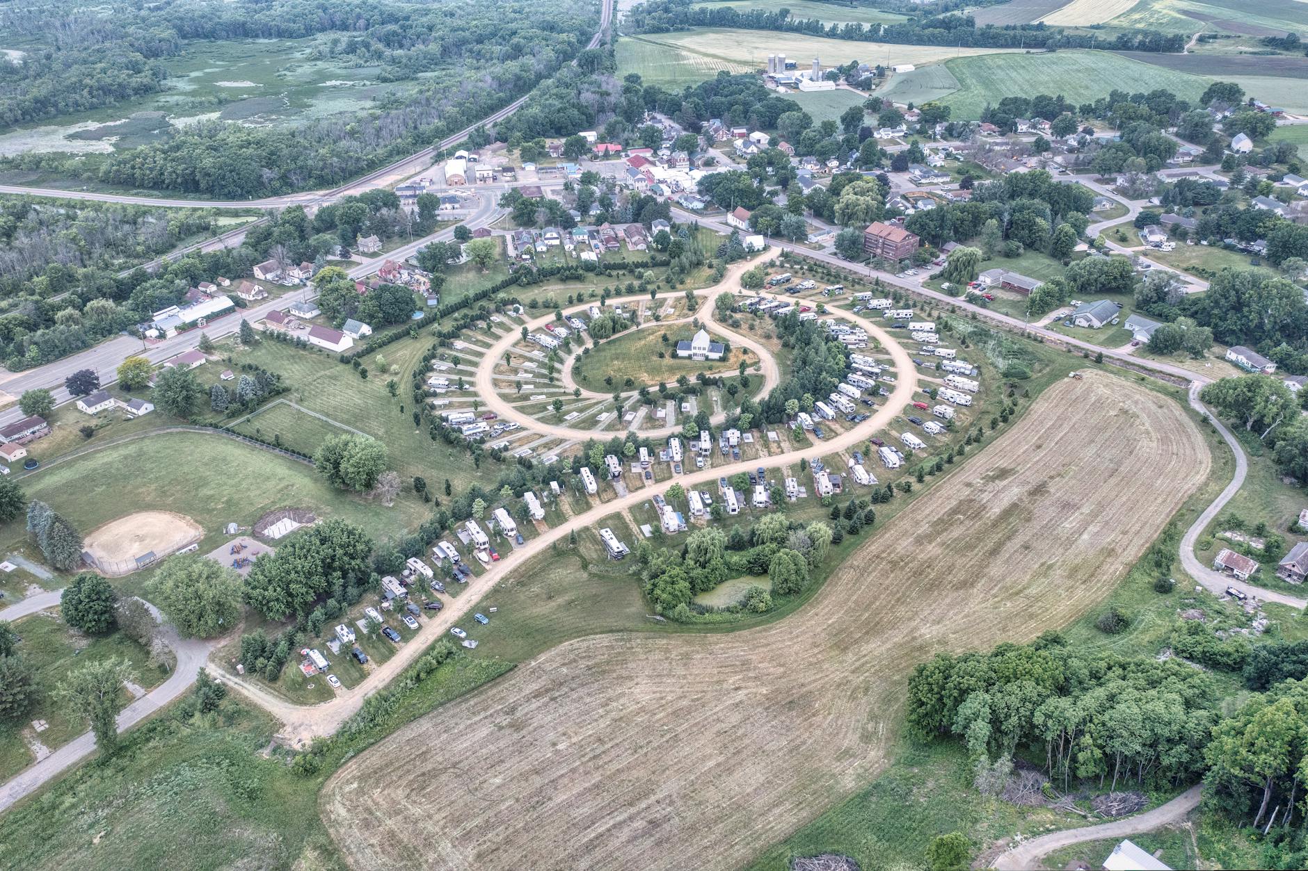
Urban and regional planning focuses on organizing the physical environment in a way that supports economic growth, social equity, and environmental sustainability. It involves the preparation of development plans, policies, and projects that guide the orderly growth of cities, towns, and regions.

Several scholars and institutions have defined planning in different ways:

  • Lewis Keeble defined town planning as โ€œthe art and science of ordering the use of land and the siting of buildings and communication routes so as to secure the maximum practicable degree of economy, convenience and beauty.โ€
  • Patrick Geddes, a pioneer of modern planning, emphasized that planning should consider the relationship between place, work, and people, and that thorough surveys should be conducted before preparing plans.
  • Planning is often described as both a scientific and creative discipline because it combines analytical techniques with design and policy-making.

Thus, planning as a discipline involves technical analysis, spatial design, policy formulation, and community engagement.


3. Multidisciplinary Nature of Planning

Planning is inherently multidisciplinary because cities and regions function as complex systems influenced by multiple factors such as population growth, economic activities, environmental conditions, transportation systems, and governance structures. To address these complex interactions, planners must integrate knowledge from several disciplines.

3.1 Geography

Geography helps planners understand spatial patterns of land use, population distribution, climate, and natural resources. Geographic Information Systems (GIS) are widely used for spatial analysis and mapping.

3.2 Economics

Economic principles help planners analyze development trends, employment opportunities, investment patterns, and the financial feasibility of projects.

3.3 Sociology

Sociology provides insights into social structures, cultural practices, community needs, and demographic characteristics. Understanding social dynamics helps planners design inclusive and equitable communities.

3.4 Environmental Science

Environmental science is essential for sustainable planning. It helps planners address issues such as pollution control, climate change, biodiversity conservation, and natural resource management.

3.5 Transportation Engineering

Transportation engineering helps planners design efficient mobility systems including roads, public transport networks, pedestrian pathways, and cycling infrastructure.

3.6 Architecture and Urban Design

Architecture and urban design contribute to the physical form and aesthetics of cities, including building design, public spaces, and street layouts.

3.7 Public Administration and Governance

Planning policies are implemented through government institutions and legal frameworks. Knowledge of governance systems and administrative processes is therefore essential for effective planning.

Because of these diverse influences, planning acts as a bridge between technical sciences, social sciences, and design disciplines.


4. Role of a Planner

A planner plays an important role in shaping the development of cities and regions. The planner acts as an analyst, strategist, coordinator, and facilitator in the planning process.

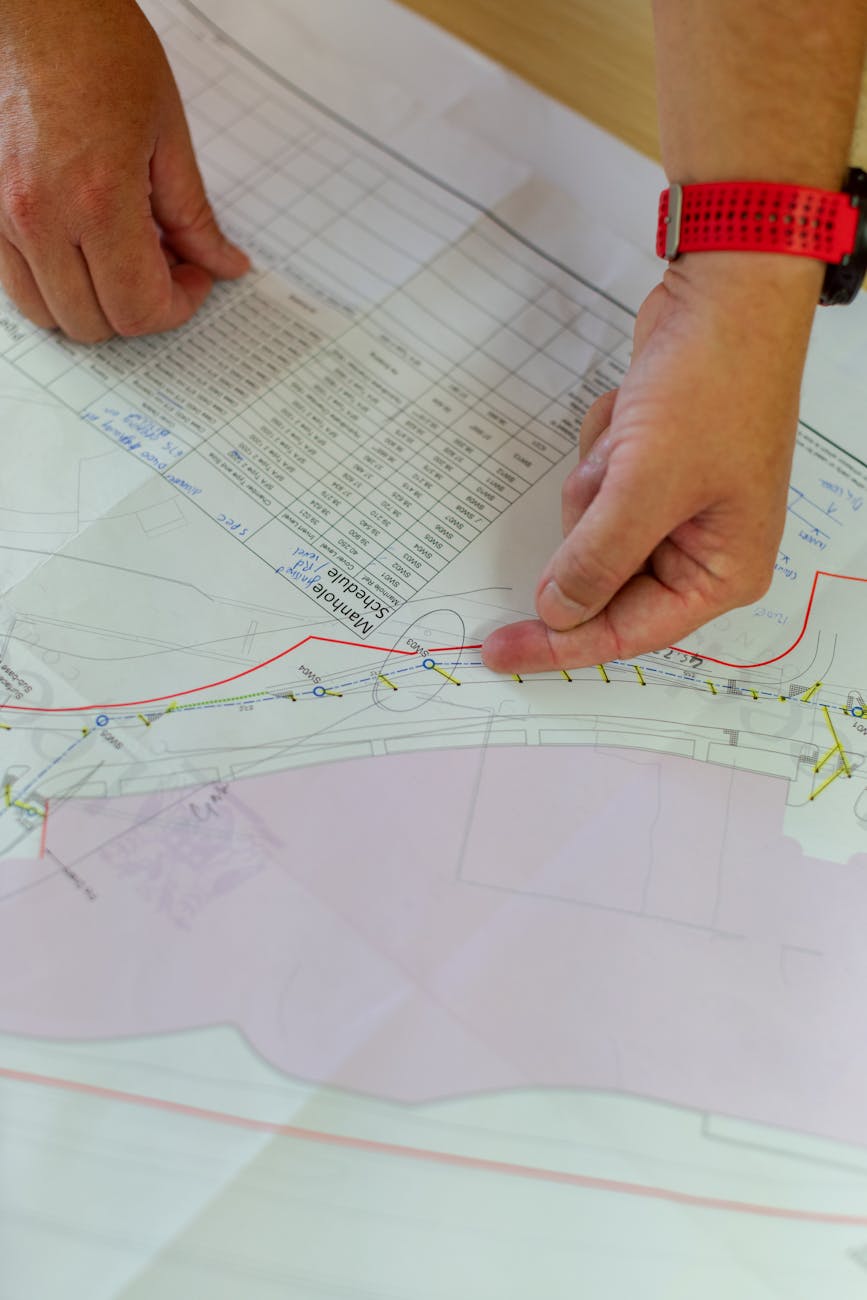
4.1 Data Collection and Analysis

Planners begin by collecting and analyzing information about population, land use, infrastructure, environment, and economic activities. This data helps identify existing problems and opportunities.

4.2 Visioning and Strategic Planning

Planners develop long-term visions and strategies for urban and regional development. They prepare master plans, development plans, regional plans, and policy frameworks that guide future growth.

4.3 Land Use Planning

One of the key responsibilities of planners is organizing land use in a city or region. This involves allocating land for residential, commercial, industrial, recreational, and institutional purposes.

4.4 Infrastructure Planning

Planners ensure that essential infrastructure such as roads, water supply, sewage systems, electricity, and public transport systems are developed efficiently.

4.5 Environmental Protection

Modern planners must address environmental concerns by promoting sustainable development, protecting natural resources, and reducing pollution.

4.6 Public Participation

Planning increasingly involves participation from local communities and stakeholders. Planners engage with residents, organizations, and government agencies to incorporate public input into planning decisions.

4.7 Policy Formulation and Implementation

Planners help governments formulate policies related to housing, transportation, land use, and environmental protection. They also monitor the implementation of development plans.


5. Skills Required for Planners

To perform these roles effectively, planners require a combination of technical and interpersonal skills.

Important skills include:

  • Spatial analysis and GIS mapping
  • Research and data analysis
  • Communication and negotiation skills
  • Policy analysis and governance knowledge
  • Urban design understanding
  • Project management

These skills enable planners to manage complex urban systems and coordinate development activities.


6. Importance of Planning in Modern Society

Planning is essential for managing urban growth and improving living conditions. Without proper planning, cities may face problems such as overcrowding, traffic congestion, environmental degradation, and inadequate infrastructure.

Effective planning helps achieve:

  • Efficient land use
  • Improved infrastructure and services
  • Sustainable environmental management
  • Economic growth and investment
  • Social equity and inclusive development

Planning therefore plays a crucial role in creating cities that are livable, sustainable, and resilient.


7. Conclusion

Planning is a dynamic and multidisciplinary discipline that integrates knowledge from various fields to guide the development of cities and regions. It involves analyzing existing conditions, forecasting future needs, and preparing strategies that promote sustainable and equitable development.

The multidisciplinary nature of planning allows planners to address complex urban challenges by combining insights from geography, economics, sociology, environmental science, transportation engineering, architecture, and governance. The role of a planner extends beyond technical analysis to include visioning, coordination, policy formulation, and community engagement.

As urban populations continue to grow and environmental challenges increase, the importance of planning will continue to expand. Effective planning ensures that urban development is organized, efficient, and beneficial for society as a whole.

Daily writing prompt
Which animal would you compare yourself to and why?

Classification of settlements

he classification of settlements is a fundamental concept in urban and regional planning. It helps planners, geographers, and policymakers understand the diversity, organization, and functional characteristics of human habitations. Settlements can be classified on multiple bases such as size, function, pattern, morphology, density, and administrative status. Each classification provides a different perspective on how settlements evolve and operate.


1. Classification Based on Size and Population

This is the most common and widely used classification.

1.1 Rural Settlements

https://images.openai.com/static-rsc-4/NP4CZOTTaYZJ5pAmOvcfzPmOJ8FocYQf8hKQDznuc2eQfdiwBsfkkmbtcH-85FD1Z5EHJQ4Ybo0jgdo1z8lVbNp9KIpMkw0akRIoNdrPBOQ631iYZl4WiL9QSlbojlKMNnoY1d9KGnfmQ52TwXfesHlxjsDZa0CSXi1cdMfxoo3UW97LSGh_HMAiJSXQiAvZ?purpose=fullsize
https://images.openai.com/static-rsc-4/4-MFeCfW2J2LZDIe8kkR1oNSc9vCfa3hF8cLysvUp6sLm1C7pnX4WnCx3XBpqcjJoARGm8PDqwY4Jl9xeol0uArV5fxhJdNhhVC8_krnZHiMDRdnfvTYze70zLzgNzsBd_Q1jI-h8TCwtv2Dtunf3D9rz3r-dDQCpQpVkSPzNca0gZrsRsDoBBeQ70q-pGBa?purpose=fullsize
https://images.openai.com/static-rsc-4/Lrntmy6wsV1v77sYbjcyVes-QCR7eJUJp-h0988BbhONINy3DHWARS_U9h1XKsjsvcqw2s1CEXM9dCoPA3Q5Pt-YJMYMOSZIwy0kjcLlGpb-038Kc80pa2BivndYBQGvZbaFwe5d4yUJ_e1rt2S61xGdSe-DXcat8wj1XFQpPDjGW5pWV1vtUYwAbcsdg6Bu?purpose=fullsize

6

  • Small population size
  • Dominated by primary activities (agriculture, fishing, forestry)
  • Low population density
  • Limited infrastructure

Types:

  • Hamlet
  • Village

1.2 Urban Settlements

https://images.openai.com/static-rsc-4/gK2WQ8rjmVvv7d8vHmc5sLNLgLOxEOgpZC49uXsMjlnCWzqG0JuF5t5NeNFt8fBc2kLT7oyctI6x-iBe8qENhF3kq4aJ6lJ53XP-hfoYjbzRyIEVeM1tkzSwZaia8FLh7TiyX8JQiT3WiRuTBcSPZcJn6yjPtNJNqq6U0Jsse45-zbT1A3XTMBSW4QeuDEgT?purpose=fullsize
https://images.openai.com/static-rsc-4/sO8rN-Tk6YYREhxn2h1TMmbb_yU1JL0GNAdh6wB1ZYFFGModX5oY_e9It1GPcyGqu4DrfAsQPlweqqxPQi0mLEvxGaJ3T_WaNixDkSI0ZDqq-HomNa0PYMJZrYDtbsSFdsHFgf1CCj1RE4d7OQ795IbCnuOmvOLX-fpqaYJ4CU9od_ze_ZKsIkzEggzj9fgu?purpose=fullsize
https://images.openai.com/static-rsc-4/09y3GsZuGEucDT1YnmigxJDGVRGnhvYx2eH39hvDagif3NRt0WaNODq6WOeoJN1avlFlImZay6Fx566YJRcIbNiunr_Xq4nKddvolS8EHEepTH0c8wBtskvQtT-09M8E_m1ZHgM816hy10FCsgaPJFrjQQEUZj-70PUCehZKUMhWe0H7PXgYHS5CczFt0lSx?purpose=fullsize

6

  • Large population
  • Dominance of secondary and tertiary activities
  • High density and infrastructure availability

Types:

  • Town
  • City
  • Metropolitan city
  • Megacity

1.3 Settlement Hierarchy

A typical hierarchy:

  • Hamlet โ†’ Village โ†’ Town โ†’ City โ†’ Metro City โ†’ Megacity โ†’ Megalopolis

This hierarchy reflects increasing complexity, services, and economic functions.


2. Classification Based on Pattern (Spatial Arrangement)

Settlement pattern refers to how buildings and houses are arranged in space.

2.1 Nucleated (Compact) Settlements

https://images.openai.com/static-rsc-4/NP4CZOTTaYZJ5pAmOvcfzPmOJ8FocYQf8hKQDznuc2eQfdiwBsfkkmbtcH-85FD1Z5EHJQ4Ybo0jgdo1z8lVbNp9KIpMkw0akRIoNdrPBOQ631iYZl4WiL9QSlbojlKMNnoY1d9KGnfmQ52TwXfesHlxjsDZa0CSXi1cdMfxoo3UW97LSGh_HMAiJSXQiAvZ?purpose=fullsize
https://images.openai.com/static-rsc-4/4L98dwrMhDMtXv3yEgJInL0zPkuYjIY2bVIbUTcRbIhunPxSsDwolMyV3rTp91jOob2wijlJA57XC-WInYOMPZixgzvpUpotJa6QQGTZPRlDzL9S7C06VIyNW8hLldZPVHEHsBr9l6y2DaJUr9KVUZgUXi2r_BrDkY2xxktGZT2tJ8vFZvSjtgWhMSEhpLNU?purpose=fullsize
https://images.openai.com/static-rsc-4/SmCxFcJXUe8AxlUfK_I8ptR78zSTY3v6HLQ18mkSU6TMu3zHiWZo0Pe_J8h14UVTJWULRgIjWi16jSmWTicDecIFXJUWdhfvf30QB3QAPDuzRIBXsGVtg_RsddkrS4x5YqIoffgwprg5aGfRzFNQxT9XJ3Lcsh3HX3KeJWWd8O-AXh6SOnlABpH21HH9EqMf?purpose=fullsize

8

  • Houses clustered together
  • Common in fertile agricultural regions
  • Promotes social interaction

2.2 Dispersed (Scattered) Settlements

https://images.openai.com/static-rsc-4/NP4CZOTTaYZJ5pAmOvcfzPmOJ8FocYQf8hKQDznuc2eQfdiwBsfkkmbtcH-85FD1Z5EHJQ4Ybo0jgdo1z8lVbNp9KIpMkw0akRIoNdrPBOQ631iYZl4WiL9QSlbojlKMNnoY1d9KGnfmQ52TwXfesHlxjsDZa0CSXi1cdMfxoo3UW97LSGh_HMAiJSXQiAvZ?purpose=fullsize
https://images.openai.com/static-rsc-4/Dhep_ff5AsHnyByWzAaXf9wZdLjg8FNsEe_UzxZyKHY-2t3qZh0DGaqHIrYu-rxBqa8Hvu3ifbH7-s16GF61CgEpf14jXl02lP1TQ3YVKVeI0eOvsMhIzgRywQOkuvhF5IW-Gv09eiuVCYvatUkIrownruGoksgBrsKQgutGqjxP86LhdBVwRyZX6k9obOc9?purpose=fullsize
https://images.openai.com/static-rsc-4/yiJq-O8ivieh5QX6cz-UHF65z5aSCp6FvdsSJ0tvXgw0vW_LYSIH2ohlnWWbqmIRYs8h1oGsLMuE0MeSsm7jNvJ6I8XvOtBTRNrLTh4peFW-ALIyzicGD0YbWt9GMQgCIUImM_XzXT2lX7xPfeCMk7GkYLLttawZlq5oEgQBib-hnfWrqR1jM4OaqA5A87VG?purpose=fullsize

7

  • Houses spread over large areas
  • Found in hilly or forested regions
  • Low population density

2.3 Linear Settlements

https://images.openai.com/static-rsc-4/3SINz1xf4FpQnHb0WHowaTPEcaleQpn-xtxS0_fmulSjSUJGqohFAisbcoOfJmku97Wq1AeoN7n3nTODn7Xoa-lz4MdhcyNgrodXbCbWxYanYcDTDeNJ3_WB58879hxfi10RlDaO4GkY4d75_T1DM7Ggz5U-7wvsaED2x7-ghUcm4uWpZ9b4PGmxr8QOfMwU?purpose=fullsize
https://images.openai.com/static-rsc-4/ff-hzOBbXcUJ-NGte0bHlVWjK2ZjWaiEccNyVe0VfO-j6VWRstExx374nTsDJn486BJJsY00IbT6daFbjnCgXtPMcp_qCXkuuNjMlZBR-SHQuixqKcXQT6WGoVOrMpmpE5AvgU43lBZRueZSnL_R2MgH58c2SLNbEJo-vJaEvuQ2rksbI2IEfQuEzSpHUrwp?purpose=fullsize
https://images.openai.com/static-rsc-4/ksFOuJeYn76R5p2DCQrs_mVEMtrowmCgDP9tYGzWJa-xuCwDMccCrDhPTmwRelt27T0uZJawENxHiV-8wwoVxjDpF0652cyLGM19GNu-J5I8jTHOnN_cLqNe8G0xrtapaoQtCclmt5rasarp2iTsxqb3ErE8ChpNHtWeYydCECHiMV1Bg8cacpNvZLlyK19P?purpose=fullsize

5

  • Develop along roads, rivers, or canals
  • Easy access to transport routes

2.4 Radial or Circular Settlements

https://images.openai.com/static-rsc-4/wkMazQpimb5zgVUA7_WEW_7IP1lCLBKh74T0o_e48ePwW55NgIAUnLmK0pvRM5MtwBmXrz31EqhIs-AS9K1QlMyweMYA95BA0Yhkl4IAE_e1Q-lsI-Rm8QKxFmJgR1R6kE2LdtRwLbedUlnaLATMLGCsLCWDq8e1ULApMyJBbSKVu7p6Peocu8MUPyDI5cOV?purpose=fullsize
https://images.openai.com/static-rsc-4/3HCBmH0339zqncaN-ZUtDaW1lPivlvzXmB2DrVLNcuJYMEdqughmcOsr6gec9HyeVCI2YrTLgWHOQvl2nfDIZ_tZRPlwVFkvEBpp2ZfkIDdLaz1gw1U1nkgrlJ5RTmICtLyIMUdOx8_VmN8K3KhhpDoid_faCoB5C4DtTooXXEYWIQzqSAfFJll-eyEnzxds?purpose=fullsize
https://images.openai.com/static-rsc-4/2tUDy5vb-E_5li-E5vo04sTGnkxZCuC2L_yyeQfbcFHBQBULE50WaX4mxM6TSgU8bOrfhMomqZrQyEiL2R6Hg68WlKhi6pv9r-b7dyo2B5PsLZOlwfIdeb6ZnjGwFZMeuEzI9KROtTdVX2rMugtujcR-SIX21y_7cr4nqIMqUJPZyxqKylRDbsTCNE36VoGB?purpose=fullsize

5

  • Develop around a central point (temple, market, water source)
  • Roads radiate outward

3. Classification Based on Function

This classification is based on the dominant economic activity.

3.1 Agricultural Settlements

  • Dominated by farming activities
  • Typically rural

3.2 Industrial Settlements

https://images.openai.com/static-rsc-4/QQjERoj0KkccLxGtsHjfdICOyIVeRTszkxSrEIa_tl6QsswIQB_ufwnYYuwGQazKhYY8dUEHA5ldcONTf2j8WUxgzlXwLaN9sL_zRrmNwicobxAtWdh4_dPZpocPRenaXDNPsJKoKNPQ97dfFHPZ0pHr8sBroXELagECR_0vN9wP7007i0de9wsH59Q9HxPb?purpose=fullsize
https://images.openai.com/static-rsc-4/Nk8Rf7jyUoSCdwr1djpe2WtmCh3DDkmyzuO9XvskN7dpkHcDhAua13-UvFNAN1vKPIOn6Icuglh36MjU-zSr0zAkxvPsOtWQ0Jem0pI9Txbg2jIheRhadPvjnCYlxF1O_7TCw1Wyv9AC7hzKdsXpXX4otBpY2lj9dJt7LG-YnU1TPMNtYmH_s5uNgQkk5N4D?purpose=fullsize
https://images.openai.com/static-rsc-4/OZ2gGjTEYeVKL6Rg5KVkvL-fWFVjRQ5SFe6PhZa_X5tGQJXdpecqwBsTxO1gYjEwrDVccIkEJ7yEdTlHbG0AZRVe3HR3RoLohBOHH1oY6f6hzt_B5Fb6yQ2w76E6im45NDB2B2uM1PwM6PWnREQNksdvxpZ5MTJKwDI3X3MzvmH_0z1LhQ6rvfzhmm7pLD4V?purpose=fullsize

7

  • Developed around industries and manufacturing units
  • Example: Jamshedpur

3.3 Commercial Settlements

  • Centers of trade and business
  • Markets and business districts

3.4 Administrative Settlements

  • Capitals and government centers
  • Example: New Delhi

3.5 Religious Settlements

https://images.openai.com/static-rsc-4/wqKe-boIBZ2bi_ZPCswcYedmWss9n8MUYRGiuHbq7IYtKif4u-o0GjGvLBOYKQ3iMKvWSacmYxXetPxsiluJlnDXXD1E1U9ZD_5J9lxYbgZ9xr_QRo3nREljvAfDmkZ37c5YaQd7gMj6EOVDTBn0SQAmt3QCqo19QutcDXuW1ylVxlBWU1P7bqv454WXMvXz?purpose=fullsize
https://images.openai.com/static-rsc-4/wkUgfANNW1aQq1U9sM0cO0C_HJ2swqIFO0XsofFaXS71yuCt8PAe-DLU04wBwXcKO95pdHijByjdSNFAqGUsGtzQLDNaO9JPRGNYqO2o0a7CAQl0l7FNeUKeWNk101U1BMPzI2r_UoFLMzS9zwe2uSGKKsmYZP6cK1PcleeG_wcxCZtQrF1YeJipCfskj7-_?purpose=fullsize
https://images.openai.com/static-rsc-4/pJ76XTnx-_7Xxpp4egzO96UkwvcXwCvkMxIXAT3NCsEdVJLa53FONYYVXdyQjO6ezb9f_KkYzZDHlQy2dKHIR9VVR3b95uhcLstPapIMBKJzvZU14GcvHIaGcHTE39dUZ4DmYwZMa28RUSEkTNfKfbp9u7dOjehGE0uwm1Qd8QjdZZTtioNLJMDM120vma1s?purpose=fullsize

6

  • Developed around religious significance
  • Example: Varanasi

3.6 Transport and Port Settlements

  • Located at transport nodes (ports, railway junctions)

3.7 Recreational/Tourist Settlements

  • Hill stations, coastal resorts
  • Example: Shimla

4. Classification Based on Morphology (Form and Layout)

4.1 Planned Settlements

https://images.openai.com/static-rsc-4/h5tHm1VM-U9UvqEefmk2XZBDb1TyU1UBRFOs1ffIwThMVh03SWbBGHa1iO9VQIpg-PWAu0-P59kzvjK1zV4-0qvFhPvJwtZiNlIAlpLyXyBAxyGT5zEFOQ-TP1l_Qj6S7nKpazlNcUrclL-sIdYFkY4nR5RCqfyBibnoRhxvNUH5iuX40A_ddX588xLmVahC?purpose=fullsize
https://images.openai.com/static-rsc-4/j-fwCU7OZesyKO78kTpBPvp4CwALmTkD7J6kB_EHr3s4kE4HbWunanqpaABdO5cpAOHAeA78pTqWg_dPMNv8IxqxzVcbBMfIaUnddgkNpSxRHeBqolVTI--kHsWzLlMu4e4mIQ3l_sCWMMym7aVpE7b8GE-MgRd0dwU_oju-I1w_p3HGJMOxKly1s6gIThzK?purpose=fullsize
https://images.openai.com/static-rsc-4/P_Lup5YyJrv_FJzCI3K71tZqToZY_Sh2OLx5VDYS871RI6b0hlicQywU3ncPPADpenunE-a71h1l0Yby6VcVjlaQZn-BGyI0Iw1uCBC1kCmPMFokV9FxehhuNshlnh79gSqBZaey1NJNpDNEtpinm1h6RE_4V9mVgCx3DxtMJwFm130enUJXUhH7SfxuOIOT?purpose=fullsize

7

  • Designed before development
  • Organized street patterns and zoning
  • Example: Chandigarh

4.2 Unplanned (Organic) Settlements

https://images.openai.com/static-rsc-4/jAyHy356PfGAcFLPxYnK7U2xCDTl1Gez4HM4oylpOu1nCYNKA_52E9zDJZGhdDb7BV4NV2mvW8wQxz-wobyVa7fLOqafSYfzaVfogkx2KEKnbYOw_wY74T5Mz1dZ53dLhvhfLweRcwL6MmmI4w_Shyz5TCYrdvs2-CJpzBR1YIZcbJtJIn5405s0rmYM1Bny?purpose=fullsize
https://images.openai.com/static-rsc-4/iAJ2Pu-nDB3jS_Lzs3W10wP56etFtGk9Y-ovTF5IoqArNw_BMZBE78PM8lBzI_FGa_tzJYKNsQP9C17QJWfmvcmtD5666DgTPLCYcIAQ9tMgrBbq_En8ivJadC_hgX8V5peXX1_3-R9oRRaxK_CGKxGjB89T-QIRWIbl_D4RQ_U7hITHtBGYcTCuDaym-XJi?purpose=fullsize
https://images.openai.com/static-rsc-4/Z2Bx6TFvdnojwWZpNzRbFGolYhkTxKTPtGmb87BSfTCG1jrqTJRdibsFKM9QgigAppzlhG8rell7Sr3yQA0qweHQRfBBzHQa6RR6F6sRo9S718utbPUeGX5toSvcxT2b43KSAIWoS293NaAGlVhWy6m5iWHH2rnD7nYAivbCCy4KQe9Q-ovTasUkFXeUfZIc?purpose=fullsize

6

  • Develop spontaneously over time
  • Irregular layout and poor infrastructure
  • Common in old city areas and informal settlements

5. Classification Based on Density

5.1 Low-Density Settlements

  • Large land area, fewer people
  • Typical in rural or suburban areas

5.2 Medium-Density Settlements

  • Balanced land use and population
  • Found in towns and planned residential areas

5.3 High-Density Settlements

  • Large population in small area
  • Found in metropolitan cities and slums

6. Classification Based on Administrative Status

6.1 Statutory Towns

  • Declared by law (municipal corporation, municipality)

6.2 Census Towns

  • Identified based on population, density, and workforce criteria

6.3 Urban Agglomerations

  • Continuous urban spread consisting of a core city and adjoining areas

7. Classification Based on Location

7.1 Rural Settlements

  • Located in countryside

7.2 Urban Settlements

  • Located in cities

7.3 Peri-Urban Settlements

  • Transitional zones between rural and urban areas

8. Modern Classification (Contemporary Context)

With urbanization and globalization, new forms of settlements have emerged:

  • Metropolitan Regions
  • Megacities
  • Megalopolis (urban corridors)
  • Smart Cities
  • Transit-Oriented Developments (TODs)

These reflect changing economic structures, mobility patterns, and technological advancements.


Conclusion

The classification of settlements provides a structured way to understand the diversity and complexity of human habitation. Whether based on size, pattern, function, or morphology, each classification reveals unique characteristics and planning needs.

In contemporary planning practice, especially in rapidly urbanizing countries like India, such classifications are essential for:

  • Policy formulation
  • Infrastructure planning
  • Resource allocation
  • Sustainable urban development

A comprehensive understanding of settlement classification enables planners to design interventions that are context-specific, efficient, and aligned with the broader goals of sustainability and inclusiveness.

Contributions of Leading Masters (Thinkers and Town Planners) in Planning

1. Introduction

Urban planning as a discipline has evolved through the ideas and contributions of several influential thinkers, planners, and architects. These individuals played a significant role in shaping modern planning principles by proposing innovative concepts, planning models, and urban design strategies. Their ideas emerged in response to the social, economic, and environmental challenges of their times, particularly during periods of rapid urbanization and industrialization.

The contributions of leading planning masters laid the foundation for modern urban and regional planning. Their work addressed issues such as urban congestion, housing shortages, transportation systems, environmental quality, and social welfare. Many of their ideas, such as the Garden City concept, regional planning, neighborhood planning, and urban design principles, continue to influence contemporary planning practices.

Photo by Mohammad Husaini on Pexels.com

2. Ebenezer Howard (1850โ€“1928)

Ebenezer Howard is one of the most influential figures in the history of urban planning. He is best known for introducing the Garden City concept, which aimed to combine the advantages of both urban and rural living.

Key Contributions

  • Proposed the Garden City model in his book โ€œTo-Morrow: A Peaceful Path to Real Reformโ€ (1898).
  • Suggested the development of self-contained towns surrounded by green belts.
  • Advocated balanced development with residential, industrial, and agricultural areas.
  • Promoted healthy living conditions through open spaces and planned communities.

Impact

Howardโ€™s ideas led to the development of Letchworth and Welwyn Garden City in England and influenced the planning of new towns and suburban developments around the world.


3. Patrick Geddes (1854โ€“1932)

Patrick Geddes was a Scottish biologist, sociologist, and town planner who emphasized the relationship between people, environment, and economic activities.

Key Contributions

  • Introduced the concept of โ€œSurvey before Plan.โ€
  • Developed the regional planning approach.
  • Emphasized the interrelationship between place, work, and folk.
  • Advocated conservation of historical urban areas rather than complete demolition.

Impact

Geddesโ€™ ideas greatly influenced modern urban planning and regional planning. His approach emphasized comprehensive analysis of social, economic, and environmental conditions before preparing development plans.


4. Le Corbusier (1887โ€“1965)

Le Corbusier was a Swiss-French architect and urban planner who proposed radical ideas for modern city planning.

Key Contributions

  • Proposed the concept of the Radiant City (Ville Radieuse).
  • Advocated high-rise buildings surrounded by open green spaces.
  • Emphasized functional zoning for residential, commercial, and industrial areas.
  • Promoted efficient transportation systems and modern infrastructure.

Impact

Le Corbusierโ€™s ideas influenced modernist urban planning and the design of several cities. He also played an important role in the planning of Chandigarh in India, which became an example of modern planned cities.


5. Clarence Perry (1872โ€“1944)

Clarence Perry was an American planner who introduced the concept of the Neighborhood Unit, which became an important model for residential planning.

Key Contributions

  • Developed the Neighborhood Unit concept.
  • Proposed that residential communities should be designed around elementary schools.
  • Emphasized safe pedestrian circulation and reduced traffic within neighborhoods.
  • Suggested the use of neighborhood parks and community facilities.

Impact

The Neighborhood Unit concept influenced the planning of residential areas in many cities and is still used as a guiding principle in neighborhood design.


6. Daniel Burnham (1846โ€“1912)

Daniel Burnham was a prominent American architect and planner associated with the City Beautiful movement.

Key Contributions

  • Advocated the creation of beautiful and orderly cities through monumental architecture and grand boulevards.
  • Played a major role in the Chicago Plan of 1909, one of the earliest comprehensive city plans in the United States.
  • Promoted large public parks, civic centers, and wide avenues.

Impact

Burnhamโ€™s work helped establish the importance of urban design and aesthetics in city planning and influenced many urban improvement projects.


7. Arturo Soria y Mata (1844โ€“1920)

Arturo Soria y Mata was a Spanish urban planner known for proposing the Linear City concept.

Key Contributions

  • Proposed the development of cities along linear transportation corridors.
  • Suggested that urban growth should occur along railways or roads.
  • Emphasized efficient transportation and distribution of urban services.

Impact

Although fully linear cities were rarely developed, the concept influenced modern urban planning ideas related to transport corridors and linear development patterns.


8. Lewis Mumford (1895โ€“1990)

Lewis Mumford was an American historian, sociologist, and urban critic who contributed significantly to planning theory.

Key Contributions

  • Criticized uncontrolled urban growth and industrial urbanization.
  • Supported regional planning and balanced urban development.
  • Advocated human-centered urban design and sustainable communities.
  • Promoted integration of technology, culture, and environment in urban development.

Impact

Mumfordโ€™s writings influenced modern urban planning philosophy and emphasized the importance of social and environmental considerations.


9. Sir Patrick Abercrombie (1879โ€“1957)

Patrick Abercrombie was a British planner known for his work in regional planning and urban reconstruction after World War II.

Key Contributions

  • Prepared the Greater London Plan (1944).
  • Proposed the development of new towns around London to reduce congestion.
  • Promoted green belts to control urban expansion.
  • Integrated transportation, housing, and land-use planning.

Impact

His planning ideas influenced modern metropolitan planning and regional development strategies.


10. Kevin Lynch (1918โ€“1984)

Kevin Lynch was an American urban planner and author known for his work on urban design and city perception.

Key Contributions

  • Introduced the concept of urban imageability in his book โ€œThe Image of the City.โ€
  • Identified five key elements of city form:
    • Paths
    • Edges
    • Districts
    • Nodes
    • Landmarks
  • Emphasized the importance of how people perceive and navigate urban environments.

Impact

Lynchโ€™s work greatly influenced urban design and the understanding of how people interact with cities.


11. Contributions of Indian Planning Thinkers

India has also seen contributions from several planners who shaped urban development.

M. N. Buch

  • Contributed to urban planning administration and policy development in India.
  • Played an important role in strengthening planning institutions.

Charles Correa

  • Prominent Indian architect and planner.
  • Designed several urban projects and advocated climate-responsive architecture.

B. V. Doshi

  • Contributed to housing and urban design in India.
  • Promoted sustainable architecture and community-oriented development.

12. Importance of Planning Thinkers

The contributions of these planning masters have shaped the development of modern planning theory and practice.

Their ideas helped introduce:

  • Planned urban growth
  • Neighborhood planning concepts
  • Integration of land use and transportation
  • Environmental sustainability
  • Human-centered urban design

These principles continue to influence contemporary urban planning and development policies.


13. Conclusion

The development of urban planning as a discipline owes much to the ideas and innovations of leading thinkers and planners. Individuals such as Ebenezer Howard, Patrick Geddes, Le Corbusier, Clarence Perry, Daniel Burnham, and others introduced influential planning concepts that addressed the challenges of urban growth and industrialization.

Their contributions established important planning principles including garden cities, regional planning, neighborhood units, modernist city design, and aesthetic urban planning. These ideas continue to guide contemporary planning practices and inspire planners to create sustainable, functional, and livable urban environments.

By studying the work of these planning masters, planners can gain valuable insights into the evolution of planning thought and apply these lessons to address modern urban challenges.

Daily writing prompt
What activities do you lose yourself in?

Different factors influencing development of settlements

The development of human settlementsโ€”whether rural villages or large metropolitan citiesโ€”is shaped by a wide range of interrelated factors. These factors determine where settlements emerge, how they grow, their spatial form, and their functional characteristics. Broadly, they can be classified into physical, economic, social, cultural, technological, and political factors. Understanding these determinants is essential for planners, as they explain both historical evolution and contemporary urban dynamics.


1. Physical (Natural) Factors

Physical factors form the foundation of settlement development, especially in the early stages of human civilization.

1.1 Relief and Topography

https://images.openai.com/static-rsc-4/2mSMEw36VIbnQyOlMnEIau9rIdTKKVwmP61hec1l9kMm1FXQLriVewaZxG_X-4YtdxOsy5IFbW0t4ddDxOSsBqKzsLGBupnX55_FQPSPj7nVXN_V6L3XQlRW94znV21w1lhwsjRKEzI9gWioibTCbz-x6Pn25_xnIi7xr9kCMkeHeFw0ebUuCGsIMm6s8eZo?purpose=fullsize
https://images.openai.com/static-rsc-4/n8px47o5M44vnUcacFiMldKDcnMDqMJzp487hFIWlEBI1xw8QbjFv0hqFN8JTfyKvTsTkrF7Kom72p5AGlOOJv4B3-rw50reyjfFoltqWkZArkMhWWIkt-1wfACqotedyMjOkHuHsOQ7Bbi9J2chubEdKVj1EnYzZa7hSsnEqzIbIXILxvpln36UCCU25mmz?purpose=fullsize
https://images.openai.com/static-rsc-4/YJW5lIjxw-LmigcZFXd1UfrsFsVPiQZdK9Ds5cOITEsAokMEUsFve0kDi6rrOKuWh3bC2CcNFxhAmdh9V66Dzh5youyE7hbLcD0yPbv91apAkRxim4h3vl9R3rECPOBlfhFPxHIKLsT_BSL7KpNW_QEslb-eYg0stPSvy6sG4xw4oSW4AZ4pNKLp8fEasbMR?purpose=fullsize

6

  • Flat and gently sloping land is ideal for settlements due to ease of construction and transport.
  • Mountainous and rugged terrain restrict settlement growth due to accessibility issues.
  • Plains (e.g., Indo-Gangetic plain) support dense populations, while hilly areas tend to have sparse settlements.

1.2 Climate

https://images.openai.com/static-rsc-4/qCL5DFO1a1ppuV7dSFrAxorhqrSPCucEy2GgFEWdwNlm8i4CCeULxU-Smt_9PKzmca-qa1ytR1lppLoXIz8RAmizuIvvAHnZUCTjCGp-QqWSo68amKl6ygUpfRGUAbRvApRNATz_Mhrm6UsQhYEpSrR1fnktMATQjlVNiLjNqMik7ptPaT8-HEHibEHwLY61?purpose=fullsize
https://images.openai.com/static-rsc-4/i0acV87i0h7xUIco22Bjc8eJxXrVPnAhWgA5OflV0FUwSLbPWj2Syq1RSWXgbdhOuejuU8ua7vhCP1L0EXN0KWqapiCIrr2ppBvcAVzqR2JlPcMMY4Xq2hFymMo9at_vtK4a5emqRnznmwVNsGu6eCiqlILyTl-sN14plUEVjkTuOnN0t2tyU0Mo8WiPX3js?purpose=fullsize
https://images.openai.com/static-rsc-4/N96jsQglwjB3ja1GXVHzoeVb2gUOxr2DYCJXjiAonNFHJUQguNF1Ws4SWCJUNmnj7GaKS5wluy_960m1EUbB76wbuKCsBuH1kBXH-uFYXfBkRKa5X4LrDBsZZlvJcAbi3pXxY1UCsQ3k1wBmIlRUFqHvtZ9b9d9M5rgeuuD0s3tNZYiFtzOw6Q6ErQbyfp4t?purpose=fullsize

5

  • Moderate climates (temperate regions) attract dense populations.
  • Extreme climates (hot deserts, cold polar regions) discourage settlement.
  • Climate influences building design, lifestyle, and economic activities.

1.3 Water Availability

https://images.openai.com/static-rsc-4/0trs6VuE3CASJZYPVyqK3nv8wl30mgGww7HZYO40CPAVzgopTTF-ZJ_hY8_HvOiV475tVzoprNmf9WNx4BV0daewHwInVVpOnq44T2mlasx8OpHfX0N3zfiO5DUHfKjAmRs6XsGFx_24K5CHVSGjh6aWAdN_8MiY6Eo11pCKQBsr7l6c-fIyA4VZUwEAPLdS?purpose=fullsize
https://images.openai.com/static-rsc-4/rRPBvN27gL-hVp4DTExO0jrtbbOf_kMXComQUhFpFam1Xbk0YLj20bes6XANMO0vTKf8rsVJ4MgcJRV_eszPfNtXcJMuZOuuwZTyaf7PZyLZqkb5fYfyga2lnU-SJ41l74oG6aDYk7wn-LCJXrVTkCbb4uj1ncULTf119uNqp_KFj_QaYqjnrW9t1P4rTm4f?purpose=fullsize
https://images.openai.com/static-rsc-4/5-Pn5BQtE5zqgQ-jEdJeyRjg-Ofxa0PwQR-j0pmpfE2iC4ubJ7-7ONxgWB6QqPejz-JrU3bduy77oPQin9sn9N8BYmR2x9z4btLJfripn_GPFJj5xF00DdcNa2cc8zn0A6bg7u6QGB3G6EOEWeaNAo-IkWDK6v7XlTubstxQIe044mnIzLPZA3PJfhrI0g-Q?purpose=fullsize

7

  • Availability of water is one of the most critical factors.
  • Settlements historically developed near rivers, lakes, and coastlines.
  • Water supports drinking needs, agriculture, industry, and transport.

1.4 Soil and Natural Resources

  • Fertile soil promotes agricultural settlements.
  • Presence of minerals and natural resources leads to industrial settlements.
  • Forests, fisheries, and energy resources influence settlement location and growth.

2. Economic Factors

Economic considerations are among the most powerful drivers of settlement development, especially in modern times.

2.1 Employment Opportunities

https://images.openai.com/static-rsc-4/gjwvrvdgY-fC7iV1fRQNnkv1rXHky-C9_lGqfOgkw9xHXIOY2SD-CeFZTT-krwZfwPk4KHMcyYB28nnphjuq9w3OiLGM9kzqUBjXEGzXNombUubNzhBBcjrW2TMIZMRc01eqP2wIRejO7USW2iR7DVM1JKkN1kgoKoFwUOZQa0-MvQi37U9heOTxoIIvqIap?purpose=fullsize
https://images.openai.com/static-rsc-4/xrK1konRR9fhfyuSpiFkBWs0Nkiu5HWiwwCUOGsMlQjGxHkvk6zSQaEwkoUTRFviAwvrkm0l3AWI4qzmu8rqsY7Ot0imdmhMJ7cbzHgkvdVFWtKe1SWlRHhSMZyEKDArGcaIVRWqJ6mqd3M1NVJHMQNUfoQ66DyCyjmQZ4bwmqEloUtqsV9xOvnciaBOnf2k?purpose=fullsize
https://images.openai.com/static-rsc-4/l5aRQ_SkO_TWGpYIOJrO0ZbB12NyiTSTDHy7fSUcDB6KRcKsELQIi4rxlKqlxyiKCXMyGIqohA4o2xEHtZ_CA9QUzKTEJ5aPJrOIr8xNrAvyEtJbJrEywkx4w4_bTLIgLxxuZ0hxfVnSvtMd1tzctSyq--Uqc2L4ALAP5Y0VpU1C6QzPfqhH360Loxa1GvFF?purpose=fullsize

7

  • Availability of jobs attracts population.
  • Industrial, commercial, and service sectors lead to urban growth.
  • Cities like Mumbai and Bengaluru grew due to economic opportunities.

2.2 Trade and Commerce

  • Settlements often develop at trade routes, ports, and market centers.
  • Historical trade hubs evolved into major cities.
  • Accessibility enhances economic viability.

2.3 Transportation and Accessibility

https://images.openai.com/static-rsc-4/ucfkfLm4ZMxp3mpJGsbiTz4a0GwJqyl2WY3u993vhUz4epwBiLMntaBZgxEKOZsDPrN-IX2OXxL2CxQUsOFlnO31qr0Sahy4eN74SbjvYh7ltJ6MdnyCAWWmKAY_QKim0_ifzIRxXDc5f6Mq0KK8o4Q0q4qmIf6gpiYo10CxQcU3Z1EyIkBzZkjmeCVIP4mA?purpose=fullsize
https://images.openai.com/static-rsc-4/fG6yiw0cPpQwOOoCVyW5aEFNfXDFJVZUNGVrHCGx41YusSG03OOjgzp2TnLfUZmOtgTlj4jO6ZayKe4UpAsIMqEoDxAey3hD6CJ4QbeW24l48XL8EnHbp8aXTTnWbkX855jK5E4HgRo_BQmyDA_TJXBOqJK4UJACPfPqUjn5A9o8GZT4UOmL1lawNnpkN32z?purpose=fullsize
https://images.openai.com/static-rsc-4/mylgGkF3bgSlTi6cdbXwV-fDW3hQ8pLx1P34rOcs8hJb9WbN2-Yf6aAHSHayp3QuQqap9eFOZawpynoshjFam7s_D-y459mtXZWYvM4OOVC7VkY0e3WdzHa88TObDaRHLz4tbeyCLrVwzHVMxJKfnkyQiWxpFIewQjmW4-hsfI4GJLGJo60uK5PFHNB_if79?purpose=fullsize

6

  • Transport networks (roads, railways, ports, airports) influence settlement location.
  • Well-connected areas grow faster due to ease of movement of goods and people.
  • Transit-oriented development (TOD) is a modern example of transport-led growth.

3. Social Factors

Social aspects influence both the formation and organization of settlements.

3.1 Population Characteristics

  • Population size, density, and growth rate affect settlement expansion.
  • Migration patterns significantly influence urbanization.

3.2 Education and Health Facilities

  • Availability of schools, colleges, and hospitals attracts population.
  • Social infrastructure enhances quality of life.

3.3 Social Organization

  • Community structure, caste, and social networks influence settlement patterns, especially in rural areas.

4. Cultural and Religious Factors

4.1 Cultural Significance

https://images.openai.com/static-rsc-4/wkUgfANNW1aQq1U9sM0cO0C_HJ2swqIFO0XsofFaXS71yuCt8PAe-DLU04wBwXcKO95pdHijByjdSNFAqGUsGtzQLDNaO9JPRGNYqO2o0a7CAQl0l7FNeUKeWNk101U1BMPzI2r_UoFLMzS9zwe2uSGKKsmYZP6cK1PcleeG_wcxCZtQrF1YeJipCfskj7-_?purpose=fullsize
https://images.openai.com/static-rsc-4/SQgP9_88Fc0eVjuVF4WXIy9o5723Q3Qj05dFM_68KTucAij6jOy7KQCktJLlDp5N7AS5YmR_RZlkpGGOI-ZEYvFUL-4Sw0IsQm_Zd0n1UwHsq_EDdc9DUeJOb4fEmv6heEMT4bVnMMM_UL-2wDmzs5F6N0GcuJm5DraJbttZe6N6a4_WI3ybC1qIdyiomtp8?purpose=fullsize
https://images.openai.com/static-rsc-4/Yr1tofIF9OQBqmtNrOii6pveVel5D4gXqkb6_3uJ4450PguMeNMWLd0pG47Ok2sXtKR46D-TaPsdKy3dpmvNb6jJ3FTNu7naHACiyO8M9FIlGg3KH75KofDrzrxK2oWiWWeCUTMPRfISd5LJ_gBA1IbzJ--uwMa-JLCEilDMbiSP3EG5Sa2y6b28u_nGytwu?purpose=fullsize

6

  • Settlements often develop around cultural and religious centers.
  • Example: Varanasi developed due to religious importance.

4.2 Traditions and Lifestyle

  • Cultural practices influence housing types, settlement layout, and land use.
  • Traditional settlements often reflect local customs and environmental adaptation.

5. Political and Administrative Factors

5.1 Government Policies

  • Urban planning policies, zoning regulations, and land use controls shape settlements.
  • Government initiatives (e.g., smart cities, industrial corridors) influence growth.

5.2 Administrative Functions

https://images.openai.com/static-rsc-4/iMHXvRF74hrjnpaljGyarXEehgCZX6ACLclfmKm1mQ3J90HgF88cjyZw94IOGVB51gHmiPchg_UCq3JmB3SkU0rUX89vWEN-4ITqUfayKgtaZ8dXUBAN79QT2RNvorJHEk3wqIpywZLBbfejRgLX5qY2NeT-ILvl1k749uk1e3dYcmdvrNyMIwsPeRN0glv2?purpose=fullsize
https://images.openai.com/static-rsc-4/h5tHm1VM-U9UvqEefmk2XZBDb1TyU1UBRFOs1ffIwThMVh03SWbBGHa1iO9VQIpg-PWAu0-P59kzvjK1zV4-0qvFhPvJwtZiNlIAlpLyXyBAxyGT5zEFOQ-TP1l_Qj6S7nKpazlNcUrclL-sIdYFkY4nR5RCqfyBibnoRhxvNUH5iuX40A_ddX588xLmVahC?purpose=fullsize
https://images.openai.com/static-rsc-4/WmSJyV7pUqX5opfJgG6XmO6HhsGhWDz0RW8ChOSRBE0AMWKVpbzyzbpeVwyQr0OZruDvuh-FvC1f5BLjFbLNNNxm1742m4uirHRAfrXUtORsppQeTosElJzbQzNjHpeH7XBje9MKNIPaVqrR_wW-jWGjupZWm6VxzypgK9aKwspsoaLIzTcDaKepKAPelRxl?purpose=fullsize

7

  • Capitals and administrative centers attract population and infrastructure.
  • Example: New Delhi developed as an administrative capital.

5.3 Defense and Security

  • Strategic locations (forts, border areas) influenced settlement development historically.

6. Technological Factors

6.1 Transport and Communication Technology

  • Advances in transport reduce distance barriers.
  • Communication technologies enable remote work and decentralized settlements.

6.2 Construction Technology

  • Modern materials and techniques allow high-rise buildings and dense urban development.
  • Infrastructure development supports large populations.

7. Environmental and Sustainability Factors

7.1 Environmental Constraints

  • Flood-prone areas, earthquake zones, and pollution affect settlement suitability.

7.2 Climate Change

  • Rising sea levels, extreme weather events influence future settlement patterns.

7.3 Sustainable Planning

  • Emphasis on green infrastructure, renewable energy, and resilience is shaping modern settlements.

8. Historical Factors

  • Early civilizations developed near rivers (e.g., Indus Valley).
  • Colonial history influenced port cities and administrative centers.
  • Legacy infrastructure continues to shape current urban form.

9. Interaction of Factors

No single factor determines settlement development. Instead, settlements evolve through the interaction of multiple factors:

  • Physical conditions provide the base
  • Economic factors drive growth
  • Social and cultural factors shape organization
  • Political and technological factors guide expansion

For example, a city may originate due to a river (physical factor), grow due to industry (economic factor), and expand due to transport infrastructure (technological factor).


10. Relevance in Contemporary Planning

In modern planning, especially in the context of sustainable development and TOD, these factors are integrated to:

  • Promote compact and efficient urban growth
  • Enhance accessibility and mobility
  • Improve quality of life
  • Ensure environmental sustainability

Understanding these factors helps planners design settlements that are resilient, inclusive, and efficient.


Conclusion

The development of settlements is a complex process influenced by a wide range of natural and human factors. From the early dependence on physical conditions such as water and climate to the modern dominance of economic and technological drivers, settlements have continuously evolved in response to changing needs and opportunities.

For planners and policymakers, recognizing these influencing factors is essential for guiding future development. A balanced approach that integrates economic growth, social equity, environmental sustainability, and technological innovation is necessary to create well-planned and livable human settlements in the 21st century.

Global Distribution of Settlements and Population

The distribution of human population and settlements across the Earth is highly uneven, shaped by a complex interaction of physical, economic, historical, and technological factors. While some regions are densely populated and heavily urbanized, others remain sparsely inhabited or even uninhabited. Understanding this global distribution is fundamental in urban and regional planning, as it reveals patterns of development, inequality, resource use, and sustainability challenges.


1. Concept of Population and Settlement Distribution

Population distribution refers to the spatial arrangement of people across the Earthโ€™s surface, while settlement distribution refers to the location and spread of human habitationsโ€”from small villages to megacities.

The Earthโ€™s population is concentrated in certain regions due to favorable living conditions, while large areas remain sparsely populated due to harsh environmental conditions.


2. Global Population Distribution Patterns

2.1 Major Population Clusters

https://images.openai.com/static-rsc-4/qbv2LZGdfJgO8UOcnUlvNhudNn5orsQFCF_z2ceyxwELl5sUVaGZA0HAxLAG0HZyBsa5BHiRgLTKWrGwByKbdDRftaJvRPDtiuvz6wwCFu-ICbV5SG9RcjolDeUbKDANeoQrcdX4c58cITD8ywsEEdwqB58dY6zSW5PQWE59diZUKgQYh7PsNFMnV3gn96vg?purpose=fullsize
https://images.openai.com/static-rsc-4/f0xuhGlOEOIh1O0FVqLQ8ytFIKBXSMmPPJVvBAgnH85xOjWnWzQUgDoRg0nzyoojfugSYbRRrmfhzenGBzd7hUCWOQUxzXt-iu5OmLCnx_bmq1qsC_bQZY9qpyDd0QUPfj1uWqy13-uZQnwL_n5irXMAuToJFG2-VHbYm6MZmAb3c2HJ7EzUs5uLc2Am3php?purpose=fullsize
https://images.openai.com/static-rsc-4/IN9JGz51X693y7dSBNfvJeAfjsUlmeAn9xIsPZbR-IhbbEi-OlDA_hGL9v67SfHbi-7MZRNQPewHIA_0dHcUK26OkggIjnCYCY6MZQgJSf6HsB_mdGpQXPuILvyIdiB5rOIC0r-yAe8YTlGp4yHdNry51VBdn86bLoNAvs3ccluqjoH6igjRBFxnHCFb12uO?purpose=fullsize

8

Globally, population is concentrated in four major clusters:

a) East Asia

  • Includes China, Japan, and the Koreas
  • High population density in river basins (e.g., Yangtze, Yellow River)
  • Advanced industrial and urban systems

b) South Asia

  • Includes India, Bangladesh, and Pakistan
  • One of the densest population regions in the world
  • Fertile plains (Indo-Gangetic basin) and historical agricultural development

c) Southeast Asia

  • Includes Indonesia, Vietnam, Philippines
  • Dense populations in coastal and delta regions

d) Europe

  • Includes countries like Germany, United Kingdom, France
  • High urbanization and industrialization
  • Well-developed infrastructure

Together, these regions account for the majority of the worldโ€™s population.


2.2 Sparsely Populated Regions

https://images.openai.com/static-rsc-4/3zDYYyo14_Kms4IfImt1NQ2t-f4Rj7eOPDX-qk7fUr5WZHX8Azf3yUNgl3NN6F5sDEzA_JMOVmzdv07_fYXbtMQbV9eZk8KsL-Ol_F5VHtXGFKNFvnKvsSfcZrTGXt8kUGkPMwvIvo73kh9TPHdV8x2wnitSolXt_UTZBG1rEEMxnHQ74z5Y8lwSLV4hax-c?purpose=fullsize
https://images.openai.com/static-rsc-4/oRTxd5eKYmlTBFXoWrdWj2JaiUGEsxby4MIhdRxW-1kctV1sda5SLPzdtAoaYXUej6ANfjxON_h8cLsRlegVLc9zlyajJ5h5qkfm9PRG3q9MgrhZmXsK_yqAVJrf89G-EmaODJ4zDN7RFzHEfy2O46ValiLqr9EUrcm3RKxHzhfGA82dGU4uV2LLovXLU62c?purpose=fullsize
https://images.openai.com/static-rsc-4/N4ju6tz2VEFteOhmt0wqReYsPTIJRYwXR2RnXMW9-bLEMxXqyWNb5m3-FBrwEasrQw035vn5A_bnXgXj599IHZJ9E8KUIY5h9wngaDdHoW5pMRO_eweQ8kW7KMXgzLwyggcXZMTQLyMyAKy-nbNZkpTi8A0bClcQ3G1E-EqFSFAjN28S5Ek49hWIk8y0Kpq0?purpose=fullsize

6

Large parts of the world have very low population densities:

  • Deserts (e.g., Sahara, Arabian Desert)
  • Polar regions (e.g., Antarctica, Arctic tundra)
  • Dense forests (e.g., Amazon Basin)
  • High mountains (e.g., Himalayas)

These areas are constrained by extreme climates, poor accessibility, and limited economic opportunities.


3. Global Distribution of Settlements

Settlement distribution closely follows population distribution but is also influenced by accessibility, resources, and economic activities.

3.1 Coastal Concentration

https://images.openai.com/static-rsc-4/KOGvR2Rv7ShtOD9bc2xfuU1XvWRFnpJ-YKhvge14aEtUemqjbj1droRoPMSKMBYTWr-ymwstDzBuCum_n6AGJqnq1IX3iPx8HQdlqMXRyiBNKKC2XUrgBlwNLwoHrQaWAszxnmvT-Gmix1MBAhdCh3s0n8pOaAR-HDNdlgWEqu7osM7hyWiKRNvvB2TW41es?purpose=fullsize
https://images.openai.com/static-rsc-4/qYbyWxSRLkmDWDJXd1VN-9C3YHaZrLCh6uw2e_JJifPzK68qs_rjWyvJ2HGiT4K1h72kHAbSt3mQreryBDY-O_fxy1HiBLpp25feWgNCC1lIckmVOZuvaQM4FtfxAa1UYG3vqL4BB93nkqKeqk8Y81Aaja3r6EYzJpbyYKRefcvXw4RBKI0XGz6UO7VPbmzp?purpose=fullsize
https://images.openai.com/static-rsc-4/PfrBGhYJjLQhAFuwJhtRQNogFjy6g_UtRzih5fDIpiuM4EsdaCCR5aL6InJM9qEgzgV7hiQgWWmROJ-bpwIHMp9R0VB_zi3mIo6oR8SAn8o4pfbOQazbrXYloDeBY_OI7NFsVrT-pRyQliuYB5E1EFVBZ0j7EK-3hUZu_9udwO4QcpfpXn51xG2tREryjLfy?purpose=fullsize

8

A large proportion of the worldโ€™s population lives near coastlines.

Reasons:

  • Access to trade and transportation
  • Availability of water resources
  • Favorable climate
  • Historical development of ports

Examples include major coastal cities like Mumbai, Shanghai, and New York.


3.2 River Valley Settlements

https://images.openai.com/static-rsc-4/04o60VHjEHyA-ptWpXBe88WzdFwkaSD2IemCtiJ3hD9cjWJrMb_1mxh565qgrtVuzzMlmJgpgeWgVh-glzKUT3rOFN5bPyfX50Z0ExgpdNMGtQ9rzM8M66Z0BI0XslwqrzxXxB2f4tJzxnFO6vTTGBamYqvX1okTCam3CLa_W4lfj3mDIpIIqZQPfFR07mbq?purpose=fullsize
https://images.openai.com/static-rsc-4/4nDKifP1VWjq26tB6K5585CH4tj_xxnxFl5iHdoNOPGS3_O-x-Mjhg-LZx8_Wrndbgpn5mcsss8e5ecG49E20pd5LPlgNe-TEDqxPVfSJkf73TmvZ4CO3kLGtH3vn2FEwXtNLaQGvuCbvrjZjX_pXaIOmXWZI3pMtwHqWpf26BkPpHsolzbFUwv-VlLkj5xy?purpose=fullsize
https://images.openai.com/static-rsc-4/UK-qvgEeDpZHC2gt3SzuqFMyFiPojabtVsyhCJRkUuFUeWdVQ3YD8TCJZFdRrJaDEe5Wr7Lk6HP9_P9T-JoKe_Kh_RkKLN_SzNVgrOw3rmcoFj7PBycwudgQh1aUmPDp9SIJG1YDwVzdKOMWi39ED-yCY8hH6-9NZDs_7cqFywv5GegfIyEWAMQ5YA-ebEG4?purpose=fullsize

6

Settlements have historically developed along rivers due to:

  • Water availability
  • Fertile soil for agriculture
  • Transport routes

Major river-based settlement regions:

  • Nile Valley
  • Ganga-Brahmaputra Basin
  • Yangtze Basin

3.3 Urban Concentration and Megacities

https://images.openai.com/static-rsc-4/6AMCBlln6HjNBQzgmPQumWgsjugxvC0lyKPXKsExGFV9HAwOmiIYkJsjBXzqBk240lVYke4IisHPnLF7lgqWd9GKWJq8z5mmdhXatKOy1XBTUPrP94VVOjIIN0wrnzlw5asG3jCkYagtBCtMIcGBBtHcnauyrCxYSSn3e5aJKXQhkGNPgZ0YwgRu6S2o9Ab2?purpose=fullsize
https://images.openai.com/static-rsc-4/94jcLwVlWpN_rbifzUcKIK1-dFMahIRIcjj4Q_6cFWCgrFGKrqPSNYvHA57V-POVXKTDXLQVOLlWIEDZt21SX2SCoBLomWyI0xLXTU7PPbej4NNtydaxsttrTFQP-4hZ01iL0U3c6jJ64GbZ5aHEM0bV0Ki7oI7lw8cVKCbG7E2B0SA0uwyGdDEaKK4ubQOh?purpose=fullsize
https://images.openai.com/static-rsc-4/jep8gPKiLSiFQkVUliE1PO7kkxa4HYHWxCb138CFPHHWxXPb5kyD_45IFeyCrQDb1E9wZkQf4550x6TEziTsz2UzzFsaZZ8OEMU9_mMzG_AEs45durIqYY_M2ziMNv6P6bln21pRL6EZimQkaiFWeaCW5LwHOax_CkOu511vZVPQcrxOxsZLHbEnS3hHq13S?purpose=fullsize

6

Urbanization has led to the growth of large cities and megacities (population >10 million).

Examples:

  • Tokyo
  • Delhi
  • New York City

These cities are economic hubs but face challenges like congestion, pollution, and housing shortages.


4. Factors Influencing Global Distribution

4.1 Physical Factors

  • Climate: Moderate climates attract population
  • Topography: Plains are more populated than mountains
  • Water availability: Essential for survival and agriculture

4.2 Economic Factors

  • Industrialization and job opportunities
  • Trade and commerce
  • Infrastructure development

4.3 Historical Factors

  • Early civilizations developed near rivers
  • Colonial trade routes shaped settlement patterns

4.4 Social and Political Factors

  • Government policies
  • Migration and conflicts
  • Urban planning decisions

4.5 Technological Factors

  • Transport networks
  • Communication systems
  • Agricultural advancements

5. Urbanization and Changing Distribution

The global population distribution is rapidly changing due to urbanization:

  • Over 50% of the worldโ€™s population now lives in urban areas
  • Rapid urban growth is occurring in developing countries
  • Emergence of megacities and megaregions
  • Decline of rural populations in some regions

Urban corridors and metropolitan regions are becoming dominant spatial forms.


6. Regional Inequalities in Distribution

Population and settlements are unevenly distributed not only globally but also within countries:

  • Dense urban cores vs. underdeveloped rural areas
  • Developed vs. developing regions
  • Coastal vs. inland disparities

These inequalities create challenges in:

  • Infrastructure provision
  • Resource allocation
  • Social equity

7. Implications for Planning and Sustainability

Understanding global distribution is essential for:

7.1 Resource Management

Efficient allocation of land, water, and energy resources.

7.2 Urban Planning

Managing urban growth, especially in rapidly growing cities.

7.3 Transport Planning

Designing efficient mobility systems based on population density and distribution.

7.4 Environmental Sustainability

Reducing ecological footprints and managing climate risks.

7.5 Disaster Risk Reduction

Planning settlements in safe and resilient locations.


8. Future Trends

  • Continued urbanization, especially in Asia and Africa
  • Growth of secondary cities
  • Expansion of urban corridors and megaregions
  • Increasing role of technology and smart cities
  • Climate-induced migration affecting settlement patterns

Conclusion

The global distribution of population and settlements is a product of both natural conditions and human interventions. While favorable regions such as river valleys, coastal areas, and fertile plains attract dense populations, extreme environments remain sparsely populated. Over time, technological advancements and economic development have reshaped these patterns, leading to rapid urbanization and the emergence of megacities.

However, this uneven distribution poses significant challenges in terms of sustainability, equity, and resource management. For planners and policymakers, understanding these spatial patterns is crucial for designing inclusive, resilient, and sustainable human settlements that can accommodate future population growth while preserving environmental balance.

Evolution of settlements: Settlement size, pattern and structure

The evolution of human settlements is a reflection of the dynamic relationship between humans, nature, technology, and socio-economic systems. From primitive shelters to complex metropolitan regions, settlements have transformed in terms of size, spatial pattern, and internal structure. This transformation is not random but guided by factors such as geography, economic activities, transport systems, governance, and cultural practices.

Understanding the evolution of settlements is essential in urban and regional planning because it helps explain present urban forms and provides insights for sustainable future development.


1. Concept of Human Settlements

A settlement refers to a place where people establish a community. It includes not only dwellings but also infrastructure, economic activities, and social institutions. Settlements can be broadly classified into:

  • Rural settlements (villages, hamlets)
  • Urban settlements (towns, cities, metropolitan areas)

The evolution of settlements can be analyzed through three key dimensions:

  • Size (population and area)
  • Pattern (spatial arrangement)
  • Structure (internal organization)

2. Evolution of Settlement Size

Settlement size refers to the population and spatial extent of a settlement. Over time, settlements have evolved from small, isolated units to large, interconnected urban regions.

2.1 Prehistoric and Early Settlements

https://images.openai.com/static-rsc-4/pzQJijiggjLCeIaWkDp5iddV77biTg-W2EsoWu-m6jOEBWzP5_1NimUj_ko82YL0F3BPYZrEm_PuDk8CS7uTrMjUjf-tOX03HJednIMpIv9CmW_hniHrvhptGib6RDHZfYw2zQRliWz8JyIeG0mtdMmW0gRLQUGmGO69KNhNBim_SOvi_6OIaLZkjlkii6cK?purpose=fullsize
https://images.openai.com/static-rsc-4/pt78d4JHpSGJ3s-3EclhV68_2OD7cHGhcDhMcjwdd4fLTLoi32BR7mLmyuwLgQiBUPrzXO1-embzIV7RIkeYnoiz7JO5uqBTvmxES9pDQSd_36d8gqjfF9n_Ee4BPO6Ky-ZS93GHsUhh4n2OBBEKxIX7KkmjQj0nfc-5qNIHBj1YVvdKXswhL1XKJcq1g-im?purpose=fullsize
https://images.openai.com/static-rsc-4/ehhLPmkTrIfWZXH4q71O7Wg9UsvBnVQHHiQukEB7jtFGTb7SMdp6xDMA1Sl3L5_-bAmUeE0NWPA_KyPTgPtWWOxv_hViNDE-TqUl1cdw3IpKq64UfZxjFRxjQOoN1xAabqu4yE2I1GGT0BNRdwsUslGBBgVbO5JEo4rBHMPzEy9ep7lhBpTs6iFZiWh0Lltg?purpose=fullsize

6

Early human settlements were small and temporary, primarily consisting of hunting and gathering communities. With the advent of agriculture (Neolithic Revolution), permanent settlements emerged near fertile land and water sources.

Characteristics:

  • Small population
  • Subsistence economy
  • Limited spatial expansion
  • Strong dependence on natural resources

2.2 Medieval Settlements

https://images.openai.com/static-rsc-4/RSQxXrq9YYmb1KJkyIJVfTD50EsRtyjYUDmME86QbzOv8_uybNbuVM2x9QmUHv3lvF0Ed0vE39766ozM0k6brju_9Bhz84b4IVIH17Ujo481MIvES9no8dA2ENiJiKyelgkO-bT9tbVClGmE07u2FrVdIfgBjbu_ZHEu01xZQ5yT3Gg_mSiQgjPZXMQdH6kD?purpose=fullsize
https://images.openai.com/static-rsc-4/rC7N9l8zpIhAJ583oFfSP1BDGsl7d39xXjh7l0M_k6ggduRjfWFl8qJnf-prhu1kNGAwqQSfnTAhs00V9ebd7DKQnefQ3o2vSvhxmzoIrJmXBmV1tYxBg8aY88p-AMaPvpnKAi7qBmHS1LsgzxyoEOAO3UqVWiK4s-_zTdHXyyhlpYUzr-YOkVrG7NLKbvtv?purpose=fullsize
https://images.openai.com/static-rsc-4/cRw2R-kic5UAxGuuonOoGBJpqvgPXoGkw6ELCScD5GDC1X2m6cjIrI7d9UWd8pqzBDtP-QloSqUCd0x-bU7gdchuYRbqvS6KbaqECHOgJ_gIWdUaTMNPgfNn_88DOLjLc6B98gh-Wp7v-zPouy8GnVMUJXentw0500UvT7JzBNtYKhQ_sSfLeNJMh0mxWj-6?purpose=fullsize

6

During the medieval period, settlements grew in size due to trade, administrative functions, and security considerations. Many towns were fortified with walls.

Characteristics:

  • Moderate population growth
  • Compact and dense settlements
  • Defensive structures (walls, forts)
  • Emergence of trade centers

2.3 Industrial Era Settlements

https://images.openai.com/static-rsc-4/C7eavZ1fUGcxW9NFc9qzyCvTMA3Kalrzm1FqNDY1olFa3lTR19m6BhG4nHUr-ZtoE2Mqpj-UQafwOQONevFpTgcdhQnwy-PX5kdHQr0vqnJPaJp0hxfcUIXMhRwomSBRqakTrF-LIXVAVSFQ-blBDB-gjKEX8B-hkI-J9k8P55Y7Y1z-DV25HY2-YwsVgJVe?purpose=fullsize
https://images.openai.com/static-rsc-4/HTfGRXgnVlaG0VAreuz1Iqn_PqaaVzLepwcjaO_6Uv4Z43B2mgXi9CGvbpRFn2moCGj_B5xlJD-oAEwgGCgekRuOXxtxOBhCWSJc-T-pQFrKz1Sy0JRUPuDfEn1h3JaBACRO5GB9E8bCqoYFGUs6lIsf7mwp5NymyiWX1PkjxGqRUShNQ-jKcfgH2abu00Pc?purpose=fullsize
https://images.openai.com/static-rsc-4/JawDvoOSPLqgJKqRexDW01EhxkTAmJAx5WL7Cet7d4asmr4hxFPhMPh86WOIUCgD2Rk6uopVlnrX4863rtyf6H_rOZ9giWL0niGDHqiGooUspai6d0yaqsbLW1Hi6do2BD7bN31UwduUPnP6YwmqGHfyV_z0kBlRfYbgRYOYlrBgc9I14kqo2I_BwECalDN-?purpose=fullsize

6

The Industrial Revolution marked a turning point in settlement growth. Rapid industrialization led to massive rural-to-urban migration.

Characteristics:

  • Rapid population growth
  • Expansion of cities
  • Emergence of slums and overcrowding
  • Development along transport corridors

2.4 Modern and Contemporary Settlements

https://images.openai.com/static-rsc-4/i8dPRi99fc4SqUfuwIDb-oJ8KMljhG3fzEa2MpIAFoE9ulFLGzkD_1ST6C3DjIkIg4jRN_61h_Z9JdjWuuy9Cicn74cafXyXHsLbnPh4dFQ4FbLVec7LNxQgJSKUUTvSK9iRnb62wvEsWstRwgdmNOcfFF2Cf4-gzYOLNKQgGxlV4Lucf_agMD9GOcZmGPvr?purpose=fullsize
https://images.openai.com/static-rsc-4/nC-iVwuPYRFdN9CB5mBVdXDVXdXe4XmO-2-hrKqIOmUDjxbCtUNBOXpdtWSPQzqGNcH8hmwUJc79fDHfp7FS4y2nLJeYCt3Di_UeslQFWmIpnTJpd9zRP7_3DCGI7HXC8Bd9WyE3ya1JiMYldEtrptYrNtMoUq0OVlctYkuLctb0AQVUAsJRCbpD3QfrflNv?purpose=fullsize
https://images.openai.com/static-rsc-4/2q25-KVU56Vy54w03Q-rlZYdziOUAlM2yjXw_GPr2uDv_I7yhNYCFqjyfYoCxhIg-kznn1FQXWDnAmXl-LgAhNqGGf1aARZKmcsst4xxxSAh0kl3WvboQPt8iFoDV5lcn8t8RnmJIVhwsE25dsTNYO-Bk3aTh1m7uEbEP2HU0yy5oAhczvtuSEsruKamSqM-?purpose=fullsize

6

Today, settlements have evolved into megacities, metropolitan regions, and urban corridors.

Characteristics:

  • Large population (millions)
  • Urban sprawl and suburbanization
  • Polycentric urban regions
  • Integration with global economy

2.5 Settlement Hierarchy

Settlement size also determines hierarchy:

  • Hamlet โ†’ Village โ†’ Town โ†’ City โ†’ Metropolitan City โ†’ Megacity โ†’ Megalopolis

This hierarchy reflects increasing complexity, services, and economic functions.


3. Evolution of Settlement Patterns

Settlement pattern refers to the spatial arrangement of buildings, streets, and open spaces.

3.1 Rural Settlement Patterns

https://images.openai.com/static-rsc-4/apAjeYqilMwTiv11WE_R9LJswlT-En6BQfeCqZhz4dqb_WDFy668z1yLIDqtbXLKH_8iK33_w5gwR6fLsNznKnwyC6H40u-TMw2y-qKEnilh3l0VF4Q4G9wz3E2DAsFPeQmiAlpWs-ugA6XPq3NlHWgEfKT1QNIrsu4z-aLdvdjmlefm8CAQ__xJjK-HCCOz?purpose=fullsize
https://images.openai.com/static-rsc-4/F3CeXCemiXx_ETHBPNdhUnCjsUp_v94i9GWlYlweDhGCkQlS0tw1uN-AbXoRqHh951jtNUIcnGnkMjLelzfV4p2M9HYTAIqsaCv1q01QYQ1EEoZjaWbxfdlU545hnlS-8rDf1oY1Eb4LsbEGlSsHo9QuVGHzWtGFQucsFFn1tBjttr_WgIegGUku16eK5zOV?purpose=fullsize
https://images.openai.com/static-rsc-4/xNWvb-yKz-d5fSpYawCR8gEDDGMQGZhOibFg-TnkvvV4_1dwy8ZqRRjfuj67qM9_oaQLsTvuBITQB2rNMPx4x6RppHPtLFSoQ4017qBkgNm5se6zQrJWJ5CAqRu41ZcgcAAVG6Ek1Jkk1EP9RTrhBmpykxR6kP30RyzfDX_yUX1UdAATsUwKlMa37iFU6d1i?purpose=fullsize

7

a) Nucleated Pattern

  • Houses clustered together
  • Common in fertile agricultural regions

b) Linear Pattern

  • Developed along roads, rivers, or canals

c) Dispersed Pattern

  • Isolated houses spread over large areas

d) Circular/Radial Pattern

  • Organized around a central point (temple, water source)

3.2 Urban Settlement Patterns

https://images.openai.com/static-rsc-4/WbLF1KFwaIm2sHR-eIiVanjJWeIDdkWO9-AIBH_qvBSOS6HnzMaDKUexTBUi3R-qk-T2qHw7Jwualp2LlTvS-bWJOHMJ1UA7sJEurQE0pfzQ-obELDey0F8D6BD4ql2UE1YTSCaTZEep76P5F9oweCQsrV-1h4JsWjHmBa5qxo52jBnc_o8sNvA7eM9ALRCi?purpose=fullsize
https://images.openai.com/static-rsc-4/LKNFywzMmQB2p3Sbcr60ji1oEaAt1HBCGOBjBHpZUrf-YBFUjvCucSi-7bifmuOgJXlq-p38tOKf-T24S8bGtFpsCpyhvCujg32V2ZG6xNmTpmT3Uoh0n97N2apGqQvBFFhU6Igqea4rBysCsb7AsfnK0GbF_WSgM5dO1N84-AfaQW8Tn9oFi6JEzJmDhUR4?purpose=fullsize
https://images.openai.com/static-rsc-4/_oQuh8-i3OuF5xQDDSguHtk2B-yLVSq-MHOUSDdchpO7UF_D5luzybI7HRO6_HM8rra3ivibAMmY_Hcz4y4oE5ZUQq4oxSy1v2hDdpWo0AtUhVwIC9FLy2xXWB4rjIl7LDYliFYKzXgQ_AiEZ-pDXe91meEfPsNIp9cIACeXreOS5eiOP44OE03jrSkmvBvz?purpose=fullsize

6

a) Grid-Iron Pattern

  • Planned layout with perpendicular streets
  • Example: New York City

b) Radial/Concentric Pattern

  • Roads radiate from a central core
  • Seen in cities like Paris

c) Organic Pattern

  • Irregular, unplanned growth
  • Common in old cities

d) Sectoral/Planned Pattern

  • Modern planned cities with sectors
  • Example: Chandigarh

4. Evolution of Settlement Structure

Settlement structure refers to the internal organization of land uses and activities within a settlement.

4.1 Classical Urban Structure Models

a) Concentric Zone Model (Burgess Model)

https://images.openai.com/static-rsc-4/Mhhjgf272tgw4fAWGyKBJHj9eo9F-M4tNPCH2HOkrF5sYLZHj91QuRqxg_zPQJ0pJ4nsbrlfHifKCKX69QYWxeYRxZCwwq5nBqaCOfvu8epW2YTrF-YrV92WAGDdz9KHPMP8eTknAXEiAjbUB-pTRyJgNFYz1oL6DbQI3-gF3zOUNw7tKv8oPdUwCyOyZgND?purpose=fullsize
https://images.openai.com/static-rsc-4/BmRtulMH9CZqQK7DQ79nNj2BV9R2T51yBJSZx5Wq4IrwCGrVOF-Yyu2s1MAcfTeW8seLEbj8VH5RzcF3EpeI73cPJvztWx548pG8fFmI9OXRAmeDsutzSVVsJVhQlk9KTbtcd4MWWyBpSAm5FXqQGWfyDiX7XO7pNumF_dOxuE34Yqt7XvVeijqK2SGwsUvo?purpose=fullsize
https://images.openai.com/static-rsc-4/-bFZzdoS5_a4rJmKYKMn5pwZc4zWxEeS9Kuj3UO1beBQhQWO4xZsNkl6qQuCdtlt_X7kEYJjjnmGRjT47f9C-CNkFFbtSmzfM_t2uE2OAEOx6-puk_aRQbfZL2EfHMiQRj5ZQMC8Bt6a2g_UrCs6efhC89ltHjNECRkMRsd1NFeWiEr-zY711Np5Qlqks2TU?purpose=fullsize

6

Proposed by Ernest Burgess, this model suggests that cities grow outward in concentric rings:

  • Central Business District (CBD)
  • Transition zone
  • Residential zones
  • Commuter zones

b) Sector Model (Hoyt Model)

https://images.openai.com/static-rsc-4/Kl_XXWUADnQ2fZaBQSJrCt4qVxd1y1LiD8NB_qdfLSohZJ94RkhigCmCuSX90yOzLSaViP7Y6Hb7zMz_gvzPSWOgnqQOYy-r4YE1ntlaehHFQrZL7SX8Yz2PhD25PwPy1absDqvAsTq3cJWaS2i0R7XbUXsj87lfawAERbxBtoBeB-9nwPZYO1-Uqhl9MnZ_?purpose=fullsize
https://images.openai.com/static-rsc-4/F75gFmYCBuUpgAZcUnCrThdAyQfadyPfNC56sYN8TAO4m9dVF7sSFyW7yzriXuabL1YSxioVbf4KkePJ4q6wW0KaMbKKGBzDmKlNVupjm7fScNM4wEHURi9p4v34hlj1Erzfu6vlb9XgZsQ80T40dhaNAOddQVJxmix5LTWzmGBky--GFIs4qTgeuPqX_Q07?purpose=fullsize
https://images.openai.com/static-rsc-4/oE6k6YfN3m0QCtzerP5kfVNAEdSUOFF01sItToiphpyPY3rBkFaSOLk0Yj-tMLUOSQI5nQC1_9QZHt_lDOX_GtiPrFzhjhqHXN93_J5q9DJJre9ogFJmN7cbchbDgzQSzz1LfDvVFksqTR6mfpJSNVaC5IptNVvB4UHAft4_N6aF1bPPSt5bHQ2DNUPrjq2p?purpose=fullsize

5

Proposed by Homer Hoyt, it suggests growth occurs in sectors along transport corridors.


c) Multiple Nuclei Model

https://images.openai.com/static-rsc-4/74XTvWOrahqjDdJbt8tsrAvhAb5to2vKKxtTaYpG7sqXgaoSSkg7Eo-NHo069zoJjnHxamw0R0EDRarJmZOSkaO4D9N1DIGguS1Y6VnEOviTxVatqeNMY-PbTy9CPMXoS2JfRbTsJCp2ABsJ_b2MNmG7chbOlAc2Xn-WBqB-KVE-UN1xsbl9RptzQSGmSJqy?purpose=fullsize
https://images.openai.com/static-rsc-4/1fuCfKjD5_JAGiXWXeUxuBA9BI-1SFbHeg8dvRDTafM89KusLkVwJo6_mw47rAKeBvm6TNHitpKZRYxsDJB9Bdp7KhXj5ci8FR0F91QGjFaORq72myAOjutXb2dO017OFSFFA5gHqw-uNjcH73K3fltJKnNiastmU544UuTjg9cjO-6Jc9482vm6ZH-O_OSv?purpose=fullsize
https://images.openai.com/static-rsc-4/vH8VeTSDBxXe_esL_nlHJicPU2xP0_XJ0Gjq5AM6RUhE_P4ibhME9wzzWJuihk-IuI-1fEXFxJNo66Om_PhnGIFCZO1FmK5q1s9q_NBNS1L9SSoDTABEf3Cp5PP17RweqxNKgcrTm1vPkwL9mmkLKXd06JDiTSl6JWd5vvcix59blf5TkmoVULJr9JFEngVl?purpose=fullsize

6

Proposed by Chauncy Harris and Edward Ullman, this model suggests cities develop multiple centers (nuclei).


4.2 Contemporary Urban Structure

Modern cities show complex structures influenced by globalization, technology, and mobility:

  • Polycentric Development (multiple business districts)
  • Urban Sprawl (low-density expansion)
  • Edge Cities (commercial hubs outside CBDs)
  • Transit-Oriented Development (TOD) (compact growth around transit nodes)

These structures reflect changing travel behavior, land values, and economic activities.


5. Factors Influencing Settlement Evolution

The transformation of settlements is influenced by multiple factors:

5.1 Physical Factors

  • Topography
  • Climate
  • Water availability

5.2 Economic Factors

  • Agriculture, industry, services
  • Trade and commerce

5.3 Social and Cultural Factors

  • Community organization
  • Traditions and lifestyle

5.4 Technological Factors

  • Transport systems
  • Communication technologies

5.5 Political and Administrative Factors

  • Planning policies
  • Governance systems

6. Relevance to Contemporary Planning

Understanding settlement evolution is crucial for:

  • Managing urban growth
  • Planning sustainable cities
  • Improving transport systems
  • Enhancing livability

In the context of Transit-Oriented Development (TOD), settlement structure plays a key role in influencing:

  • Travel behavior
  • Accessibility
  • Public transport ridership
  • Active travel (walking, cycling)

Conclusion

The evolution of settlements from small agrarian communities to complex metropolitan systems reflects the continuous interaction between human needs, economic forces, and technological advancements. Changes in size demonstrate increasing population and spatial expansion, while shifts in patterns highlight the transition from organic to planned forms. The transformation of structure reveals the growing complexity of urban systems, from monocentric to polycentric models.

In the contemporary era, the challenge is not just to understand this evolution but to guide it toward sustainability. Planners must integrate lessons from past settlement patterns and structures with modern approaches such as TOD, smart growth, and sustainable development to create cities that are efficient, inclusive, and resilient.

Development Plan: Purpose and Process of Preparation

A Development Plan is a statutory, long-term planning document that provides a framework for the spatial, economic, social, and environmental development of a city or region. In the Indian planning system, the term is often used interchangeably with the Master Plan, especially under Town and Country Planning legislation. However, conceptually, a development plan is broader in scope, integrating land use planning with infrastructure, governance, and sustainability considerations.

It acts as a guiding instrument to regulate growth, ensure orderly development, optimize land use, and improve the quality of life of citizens. Given the rapid pace of urbanization, particularly in developing countries, development plans play a crucial role in balancing growth with sustainability.


1. Purpose of a Development Plan

The purpose of a development plan extends beyond physical planning. It aims to create a structured and sustainable pathway for urban and regional growth. The major objectives are as follows:

1.1 Planned and Orderly Development

One of the primary purposes is to ensure that urban growth occurs in a planned and systematic manner rather than haphazardly. Without planning, cities tend to experience unregulated expansion, leading to congestion, slums, and inefficient land use.

1.2 Optimal Land Use Allocation

A development plan allocates land for different usesโ€”residential, commercial, industrial, institutional, recreational, and transportation. This ensures compatibility of land uses and prevents conflicts such as industrial activities in residential areas.

1.3 Provision of Infrastructure and Services

The plan identifies current and future infrastructure needs, including:

  • Water supply
  • Sewerage and sanitation
  • Transportation systems
  • Power supply
  • Social infrastructure (schools, hospitals, parks)

It ensures that infrastructure development keeps pace with population growth.

1.4 Economic Development and Growth

Development plans promote economic activities by:

  • Identifying industrial zones and commercial hubs
  • Supporting employment generation
  • Encouraging investment and business growth

This aligns with broader economic planning goals.

1.5 Social Equity and Inclusiveness

A key purpose is to ensure equitable access to resources and services. This includes:

  • Affordable housing
  • Inclusive public spaces
  • Accessibility for vulnerable groups

Modern development plans emphasize reducing socio-economic disparities.

1.6 Environmental Protection and Sustainability

Development plans incorporate environmental considerations such as:

  • Protection of green areas and water bodies
  • Pollution control measures
  • Climate resilience strategies

This aligns with the principles of sustainable development.

1.7 Regulation and Development Control

The plan provides legal backing for regulating development through:

  • Zoning regulations
  • Building bylaws
  • Floor Area Ratio (FAR) norms

This helps in controlling unauthorized construction and ensuring compliance.

1.8 Guidance for Future Growth

Development plans act as a roadmap for future growth by:

  • Identifying expansion areas
  • Planning urban extensions
  • Anticipating population and economic trends

2. Process of Preparation of a Development Plan

The preparation of a development plan is a systematic, multi-stage process involving technical analysis, stakeholder participation, and statutory procedures. While the exact process may vary across states in India, the general steps are as follows:


2.1 Delineation of Planning Area

The first step is to define the planning area, which may include:

  • Municipal limits
  • Peri-urban areas
  • Surrounding villages

This ensures that future growth areas are included within the planning framework.


2.2 Collection of Base Data

a) Primary and Secondary Data Collection

Planners collect extensive data related to:

  • Population (demographics, growth trends)
  • Land use patterns
  • Economic activities
  • Transport and traffic
  • Infrastructure and services
  • Environment (air, water, green cover)

b) Surveys and Studies

Field surveys, household surveys, traffic counts, and GIS mapping are conducted to understand ground realities.


2.3 Existing Situation Analysis

This stage involves analyzing the collected data to assess:

  • Strengths and weaknesses of the city
  • Infrastructure gaps
  • Land use conflicts
  • Environmental issues
  • Socio-economic conditions

Techniques such as SWOT (Strengths, Weaknesses, Opportunities, Threats) analysis are often used.


2.4 Population and Economic Projections

Future growth is estimated through:

  • Population forecasting methods (arithmetic, geometric, logistic)
  • Employment projections
  • Land demand estimation

These projections form the basis for planning future infrastructure and land use.


2.5 Formulation of Vision and Objectives

A long-term vision statement is developed, reflecting the aspirations of the city. This is often done through stakeholder consultations involving:

  • Government agencies
  • Local communities
  • Experts and planners

Objectives are then defined to achieve this vision.


2.6 Development of Alternative Scenarios

Planners may prepare multiple development scenarios, such as:

  • Compact city model
  • Corridor-based development
  • Transit-Oriented Development (TOD)

Each scenario is evaluated based on feasibility, sustainability, and impact.


2.7 Preparation of Draft Development Plan

This is the most critical stage where detailed proposals are prepared, including:

a) Land Use Plan

Allocation of land for various uses based on projected demand.

b) Transportation Plan

Road networks, public transport systems, and non-motorized transport infrastructure.

c) Infrastructure Plan

Water supply, sewerage, drainage, solid waste management, and energy systems.

d) Social Infrastructure

Schools, hospitals, community centers, and recreational spaces.

e) Environmental Plan

Green belts, conservation areas, and environmental safeguards.

f) Development Control Regulations

Zoning rules, building regulations, FAR, density norms.


2.8 Public Participation and Consultation

The draft plan is made available to the public for feedback. This stage includes:

  • Public notices
  • Stakeholder meetings
  • Objections and suggestions

Public participation enhances transparency and ensures that the plan reflects community needs.


2.9 Revision and Finalization

Based on feedback, necessary modifications are made to the draft plan. This ensures:

  • Practical feasibility
  • Public acceptance
  • Policy alignment

2.10 Approval by Competent Authority

The finalized plan is submitted to the relevant authority (state government or planning authority) for approval. Once approved, it becomes a statutory document.


2.11 Implementation

Implementation involves:

  • Phasing of development
  • Budget allocation
  • Institutional coordination
  • Monitoring mechanisms

Projects are executed by various agencies over the plan period.


2.12 Monitoring and Review

A development plan is not static. It requires:

  • Periodic review (every 5 years)
  • Mid-term corrections
  • Updating based on changing conditions

3. Key Challenges in Development Planning

Despite its structured process, several challenges affect the effectiveness of development plans:

  • Implementation gaps between plan proposals and actual execution
  • Lack of coordination among agencies
  • Data limitations and outdated information
  • Political and administrative constraints
  • Rapid urbanization leading to unforeseen pressures

4. Contemporary Approach to Development Plans

Modern development planning is evolving to address these challenges by incorporating:

  • GIS and data-driven planning
  • Participatory planning approaches
  • Sustainability and climate resilience
  • Transit-Oriented Development (TOD) principles
  • Integration of land use and transport planning

There is also a shift from rigid master plans to more flexible and dynamic planning frameworks.


Conclusion

A development plan is a vital instrument for guiding the growth and transformation of cities and regions. Its purpose is not only to regulate land use but also to ensure economic vitality, social equity, and environmental sustainability. The preparation process is comprehensive and participatory, involving data analysis, forecasting, visioning, and stakeholder engagement.

However, the success of a development plan ultimately depends on effective implementation, institutional capacity, and adaptability to changing conditions. In the context of sustainable development and rapid urbanization, development plans must evolve into more integrated, flexible, and people-centric toolsโ€”ensuring that cities grow in a manner that is inclusive, resilient, and sustainable.