
Roads and pathways form the backbone of urban and regional transport systems, enabling mobility, accessibility, and economic activity. Their design and construction must ensure safety, durability, efficiency, and user comfort while accommodating different modes of transport including pedestrians, cyclists, motor vehicles, and public transport. Detailed specifications for roads and pathways are governed by standards such as IRC (Indian Roads Congress), MoRTH, and urban street design guidelines, especially in the context of sustainable and Transit-Oriented Development (TOD) planning.
Classification of Roads
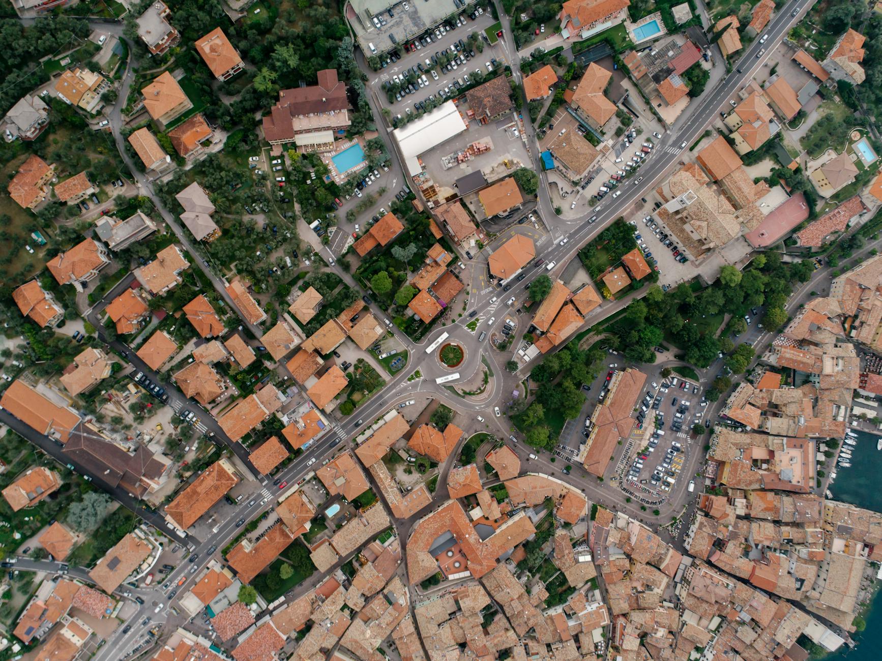
Roads are classified based on their functional hierarchy, traffic volume, and purpose within the network. Arterial roads serve high-speed, long-distance traffic and connect major urban centers, typically having wide right of way and limited access points. Sub-arterial roads act as intermediate links distributing traffic between arterial and collector roads. Collector streets gather traffic from local streets and feed it into higher-order roads, while local streets primarily provide access to residential or commercial properties. Each category requires different geometric standards, lane widths, and control measures.
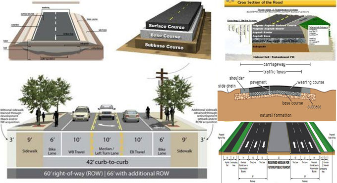
Right of Way and Cross-Sectional Elements
The right of way (ROW) is the total width of land reserved for road construction, including carriageway, footpaths, medians, drainage, and utilities. In urban areas, ROW typically ranges from 6 m for local streets to 60 m or more for arterial roads. The cross-section of a road includes carriageway, shoulders, medians, kerbs, footpaths, cycle tracks, and service lanes. Proper allocation of space ensures balanced usage among different transport modes and enhances safety and efficiency.
Carriageway Specifications
The carriageway is the portion of the road used by vehicular traffic. Standard lane width is generally 3.5 m in urban areas, although it may vary depending on road type and traffic conditions. A single-lane road typically measures 3.75 m, an intermediate lane 5.5 m, and a two-lane road 7.0 m. Multi-lane roads may include four, six, or more lanes depending on traffic demand. The surface of the carriageway must be smooth, skid-resistant, and capable of withstanding traffic loads and environmental conditions.
Shoulders and Margins
Shoulders are provided adjacent to the carriageway and serve as emergency stopping space, structural support, and lateral clearance. In urban areas, shoulders may be replaced by kerbs and parking lanes. The width of shoulders generally ranges from 1.5 m to 2.5 m. In rural roads, earthen shoulders are common, while in urban areas paved shoulders are preferred for durability and usability.
Medians and Traffic Separators
Medians are used to separate opposing streams of traffic and improve safety. They may be raised, depressed, or flush, depending on design requirements. The width of medians typically ranges from 1.2 m to 5 m or more. Medians can also accommodate landscaping, lighting, or barriers. In high-speed corridors, crash barriers are often installed to prevent head-on collisions.
Camber and Cross Slope
Camber is the transverse slope provided on the road surface to facilitate drainage of rainwater. Proper camber prevents water accumulation and reduces pavement deterioration. Typical camber values are 2–3% for bituminous surfaces and 1.5–2% for cement concrete roads. The slope is designed to ensure quick runoff without causing discomfort to vehicles.
Geometric Design Considerations
Geometric design includes horizontal alignment, vertical alignment, gradients, and sight distances. Horizontal curves are designed based on design speed and radius, ensuring smooth transitions and safety. Superelevation is provided on curves to counteract centrifugal force, usually limited to about 7% in plain terrain. Vertical alignment includes gradients and curves, ensuring comfort and visibility. Gradients should be gentle in urban areas, generally between 1% and 4%. Sight distance is a critical factor and includes stopping sight distance, overtaking sight distance, and intersection sight distance, ensuring safe vehicle operation.
Pavement Structure and Materials
Pavement design involves selecting suitable materials and layer thicknesses to withstand traffic loads. Flexible pavements consist of subgrade, sub-base, base course, and bituminous surface layers. Rigid pavements use cement concrete slabs and are suitable for heavy traffic conditions. The subgrade is the natural soil prepared to support the pavement, while the sub-base and base layers provide strength and load distribution. Bituminous layers offer smooth riding quality, whereas concrete pavements provide durability and low maintenance.
Drainage System
Efficient drainage is essential for maintaining pavement performance and longevity. Surface drainage is achieved through camber, side drains, and stormwater channels. Subsurface drainage systems are provided to remove water from the pavement structure. Improper drainage can lead to waterlogging, weakening of subgrade, and pavement failure. Urban roads often include covered drains integrated with footpaths.
Pathways and Pedestrian Facilities
Pathways or footpaths are essential for safe pedestrian movement and should be designed as integral components of the road network. The minimum width of footpaths is generally 1.5 m, but in high pedestrian areas it may be increased to 3 m or more. Footpaths should be continuous, obstruction-free, and provided on both sides of the road wherever possible. The surface must be even, non-slippery, and accessible for all users, including persons with disabilities.
Cycle Tracks
Cycle tracks promote non-motorized transport and reduce dependency on motor vehicles. They should be physically segregated from vehicular traffic for safety. The typical width of a one-way cycle track is 2 m, while a two-way track may be 3 m or more. Proper markings, signage, and intersections design are necessary to ensure cyclist safety.
Kerbs and Edges
Kerbs are provided to separate the carriageway from footpaths and medians. They help in channelizing traffic, protecting pedestrians, and aiding drainage. Types of kerbs include mountable, semi-barrier, and barrier kerbs. The height of kerbs generally ranges from 100 mm to 300 mm depending on function.
Intersections and Junction Design
Intersections are critical points in a road network and require careful design to ensure smooth traffic flow and safety. Types include at-grade intersections, roundabouts, and grade-separated intersections. Proper channelization, traffic signals, pedestrian crossings, and signage must be provided. Visibility and turning radii are important considerations in intersection design.
Road Markings and Signage
Road markings guide drivers and enhance safety. These include lane markings, pedestrian crossings, stop lines, and directional arrows. Thermoplastic paints are commonly used for durability. Traffic signs provide information, warnings, and regulations and must conform to IRC standards.
Street Lighting
Street lighting improves visibility and safety during nighttime. Lighting design depends on road width, traffic volume, and surrounding land use. LED lighting is widely used due to energy efficiency. Poles are typically spaced 25–40 m apart and positioned to avoid glare.
Utility Integration
Road corridors often accommodate utilities such as water supply lines, sewer systems, electrical cables, and telecommunication ducts. Proper planning ensures that these utilities do not interfere with road performance or maintenance. Utility corridors or ducts are often provided to minimize repeated excavation.
Construction Specifications
Construction involves site clearance, earthwork, subgrade preparation, laying of sub-base and base layers, and surfacing. Proper compaction is essential at each stage to ensure strength and durability. Quality control tests such as density tests, material tests, and surface checks must be conducted. Construction should follow approved drawings and specifications.
Maintenance and Rehabilitation
Regular maintenance is necessary to ensure the longevity and safety of roads. This includes pothole repair, resurfacing, cleaning of drains, and repainting of markings. Periodic rehabilitation may involve strengthening of pavement layers or reconstruction. Preventive maintenance reduces long-term costs and improves service quality.
Accessibility and Universal Design
Roads and pathways must be designed to accommodate all users, including elderly persons and those with disabilities. Features such as ramps, tactile paving, audible signals, and adequate crossing time at signals are essential. Universal design principles ensure inclusivity and equity in urban mobility.
Environmental Considerations
Road design should minimize environmental impact by reducing emissions, preserving natural features, and promoting sustainable materials. Use of recycled materials, green medians, and permeable pavements are some measures. Proper planning also reduces noise pollution and enhances urban aesthetics.
TOD and Urban Context (Delhi Perspective)
In Transit-Oriented Development areas such as Mukundpur, Dwarka Sector-21, and Kashmere Gate, roads and pathways must prioritize pedestrians, cyclists, and public transport users. Wider footpaths, dedicated cycle tracks, and integrated street design enhance accessibility to transit stations. Emphasis is placed on reducing private vehicle dependency and promoting active mobility, thereby improving ridership and urban livability.
Conclusion
Detailed specifications of roads and pathways ensure the development of safe, efficient, and sustainable transport infrastructure. By integrating engineering standards with urban design principles and emerging mobility needs, especially in TOD contexts, cities can achieve improved connectivity, reduced congestion, and enhanced quality of life. Proper planning, construction, and maintenance of roads and pathways are essential for supporting economic growth and sustainable urban development.


You must be logged in to post a comment.