Mughal and British influences of Indian Cities

By Pranjal Singh Baghel

Abstract 

This essay examines the profound impact of Mughal and British rule on the urban development, architecture, and socio-cultural identity of Indian cities. The Mughal emperors introduced geometric city planning, monumental architecture, and cosmopolitan marketplaces, creating integrated urban centers defined by gardens, forts, and bustling bazaars. In contrast, British colonialists imposed rational grid layouts, segregated neighborhoods, and modern infrastructure, fundamentally restructuring city landscapes through administrative and sanitary reforms. By comparing planning concepts, architectural styles, social organization, and enduring legacies, this essay highlights how the interplay of these two eras produced Indiaโ€™s unique urban morphology which came out as a  blend of symbolic harmony and functional order that continues to shape the physical and cultural character of modern Indian cities.

1. INTRODUCTION

The cities of India are living palimpsests-layers of history, culture, and power inscribed upon their streets, monuments, and patterns of life. Over centuries, various dynasties, empires, and colonial regimes have contributed to their form and identity, but none more profoundly than the Mughals and the British. Each of these powers envisioned the city as a reflection of their ideals: for the

Mughals, it was a symbol of imperial glory, divine harmony, and aesthetic perfection; for the British, it became an instrument of control, order, and modernization. The Mughal period introduced a distinctly Indo-Islamic urban culture that celebrated geometry, balance, and environmental integration, visible in grand cities like Fatehpur Sikri, Agra, and Shahjahanabad. The British, arriving centuries later, reinterpreted urbanism through the lens of Western rationality, introducing wide avenues, civic institutions, and infrastructural systems that marked the onset of modern urban planning in India. Together, these two periods produced a remarkable dual legacy of the coexistence of historical beauty and colonial order-that continues to define the spatial and cultural character of Indian cities today.

2. Discussion 

2.1 Mughal Influence [ Integration of power, Aesthetics and Culture]

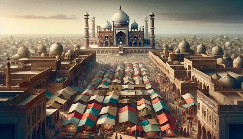
The Mughal emperors (16th-18th century) were visionary urban planners who infused Indian cities with a blend of Persian, Central Asian, and indigenous Indian elements. They sought to create imperial capitals that were not just centres of governance but also expressions of cosmological order, grandeur, and cultural integration. Cities like Agra, Fatehpur Sikri, Lahore, and Shahjahanabad (Old Delhi) epitomize this vision. 

Mughal urbanism prioritized symmetry and geometry like fortified walls and monumental gateways defined city boundaries, while axial avenues aligned palaces, mosques, and bazaars to create a hierarchical spatial order. The Persianinspired Charbagh gardens formed core elements, integrating nature, water, and architecture to symbolize paradise on earth and provide environmental comfort. Waterworks such as canals, tanks, and stepwells further enhanced urban functionality and aesthetics. 

Architecturally, Mughal cities were dominated by grand constructions using red sandstone and white marble. Notable features included domes, minarets, arches, jharokhas (projecting balconies), and chhatris (elevated pavilions), manifesting an Indo-Islamic style marked by intricate ornamentation and monumentality. The Red Fort and Jama Masjid in Delhi, the Taj Mahal and Agra Fort in Agra, and the Shalimar Gardens in Lahore remain testaments to this era’s artistic and urban achievements. 

Beyond architecture, Mughal cities were vibrant trade and craft centres, attracting artisans, scholars, and merchants from across Asia. Urban life was relatively integrated, with markets and neighbourhoods accommodating diverse religious and ethnic communities, fostering a cosmopolitan culture that underpinned both economic prosperity and social cohesion.

2.2 British Influence [ Rational Planning, Segregation and Modernity]

Contrasting with Mughal organic and symbolic city forms, British colonialism (18th-20th century) introduced rational, functional, and segregated urban models aligned with administrative control, military strategy, and commercial expansion. The British developed key presidency towns, for example, Calcutta (Kolkata), Bombay (Mumbai), and Madras (Chennai) by often expanding preexisting settlements or creating entirely new urban quarters.

British urban planning favoured gridiron layouts with wide, straight roads, clear zoning, and enforced segregation between Europeans and indigenous populations, embodied in the โ€œWhite Townโ€ and โ€œBlack Townโ€ duality. Administrative buildings, cantonments, and civil lines were carefully laid out, with emphasis on sanitation, public health, and civic order. Public parks, railway stations, and colonial civic institutions like town halls and courts became prominent features of the urban landscape.

Architecturally, British cities displayed neo-classical, Gothic Revival, and IndoSaracenic styles that symbolized imperial power while incorporating local motifs. Buildings such as the Victoria Memorial in Kolkata, Gateway of India in Mumbai, and Rashtrapati Bhavan in New Delhi display this hybrid grandeur. The creation of New Delhi as the colonial capital in the early 20th century epitomized British urban ambitions with monumental axes, hexagonal road grids, and imposing government complexes designed by architects like Edwin Lutyens and Herbert Baker.

Railway expansion, port development, and telegraph networks spurred industrial growth and connected colonial cities to global trade circuits. However, British urban policies often neglected Indian quarters, maintaining social segregation and reinforcing racial hierarchies.

2.3 Comparative Insights

The Mughal and British periods reflect divergent urban philosophies. Mughals emphasized symbolic imperialism, integration, and environmental harmony, while the British stressed administrative efficiency, segregation, and modern infrastructure. Mughal cities blended religious, commercial, and residential uses in hierarchical, organic patterns; British cities introduced zoning, gridiron layouts, and clear social separation. Architecturally, the Mughals emphasized Indo-Islamic synthesis; the British created eclectic hybrids with European forms and Indian motifs. Despite differences, both eras profoundly shaped Indian urban identity. Mughal heritage endures in the lively bazaars, gardens, and forts of historical cores, while British legacies structure metropolitan governance, transportation, and commercial activities, visible in central business districts and civic institutions.

Conclusion

The Mughal and British influences form intertwined yet distinct chapters in the urban history of India. Mughal cities reflected the grandeur of imperial power, artistic refinement, and cultural synthesis. Their urban form was characterized by symmetry, geometric planning, and monumental architecture that embodied both aesthetic unity and functional harmony. Features such as fortified walls, axial streets, grand mosques, bustling bazaars, and lush gardens created an environment that celebrated inclusivity and cosmopolitanism. Cities like Agra,

Delhi, and Fatehpur Sikri showcased how Mughal urbanism integrated Islamic, Persian, and Indian traditions, producing a vibrant and human-scaled urban experience.

In contrast, British colonial cities represented an entirely different set of priorities rooted in administration, control, and economic exploitation. The British introduced grid layouts, civil lines, cantonments, and segregated zones that physically and socially divided colonial elites from the indigenous population. Cities such as Bombay (Mumbai), Calcutta (Kolkata), and Madras (Chennai) became symbols of modernization and infrastructural progress, featuring railways, ports, and civic buildings in the neoclassical style. Yet, they also reflected deep spatial and racial hierarchies. Together, Mughal and British influences created a rich, layered urban morphology that continues to shape the cultural, architectural, and social identity of Indian cities today. Understanding this composite legacy is vital for informed urban conservation, sustainable development, and culturally rooted planning in contemporary India.

References 

  1. 1. Iftikhar, R. (2016). Urban formation and cultural transformation in Mughal India. International Planning History Society Proceedings.

https://journals.open.tudelft.nl/iphs/article/view/1363

  • Ministry of Culture, Government of India – “About Us / Mandate /

Heritage protection”  https://www.indiaculture.gov.in/ministry  /about-us 

  • Iftikhar, R. (2018). Urban formation and culture transformation in Mughal India. South Asian Studies, 33(1).
  • Din, N. U. (2022). British impact on Lahore: Colonial planning and architectural heritage. CUNY Academic Works.

https://academicworks.cuny.edu/cgi/viewcontent.cgi?article=3697&conte xt=gc_etds  

  1. https://ignited.in/index.php/jasrae/article/view/12761/25326 ย 

Selecting a Research Problem in Urban Planning

Urban planning isย the comprehensive process of developing and managing land use, infrastructure, and the built environment to improve the quality of life for urban residents and ensure sustainable development.ย It is a multidisciplinary field that involves creating spatial plans for cities, balancing economic growth, social equity, and environmental considerations to build resilient and functional urban areas.ย 

Selecting a research problem in urban planning for a thesis is one of the most crucial steps because it determines the direction, relevance, and overall quality of your work. A well-defined problem ensures that your research contributes meaningfully to the discipline, aligns with your interests, and has practical applicability. Below are detailed guidelines to help you systematically select a suitable research problem:


1. Identify Your Area of Interest

  • Self-reflection: Think about which sub-field excites you mostโ€”transportation planning, land use, housing, TOD (Transit-Oriented Development), environmental planning, resilience, smart cities, governance, etc.
  • Past exposure: Review your coursework, internships, and projects to see which topics you enjoyed and where you performed well.
  • Sustainability of interest: Since a thesis is a long-term project, ensure the topic is something you can stay motivated about.

2. Review Existing Literature

  • Survey journals and books: Look into reputed sources such as Journal of Urban Planning and Development (ASCE), Transport Policy, Habitat International, etc.
  • Identify gaps: Check where existing studies lackโ€”geographical gaps (e.g., limited studies in Indian or Global South context), methodological gaps (e.g., limited use of advanced modelling), or thematic gaps (e.g., underexplored areas like informal transit, active mobility).
  • Track current debates: Identify emerging themes like climate-resilient cities, equity in transport, gender and mobility, AI in urban planning, or post-COVID mobility trends.

3. Relevance to Local Context

  • Urban planning problems are place-specific. Select an issue that is relevant to your city, state, or country. For example:
    • In Delhi: firstโ€“last mile connectivity, TOD effectiveness, informal housing, air quality, urban flooding.
    • In tier-2 cities: rapid urbanisation, peri-urban growth, infrastructure deficits.
  • This ensures your thesis is not only academically rigorous but also socially impactful.

4. Practicality and Feasibility

  • Data availability: Consider whether you can access data (primary surveys, government databases, GIS datasets, remote sensing, etc.).
  • Time constraints: Make sure the research can be realistically completed within your thesis timeline.
  • Resource availability: Check whether you have the technical tools (software like ArcGIS, SPSS, R, Python, SmartPLS) and guidance to carry out the research.
  • Field access: Ensure you can conduct site visits, interviews, or surveys safely and practically.

5. Alignment with Research Objectives

  • A good problem should lead to clear objectives (e.g., evaluating TODโ€™s influence on mode choice, assessing green building adoption, analysing resilience strategies for flood-prone urban areas).
  • Frame research questions that are:
    • Specific โ€“ clearly state the issue.
    • Measurable โ€“ based on data or empirical evidence.
    • Relevant โ€“ aligned with urban planning principles and societal needs.
    • Achievable โ€“ feasible within available resources and time.
    • Time-bound โ€“ can be addressed within your programโ€™s duration.

6. Contribution to Knowledge and Practice

  • The problem should add something new to urban planning theory, policy, or practice:
    • Theoretical contribution: Enhancing or testing an existing framework (e.g., TOD 8Ds, accessibility measures).
    • Methodological contribution: Introducing new models (e.g., SEM, MCDM, agent-based modelling).
    • Practical contribution: Providing solutions for urban policymakers and planners.
  • Always ask: โ€œWho will benefit from my research?โ€โ€”academia, government agencies, urban residents, or specific groups like women, cyclists, or low-income communities.

7. Scoping the Research

  • Avoid problems that are too broad (e.g., โ€œUrban transport in Indiaโ€) or too narrow (e.g., โ€œEffect of streetlight color on pedestrian flow in one laneโ€).
  • Define a scope that is:
    • Manageable in size (e.g., one neighborhood, one transport corridor).
    • Rich enough for analysis (enables both quantitative and qualitative dimensions).
  • Ensure your problem allows you to apply urban planning tools and frameworks rather than just descriptive reporting.

8. Policy and Societal Relevance

  • Link the research to ongoing policies, programs, or SDGs:
    • Smart Cities Mission
    • AMRUT
    • National TOD Policy
    • Sustainable Development Goals (Goal 11: Sustainable Cities and Communities)
    • National Urban Transport Policy
  • This alignment ensures your thesis outcomes can influence real-world decision-making.

9. Discussion with Advisors and Experts

  • Discuss potential problems with faculty, mentors, and professionals. They can:
    • Highlight feasibility issues.
    • Suggest refined angles.
    • Provide access to networks and data sources.

10. Refining and Formulating the Problem Statement

  • Once a topic is identified, write a problem statement that includes:
    • Context: Background and why the problem matters.
    • Gap: What existing research lacks.
    • Objective: What you intend to achieve.
    • Justification: Why it is important for urban planning and society.

โœ… Checklist for Selecting a Research Problem

  • Is it aligned with your interest?
  • Is it relevant to urban planning discipline?
  • Does it address a real-world/local issue?
  • Is it feasible with available data, time, and resources?
  • Does it contribute to knowledge or practice?
  • Is it clear, specific, and researchable?

Figure-Ground Theory in Urban Design: A Detailed Exploration

By Shashikant Nishant Sharma

The Figure-Ground Theory is a foundational concept in urban design that helps in analyzing and understanding the relationship between built forms (figures) and the open spaces (grounds) that surround and define them. Rooted in principles of Gestalt psychology and architectural morphology, this theory provides a visual and analytical method to interpret the urban fabric by distinguishing solid mass (buildings) from voids (open spaces). It plays a crucial role in understanding spatial organization, connectivity, enclosure, and the overall quality of urban environments.


1. Origin and Conceptual Basis

The term โ€œfigure-groundโ€ was originally used in Gestalt psychology, where it referred to the human perception of visual elements as either the object of focus (figure) or the background (ground). In urban design, this concept was adopted and developed most notably by theorists like Colin Rowe and Fred Koetter, especially in their influential work โ€œCollage Cityโ€ (1978), where they emphasized the importance of the figure-ground diagram as a tool for analyzing urban space.

In an urban context:

  • Figure = The built elements, such as buildings, monuments, or blocks.
  • Ground = The open space around and between these built forms, including streets, plazas, parks, and courtyards.

2. Purpose and Utility in Urban Design

Figure-ground theory serves multiple purposes in the practice and pedagogy of urban design:

A. Analyzing Spatial Hierarchy

The theory reveals how different types of spaces are ordered within a city โ€” from tightly enclosed courtyards to wide open plazas. It helps in understanding:

  • Public vs. Private space
  • Dominant vs. Subordinate structures
  • Primary vs. Secondary networks (e.g., major streets vs. alleys)

B. Understanding Urban Morphology

Through figure-ground diagrams, designers and planners can trace the evolution of urban form, assess the compactness or sprawl of development, and evaluate density and grain (fine or coarse) of urban patterns.

C. Evaluating Connectivity and Accessibility

The layout of built forms and open spaces reveals how pedestrian and vehicular flows operate. A balanced figure-ground relationship enhances walkability, visual continuity, and social interaction, while imbalances may cause segregation, inaccessibility, or monotony.

D. Guiding Urban Design Interventions

By studying figure-ground relationships, designers can:

  • Identify underutilized spaces for infill or revitalization.
  • Propose new developments that respect or enhance existing spatial structure.
  • Create more legible, coherent, and meaningful urban environments.

3. Figure-Ground Diagram as a Tool

The figure-ground diagram is the primary tool used to visualize and interpret this theory. It typically involves a black-and-white map:

  • Black (or solid color) = Built forms (figure)
  • White (or negative space) = Open spaces (ground)

This simplified abstraction helps:

  • Strip away non-essential elements to focus purely on spatial relationships.
  • Compare urban blocks across different cities or historical periods.
  • Assess enclosure, openness, and edge conditions.

Example:

  • A traditional European city center (like Rome or Paris) often shows a high degree of figure-ground balance โ€” with a dense network of built forms interspersed with well-defined open squares and streets.
  • A modernist development (such as Le Corbusierโ€™s Radiant City) often shows dispersed buildings floating in open space, resulting in a lower figure-ground ratio and reduced spatial definition.

4. Applications and Implications

A. Historic Preservation and Urban Infill

Figure-ground studies can help preserve the character of historic cores by guiding sensitive infill projects that maintain the existing spatial grain and hierarchy.

B. Transit-Oriented Development (TOD)

TOD areas often require compact, connected, and mixed-use urban forms. Figure-ground theory can be used to ensure appropriate density, enclosure, and human-scale design in such developments.

C. Urban Legibility and Imageability

According to Kevin Lynchโ€™s concepts in โ€œThe Image of the City,โ€ figure-ground relationships contribute to how clearly people can read and navigate the city. Strong spatial definition improves the mental map of urban dwellers.

D. Sustainable and Livable Design

Well-proportioned built-to-open space ratios can influence microclimate, social interaction, safety, and walkability, all of which contribute to urban sustainability and livability.


5. Limitations and Critiques

While figure-ground theory is a powerful tool, it also has limitations:

  • Over-simplification: It reduces complex spatial realities to binary visuals, ignoring building heights, uses, and materials.
  • Contextual Blindness: It may not capture the socio-cultural dynamics, economic conditions, or lived experiences of urban space.
  • Static Representation: The diagrams are snapshots in time and do not reflect temporal changes, such as seasonal use or day-night variation.

To overcome these, figure-ground analysis is often supplemented with section drawings, land-use maps, 3D models, and behavioral studies.


6. Conclusion

The Figure-Ground Theory remains a core analytical framework in urban design. It distills the city into its fundamental spatial components โ€” solids and voids โ€” enabling planners and designers to read, compare, and shape urban form with greater clarity. Though simple in its graphic expression, it offers deep insights into the organization, legibility, and quality of urban spaces. When integrated with other design tools and socio-cultural analysis, it becomes an invaluable method for crafting cities that are both functional and humane.

References

Grossberg, S. (1994). 3-D vision and figure-ground separation by visual cortex.ย Perception & psychophysics,ย 55(1), 48-121.

Hebbert, M. (2016). Figure-ground: History and practice of a planning technique.ย Town Planning Review,ย 87(6), 705-728.

Roberts, L. D. (1986). The figure-ground model for the explanation of the determination of indexical reference.ย Synthese, 441-486.

Wever, E. G. (1927). Figure and ground in the visual perception of form.ย The American Journal of Psychology,ย 38(2), 194-226.

12th Schedule of the Indian Constitution: Empowering Urban Local Governance

By Shashikant Nishant Sharma

The 74th Constitutional Amendment Act, 1992 was a landmark reform in India’s urban governance landscape. It provided constitutional status to Urban Local Bodies (ULBs) like Municipal Corporations, Municipal Councils, and Nagar Panchayats, recognizing them as the third tier of government.

The 12th Schedule of the Constitution, added through this amendment, lists 18 functional items that Municipalities are responsible for. These functions ensure a decentralized, participatory, and efficient framework for urban governance.


๐Ÿ”ฐ Overview of the 18 Functions in the 12th Schedule


1. Urban Planning Including Town Planning

Urban planning involves formulating land-use policies, zoning regulations, master plans, and development control to guide the orderly growth of urban areas. ULBs play a pivotal role in preparing and implementing Development Plans and Town Planning Schemes in alignment with state-level urban policy.


2. Regulation of Land Use and Construction of Buildings

Municipalities regulate building permits, enforce development control norms, ensure adherence to zoning regulations, and prevent unauthorized constructions. This ensures planned development, safety, and optimized land use.


3. Planning for Economic and Social Development

ULBs contribute to local economic development by supporting markets, industries, and small businesses, while also implementing welfare programs in health, education, housing, and skill development to address urban poverty and inequality.


4. Roads and Bridges

Maintenance, construction, and widening of municipal roads, flyovers, footpaths, and bridges fall under the municipalityโ€™s domain. They ensure connectivity, road safety, and traffic decongestion within city limits.


5. Water Supply for Domestic, Industrial, and Commercial Purposes

Municipalities manage water sourcing, treatment, and distribution. They ensure equitable access to potable water and promote water conservation, leak management, and metering systems.


6. Public Health, Sanitation, Conservancy, and Solid Waste Management

ULBs oversee disease control, public health campaigns, sanitation drives, street cleaning, and integrated solid waste management. Effective service delivery in this function is crucial for urban hygiene and environmental health.


7. Fire Services

Fire safety is a municipal mandate, involving provision of fire stations, emergency response teams, fire-fighting infrastructure, and regulatory checks for fire compliance in buildings and public spaces.


8. Urban Forestry, Protection of the Environment, and Promotion of Ecological Aspects

Municipalities are expected to implement urban greening programs, manage green belts and biodiversity parks, and enforce environmental regulations like air and noise pollution control.


9. Safeguarding the Interests of Weaker Sections of Society Including the Handicapped and Mentally Retarded

ULBs must ensure inclusive policies that support vulnerable groups through social housing, accessible infrastructure, education, and special assistance programs.


10. Slum Improvement and Upgradation

A key function of ULBs is improving the quality of life in urban slums by providing basic services, upgrading housing, implementing in-situ redevelopment projects, and promoting livelihood opportunities.


11. Urban Poverty Alleviation

Municipalities run programs like skill development, self-employment schemes, microfinance, shelter homes, and targeted subsidies for urban poor, often under centrally or state sponsored schemes like NULM.


12. Provision of Urban Amenities and Facilities such as Parks, Gardens, Playgrounds

Recreational infrastructure like parks and playgrounds enhances urban livability. ULBs are tasked with creating and maintaining these public spaces for community health and well-being.


13. Promotion of Cultural, Educational, and Aesthetic Aspects

ULBs support the arts, preserve heritage sites, and organize cultural events. They also promote urban aesthetics through design guidelines and beautification projects.


14. Burials and Burial Grounds; Cremations, Cremation Grounds; and Electric Crematoriums

ULBs are responsible for the management of public burial and cremation facilities, including upkeep, hygiene, and promoting eco-friendly alternatives like electric crematoriums.


15. Cattle Pounds; Prevention of Cruelty to Animals

Municipalities manage cattle pounds, enforce regulations against stray animals, and work with NGOs to promote animal welfare and sterilization programs.


16. Vital Statistics Including Registration of Births and Deaths

The registration of births, deaths, and marriages is a legal function of municipalities, which also act as custodians of this crucial demographic data.


17. Public Amenities Including Street Lighting, Parking Lots, Bus Stops, and Public Conveniences

ULBs ensure the provision and maintenance of basic civic infrastructure that supports mobility and public hygiene, especially in crowded urban environments.


18. Regulation of Slaughter Houses and Tanneries

Municipalities regulate these units to ensure hygiene, compliance with environmental laws, and humane practices, along with zoning to prevent nuisance in residential areas.


๐Ÿ™๏ธ Conclusion: A Pillar of Decentralized Urban Governance

The 12th Schedule empowers Urban Local Bodies to function as effective self-governing institutions. However, success depends on financial devolution, technical capacity, and accountability mechanisms. As Indian cities face rapid urbanization, fulfilling these 18 functions through participatory and sustainable governance models is essential to build inclusive, resilient, and liveable urban futures.

References

Datta, A. (1994). Institutional aspects of urban governance in India.ย Indian Journal of Public Administration,ย 40(4), 616-632.

Idiculla, M. (2023). The Travails of Urban Planning in India: An Examination of the Planning Law Regime of Bangalore.ย The Chinese Journal of Comparative Law,ย 11(1), cxad002.

Kumbhar, S. Urban Governance in India.ย Constitutional Government and Democracy in India| For UG, PG & aspirants of State and Civil Service Exams| By Pearson, 311.

Kundu, D. (2020). Urbanisation in India: Towards a national urban policy framework and smart cities.ย Developing National Urban Policies: Ways Forward to Green and Smart Cities, 89-119.

Rao, P. S. N. Urban Decentralisation and Regional Planning in India: Negotiating State-Local Relations.

Sivaramakrishnan, K. C. (2013). Revisiting the 74th Constitutional Amendment for better metropolitan governance.ย Economic and Political Weekly, 86-94.